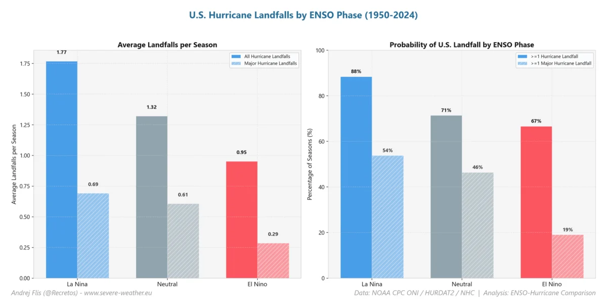
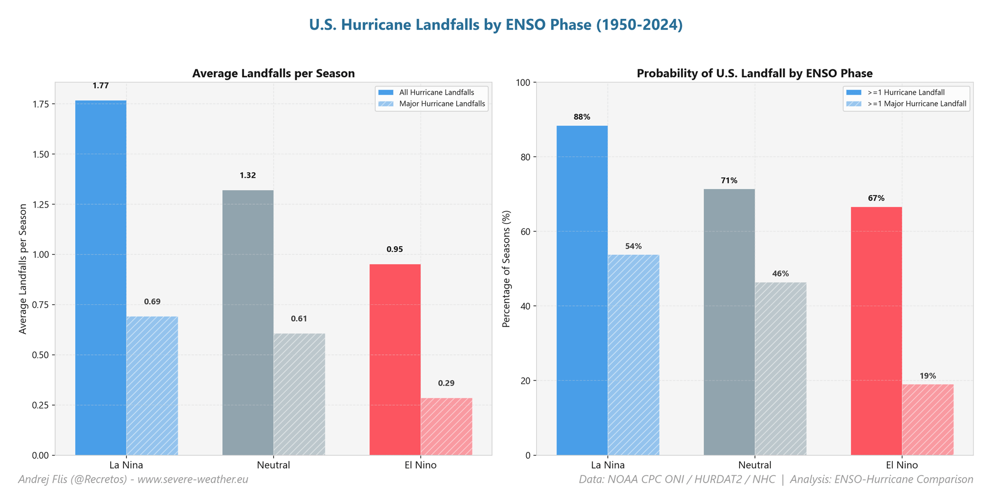
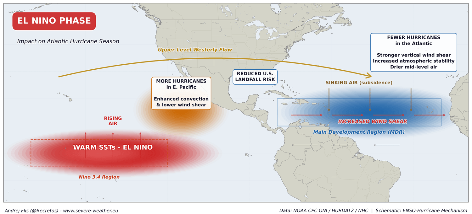
As we move toward the meteorological peak of the Atlantic hurricane season, a striking anomaly has emerged across the global climate system. A powerful "Super El Niño"—an event of historic proportions—is currently unfolding in the Pacific Ocean. This oceanic phenomenon is doing more than just shifting rainfall patterns; it is acting as a massive "atmospheric hurricane shield" for the United States, effectively neutralizing the conditions required for tropical storm development in the Atlantic basin.

This article provides an in-depth analysis of why the 2026 Atlantic season remains historically quiet, the mechanics of the atmospheric shield, and what these tropical signals suggest for the upcoming winter season, including the potential stability of the Polar Vortex.
Main Facts: The Anatomy of a Super El Niño
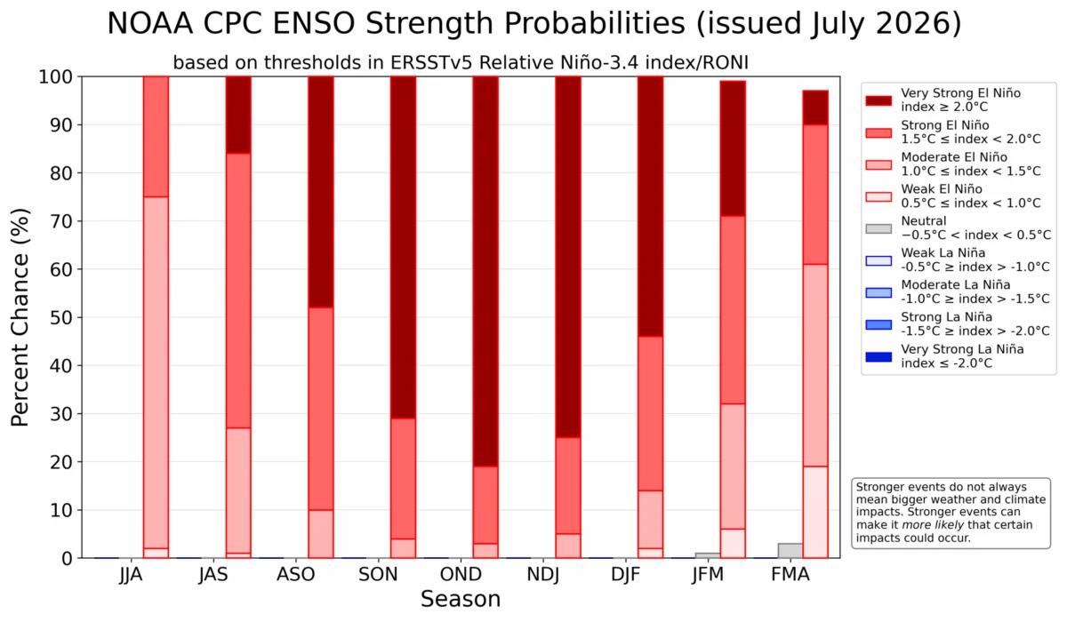
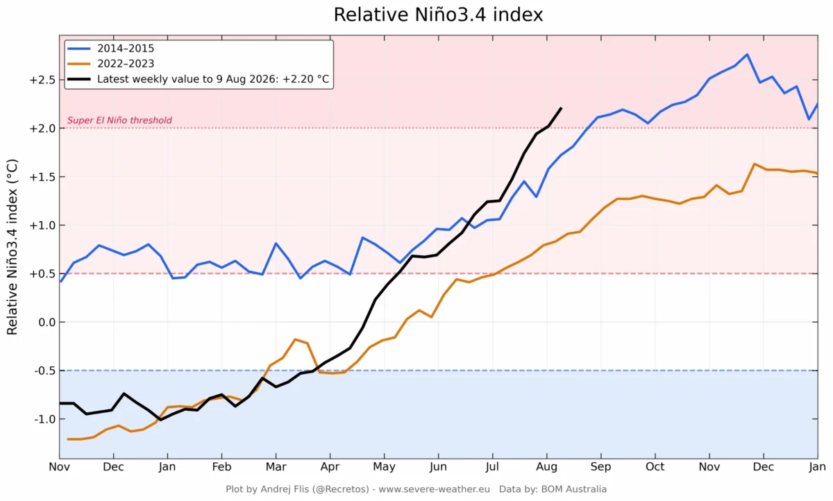
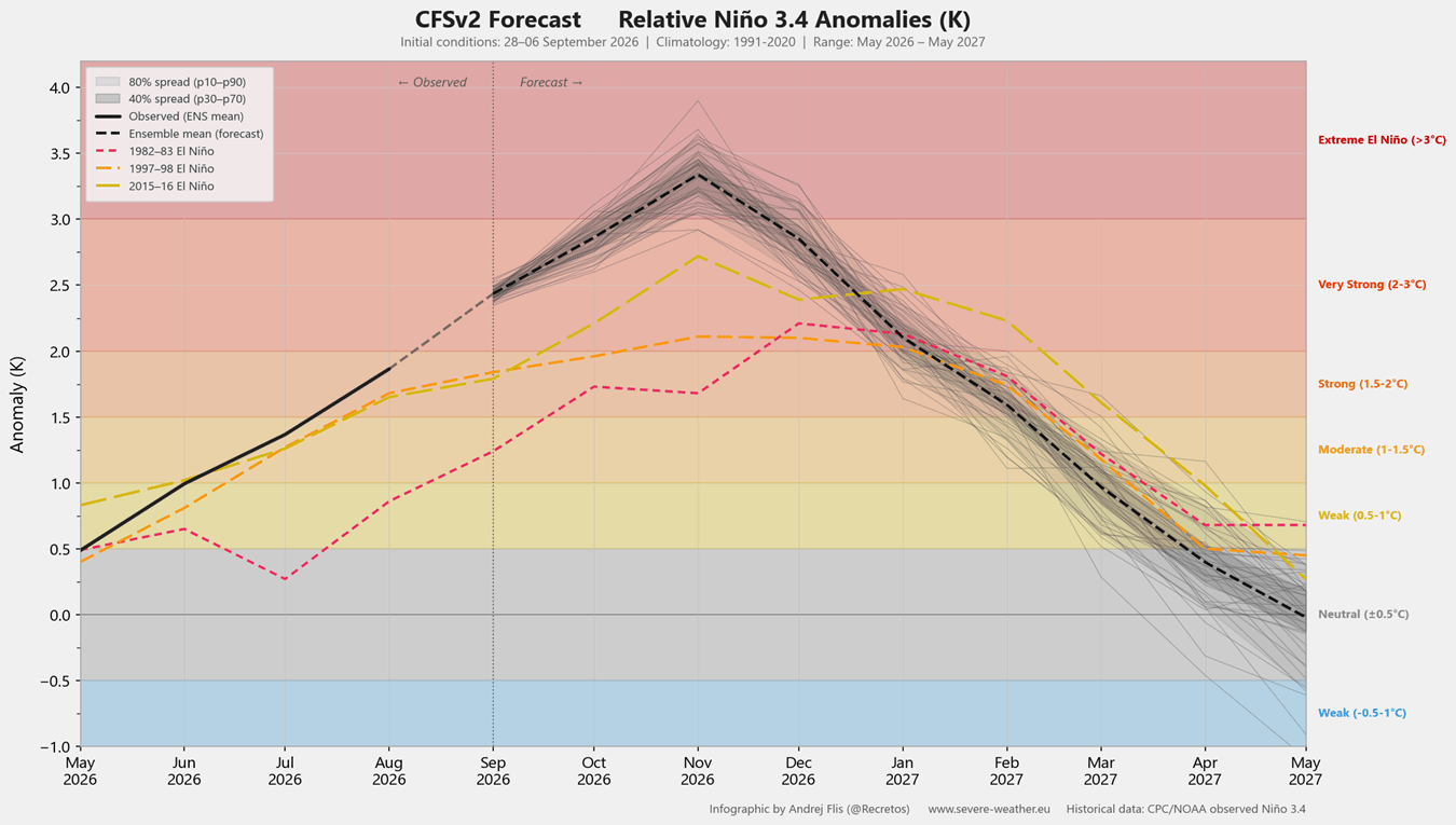
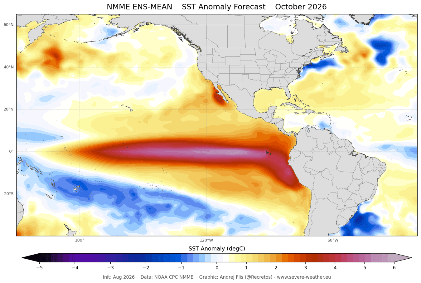
Oceanic anomalies are the primary engines of our global weather system. Currently, the El Niño-Southern Oscillation (ENSO) region in the tropical Pacific is undergoing a rapid, high-intensity transition. We are witnessing a "Super El Niño," a classification reserved for events where sustained seasonal temperature anomalies exceed +2°C.
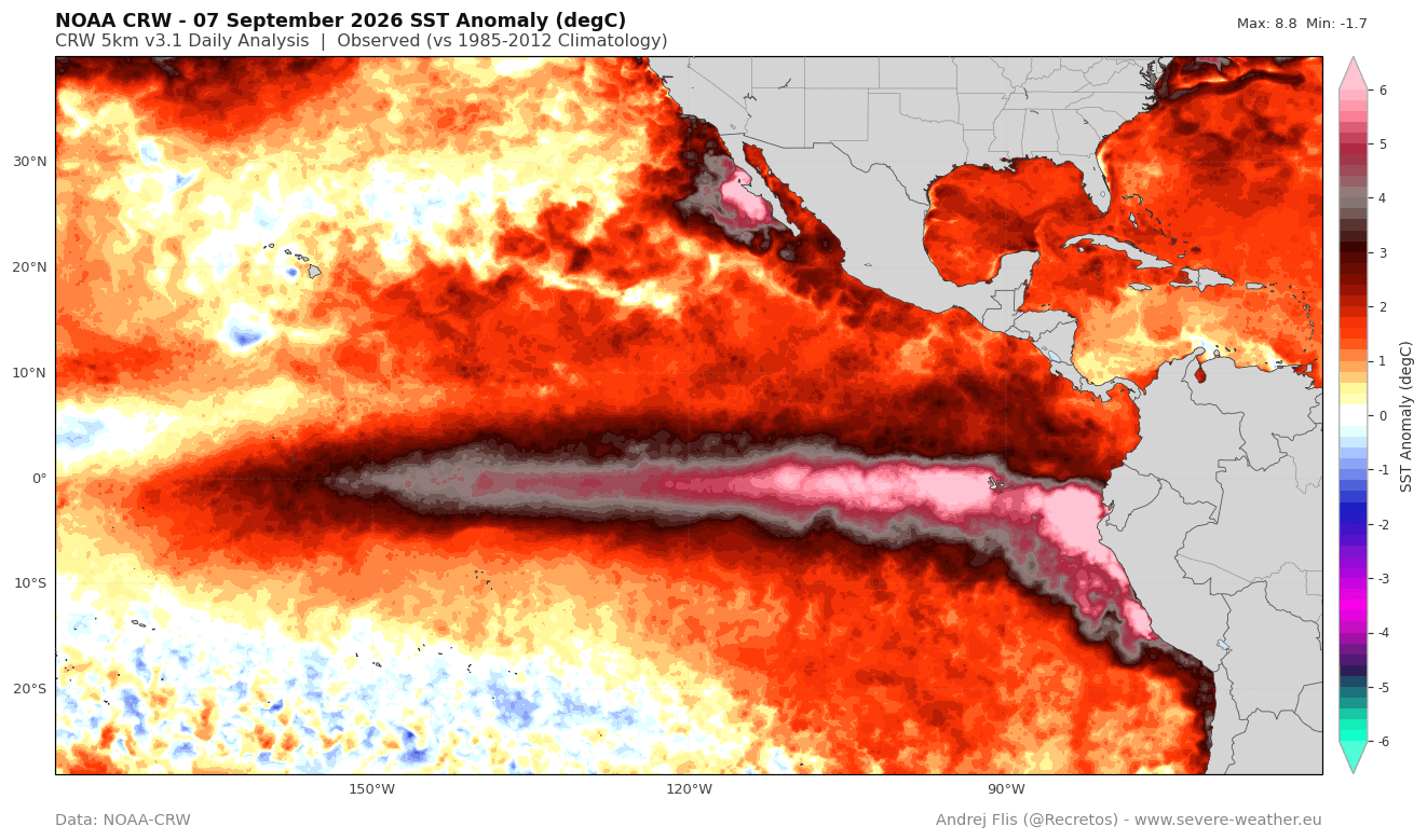
Current NOAA-CRW data indicates that peak anomalies in the eastern Pacific have surged to over 7°C (12.6°F) above historical norms. This is not merely a moderate fluctuation; the latest NCEP CFSv2 model forecasts suggest that this event could exceed the intensity of the last three recorded Super El Niños, potentially becoming the most powerful event in over a century.
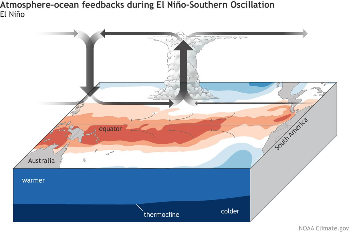
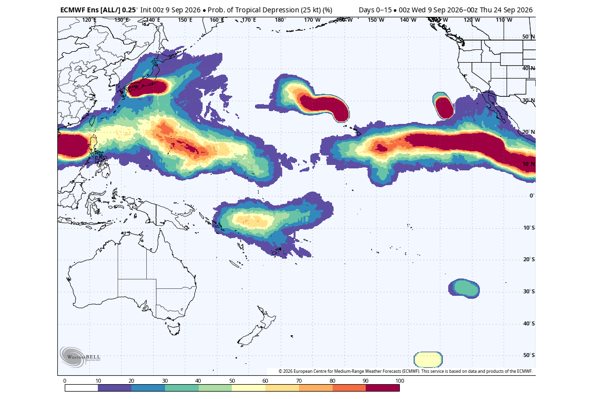
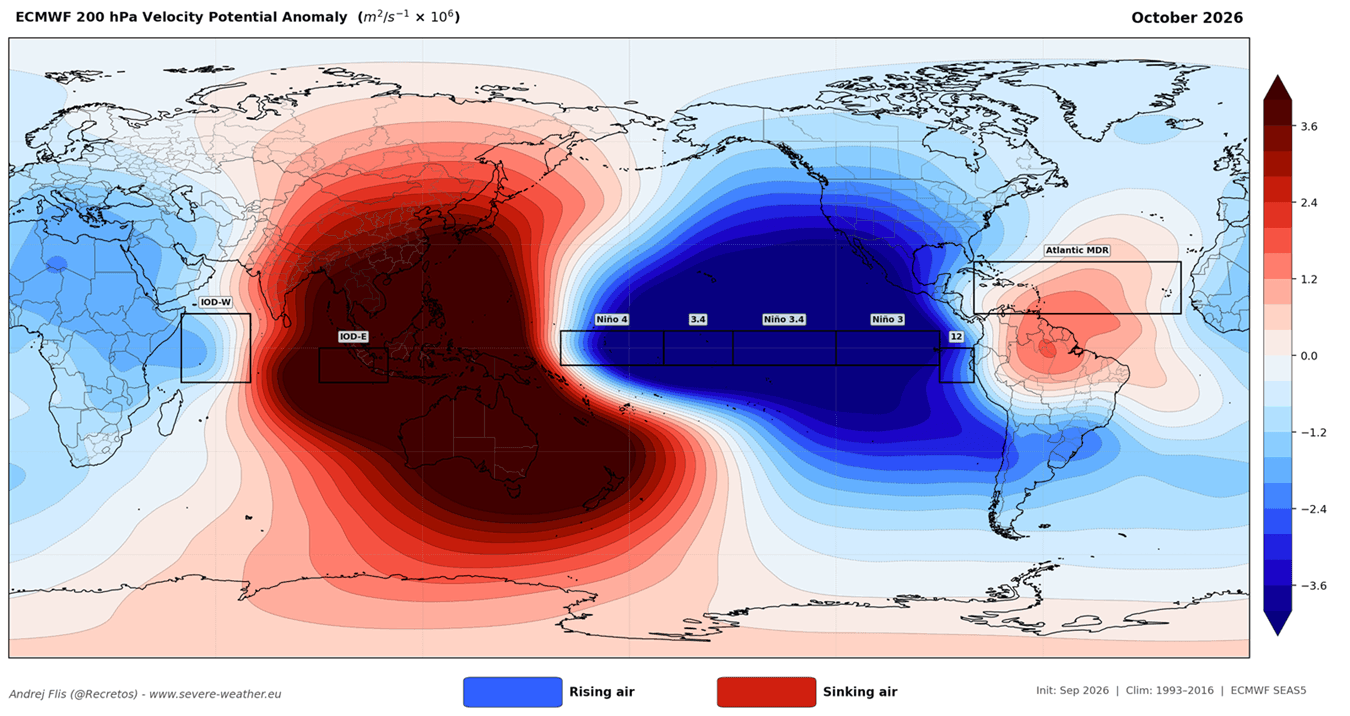
This heating of the Pacific ocean surface initiates a chain reaction known as the "Walker Circulation." In a neutral year, air rises in the western Pacific and sinks in the east. During a Super El Niño, this pattern flips: warm water shifts eastward, causing massive air displacement that travels from the tropical Pacific to the poles. This planetary-scale reorganization is what directly interferes with Atlantic hurricane development.
Chronology: A Season of Unprecedented Suppression
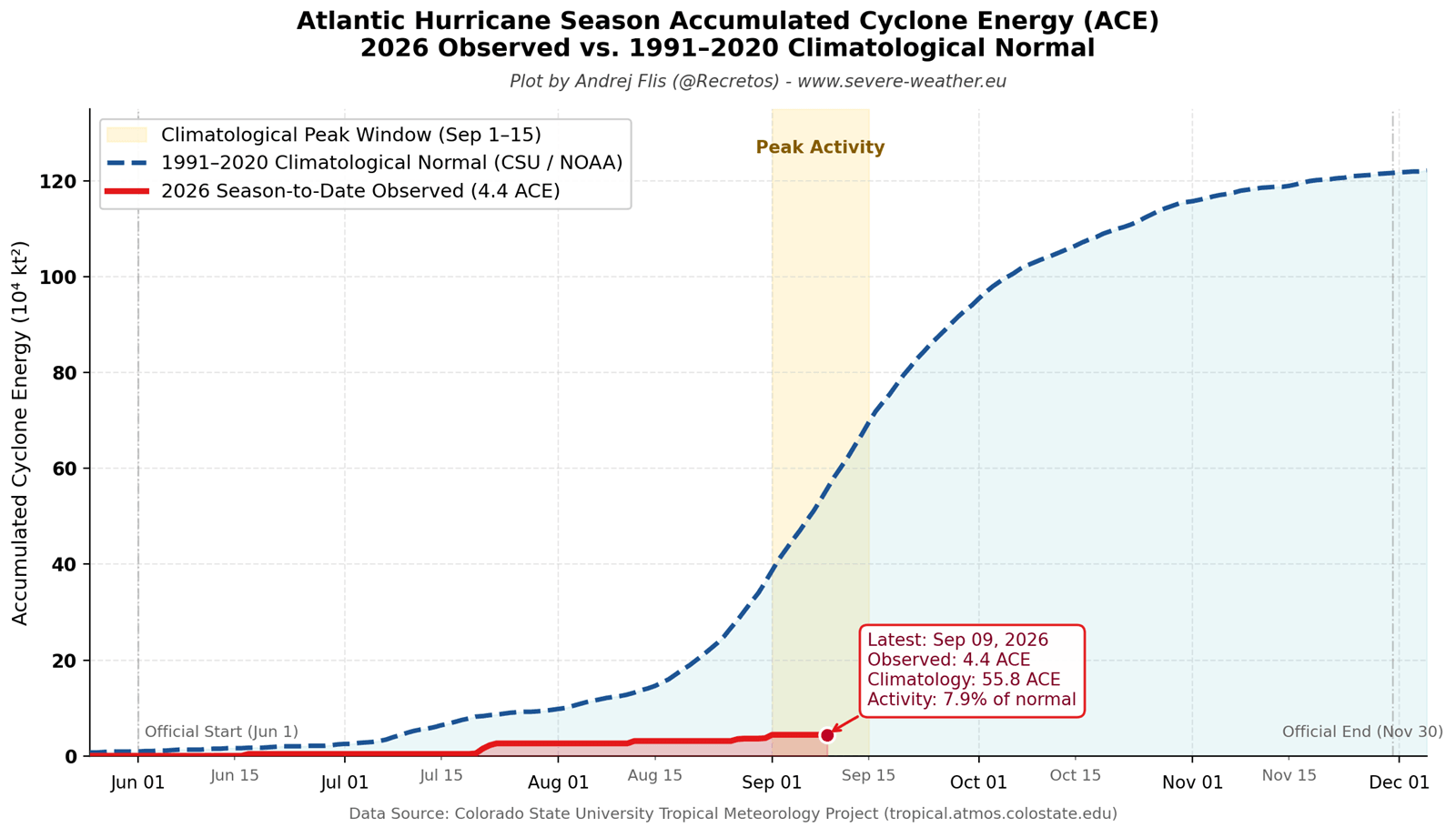
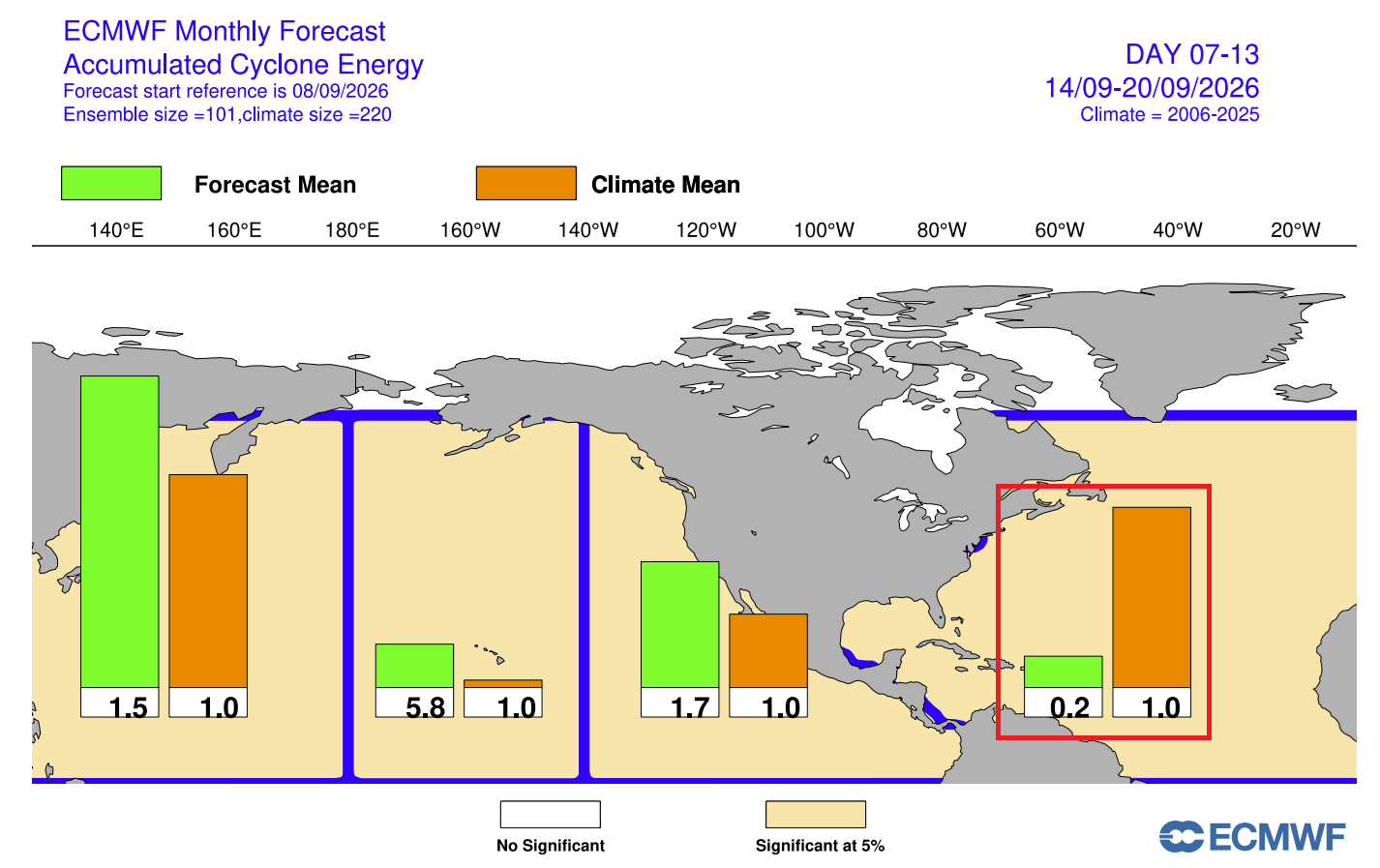
The 2026 hurricane season began with expectations of activity, yet the data from June through late August tells a different story. The Accumulated Cyclone Energy (ACE) index—a metric used by NOAA to measure the total intensity and duration of tropical systems—provides a clear timeline of this suppression.
- Early Summer (June–July): Tropical activity remained stagnant. While historical averages suggest an uptick in systems during these months, 2026 saw only five short-lived named systems, none of which achieved hurricane status.
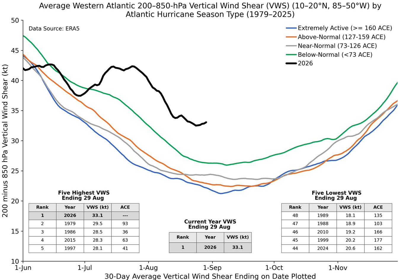
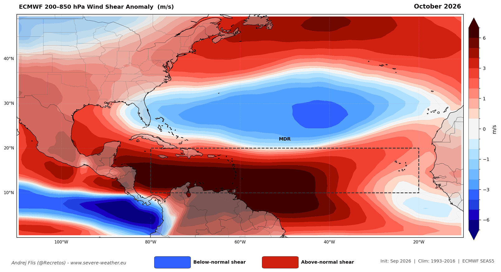
- The Mid-Season Peak (August): Data from Dr. Philip Klotzbach and other meteorological experts confirms that Atlantic wind shear reached its highest levels in 47 years. This shear effectively acts as a "blade," tilting and decapitating nascent storms before they can develop a core.
- Current Status (September): As we navigate the peak of the season, the atmospheric shield remains in full effect. ECMWF forecasts show no medium-range landfall threats for the United States, with widespread subsidence (sinking air) inhibiting cloud formation across the Main Development Region (MDR).
Supporting Data: Why the Atlantic is "Locked"
The suppression of the 2026 season is not a matter of luck; it is a direct consequence of three specific physical mechanisms driven by the Super El Niño:
1. The Wind Shear Barrier
Wind shear is the variation in wind speed and direction at different altitudes. When shear is high, it prevents a storm from growing vertically. The 2026 season has seen record-breaking shear across the Atlantic. This hostile environment ensures that any system attempting to organize is quickly torn apart, preventing the accumulation of the deep moisture required for hurricane intensification.
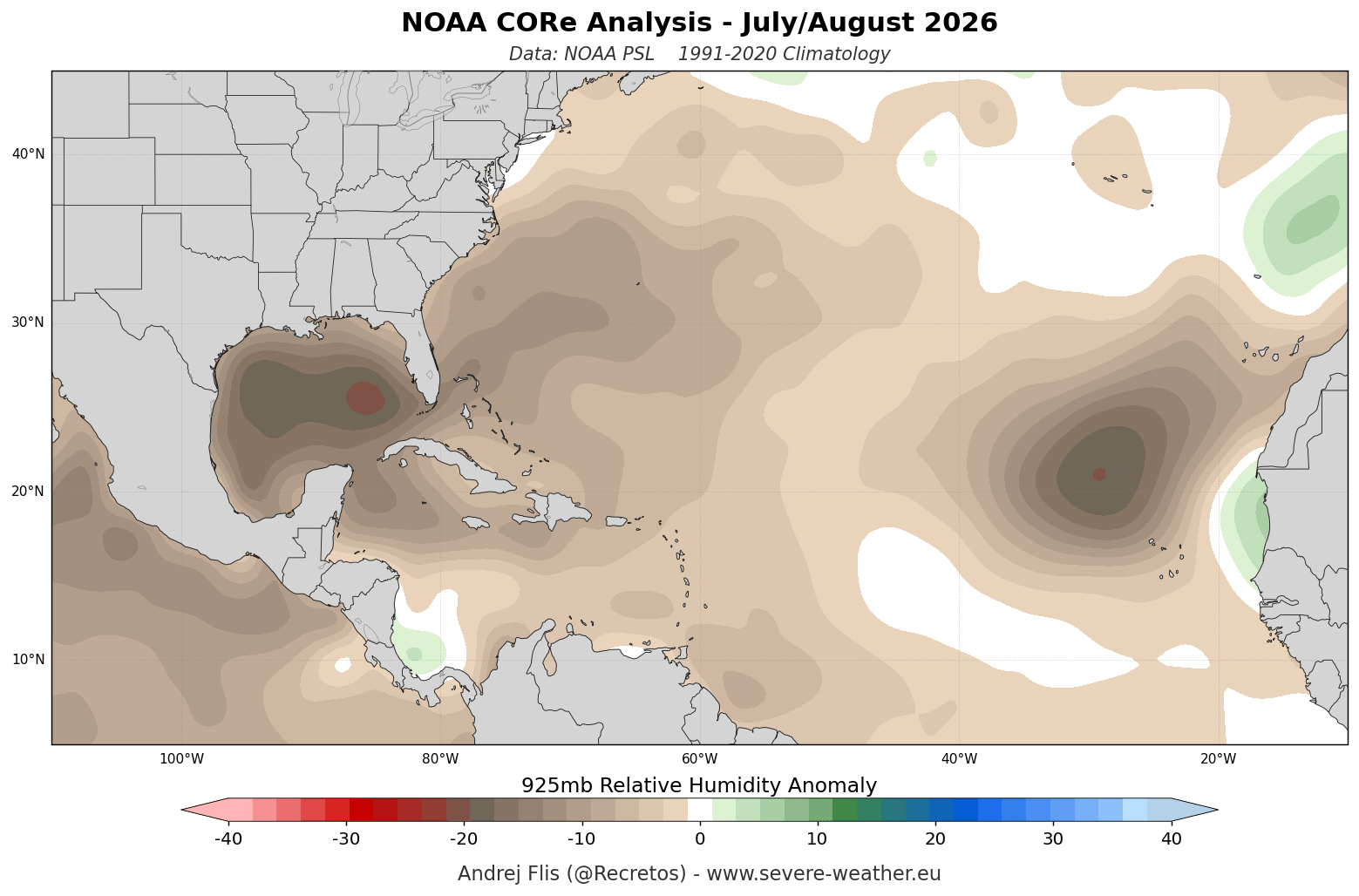
2. The Subsidence Trap
While the Pacific is experiencing massive, rising, moisture-laden air, the Atlantic is experiencing the opposite: sinking air. This "subsidence" creates a stable atmosphere where clouds struggle to grow. Data from the 925mb relative humidity levels shows a broad, persistent dry patch across the MDR, cutting off the "fuel" (moisture) that storms need to sustain themselves.
3. The Precipitation Deficit
Precipitation anomaly maps for September and October consistently show below-normal rainfall across the Caribbean, the Gulf of Mexico, and the U.S. East Coast. This lack of rain is a primary indicator that the atmosphere is not conducive to tropical development. Even as we head into October—a month typically known for late-season Caribbean threats—the global circulation models suggest that the basin will remain locked in this suppressed, dry state.
Official Perspectives and Model Forecasts
Meteorological organizations, including the European Centre for Medium-Range Weather Forecasts (ECMWF) and the National Centers for Environmental Prediction (NCEP), are in rare agreement regarding the intensity of this year’s suppression.
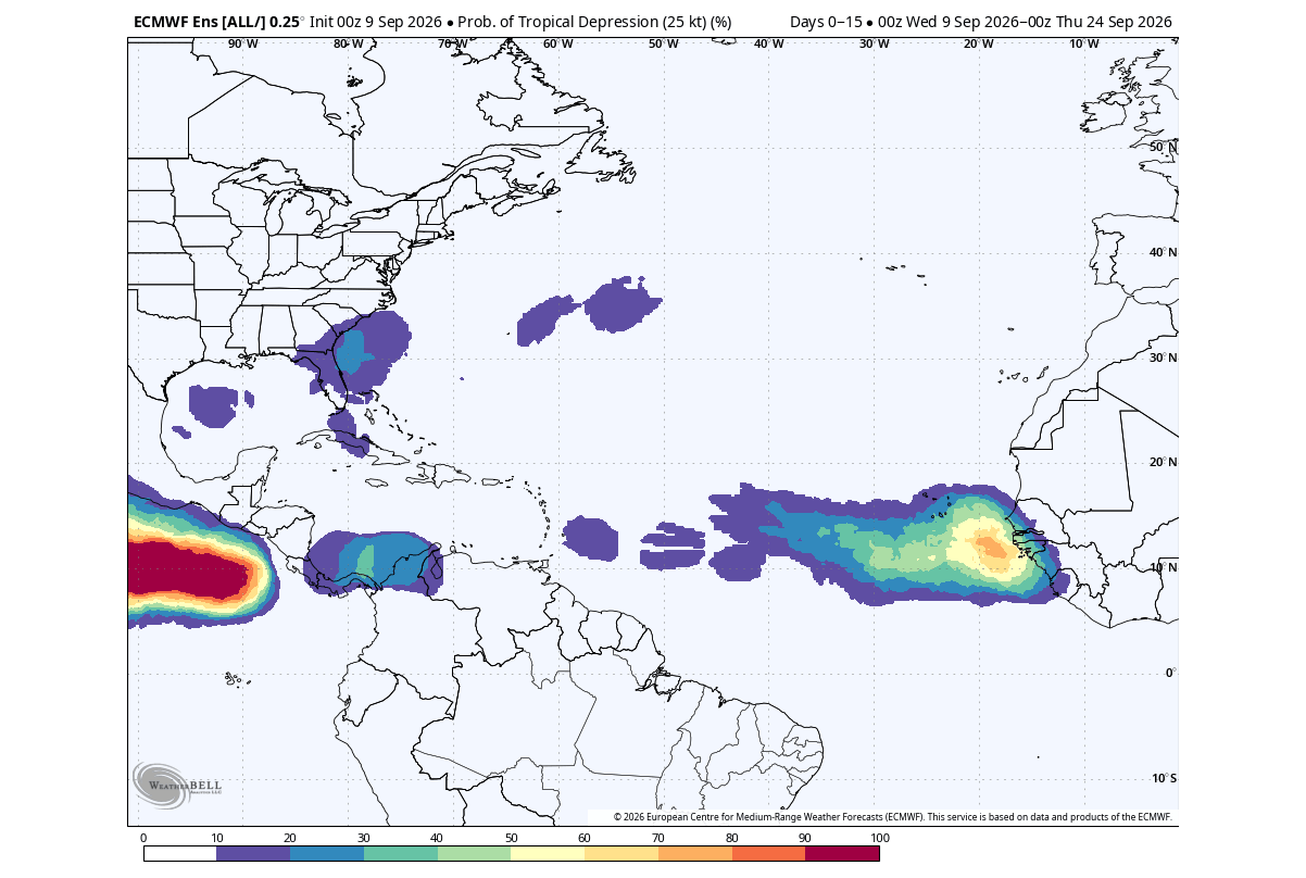
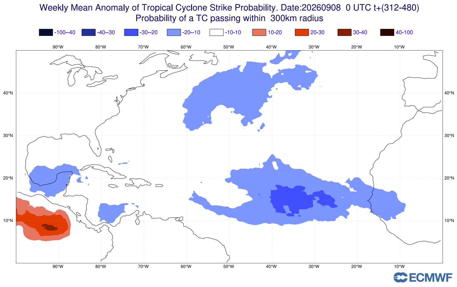
The ECMWF’s extended-range probability forecasts for late September confirm a "collapse" of the hurricane season. While some moderate tropical depression probabilities exist near the West African coast, these systems are consistently forecast to dissipate rapidly as they move westward into the hostile environment created by the El Niño-driven shear and dry air.
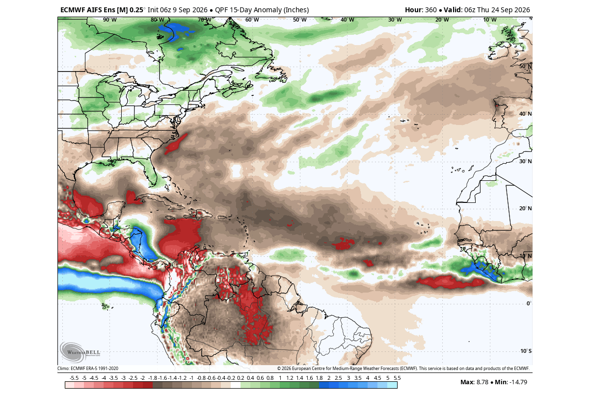
Experts note that while the odds are stacked against hurricane development, the public should remain vigilant. The "shield" is a broad-scale statistical reality, but localized, short-lived systems can still occur. However, the overarching trend is one of the weakest Atlantic seasons in recent memory.
Implications: Connecting Hurricanes to Winter 2026/2027
A quiet hurricane season is often a "canary in the coal mine" for the upcoming winter. Historical data indicates that the global climate state that suppresses Atlantic hurricanes—specifically the Super El Niño—often drives a predictable pattern for the following winter.
The Winter Temperature Pattern
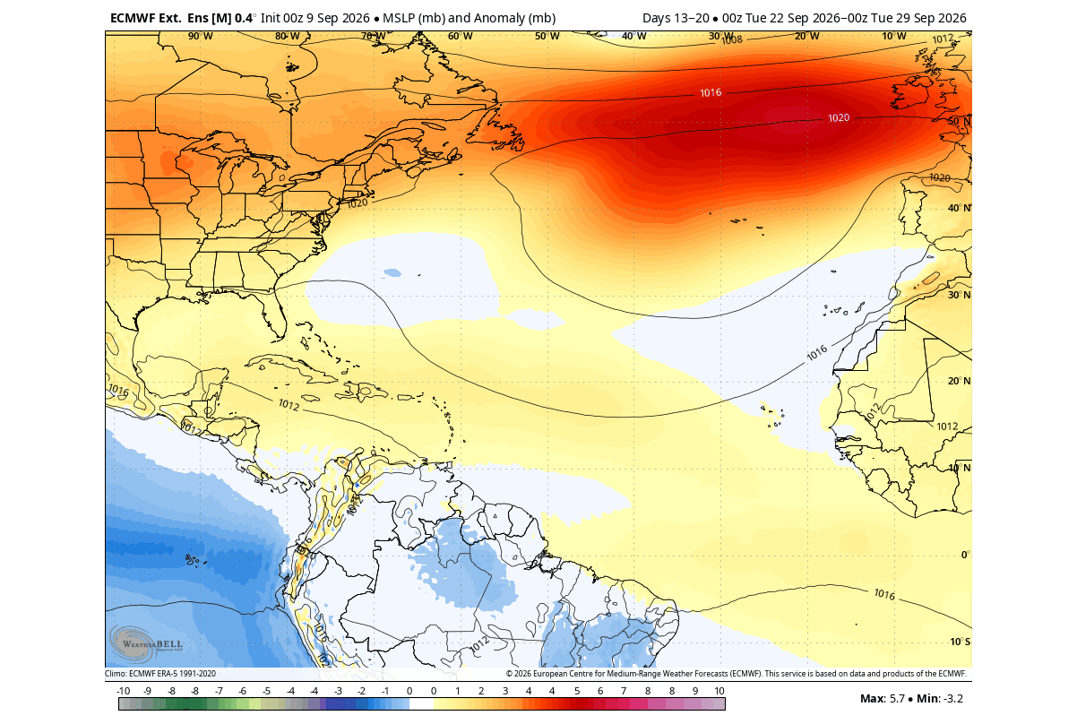
Following a weak hurricane season, meteorological models frequently show a specific temperature distribution: colder-than-normal air settling over the southern and central United States, while Canada and Europe experience warmer-than-average conditions. This is driven by high-pressure zones over the North Atlantic and a shifting jet stream.
The Polar Vortex Connection
Perhaps the most significant long-range implication is the status of the Polar Vortex. While the hurricane season does not "cause" the vortex to collapse, both are influenced by the same atmospheric waves generated by the Super El Niño.
Latest stratospheric plots show a deceleration in the strength of the Polar Vortex heading into January and February 2027. If the vortex weakens as predicted, it may fail to contain frigid arctic air, leading to a "spill-out" of cold air into mid-latitude regions. For the United States, this suggests that despite a quiet, "easy" autumn, the winter months could be marked by significant cold snaps and increased volatility as the stratospheric circulation struggles to maintain its integrity.
Summary of Outlook
As we look toward the remainder of 2026, the primary message is one of cautious optimism for the coastlines, followed by a transition to a potentially turbulent winter. The Super El Niño has effectively turned the Atlantic into a hostile environment for storms, sparing the United States from the typical intensity of an autumn hurricane season. However, the energy shifted by this global phenomenon will inevitably find expression in the winter weather patterns of 2027, necessitating a shift in focus from tropical readiness to cold-weather preparation.
We will continue to monitor the development of the Polar Vortex and provide in-depth analysis on how this Super El Niño will shape the coming months.