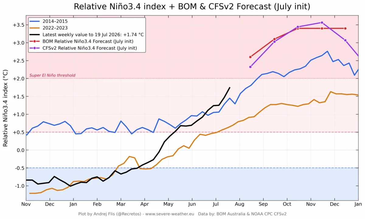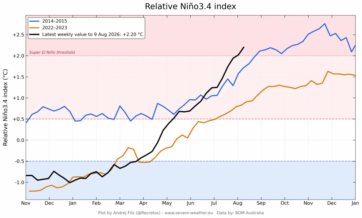
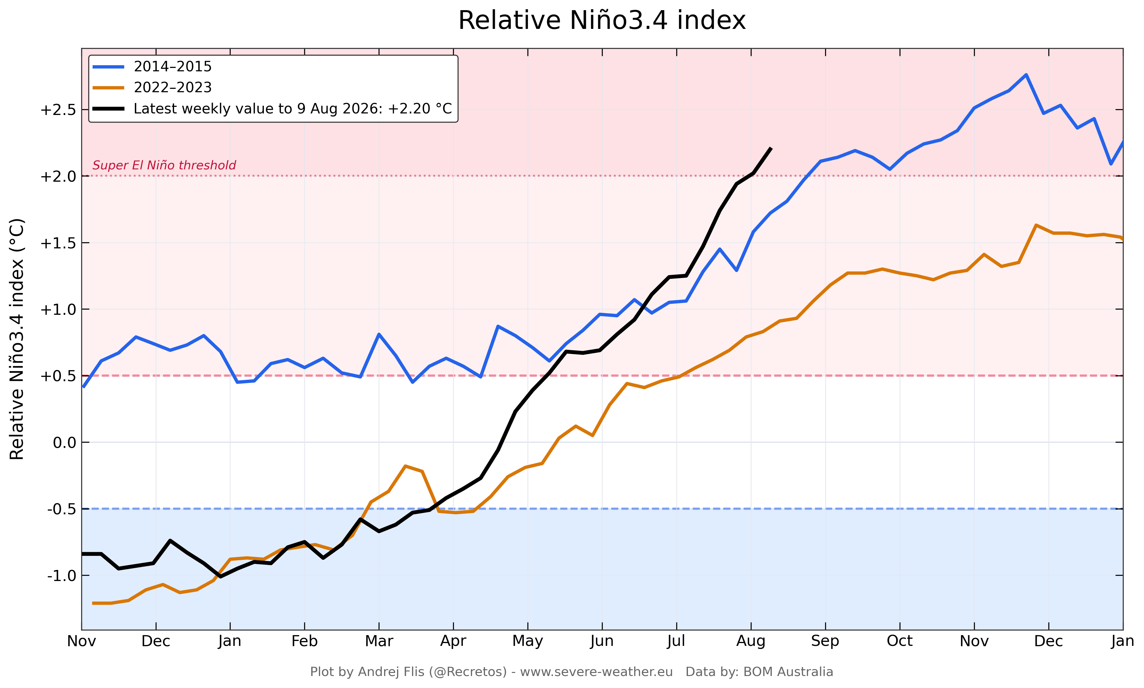
The tropical Pacific Ocean is currently the stage for a meteorological event of historic proportions. A "Super El Niño"—a rare and extreme phase of the El Niño-Southern Oscillation (ENSO)—is strengthening at a rate that has left climate researchers and long-range forecasters stunned. As of August 2026, real-time ocean and atmospheric data confirm that this event is not merely a standard oscillation but a powerhouse weather driver, rapidly exceeding the intensity of the 2015-2016 cycle, which was previously considered a benchmark for extreme activity.

The atmospheric implications of this event are global, promising to reshape weather patterns across the Northern Hemisphere for the remainder of 2026 and well into the winter of 2027.
The Anatomy of a Super El Niño
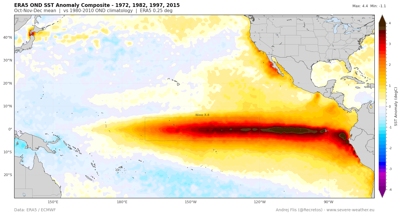
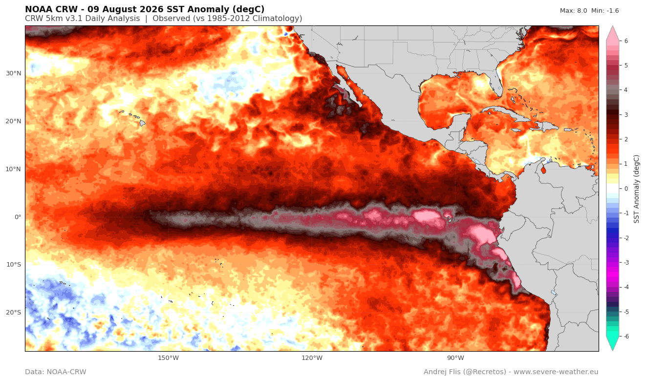
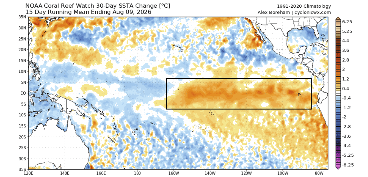
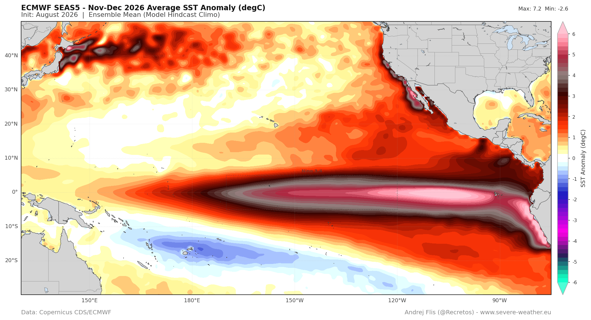
At its core, an El Niño event is characterized by the warming of sea surface temperatures (SSTs) in the central and eastern Pacific. However, a "Super" designation is reserved for events where anomalies exceed 2°C above the long-term average. The 2026 event is currently tracking toward an extreme threshold, with some regions experiencing anomalies upwards of 5°C to 6°C.
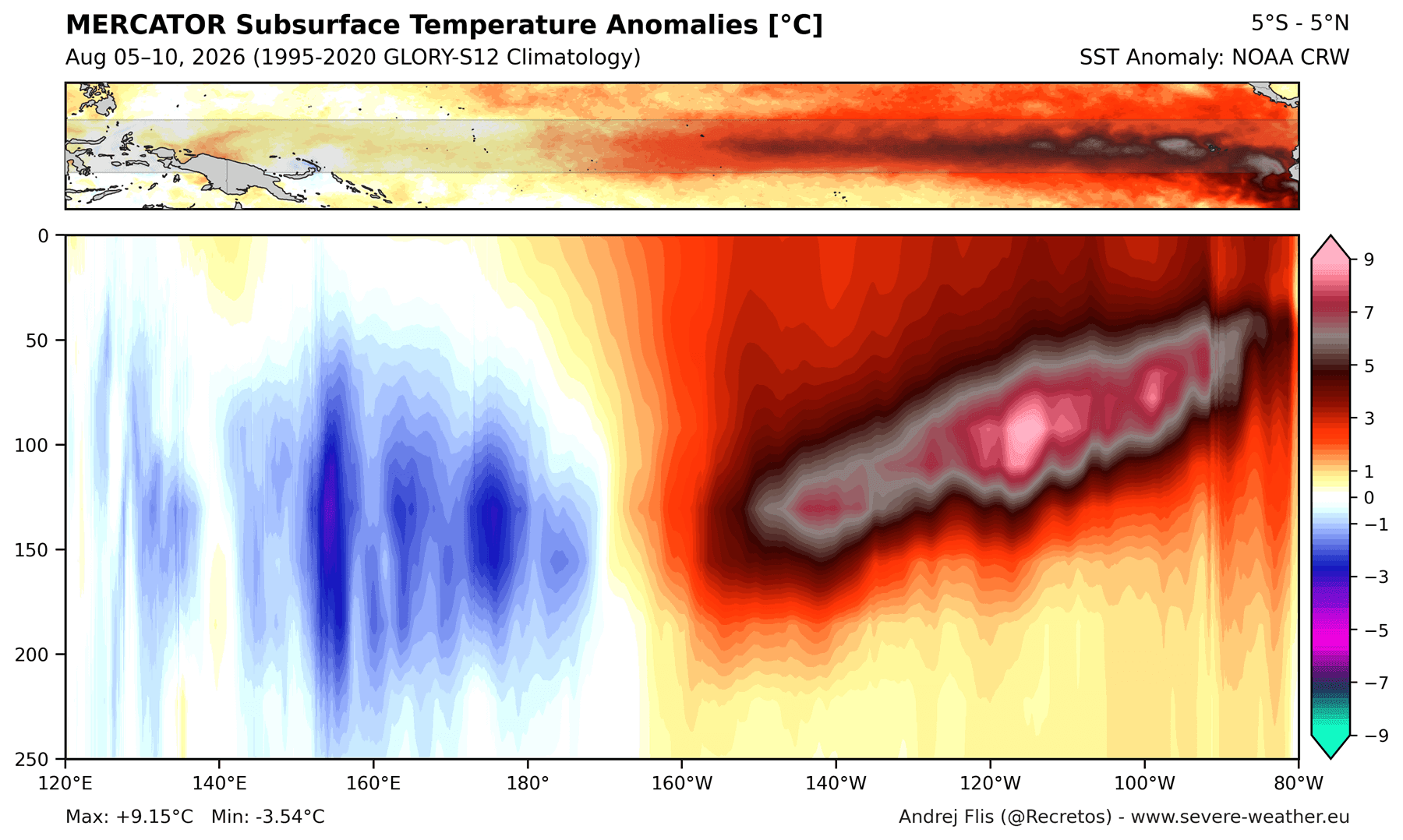
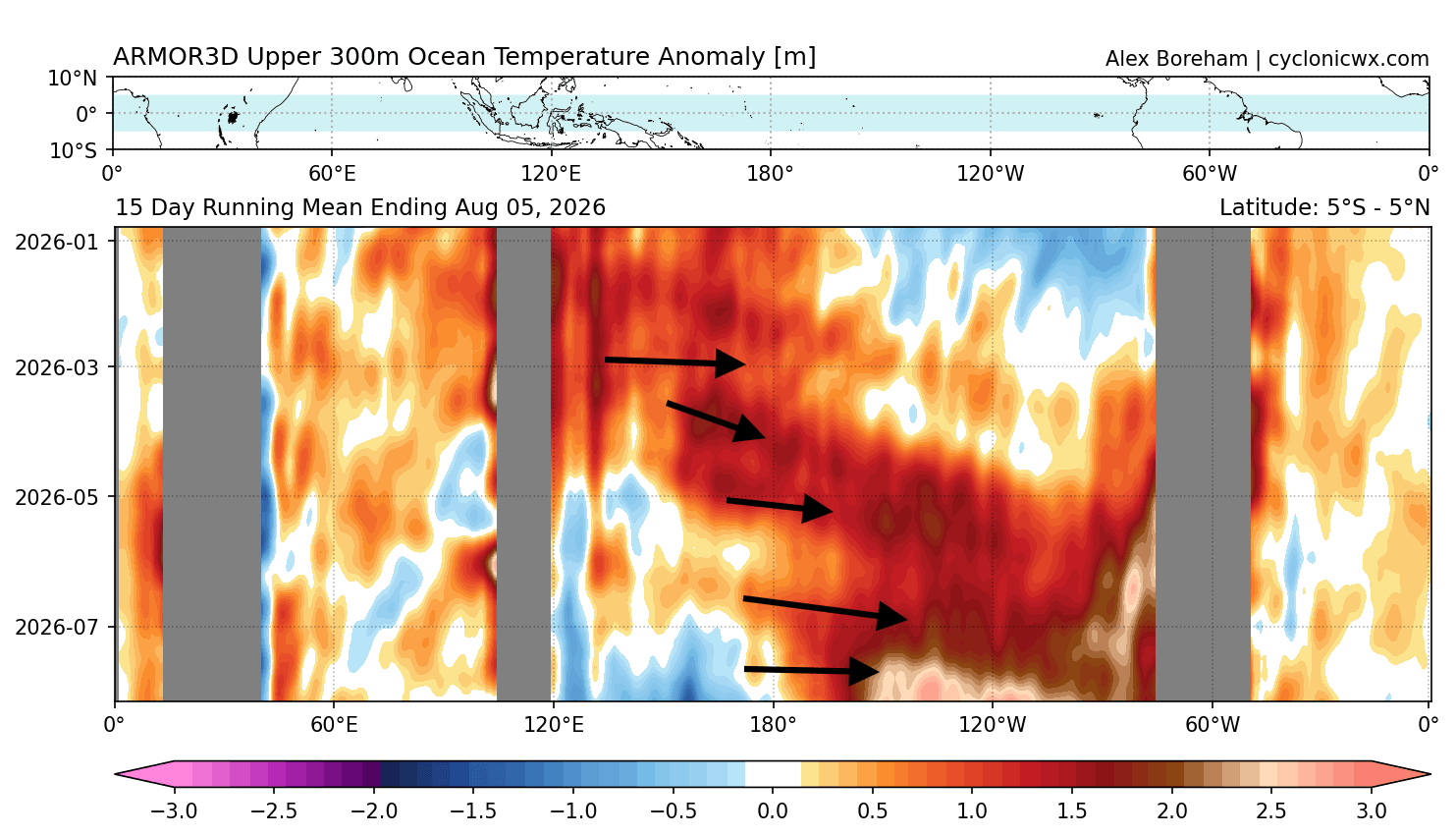
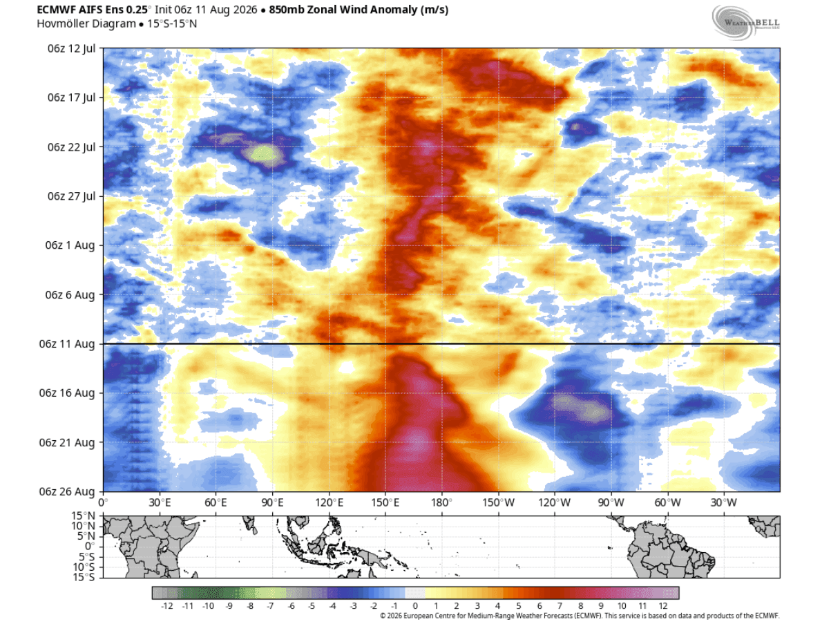
This rapid intensification is fueled by an "ocean-atmospheric engine." When westerly wind bursts—a reversal of the usual trade winds—occur in the western Pacific, they push massive volumes of warm water eastward. This creates a "Kelvin Wave," a submerged pulse of thermal energy that travels across the Pacific basin, eventually surfacing to further elevate SSTs. The current 2026 Kelvin Wave is displaying an energy signature that exceeds virtually all recorded events in the modern meteorological archive.
Chronology of Development: From Spring to Peak
The rapid development of this event began in early spring 2026, when trade winds began to falter. By June, the Pacific was already showing signs of a "coupled" system—a feedback loop where the ocean and atmosphere begin to influence one another in a sustained, self-reinforcing cycle.
- June–July 2026: The Multivariate ENSO Index (MEI), which synthesizes both ocean and atmospheric data, hit a record-high value of +2.4. This is an unprecedented jump for a two-month period, signaling that the event had matured far earlier than historical averages would suggest.
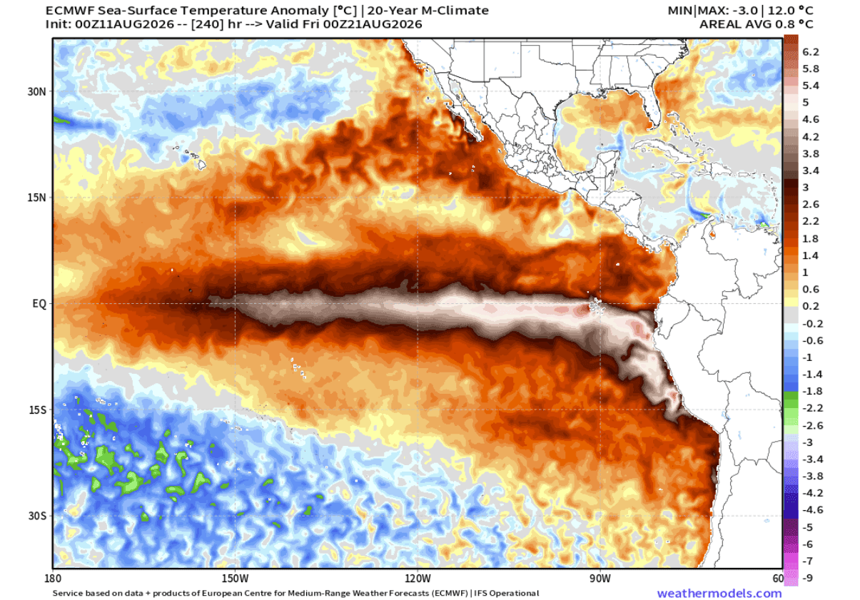
- August 2026: Mid-month analysis from the European Centre for Medium-Range Weather Forecasts (ECMWF) confirmed that the warming trend shows no signs of dissipation. If current trajectories hold, the event will reach its absolute peak intensity during the November-December window.
- Winter 2026/2027 Outlook: As the year closes, the "atmospheric standing wave" created by this Super El Niño will likely lock into place, dictating the position of the jet stream for months to come.
Supporting Data: The Engine Beneath the Surface
The strength of this El Niño is not just visible on the surface; it is profoundly driven by subsurface heat content. Current NOAA CRW (Coral Reef Watch) and global ocean analysis indicate that the top 250 meters of the Pacific are holding a massive pool of anomalous heat.
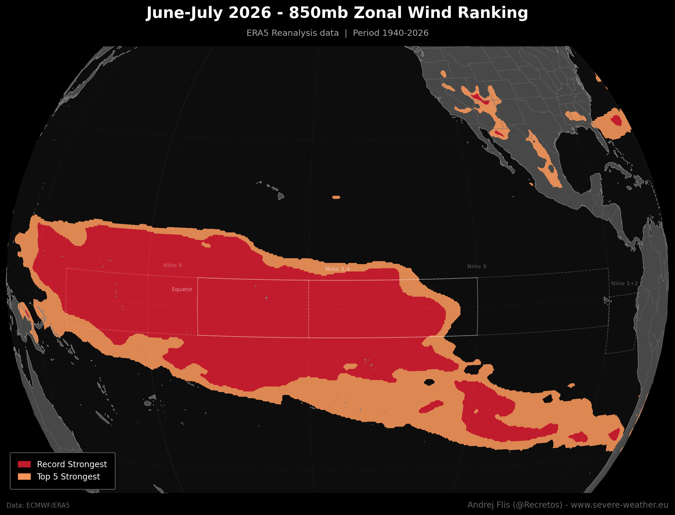
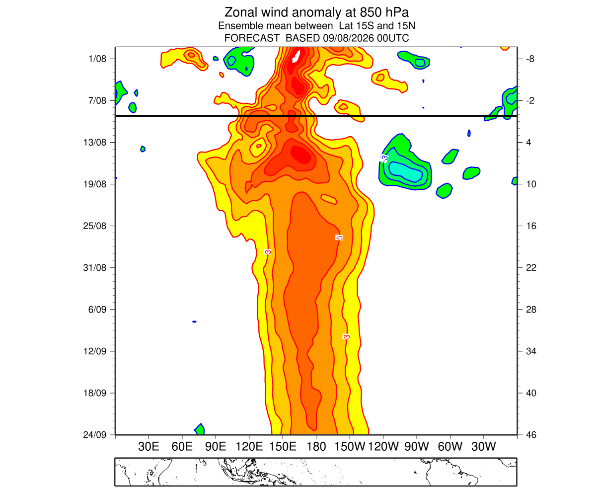
Data from the ERA5 reanalysis highlights that low-level westerly wind anomalies over the last two months rank as the strongest in the past 86 years. This persistent "push" ensures that the Kelvin Wave remains well-fed, providing a continuous supply of warm water that prevents the system from cooling. Furthermore, ensemble forecasts from the ECMWF show a persistent signal for westerly winds through late September, suggesting that the "engine" driving this event will remain operational for the foreseeable future.
Global Atmospheric Forcing: The Walker Cell Shift
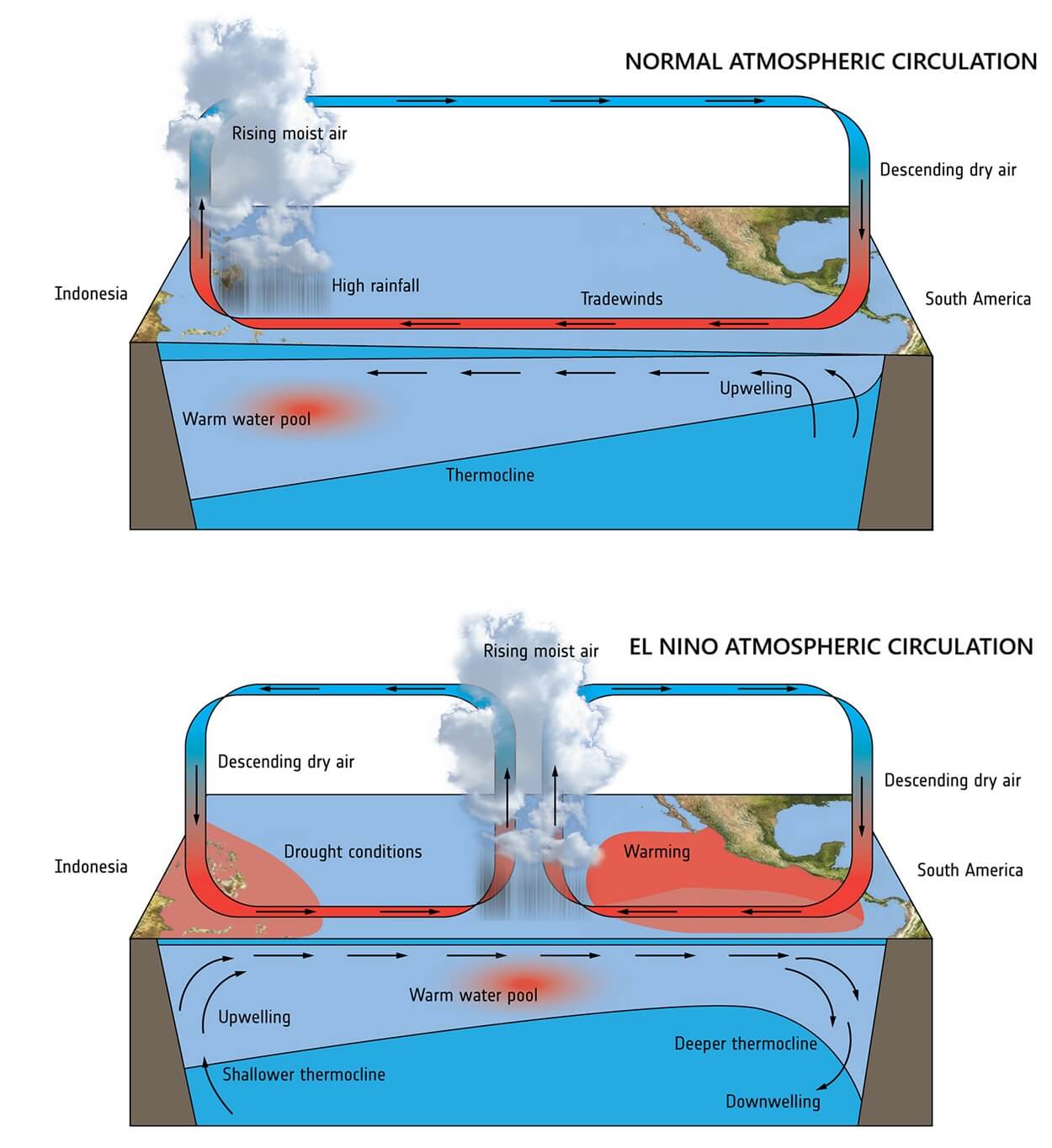
The Walker Cell—the primary atmospheric circulation pattern in the tropics—is currently undergoing a radical transformation. Normally, air rises in the western Pacific and sinks in the east. The 2026 Super El Niño has reversed this, creating a massive zone of rising air over the central and eastern Pacific.
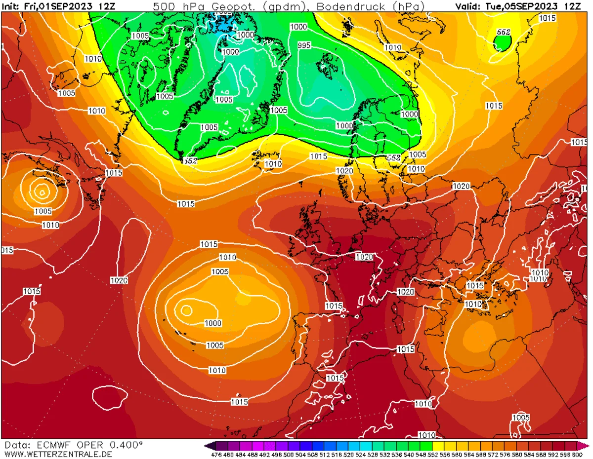
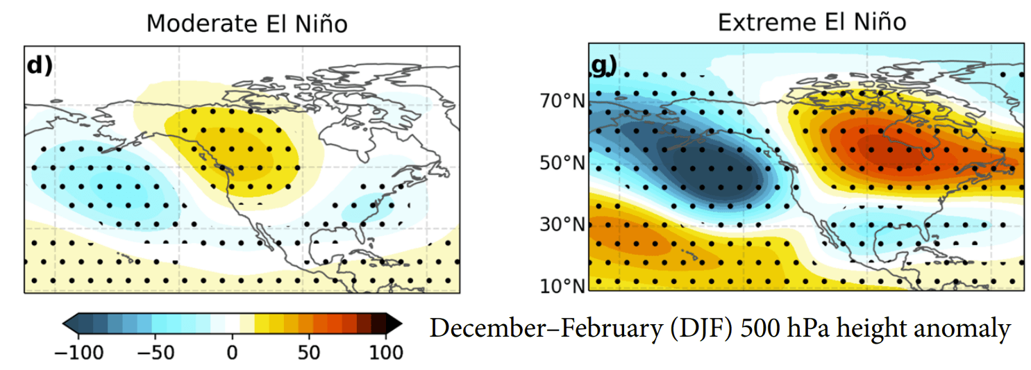
This creates an "atmospheric standing wave." When such a massive, high-energy system forms, it essentially "bullies" other weather drivers, forcing them to align with its circulation. This phenomenon explains why meteorologists are already seeing winter-like pressure patterns appearing in late summer; the sheer energy of the Super El Niño is forcing the global atmosphere to adapt to a winter configuration prematurely.
Implications for North America: A Tale of Two Seasons
The primary impact on the United States and Canada is the amplification of the Pacific jet stream.
The United States and Canada
The typical "El Niño Winter" signature involves a high-pressure ridge over Canada and the northern United States, which often leads to milder, drier conditions in those regions. Conversely, the southern United States is expected to see an active, moisture-laden storm track.
Current models suggest:
- The South and Southeast: Increased frequency of storm systems, potentially leading to above-average precipitation and a higher risk of flooding.
- The Northern Plains and Canada: A higher probability of warmer-than-normal temperatures, as the Canadian ridge blocks the influx of polar air.
- Mid-Late Winter Shifts: Late-winter forecasts (February 2027) indicate a potential "overdrive" scenario where the atmospheric wave shifts eastward. This could result in a surge of cold air and increased snowfall potential for the central, eastern, and northeastern United States, provided there is enough cold air mass to interact with the moisture.
Europe: The Westerly Flow
While the Pacific is the origin point, the impacts ripple globally. For Europe, the Super El Niño is projected to reinforce a dominant westerly flow from the Atlantic. This typically results in a milder, wetter winter for much of the continent, particularly in the western and central regions. While northern and northeastern Europe may see periods of colder weather as low-pressure systems track inland, the overall seasonal trend leans toward warmer temperatures and increased precipitation.
Official Observations and Long-Range Forecasting
The scientific community is currently treating the 2026/2027 event with extreme caution. Because seasonal models often underpredict the speed at which Super El Niño events develop—due to their inability to fully simulate individual, stochastic wind bursts—the current forecast trends are being updated on a rolling, weekly basis.
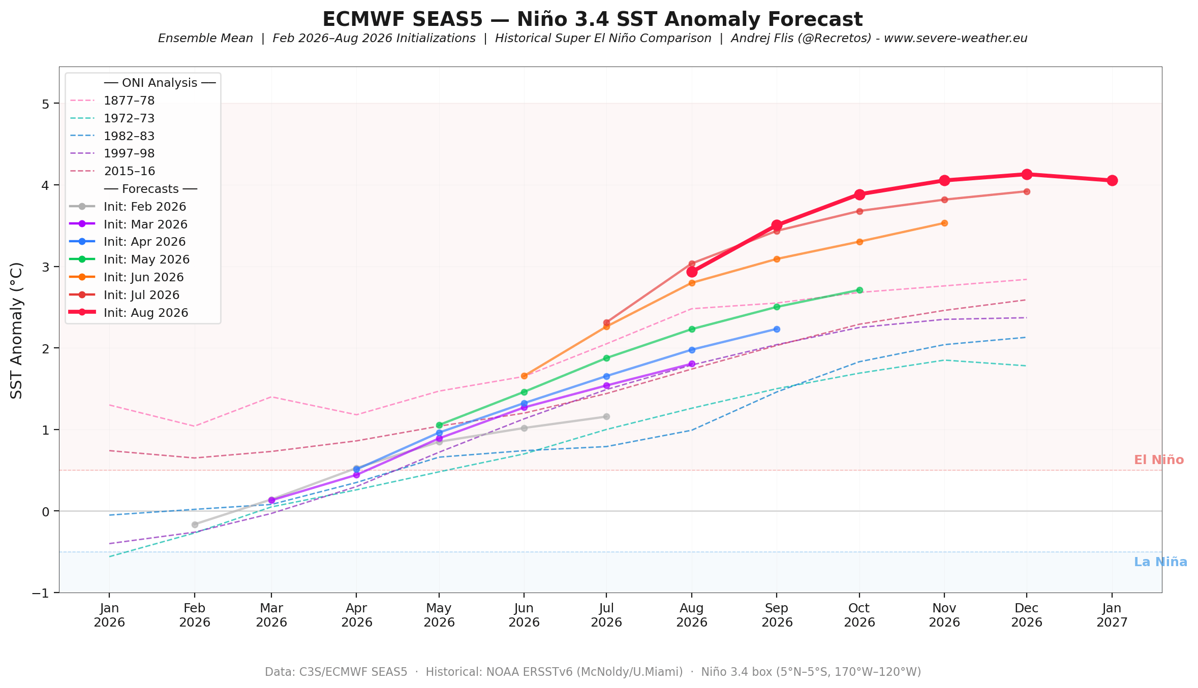
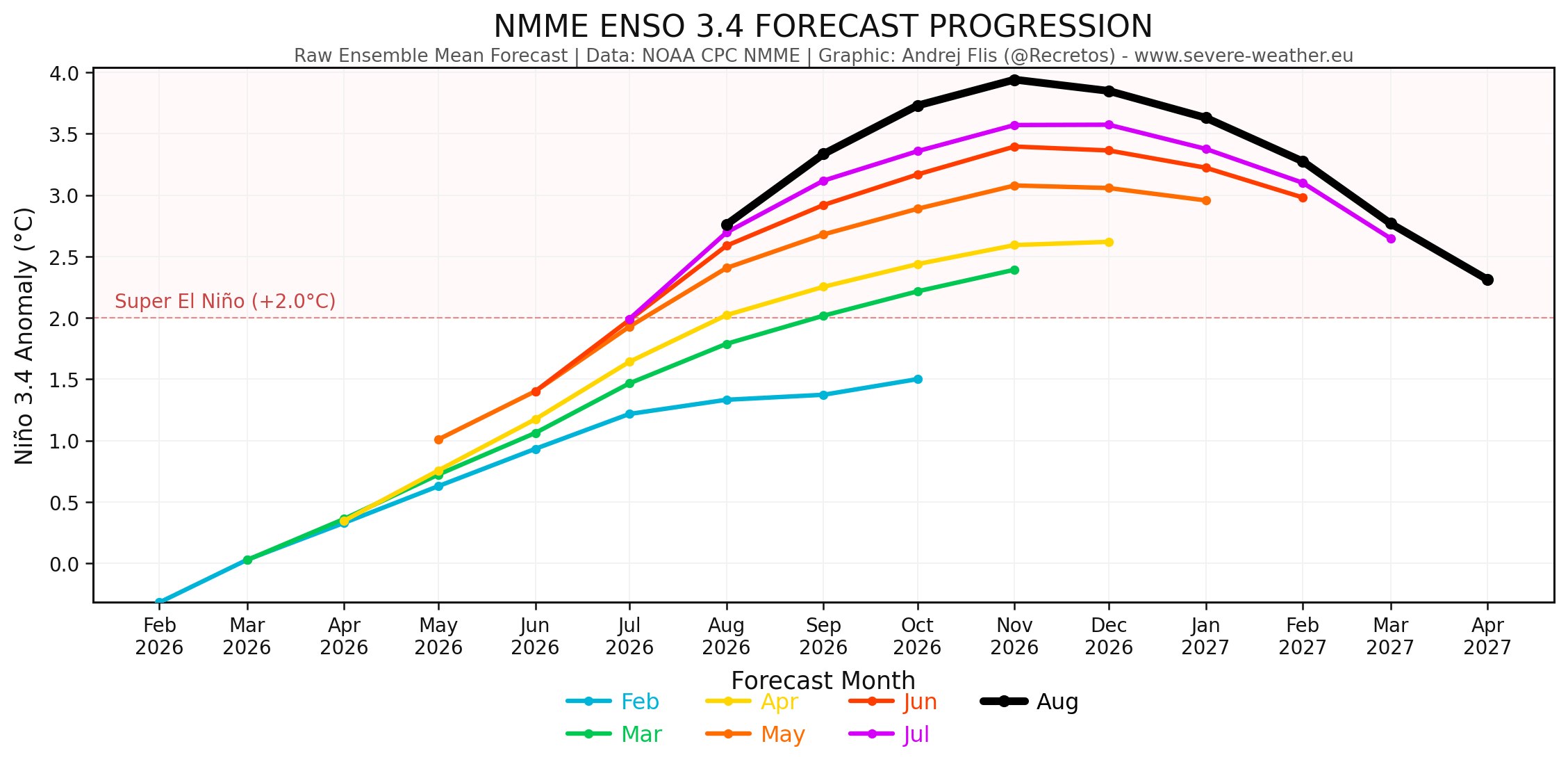
Each new model run from the ECMWF and the NMME (National Multi-Model Ensemble) has shown a consistent trend: the peak anomaly is being pushed higher with every iteration. Meteorologists warn that we are entering "uncharted territory." When an event reaches the +3°C to +4°C threshold (the current projected peak for the main ENSO region), the predictability of local weather outcomes becomes more difficult, as the sheer energy of the event can trigger secondary, chaotic atmospheric responses.
Conclusion: Preparing for the Unpredictable
As we transition into the autumn and winter of 2026, the global weather community will remain focused on the Pacific. The "Super" designation is not a term used lightly; it implies a level of disruption to global circulation that can influence everything from agricultural yields to energy consumption and public safety.
For the general public, this means that the typical seasonal averages of the past may be unreliable predictors for the coming months. With a historic, record-setting El Niño event as the primary driver, the 2026/2027 winter season is poised to be one of the most volatile and closely watched meteorological periods in recent history. Residents in regions prone to heavy winter storms or intense precipitation are encouraged to monitor local weather services closely as the autumn months unfold.