August 12, 2026 — Atmospheric and oceanic data from across the globe confirm that we are currently witnessing the rapid intensification of a "Super El Niño" event. This phenomenon, characterized by a massive surge in sea surface temperatures across the equatorial Pacific, has reached levels that place it on a trajectory to become the strongest event in at least 155 years of recorded climate history.

As the Pacific Ocean’s thermal engine drives global circulation patterns, meteorologists and climatologists are observing clear "atmospheric signatures" that suggest the upcoming Winter 2026/2027 season will be defined by extreme variability, with profound implications for North America and Europe.
The Mechanics of a Super El Niño
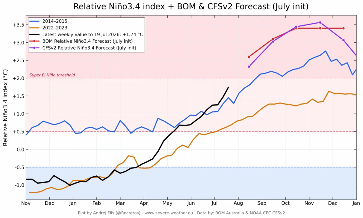
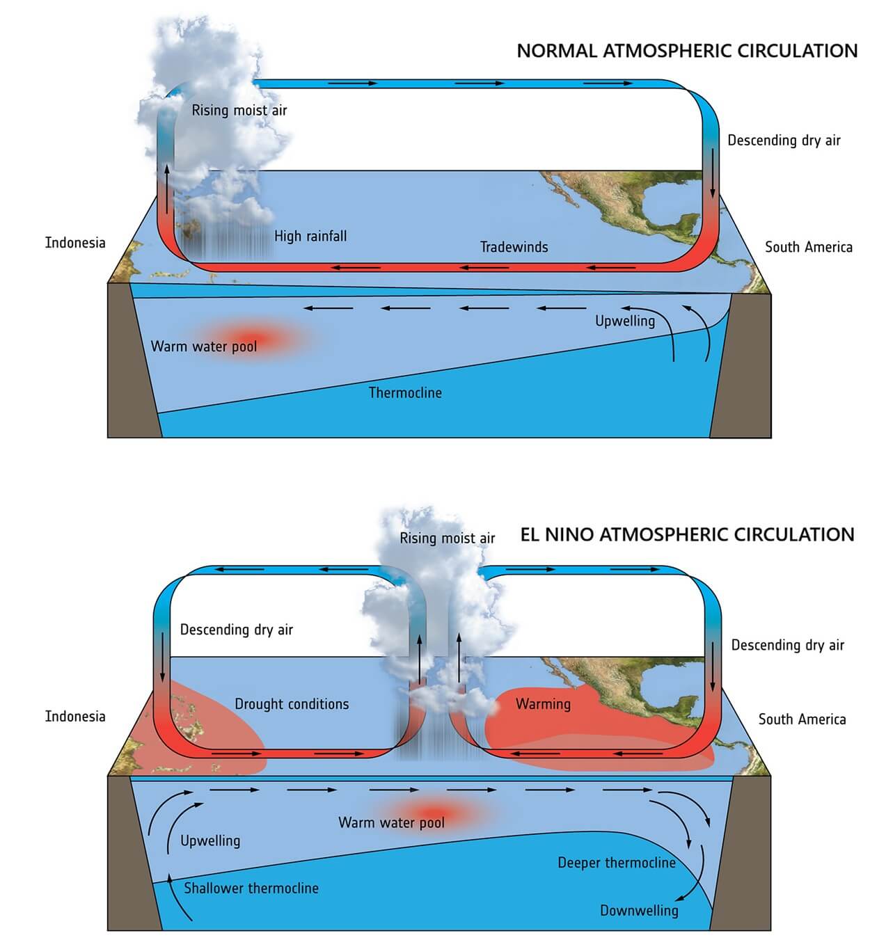
At its core, an El Niño event is the warm phase of the El Niño-Southern Oscillation (ENSO), an irregular, periodic variation in winds and sea surface temperatures over the tropical eastern Pacific Ocean. When the event reaches "Super" status—defined by temperature anomalies exceeding +2.0°C above the long-term average—it acts as a planetary-scale "pressure release valve" for the massive amounts of thermal energy stored in the deep ocean.
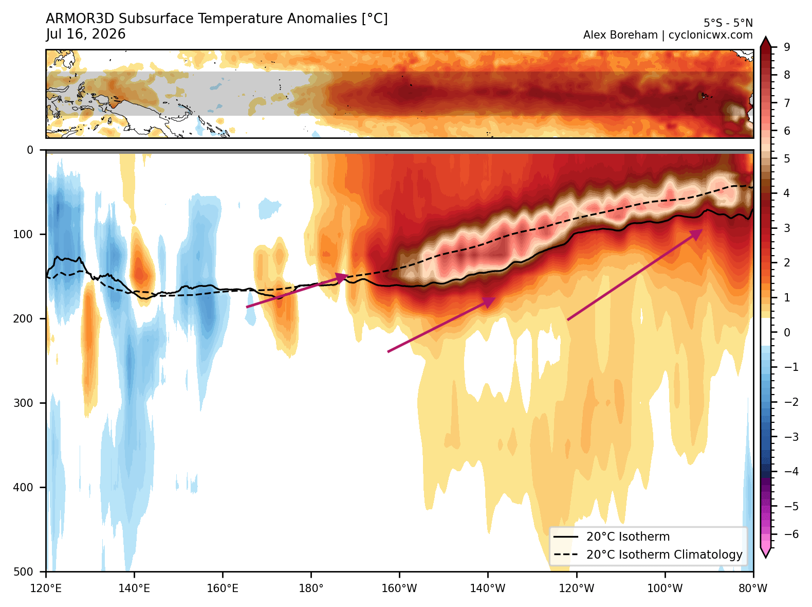
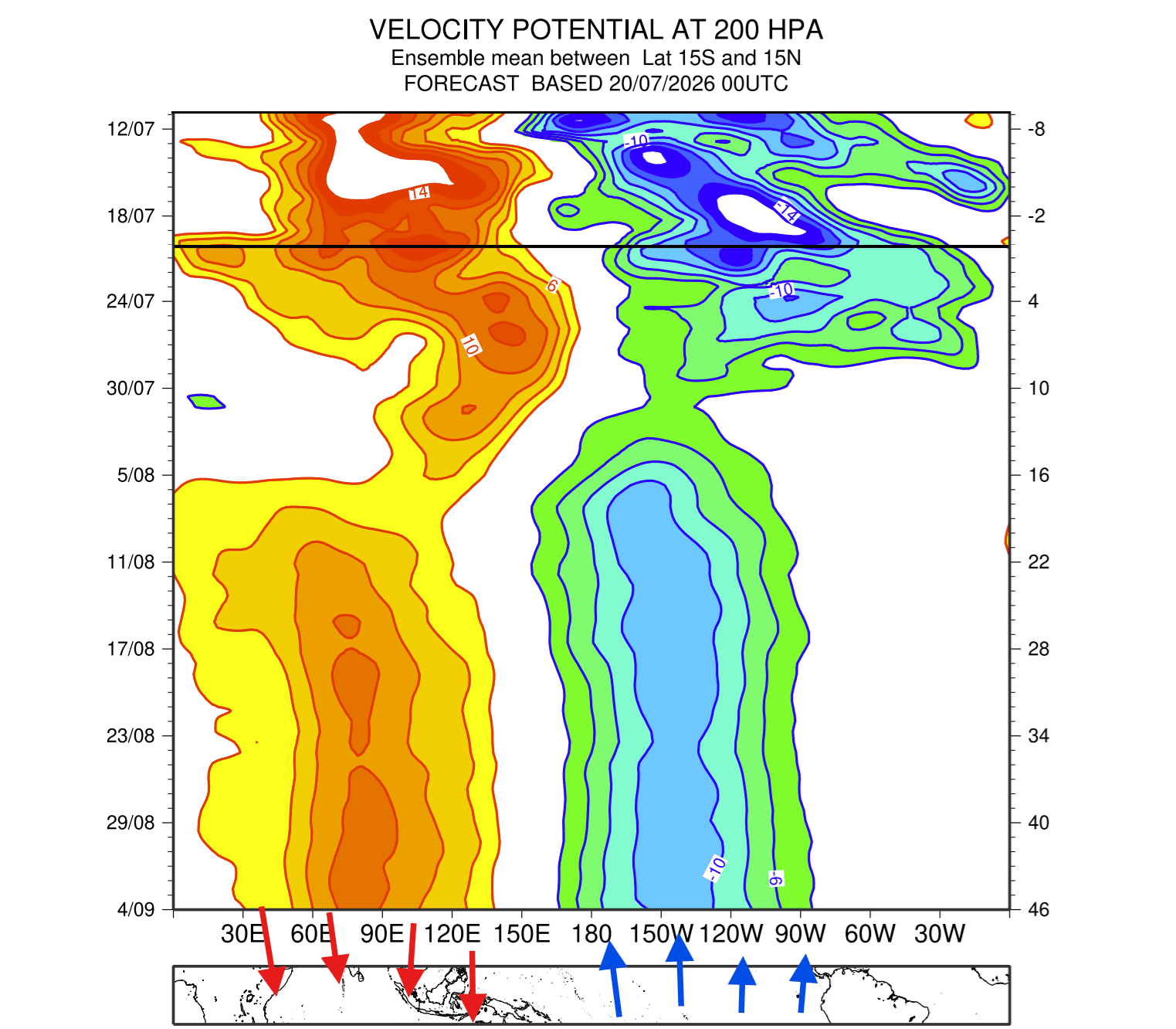
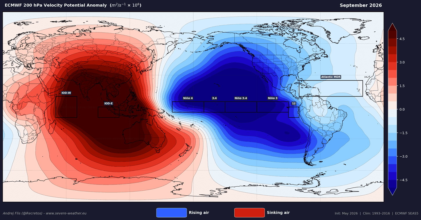
The current 2026 event is being fueled by a powerful Kelvin Wave—a massive pulse of warm water moving eastward beneath the ocean’s surface. As this energy reaches the eastern Pacific and rises, it fundamentally alters the "Walker Cell," the atmospheric circulation pattern that dictates global rainfall and pressure systems. By shifting the zone of rising air from the western to the central and eastern Pacific, the ocean is essentially "locking" the atmosphere into a persistent, high-energy state that will likely dominate weather patterns through the spring of 2027.
Chronology of Intensification: A Rapid Onset
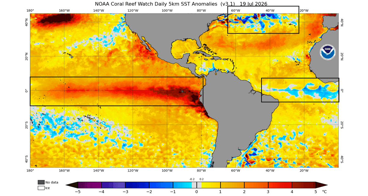
The development of this event has been startling in its velocity. Since early summer 2026, satellite data and buoy arrays have monitored a steady rise in ocean temperatures.
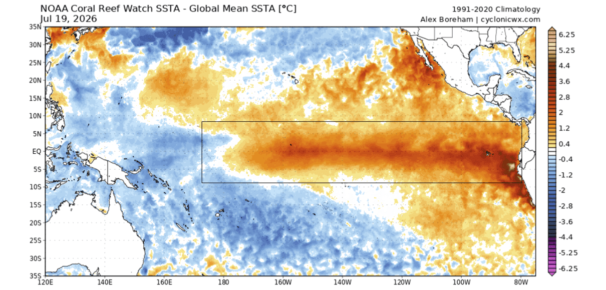
- Early Summer 2026: Initial sea surface temperature anomalies began to break historical benchmarks, with subsurface temperature anomalies in the top 500 meters of the Pacific reaching more than 7°C above normal.
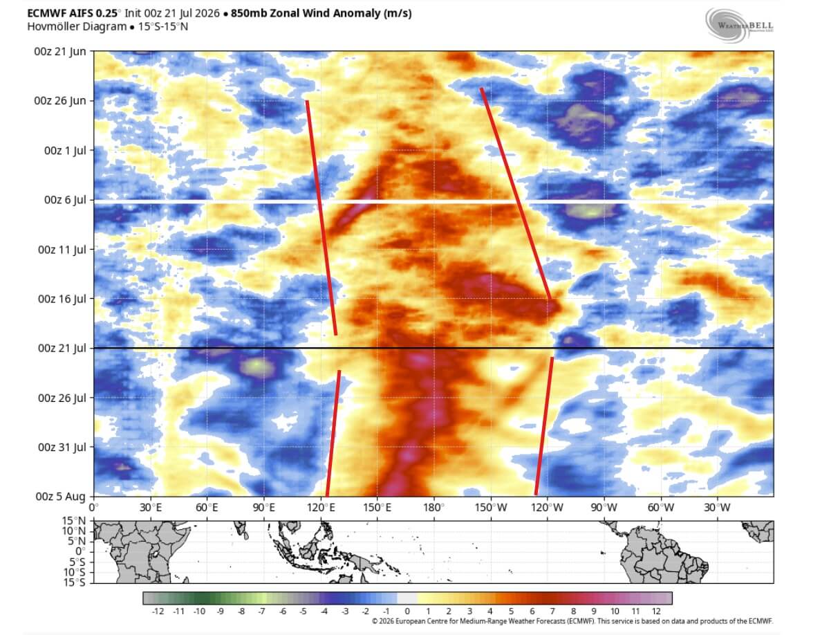
- Mid-Summer 2026: The emergence of intense westerly wind bursts across the tropics provided the necessary momentum to push the event into the Super category.
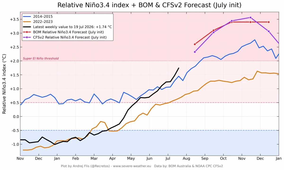
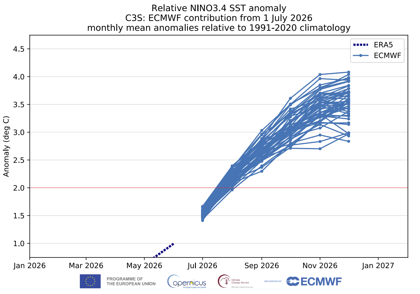
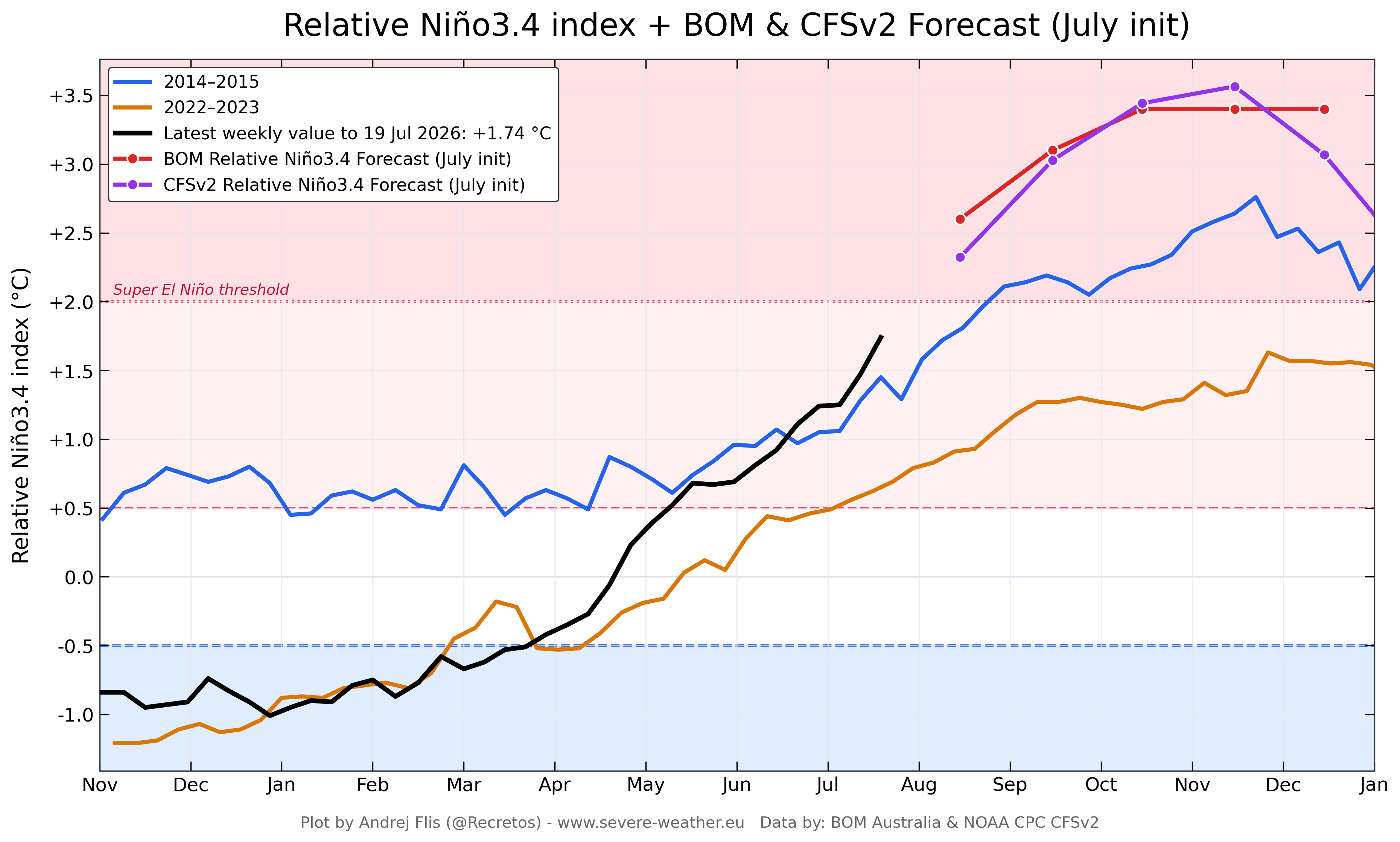
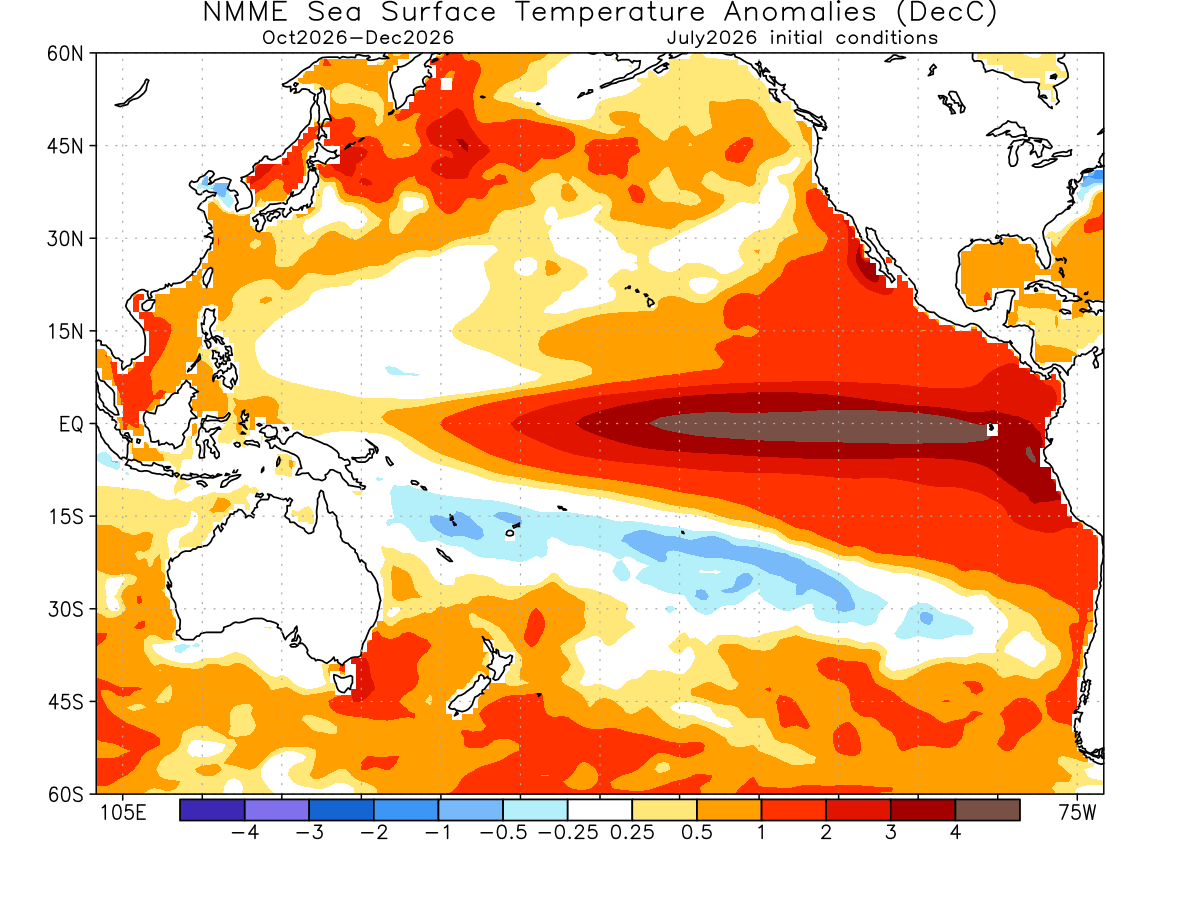
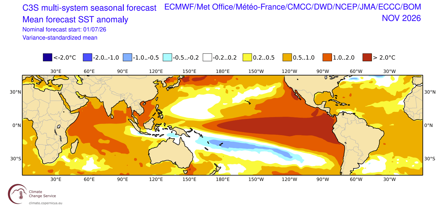
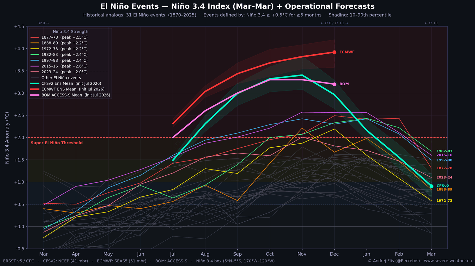
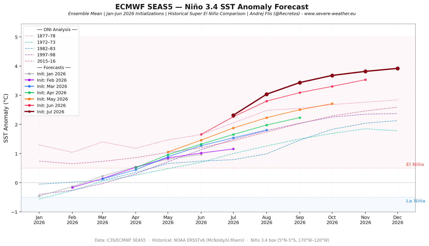
- Current Status: Multi-model consensus—including data from the European Centre for Medium-Range Weather Forecasts (ECMWF), the American NOAA CFSv2, and the Australian Bureau of Meteorology (BOM)—indicates that the peak of the event will likely occur between November and December 2026, with anomalies potentially breaching the +3.0°C to +4.0°C threshold.
Each subsequent model run since January has consistently trended toward a stronger event, suggesting that previous climate models may have underestimated the sheer magnitude of the atmospheric feedback loops involved in this year’s phenomenon.
Supporting Data: Why This Event is Unique
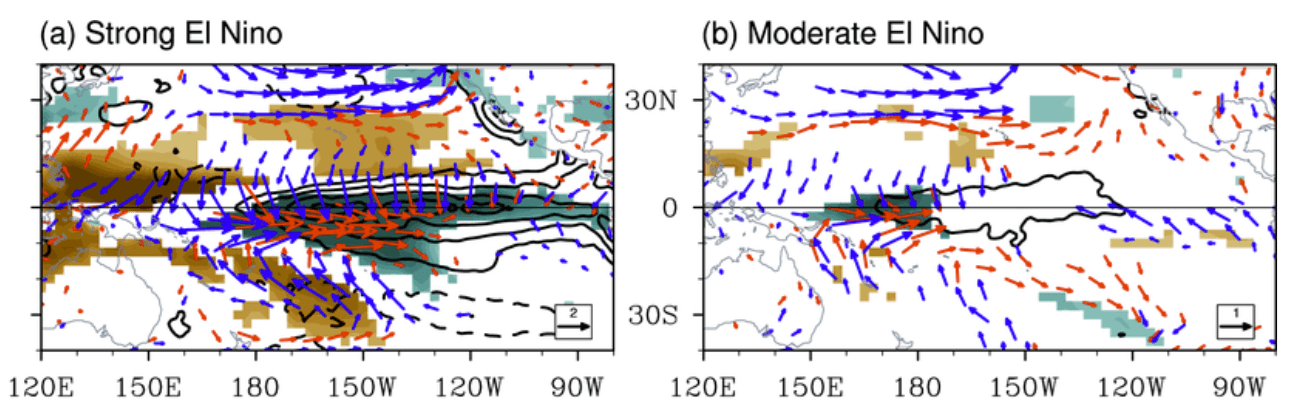
The distinction between a standard El Niño and a Super event lies in the atmospheric response. While a moderate event may cause scattered shifts in weather, a Super El Niño creates a global "atmospheric bridge."
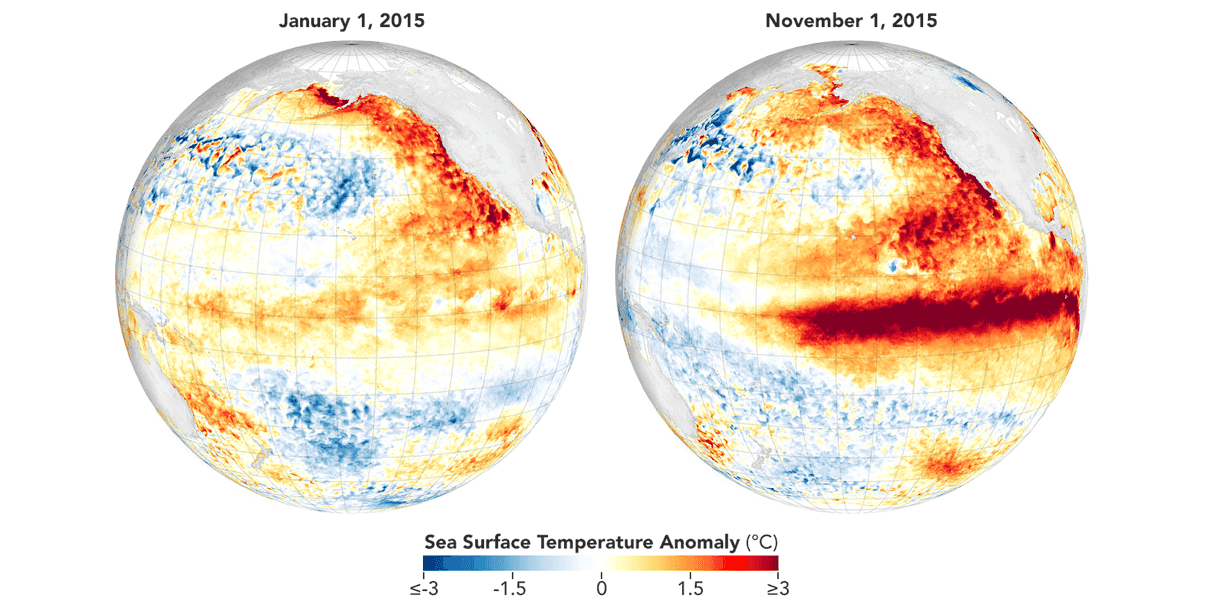
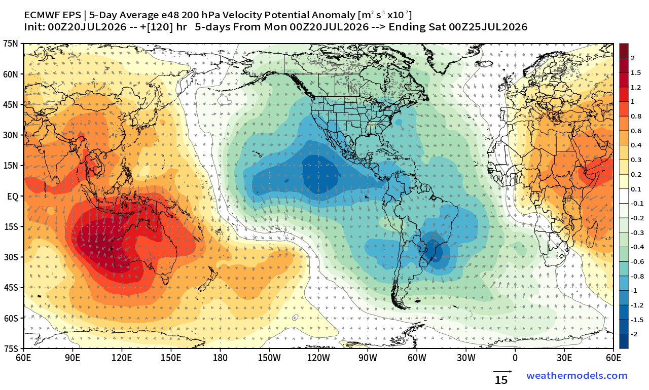
Evidence for this is found in the "Velocity Potential" maps, which reveal a stationary, fixed area of rising air over the Pacific. This signifies that the atmosphere has become "locked," losing its typical dynamic variability. Comparison plots between the 2015/2016 Super El Niño and the current 2026 data show that the current event is developing faster and with a broader thermal footprint than its predecessor. This "red flag" scenario suggests that the impacts on seasonal precipitation and temperature will be more severe and geographically widespread than in typical years.
Implications for North America and Europe
The most immediate and high-impact consequences of this Super El Niño will manifest during the winter months in the Northern Hemisphere.
North American Winter Trends
The standard El Niño impact on North America involves a shift in the polar jet stream. In 2026/2027, the primary expectation is a strong, persistent low-pressure area in the North Pacific. This will likely drive the polar jet stream further north, resulting in significantly warmer-than-normal conditions across Western Canada and the Northern United States.
Conversely, the southern Pacific jet stream is expected to become highly amplified. This will channel a constant stream of moisture-rich, low-pressure systems across the Southern and Eastern United States. The result will be increased precipitation, potential flooding, and more frequent winter storm systems for states ranging from California and Texas through to the Gulf Coast and the Mid-Atlantic.
European Outlook
Europe remains a more complex variable. Unlike North America, which sits in the direct path of the Pacific-driven atmospheric bridge, Europe’s weather is influenced by a wider array of teleconnections. However, current forecasts indicate a trend toward high-pressure ridging over southern Europe, with the potential for low-pressure systems to track further north. This could result in a mild winter for the continent, though the uncertainty remains higher compared to the North American outlook.
The "Polar Vortex" Factor
One of the most critical implications of this Super El Niño is its interaction with the stratospheric Polar Vortex. A weak or disrupted Polar Vortex is the primary driver of extreme, sustained cold-air outbreaks in the mid-latitudes.
Historically, the strong tropical forcing provided by a Super El Niño increases the probability of a "Sudden Stratospheric Warming" (SSW) event. If such an event occurs in the winter of 2026/2027, it could lead to a complete or partial collapse of the Polar Vortex. This would release the reservoir of Arctic air, allowing it to spill southward into the United States, Canada, and Europe.
Recent model runs from the ECMWF show a significant "disruption signal" for January and February. While a collapse is not a guarantee, the atmospheric conditions—driven by the heat from the Pacific—are creating the exact environment that has preceded historic cold-air outbreaks in the past.
Official Scientific Perspectives
Meteorological agencies worldwide are treating the 2026/2027 Super El Niño as a priority for disaster risk reduction. The combination of intense moisture in the southern United States and the potential for a volatile Polar Vortex suggests that emergency management sectors should prepare for a season of "extremes."
The scientific community is currently focusing on the "non-linear" nature of this event. Because the anomaly is so far beyond historical averages, there is a legitimate concern that traditional climatological "textbooks" may not accurately predict the severity of the weather. Researchers are actively monitoring the Kelvin Wave propagation and the resulting atmospheric pressure anomalies to provide more granular, short-term updates as the winter season approaches.
Conclusion: A Season of Uncertainty
As we head into the final months of 2026, the global climate system is clearly under the influence of a record-breaking oceanic anomaly. The 2026/2027 Super El Niño is not merely a regional Pacific event; it is a fundamental driver of planetary circulation.
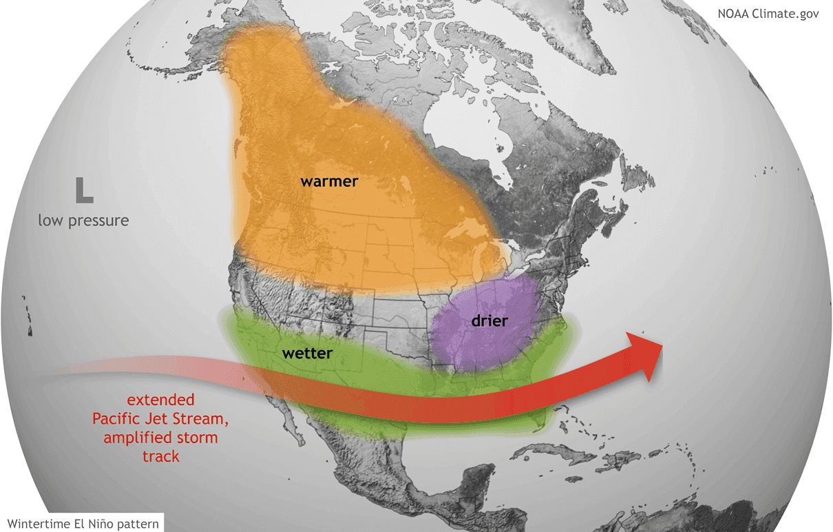
Residents in the United States and Canada should prepare for a winter defined by sharp contrasts: warm and dry in the north, and potentially stormy, wet, and volatile in the south. For Europe, the impacts remain dependent on the downstream effects of the Pacific jet stream and the stability of the Polar Vortex.
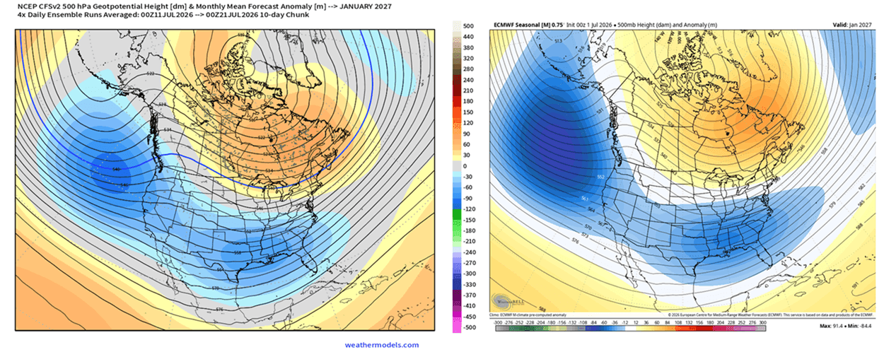
As always, the situation remains fluid. Ongoing satellite monitoring and ensemble model forecasting will be essential in refining these outlooks as the winter season progresses. Citizens are encouraged to stay informed through local meteorological services, as this Super El Niño represents a rare, high-energy climate event that will continue to challenge our understanding of seasonal weather predictability.