The global climate system is currently bracing for an atmospheric shift of historic proportions. Meteorologists and climatologists are observing the rapid emergence of a "Super El Niño," a powerful oceanic and atmospheric phenomenon that is poised to serve as the primary driver of global weather patterns for the upcoming Fall and Winter seasons. With sea surface temperature anomalies in the equatorial Pacific already climbing at a remarkable pace, the stage is set for a highly volatile and active weather regime across the Northern Hemisphere.

Main Facts: A Global Weather Driver
The El Niño Southern Oscillation (ENSO) refers to the periodic warming and cooling of the central and eastern tropical Pacific Ocean. We are currently witnessing a transition into a strong warm phase—an El Niño event—that shows all the hallmarks of becoming a "Super" event.
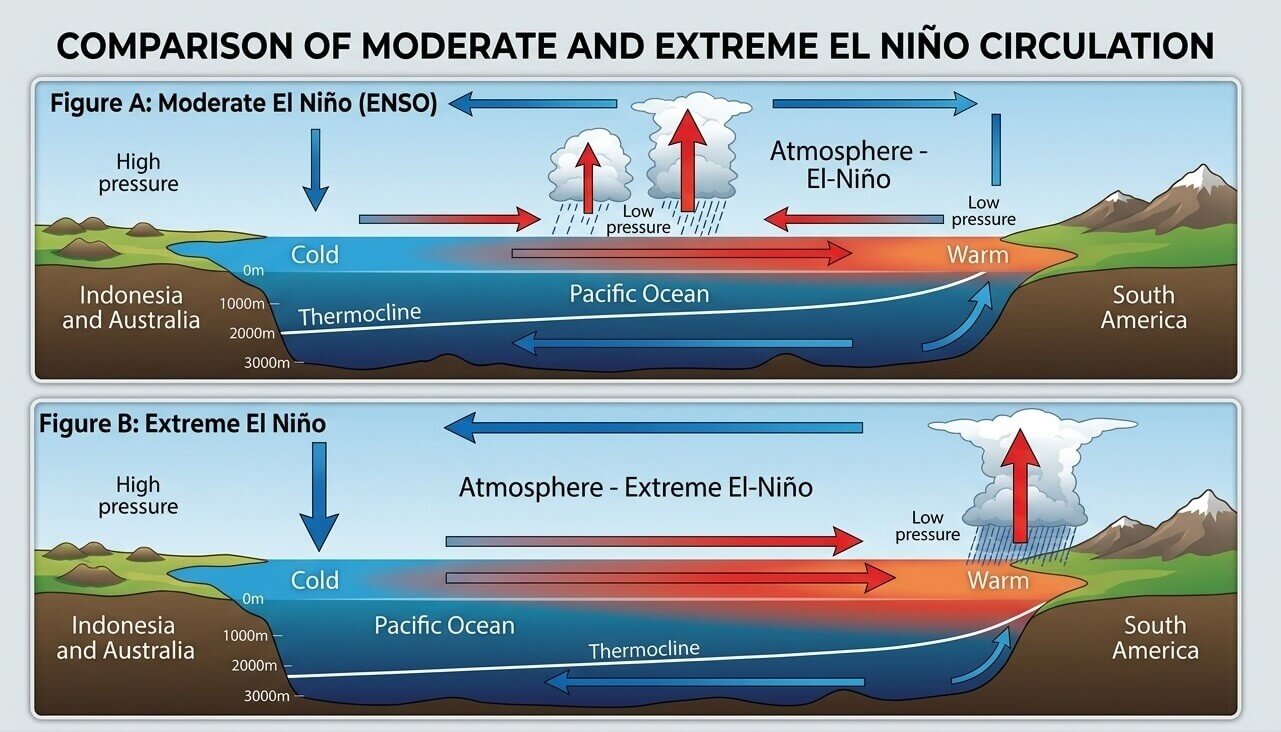
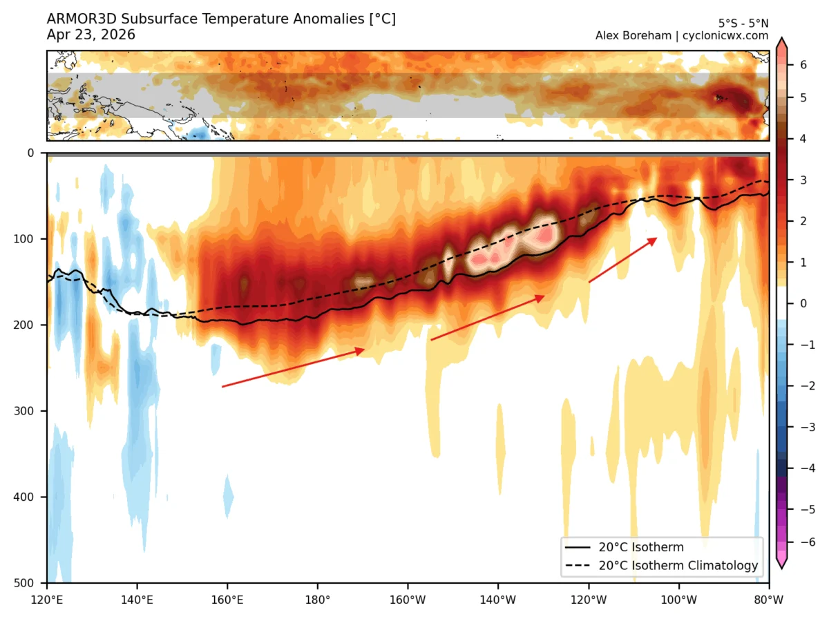
By definition, a Super El Niño requires sustained seasonal temperature anomalies in the ENSO region to exceed +2.0 degrees Celsius. Recent data indicates that the Pacific is not only reaching this threshold but is trending toward peak anomalies that could rival the most significant events on record. Unlike typical seasonal transitions, which often feature weaker, disorganized patterns, the 2026/2027 cycle shows an early and aggressive coupling between the ocean and the atmosphere. This "atmospheric bridge" means the effects of the warming Pacific are already beginning to influence weather patterns in North America, Europe, and the tropics well ahead of the traditional winter peak.
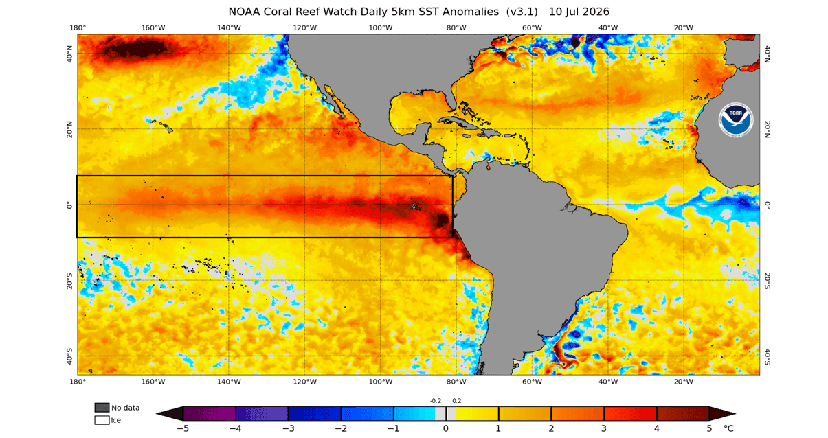
Chronology: The Evolution of a Record-Breaking Event
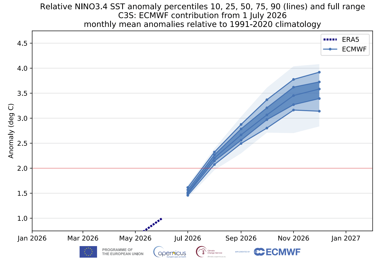
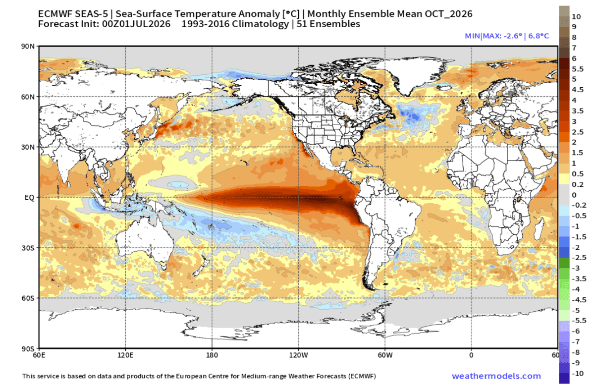
The progression of this event has been unusually swift. Data collected over the last 90 days shows a consistent, rapid warming trend across the main ENSO region. While raw anomalies have already surpassed the +2.0-degree mark, the latest climate models—including the ECMWF (European Centre for Medium-Range Weather Forecasts) and the North American Multi-Model Ensemble (NMME)—suggest that the warming will continue to intensify through the Autumn of 2026.
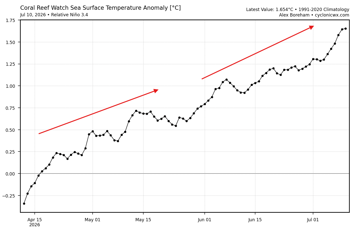
- Summer 2026: Initial identification of rapid warming in the eastern Pacific.
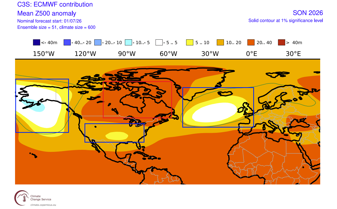
- Early Fall 2026: Emergence of a "winter-like" pressure pattern, characterized by a persistent high-pressure ridge over Canada and a deepened low-pressure trough in the North Pacific.
- Late Fall 2026: Expected peak of atmospheric coupling, where the Walker Cell circulation—the tropical atmospheric motion—adjusts to the extreme ocean temperatures.
- Winter 2026/2027: Anticipated peak of the event, with potential for historically strong anomalies through January and February.
Supporting Data: Decoding the Models
The scientific consensus is built on a suite of advanced modeling systems. The ECMWF ensemble forecast provides a sobering look at the magnitude of this event. Projections indicate a seasonal peak in ocean temperature anomalies that could exceed +3.0 degrees Celsius, with some individual model runs suggesting spikes as high as +6.0 degrees in localized eastern regions by October.
The Walker Cell and Global Circulation
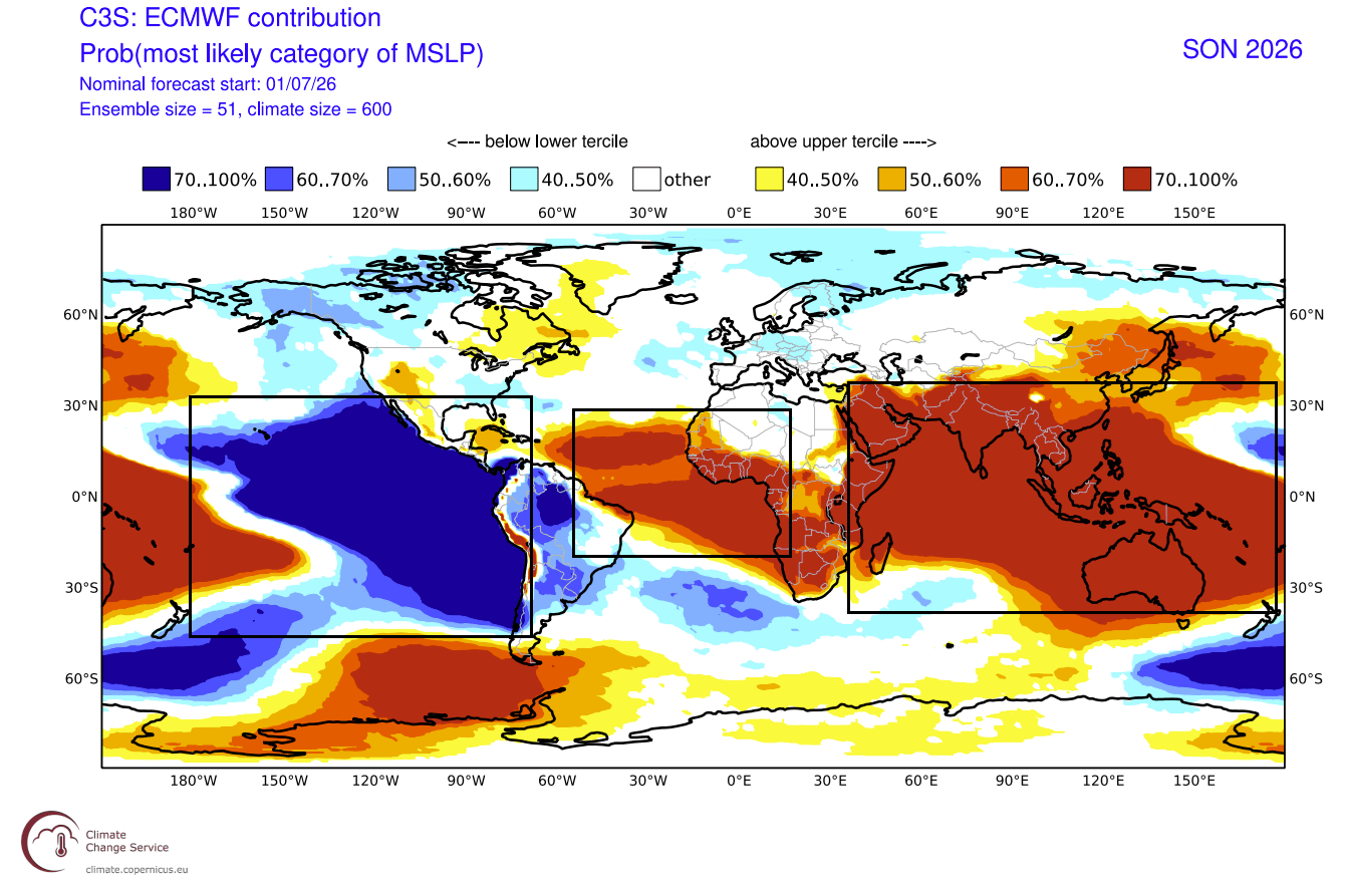
A critical component of this phenomenon is the Walker Cell, which governs tropical rainfall and pressure. Under normal conditions, this circulation keeps the western Pacific wet and the eastern Pacific relatively dry. A Super El Niño reverses or drastically alters this, creating a pressure drop in the eastern and central Pacific and a high-pressure zone over the west. This imbalance acts as a pebble dropped in a pond, sending atmospheric ripples that reorganize the jet streams across the entire globe.
North American and European Impacts
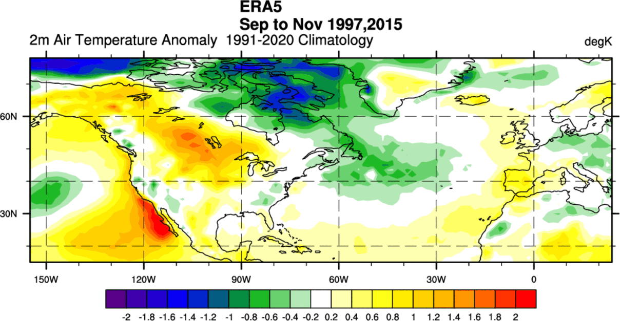
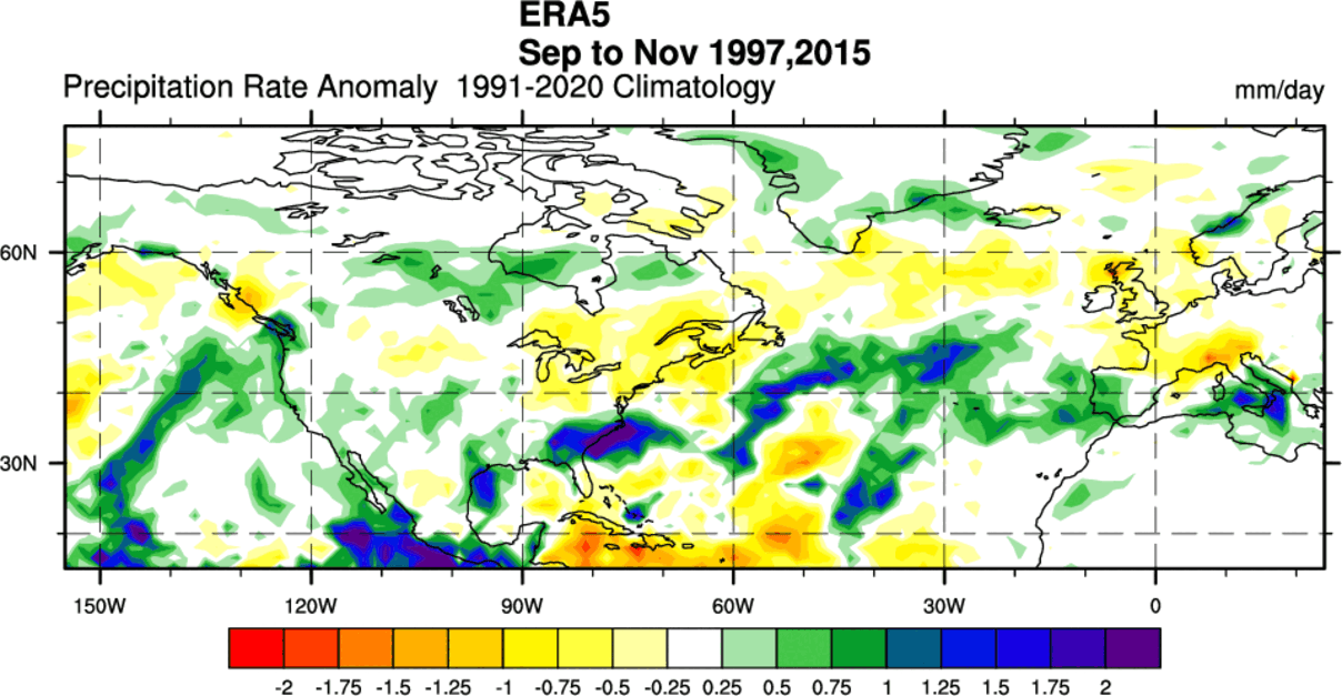
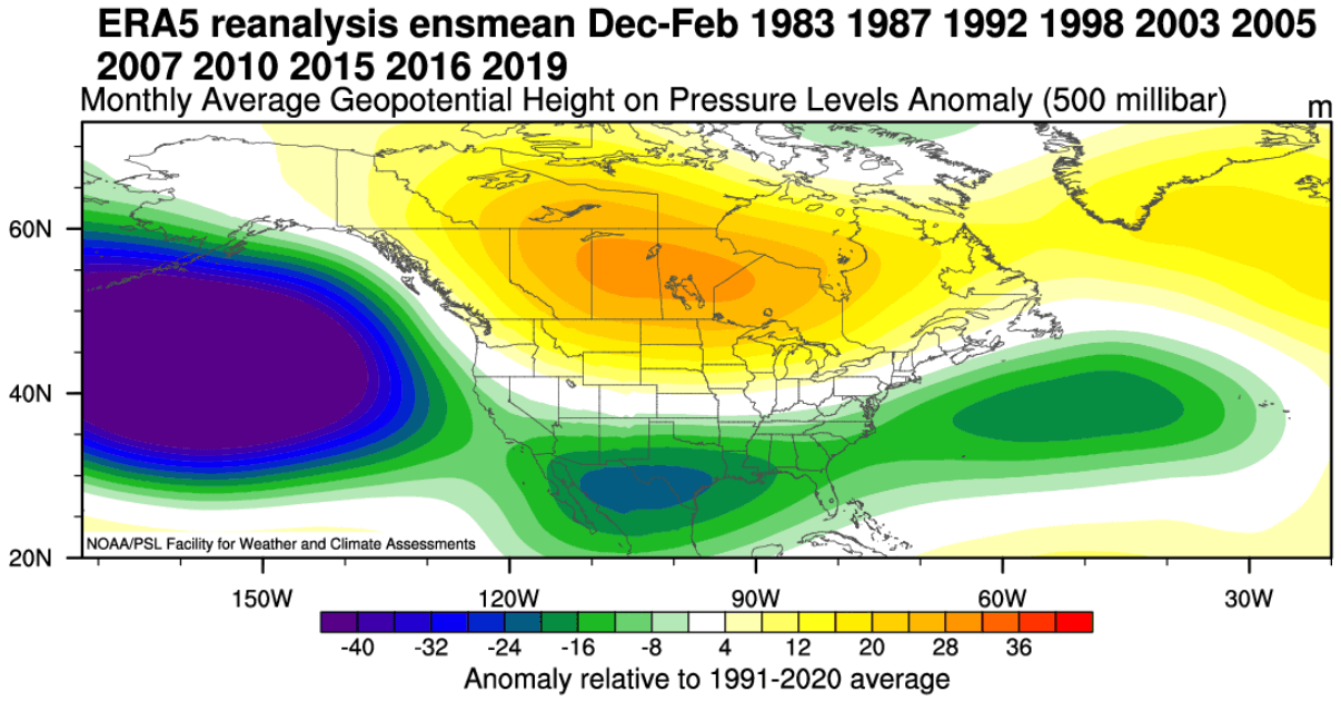
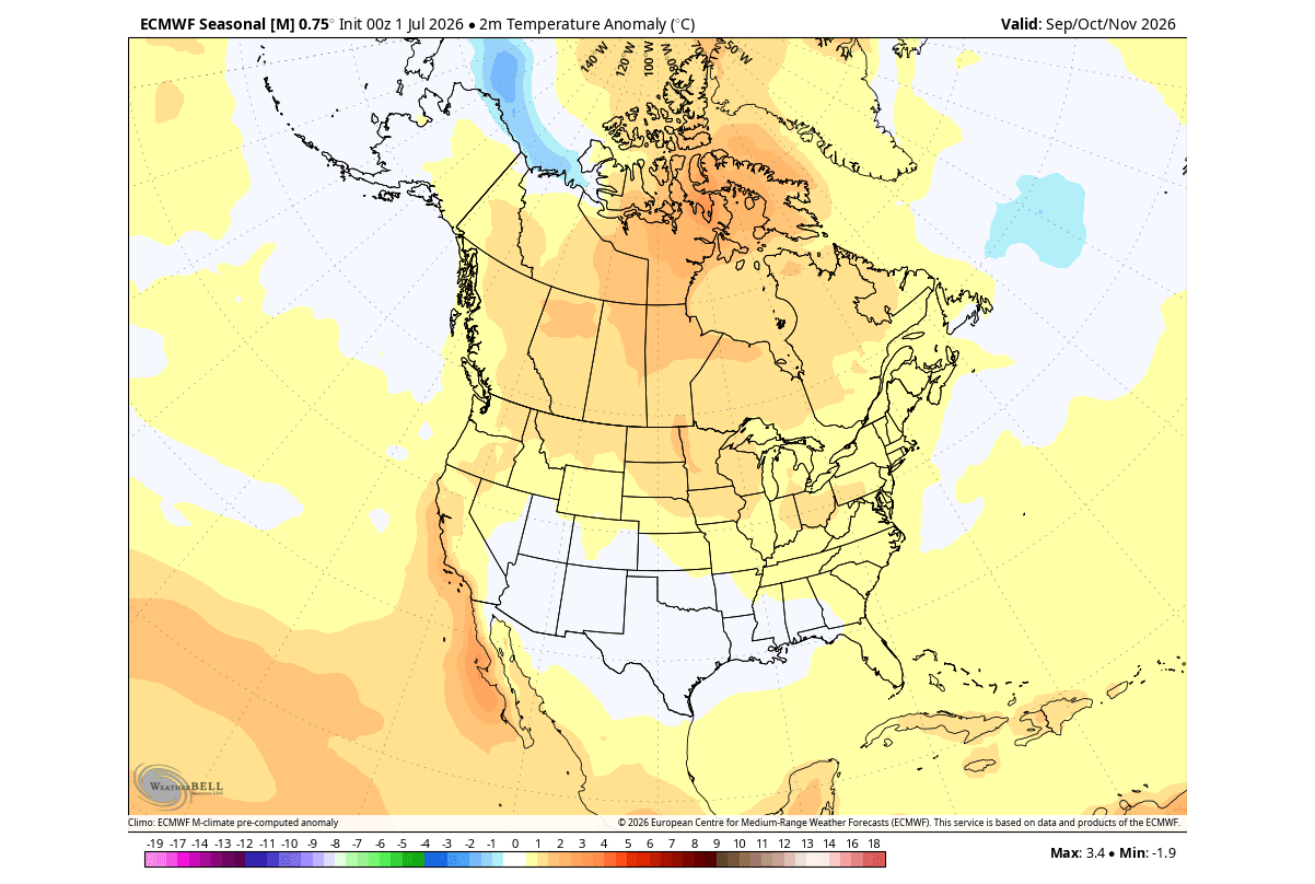
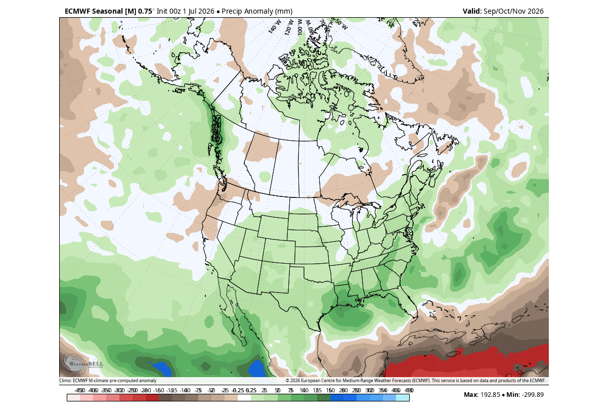
For North America, the models forecast an amplified subtropical jet stream. This is expected to bring a steady parade of moisture-rich storm systems into the southern and southeastern United States, while simultaneously fostering a high-pressure block over Canada and the northern U.S. This blocking pattern often acts as a deflector, keeping the northern regions warmer than average while setting up the central and eastern regions for sharper temperature contrasts and potentially severe winter storms as the season progresses.
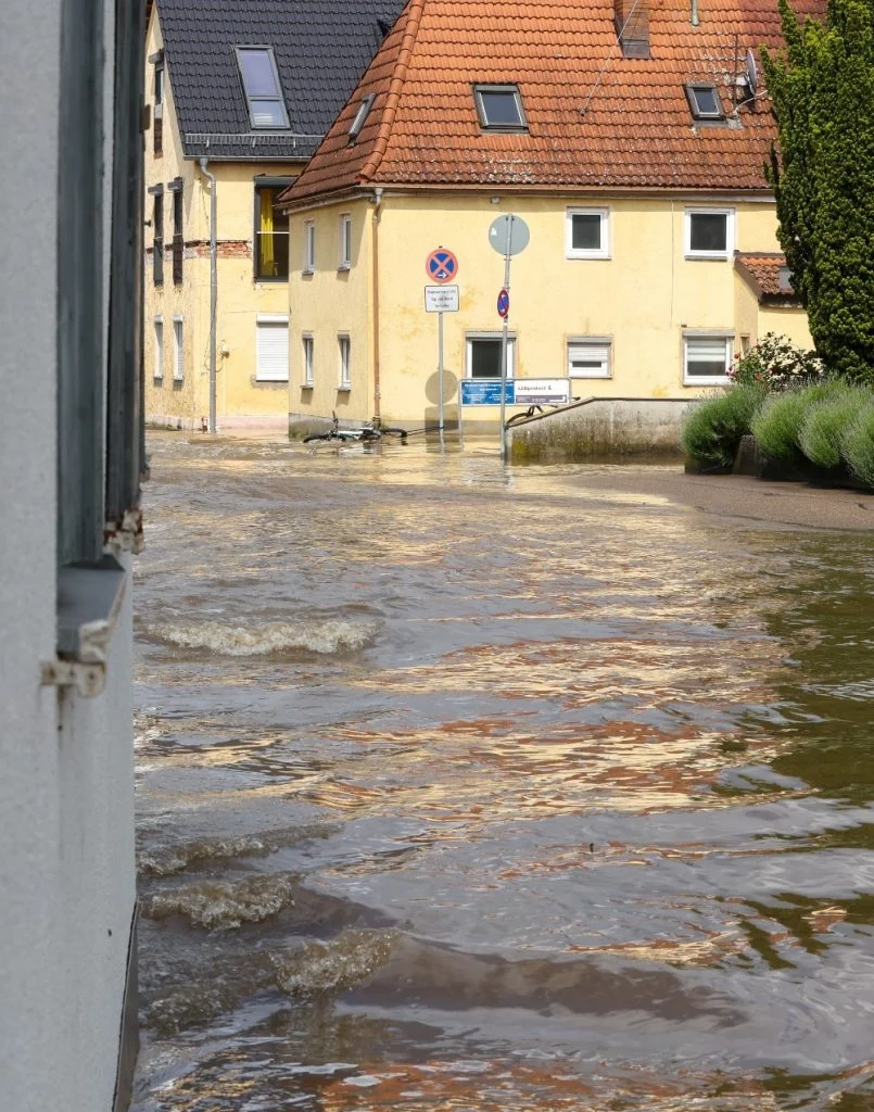
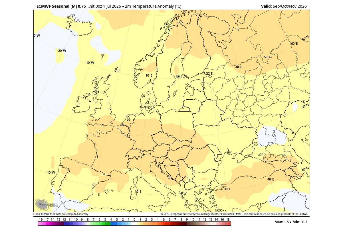
In Europe, the signature of this El Niño is expressed through a more westerly flow. The North Atlantic is forecast to host a persistent low-pressure area, which acts as a "pump," drawing mild, moist air into the European continent. While this limits the frequency of deep-freeze events in many regions, it increases the probability of high-wind events and above-average precipitation across central and western Europe.
Official Responses and Meteorological Outlooks
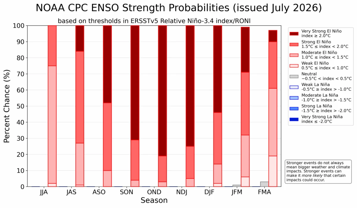
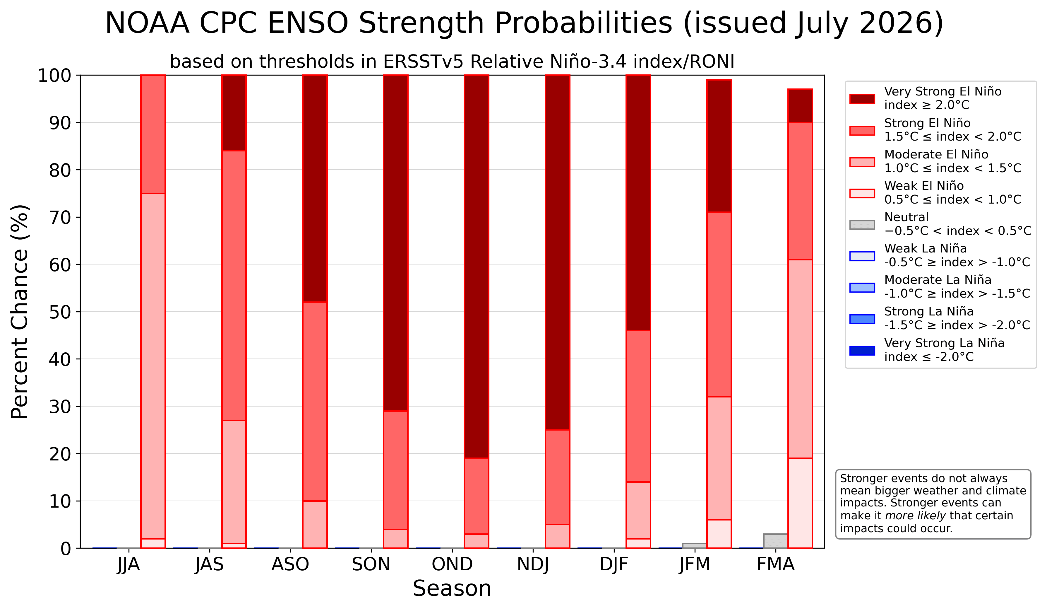
The National Oceanic and Atmospheric Administration’s Climate Prediction Center (NOAA CPC) has consistently updated its probability outlooks to reflect the extreme nature of this event. Official forecasts show overwhelming support for an extreme El Niño classification.
Meteorologists emphasize that while these models provide a high-confidence forecast for the general pattern, they do not guarantee specific outcomes for individual locations. However, the sheer strength of the current anomaly gives scientists a high degree of certainty that the upcoming winter will be characterized by "locked-in" atmospheric configurations. The persistence of these patterns suggests that once the winter regime takes hold in November and December, it is unlikely to shift significantly until the spring.
Implications: The Polar Vortex and Winter Volatility
Perhaps the most significant implication of a Super El Niño is its potential interaction with the Polar Vortex. The Polar Vortex is the large-scale cyclonic circulation that resides in the stratosphere above the North Pole.
The Stratospheric Connection
Historically, strong El Niño winters are statistically correlated with a higher frequency of Sudden Stratospheric Warming (SSW) events. When these events occur, they can cause the Polar Vortex to weaken, displace, or even collapse. If the vortex collapses, the cold, dense air traditionally trapped in the Arctic is no longer contained.
A weakened vortex allows this frigid air to spill southward into the mid-latitudes, impacting Canada, the United States, and Europe. While the El Niño itself creates a "mild" signal for many regions, a concurrent collapse of the Polar Vortex can create a "wildcard" effect, leading to sudden, severe cold snaps and major snowfall events that defy the seasonal averages.
A Winter of Extremes
The combination of a Super El Niño and the potential for a disrupted Polar Vortex creates a high-stakes environment for the 2026/2027 season. We are looking at a winter that will likely be defined by:
- Increased Storm Frequency: An active southern storm track in the U.S. will likely lead to high precipitation and potential flood risks in southern states.
- Temperature Duality: A sharp divide between the warmer, high-pressure-dominated north and the volatile, storm-driven south.
- Stratospheric Sensitivity: A higher-than-average risk of mid-winter "shocks" to the system, where stratospheric warming events bring polar air into lower latitudes, despite the overall warm signal of the El Niño.
Conclusion: Monitoring the Transition
As we head deeper into the Fall of 2026, the scientific community remains focused on the rapid evolution of these oceanic anomalies. The "Super" designation is not merely a label; it represents a fundamental shift in the engine that drives our climate. For residents in the Northern Hemisphere, this implies a need for preparedness—not only for the expected patterns of increased rain and mild temperatures but also for the inherent volatility that comes with a system this powerful.
The 2026/2027 Winter season will be a critical case study in how global weather systems respond to record-breaking oceanic forcing. By monitoring the strength of the atmospheric ridge over Canada and the stability of the Polar Vortex in the coming months, meteorologists hope to refine their predictions and provide the necessary foresight to manage the impacts of this historic event. Stay tuned to official weather services and long-range climate updates as this Super El Niño continues to reshape the global weather landscape.