In the late stages of September 2026, the North Atlantic is playing host to a meteorological phenomenon of extraordinary proportions. A rapidly intensifying "bomb cyclone"—a storm system defined by a catastrophic drop in central pressure—is currently carving a path toward Western Europe. This explosive development, driven by a violent collision between an upper-level trough and a stationary high-pressure system, has triggered widespread concern across the UK, Ireland, and Iceland. As meteorologists monitor the deepening core, the system promises to deliver a trifecta of extreme weather: hurricane-force wind gusts, massive ocean swells, and severe, orographic-driven rainfall.
The Science of Bombogenesis: Understanding the "Bomb"
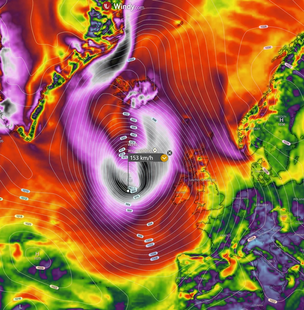
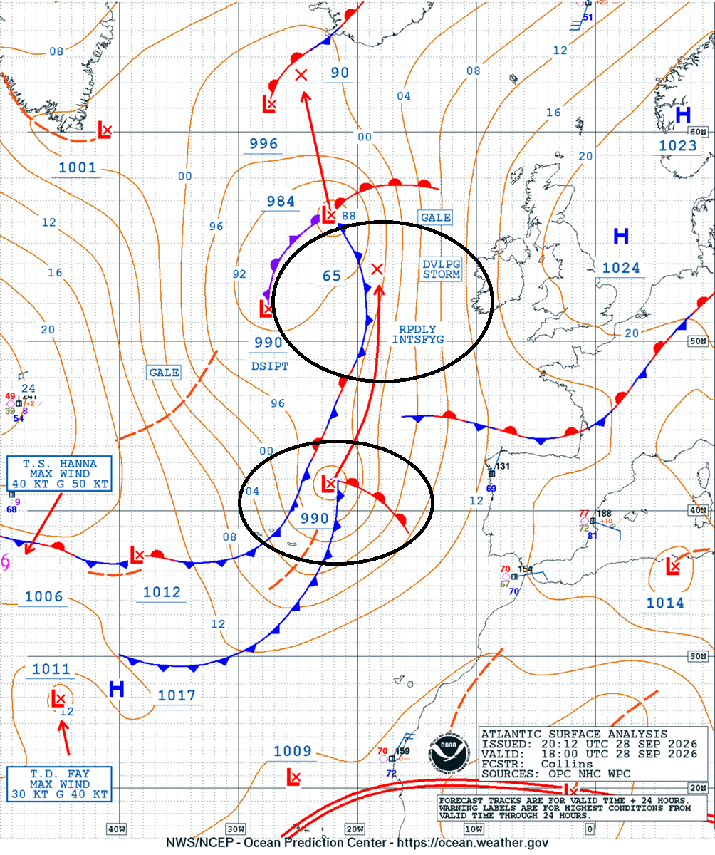
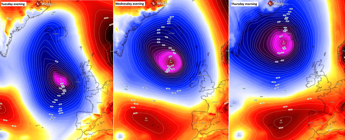
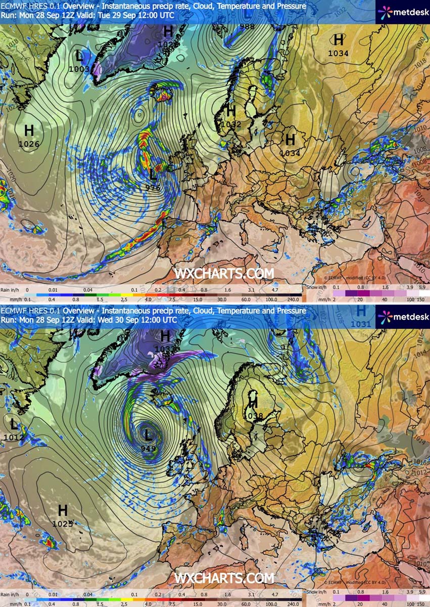
At the heart of this event lies a process known as bombogenesis. In meteorological terms, a "bomb cyclone" occurs when the central barometric pressure of a mid-latitude system plummets by at least 24 millibars (mbar) within a 24-hour window. This specific event is behaving with textbook intensity, with models confirming a pressure drop from approximately 990 mbar on Monday evening to a forecasted 945 mbar by Wednesday.
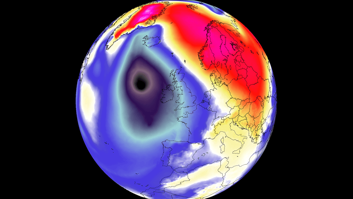
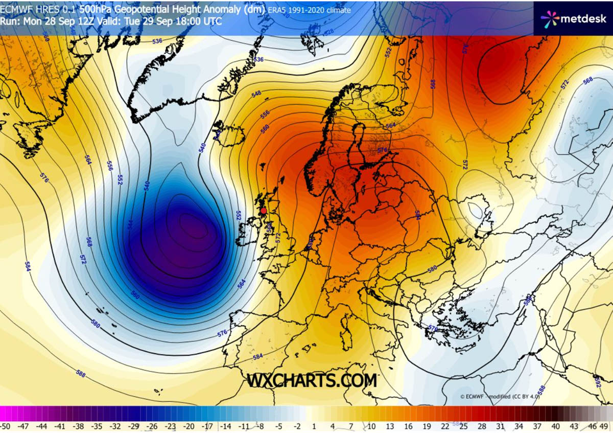
This rapid deepening is the result of a severe baroclinic gradient. A high-amplitude upper-level trough, surging out of the North Atlantic, is currently clashing with a stubborn 1035 hPa blocking high-pressure system anchored firmly over Central Europe and Scandinavia. This atmospheric stalemate acts like a vice, squeezing the isobars together over the British Isles and Ireland, forcing air to accelerate rapidly and fueling the storm’s violent circulation.
Chronology: From Formation to Landfall
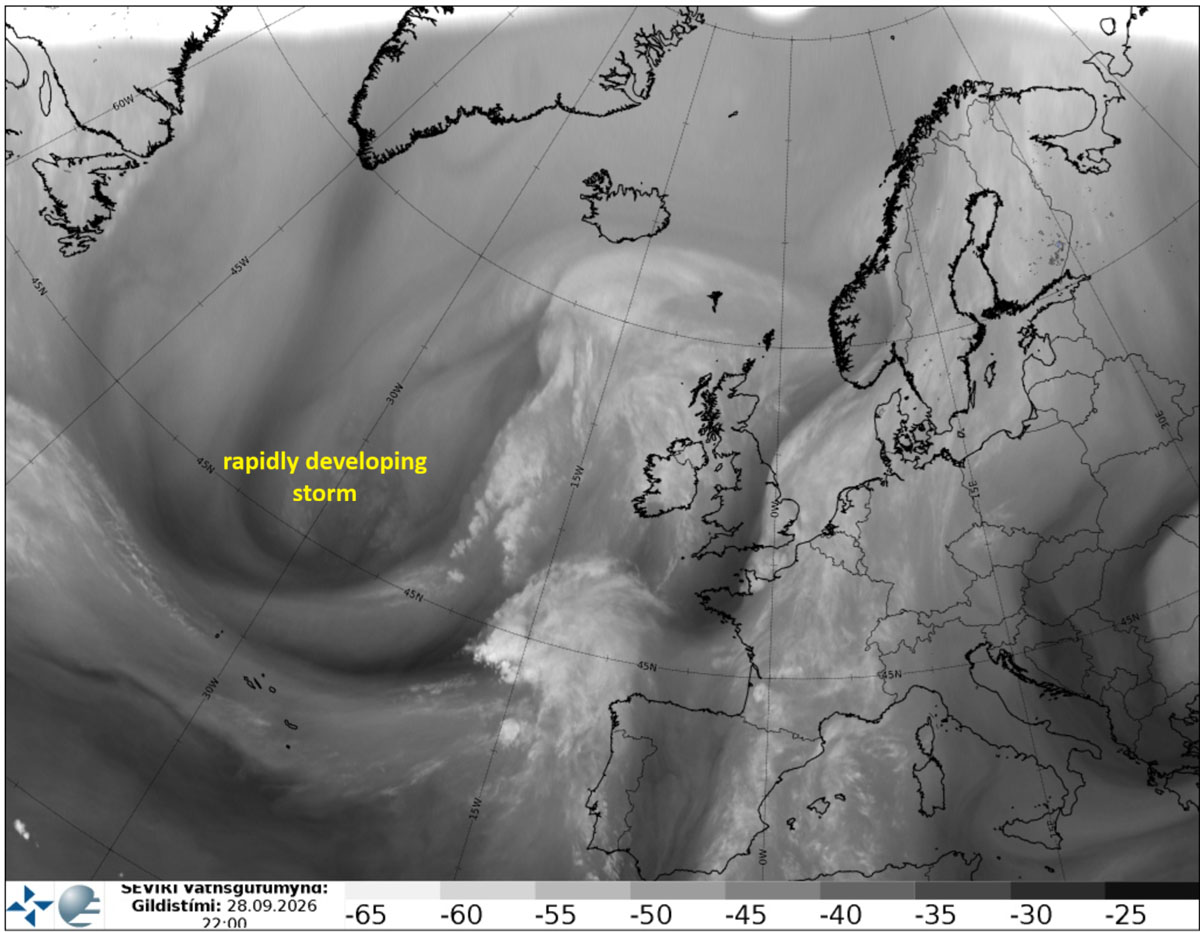
The genesis of this storm was clearly visible on satellite imagery as early as Monday night. Water vapor spectrum analysis revealed a burgeoning jet stream interacting with a potent baroclinic zone, signaling the onset of the rapid intensification.
Tuesday: The Initial Onslaught
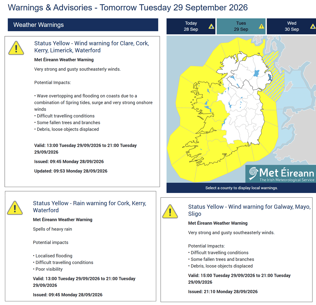
By Tuesday morning, the storm was already organizing into a formidable structure. As the center moved closer to the western shores of Ireland and the UK, Met Éireann issued urgent yellow weather warnings for coastal regions. The primary threats on Tuesday included dangerous, gusty southeast winds capable of downing trees, disrupting power grids, and creating hazardous conditions for motorists. The rapid advancement of a surface cold front across Ireland, Northern Ireland, and Scotland brought with it the first major wave of intense rain squalls.
Wednesday: The Peak of Intensity
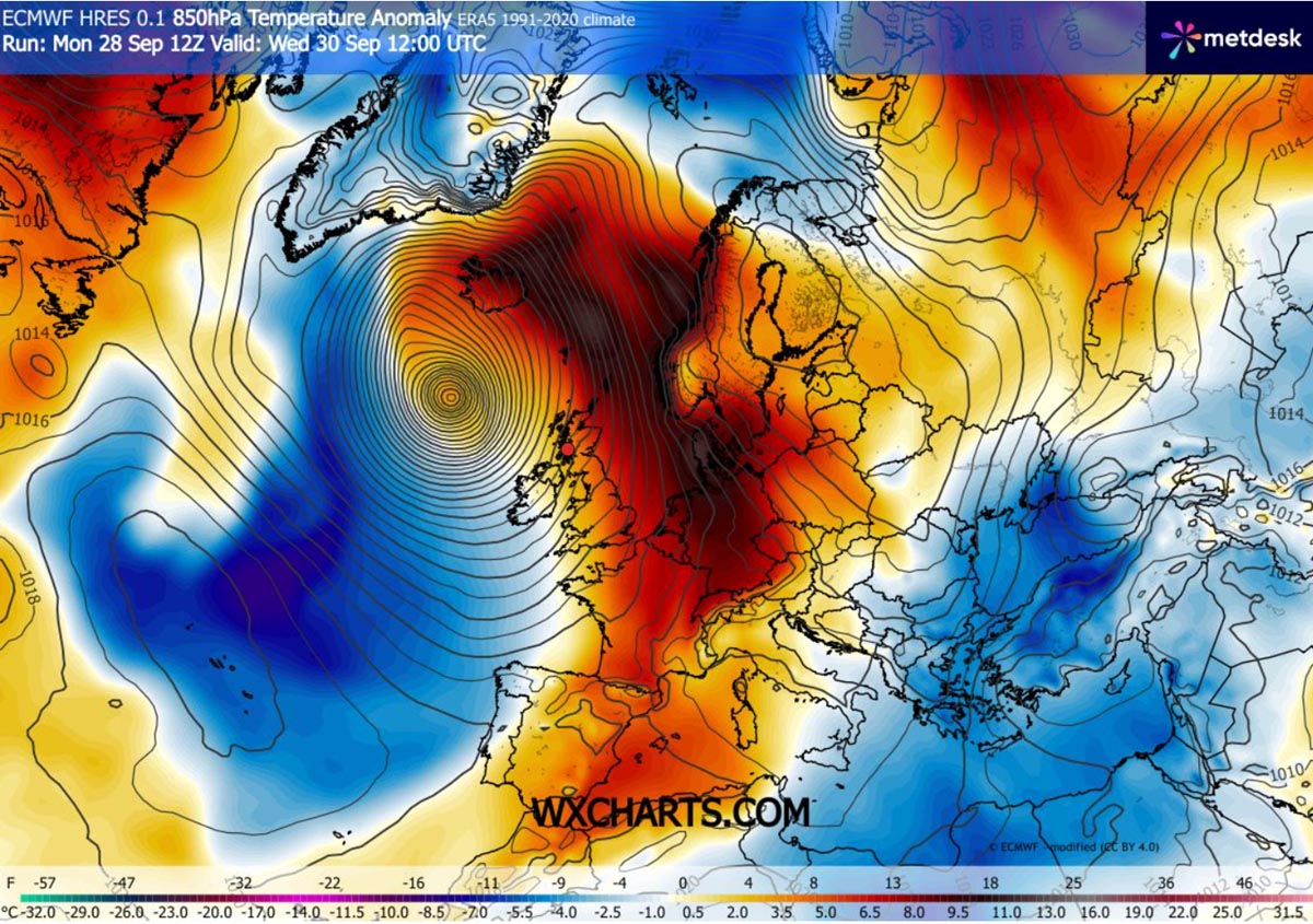
Wednesday marks the crescendo of the storm. As the system tracks north, passing west of the Faroe Islands, its central pressure is expected to dip below 950 mbar. The pressure gradient around the center is so tight that sustained winds are reaching near-hurricane force. While the center of the storm remains offshore, the sheer scale of the circulation is pulling an unseasonably warm air mass from the south, leading to an anomalous temperature spike across Denmark, Scandinavia, and the North Atlantic islands.
Thursday: The Icelandic Climax
By Thursday morning, the system will reach its mature phase as it approaches Iceland. While the storm begins to weaken slightly in terms of pressure, its impact on Iceland will be profound. The combination of a powerful south-southeasterly jet stream and the rugged terrain of the island will create an "atmospheric river" effect, leading to extreme orographic rainfall in the southern and southeastern regions.
Supporting Meteorological Data
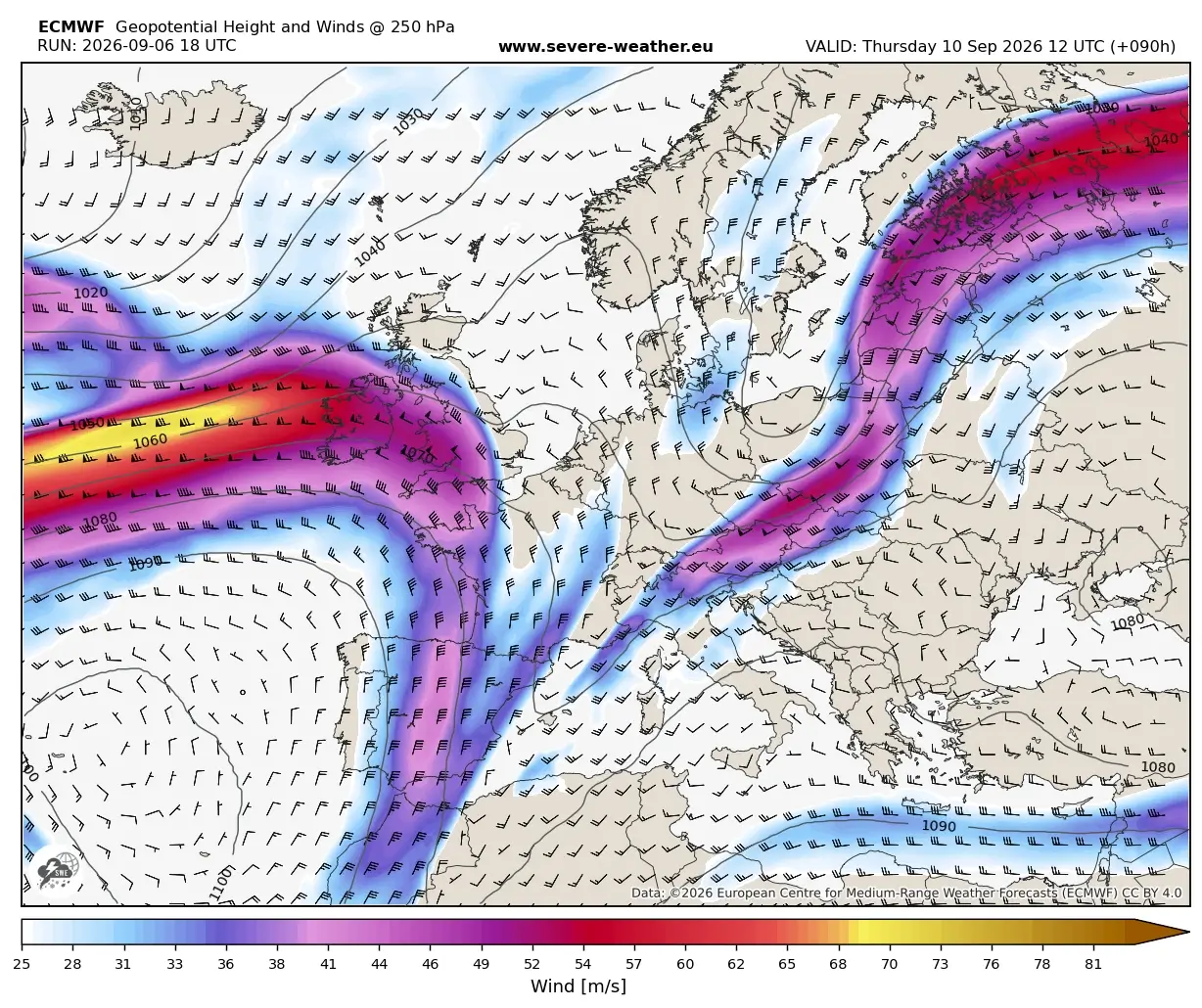
The intensity of this system is best illustrated by the predictive modeling provided by agencies like the Ocean Prediction Center (OPC). Analysis confirms that the storm’s trajectory is heavily influenced by the "Omega" blocking pattern currently dominating the European continent. This pattern has prevented the storm from following a standard zonal track, forcing it to pivot northward toward the Arctic.
Data highlights:
- Pressure Drop: A massive shift from 990 mbar to 945 mbar within 48 hours.
- Wind Speeds: Peak gusts in the storm’s core are estimated to exceed 150 km/h.
- Wave Heights: The most significant marine threat involves 10-12 meter waves west of Ireland and Scotland, with 8-10 meter swells expected along the immediate Atlantic-facing coastlines.
- Rainfall Accumulation: Models for southern Iceland suggest an extraordinary 250-300 mm of rainfall in a 24-hour period, a total that poses a significant risk for flash flooding and landslides.
Official Responses and Public Safety
Meteorological services across the affected regions have been working in overdrive to coordinate warnings. Met Éireann’s decision to issue yellow warnings for coastal Ireland served as the first line of defense, emphasizing the risk of "difficult driving conditions."
Authorities are urging residents in Western England, Scotland, and the Northern Isles to secure loose outdoor items, avoid coastal cliff paths, and monitor local transit updates. In Iceland, where the impact is expected to be most severe in terms of precipitation, the Icelandic Meteorological Office (Veðurstofa Íslands) is preparing for potential infrastructure strain caused by the massive water volume and sustained gale-force winds.
The Human and Environmental Implications
Beyond the immediate damage to property, the "bomb cyclone" of September 2026 carries broader implications.
Infrastructure and Energy
The combination of wind and saturated soil creates the perfect environment for widespread power outages. Utility companies are bracing for "tree-on-line" scenarios, particularly in rural parts of Scotland and Ireland. Furthermore, the marine sector is facing significant disruptions, as Atlantic swells of 12 meters make shipping and ferry crossings essentially impossible.
The "Warm Plume" Anomaly
While the storm is destructive, its circulation is also a mechanism for massive heat transport. The "warm plume" being pulled northward is causing temperatures to deviate significantly from the seasonal average for late September. In a broader climatic context, this highlights how deep Atlantic lows act as primary regulators of heat distribution, even while causing localized devastation.
Long-term Climate Context
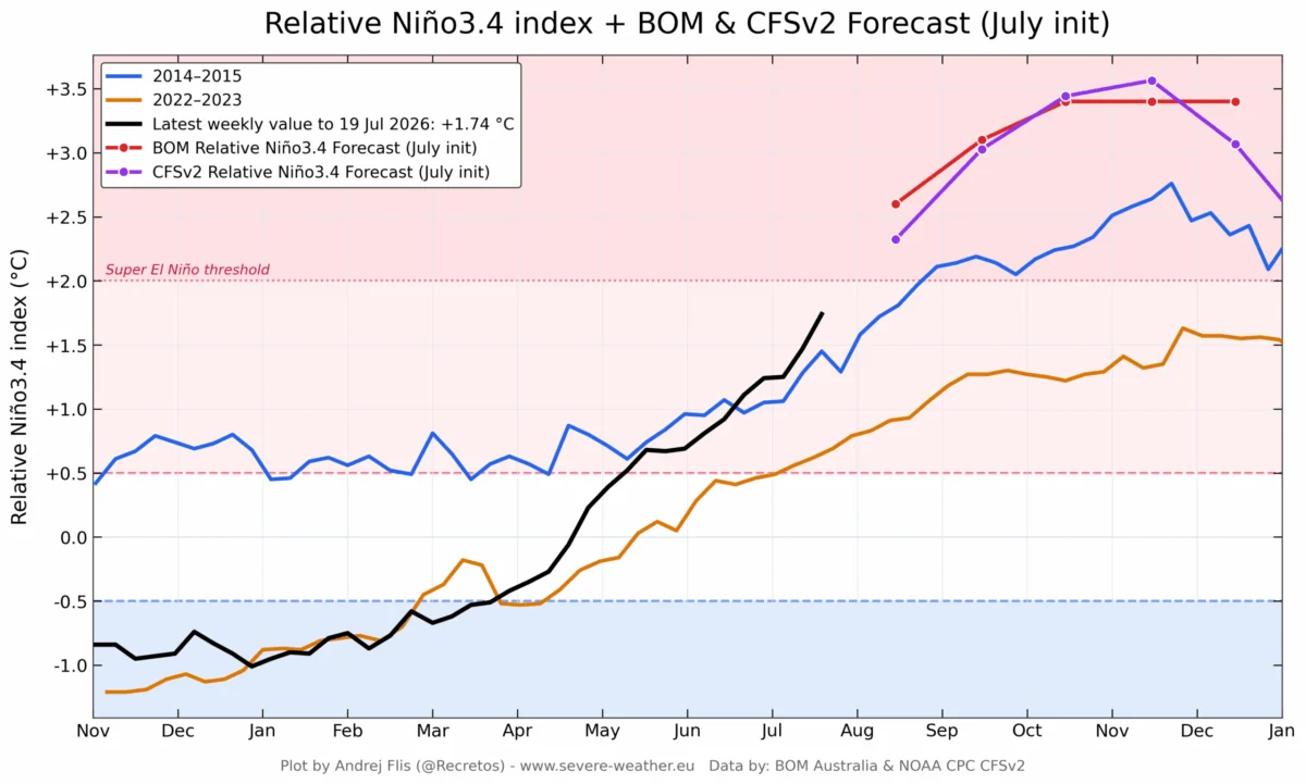
This event arrives in the shadow of the 2026 "Super El Niño," which has been breaking meteorological records globally. While this specific storm is a synoptic-scale event, climate researchers are increasingly looking at whether the frequency of such rapid-intensification events is being altered by the warming North Atlantic waters. When the ocean surface acts as a vast reservoir of latent heat, the "fuel" available for such bomb cyclones increases, potentially leading to more intense and frequent extreme weather events in the coming years.
Conclusion: A Season of Extremes
The late September 2026 bomb cyclone is a stark reminder of the volatile nature of the North Atlantic transition into autumn. While modern forecasting—leveraging advanced satellite imagery from entities like Windy and Wxcharts—allows for earlier warnings, the sheer kinetic energy contained within a sub-950 mbar low remains a formidable challenge for human infrastructure.
As the storm moves toward Iceland, the focus shifts from the initial wind-driven destruction in the UK and Ireland to the hydrological emergency facing the Icelandic interior. Citizens in the path of this system are advised to prioritize safety, heed the guidance of local emergency services, and remain vigilant until the system dissipates into the high Arctic. This event serves as a critical case study in how pressure, temperature, and geography collide to create some of the most powerful weather systems on the planet.