The global climate system is currently witnessing the rapid intensification of a meteorological phenomenon that promises to reshape weather patterns across the Northern Hemisphere for the next year. Latest data confirms that the 2026 El Niño event is not merely developing; it is accelerating into the "Super El Niño" category. With warm Pacific waters expanding across the equatorial belt and atmospheric pressure systems realigning to accommodate this massive energy release, meteorologists are warning that this event could potentially become the strongest El Niño in the historical record.

As the tropical Pacific experiences a massive "pressure release valve" effect, the resulting atmospheric bridge is beginning to dictate weather trends from North America to Europe. This article provides a comprehensive examination of the planetary dynamics, the supporting data from international climate models, and the significant implications for the upcoming Winter 2026/2027 season.
The Mechanics of a Super Event: Main Facts
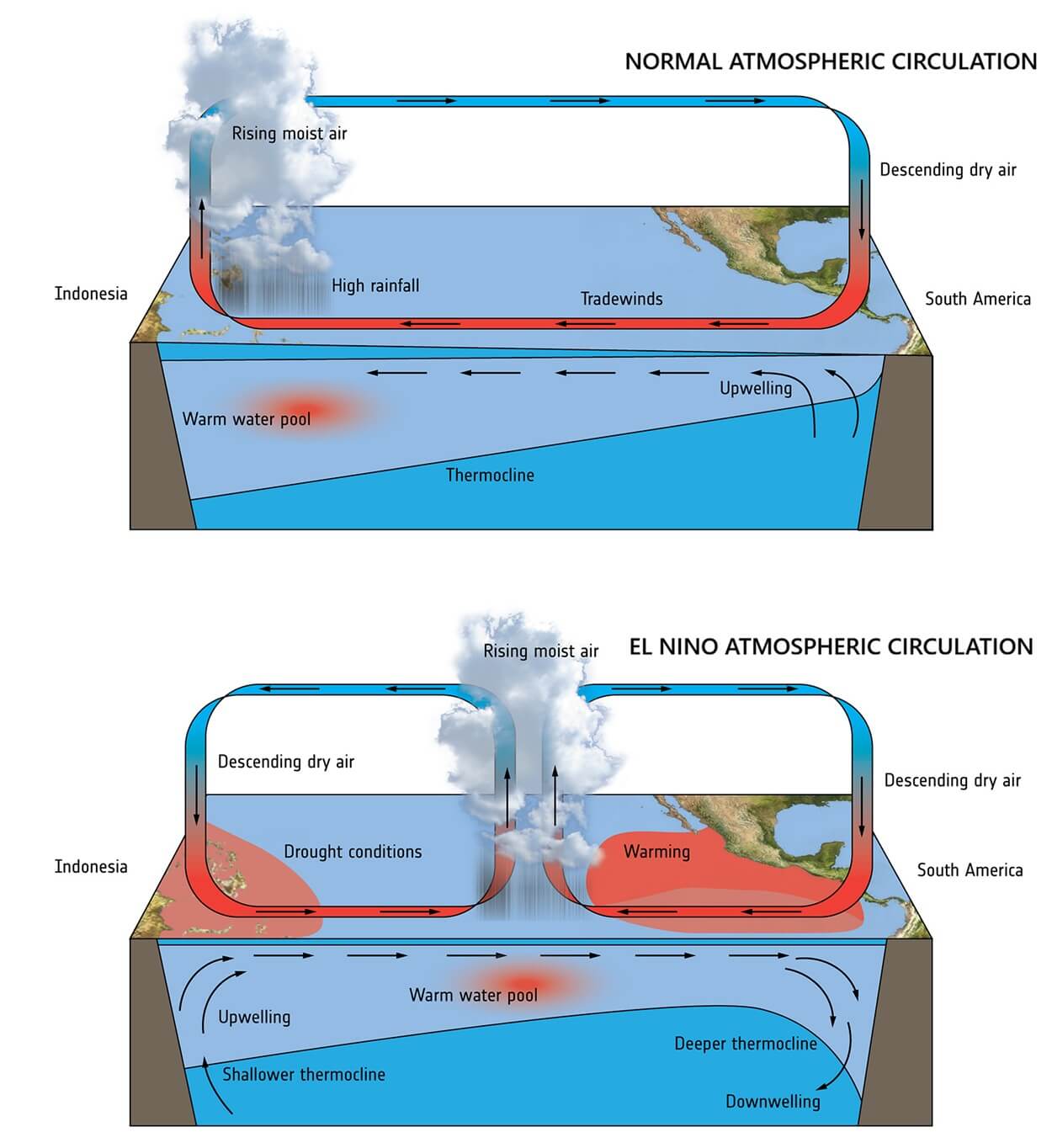
At its core, El Niño is a warm phase of the El Niño-Southern Oscillation (ENSO) cycle. It is characterized by a significant rise in sea surface temperatures (SST) in the central and eastern equatorial Pacific. When these anomalies exceed the +2.0°C threshold, the event is classified as a "Super El Niño."
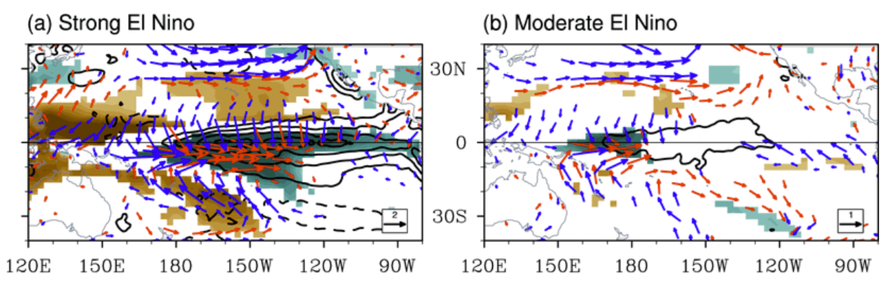
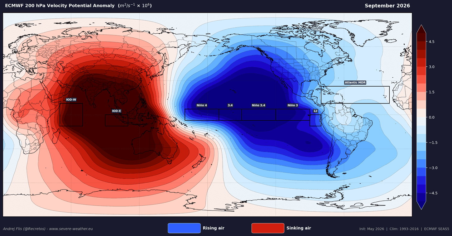
The primary driver of this year’s intensification is a phenomenon known as the Walker Cell disruption. In a neutral state, the Walker Cell governs the circulation of air across the tropics, with rising air over the western Pacific and sinking air over the eastern Pacific. A Super El Niño reverses or drastically alters this flow. As the eastern Pacific warms, lower atmospheric pressure establishes itself over the central and eastern tropical regions, forcing a shift in global circulation that influences mid-latitude jet streams and seasonal pressure systems.
Chronology of Development: From Subsurface to Surface
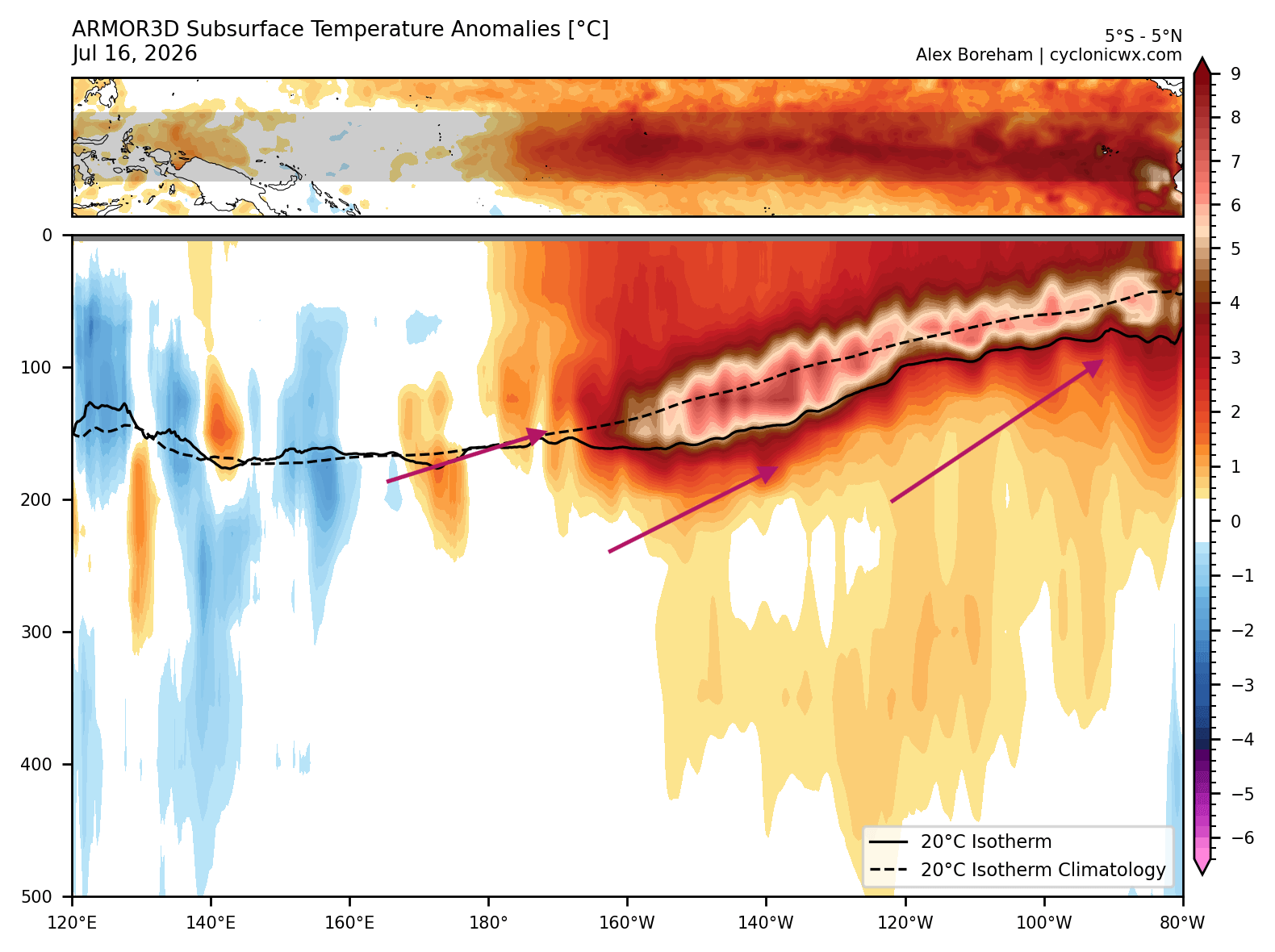
The evolution of the 2026 event began deep beneath the ocean surface. Oceanographic analysis indicates that a powerful Kelvin Wave—a massive pulse of warm subsurface water—has been traversing the equatorial Pacific.
- Initial Phase: Earlier this year, subsurface sensors recorded temperature anomalies peaking more than 7°C above the long-term average in the top 500 meters of the ocean.
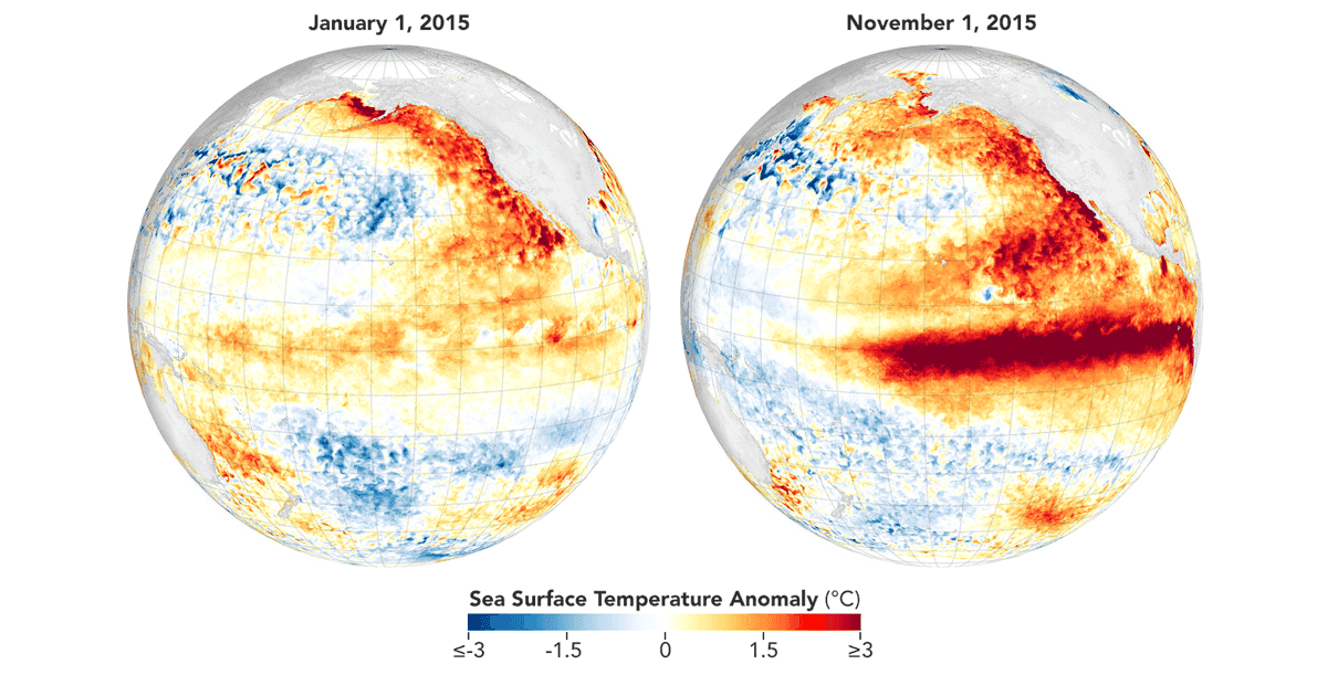
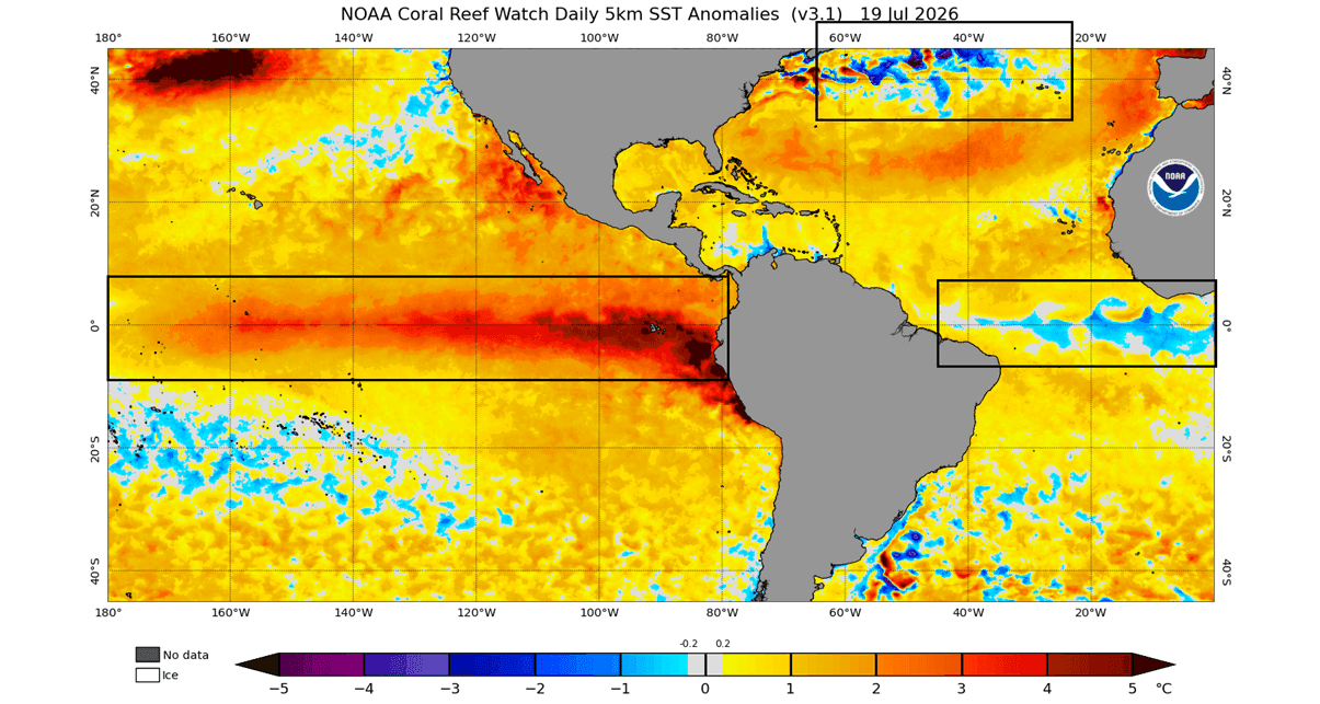
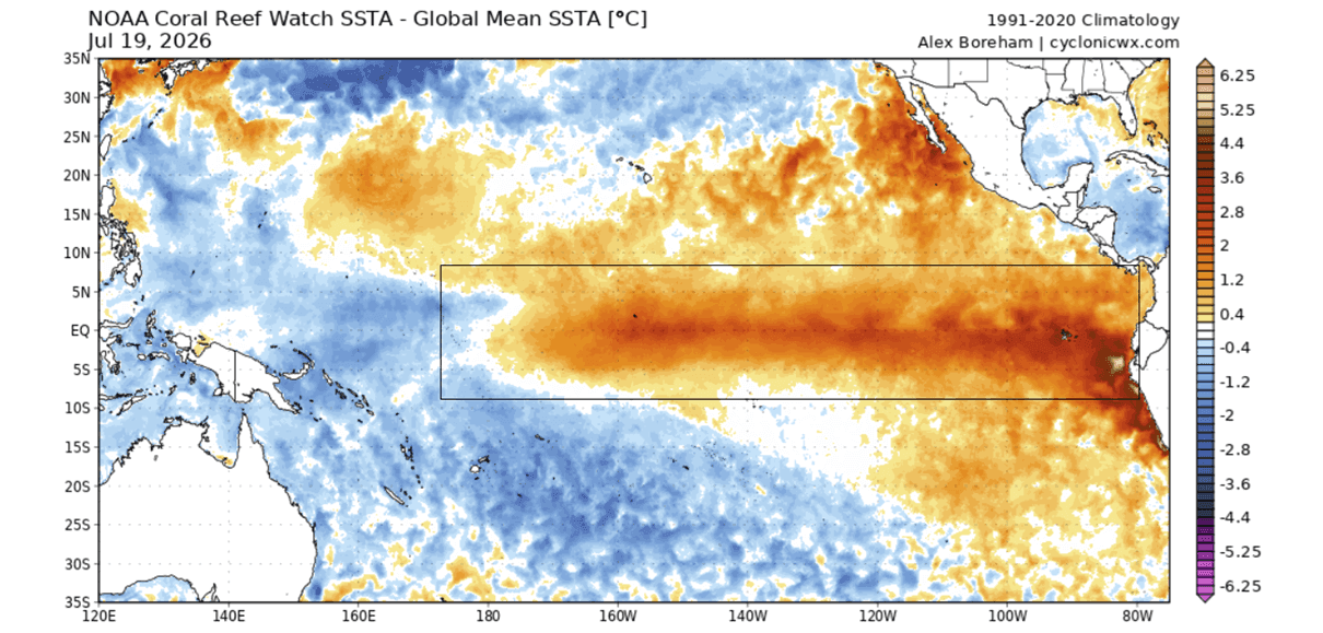
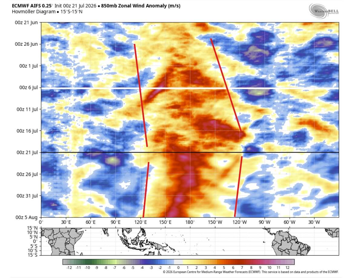
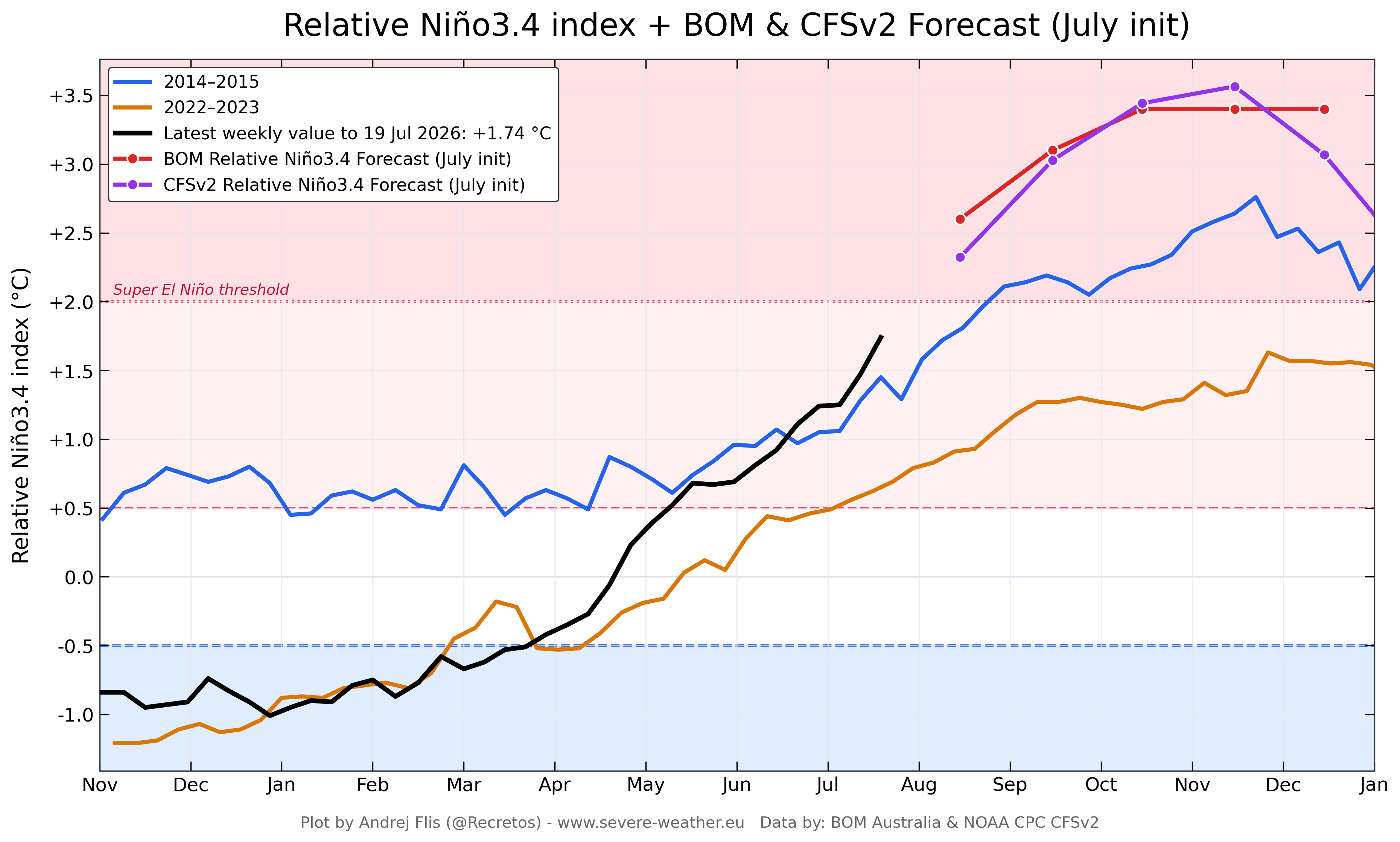
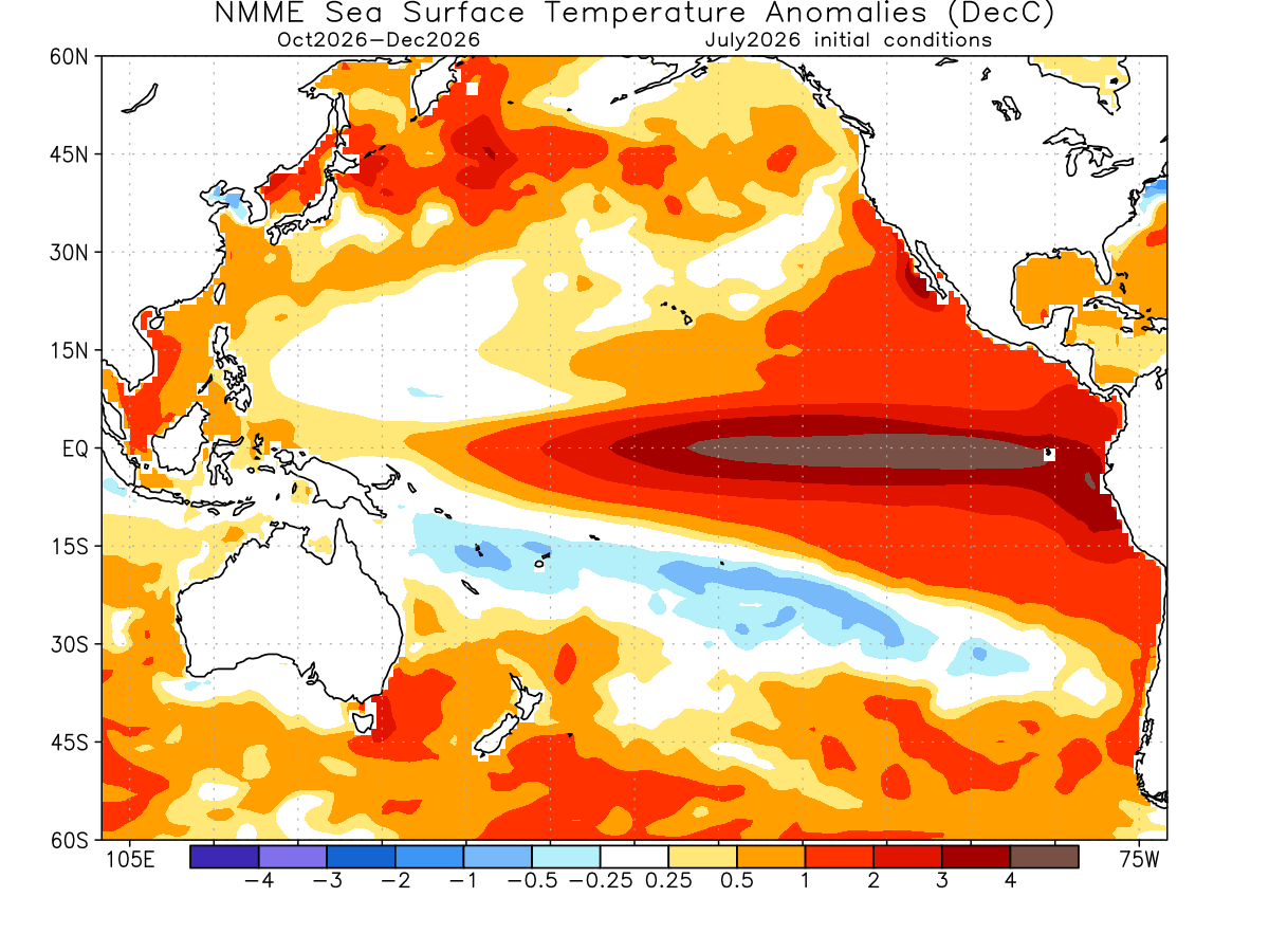
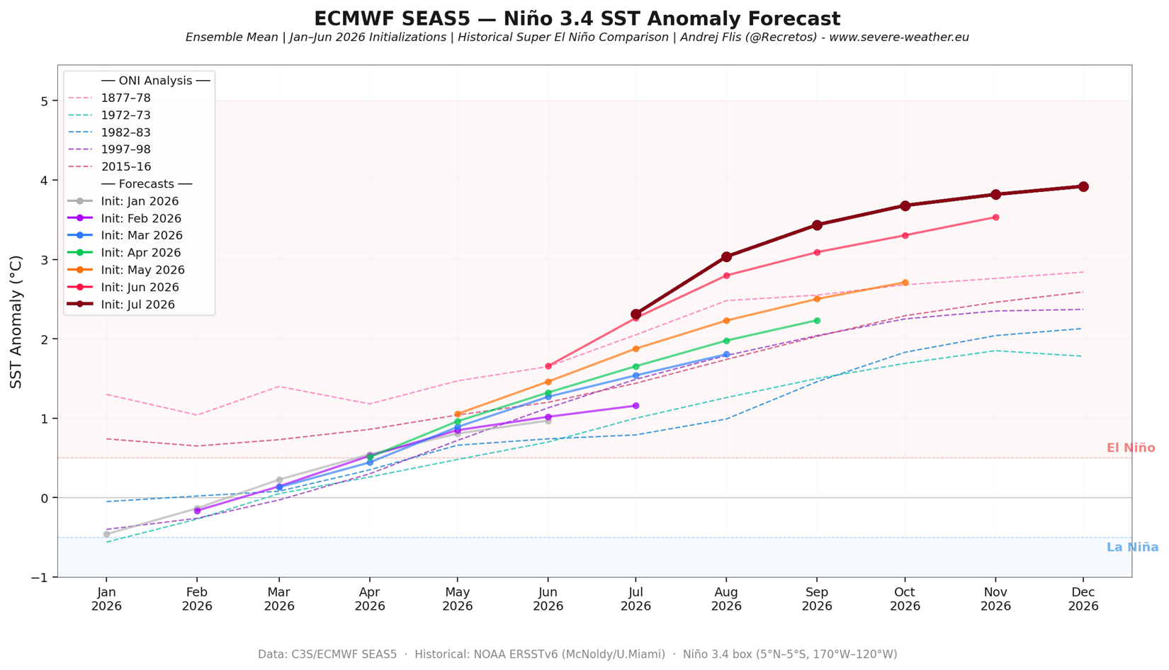
- Surface Manifestation: Driven by sustained westerly wind bursts, this warm subsurface water has breached the surface. As of late summer, sea surface temperature anomalies in the key ENSO regions have already reached +3°C to +4°C.
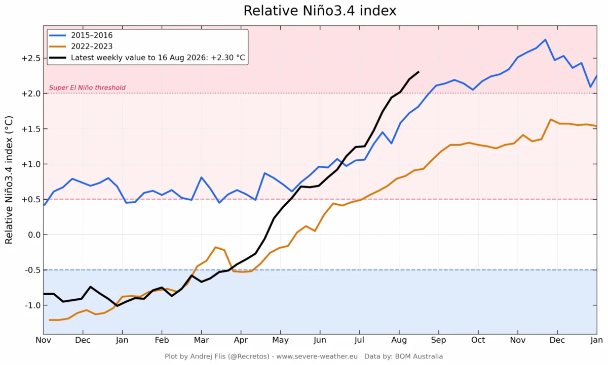
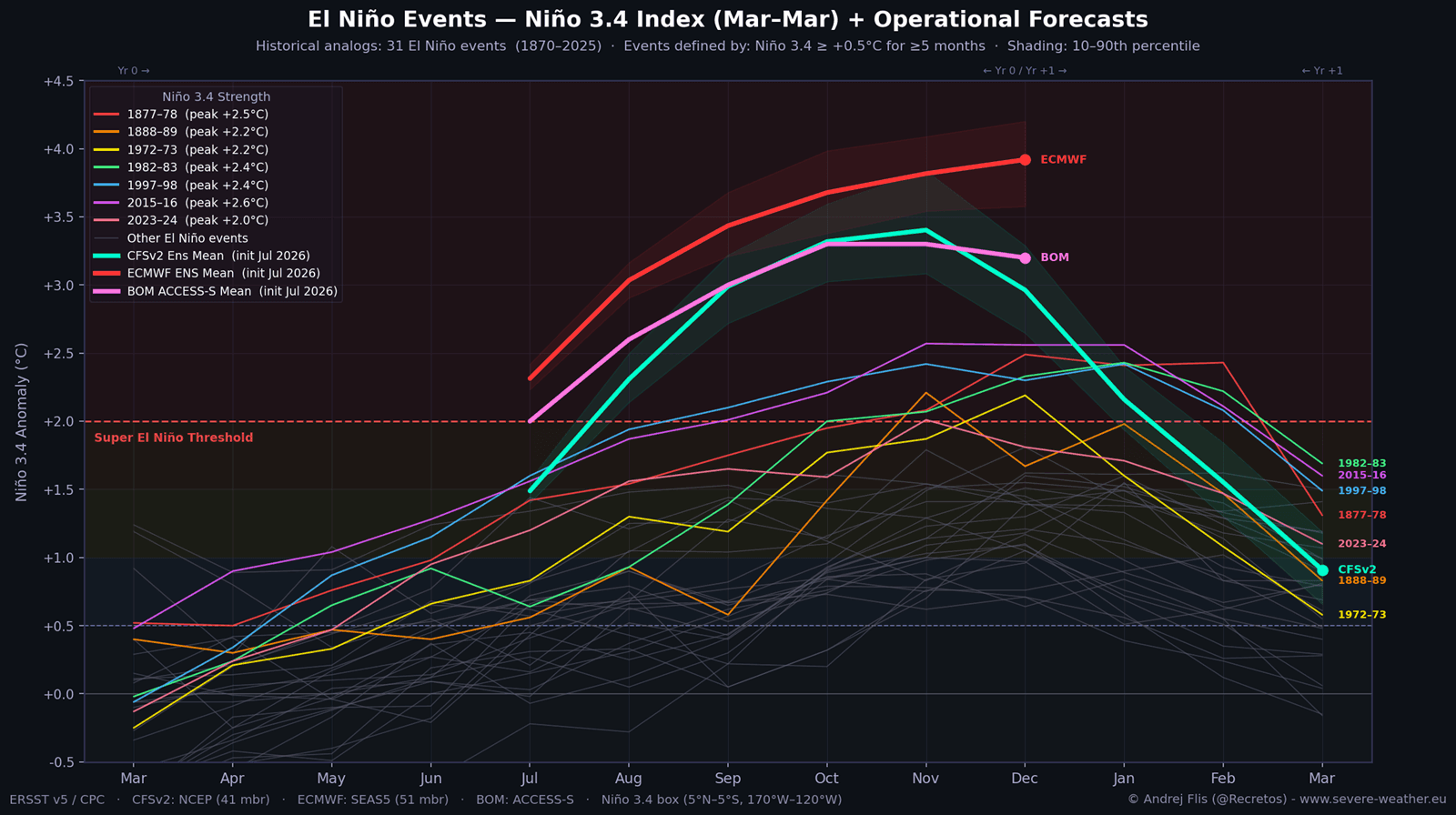
- Current Status: The event has now bypassed the developmental trajectory of the 2015/2016 Super El Niño, which was previously considered the benchmark for modern events. Each successive model run by agencies such as the ECMWF (European Centre for Medium-Range Weather Forecasts) and NOAA (National Oceanic and Atmospheric Administration) has consistently adjusted the peak intensity upward.
Supporting Data: Multi-Model Consensus
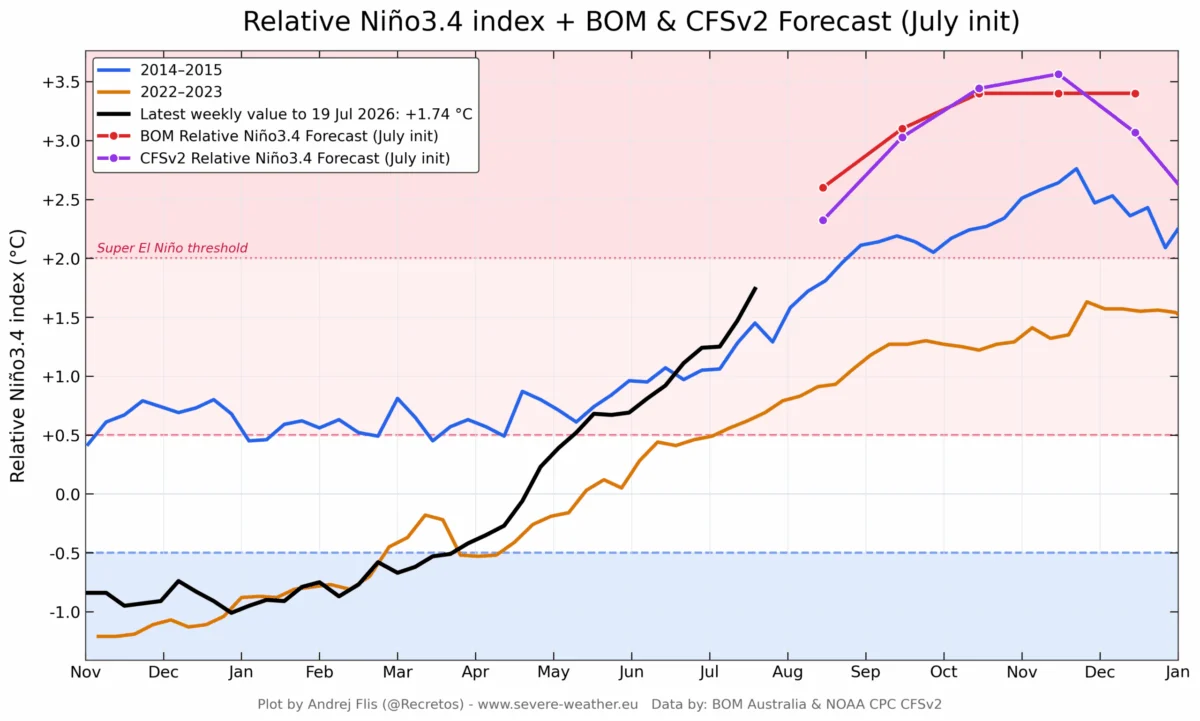
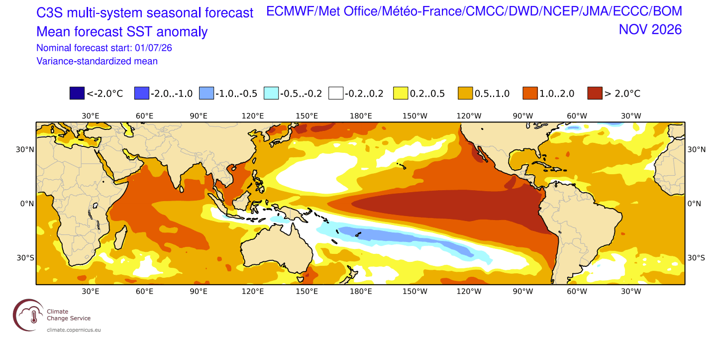
The scientific consensus regarding the 2026 event is built upon a convergence of data from multiple international climate modeling centers. The NOAA CFSv2, the Australian Bureau of Meteorology (BOM), and the ECMWF models are in rare agreement, all projecting an anomaly peak that may surpass any event since record-keeping began in 1870.
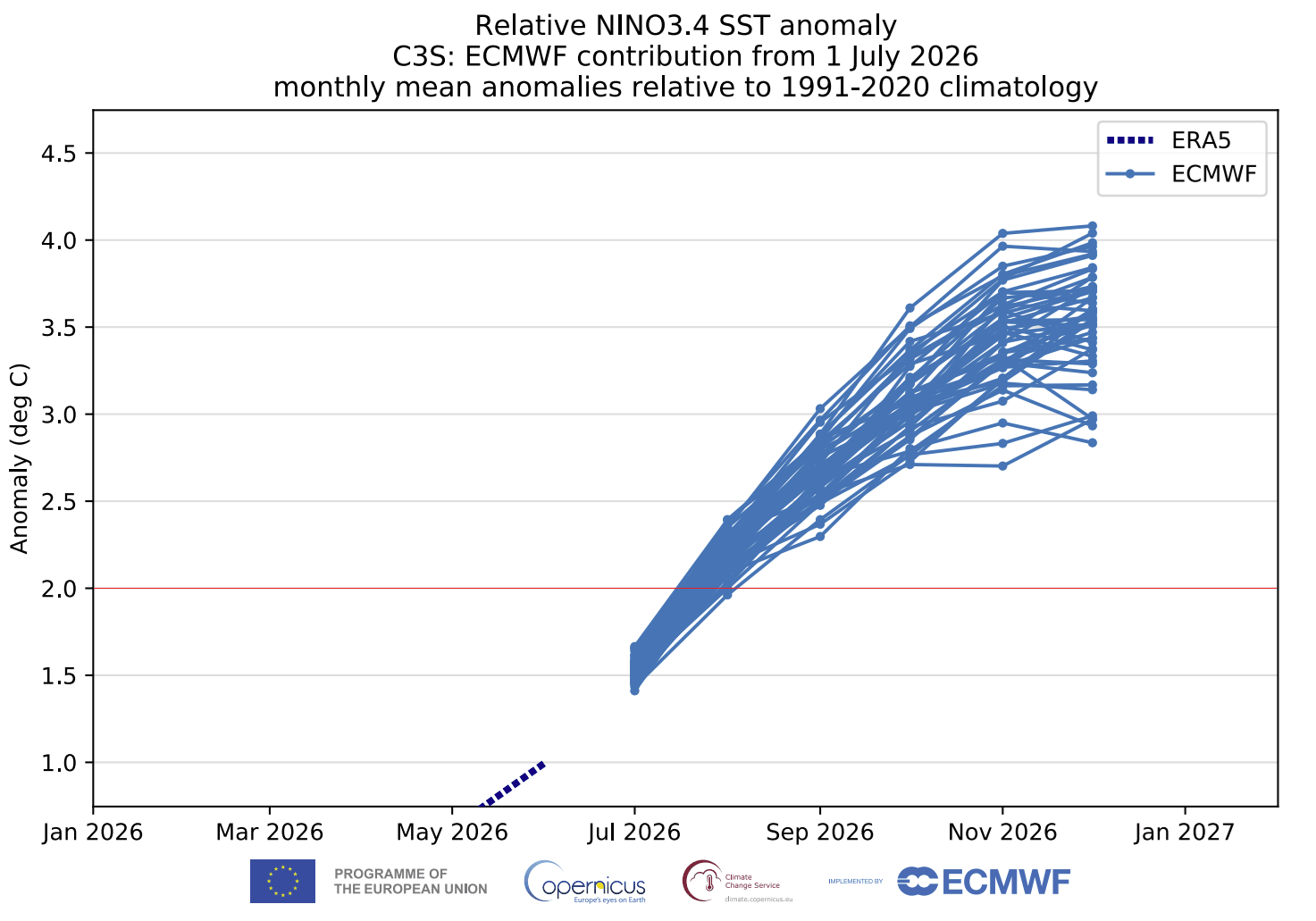
The "Relative ENSO" index, which normalizes data across decades, reveals that the 2026 event is not just strong; it is statistically anomalous. Model ensemble forecasts suggest the peak will occur between November and December 2026, with the warm anomaly covering more than 10% of the global ocean surface—a staggering footprint that illustrates the sheer scale of energy currently being injected into the atmosphere.
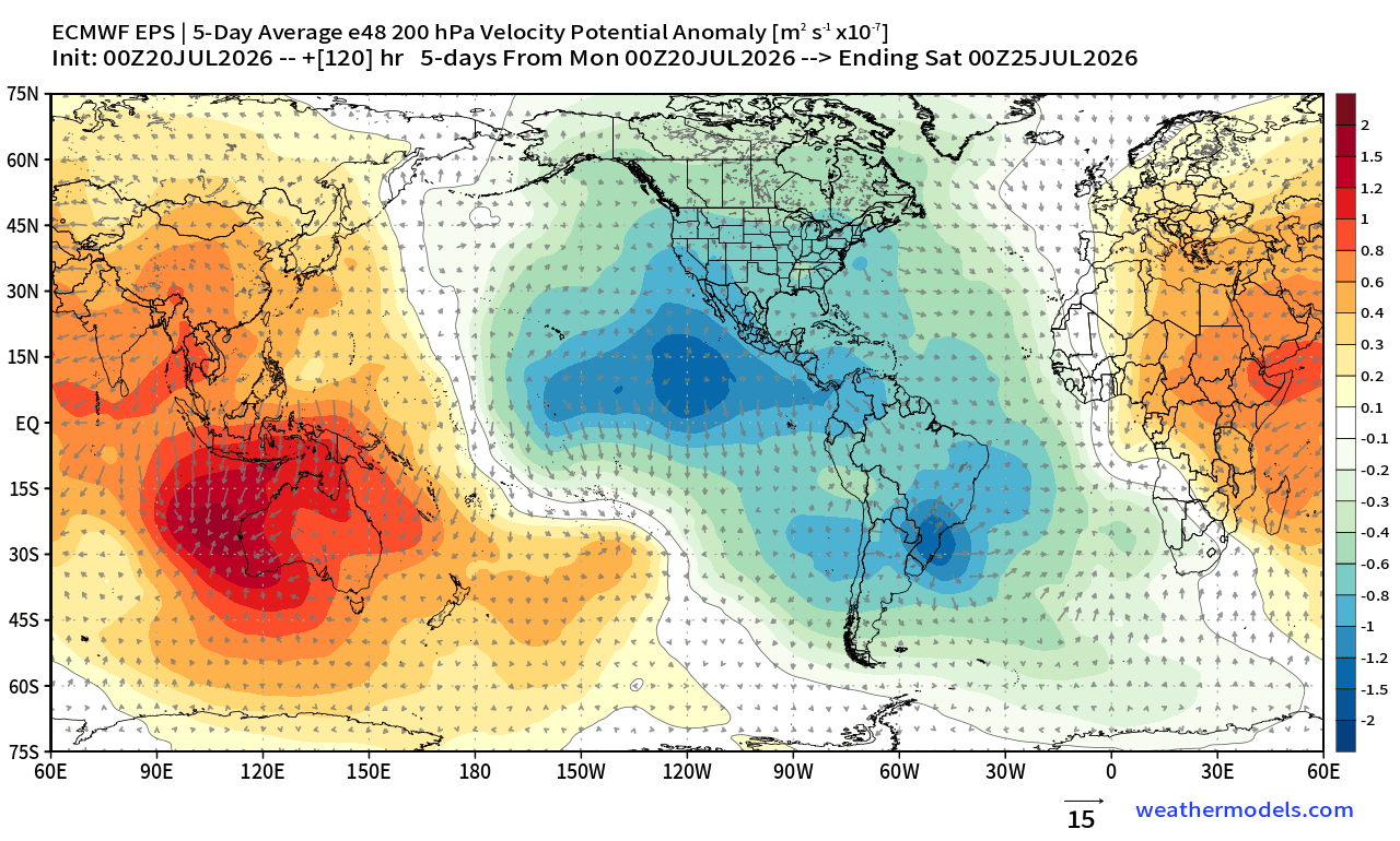
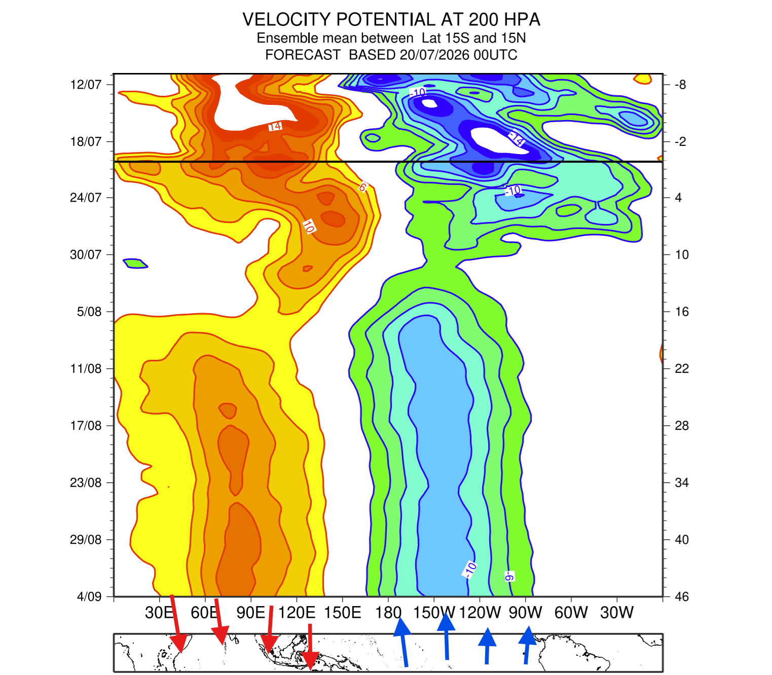
Furthermore, the "Velocity Potential" parameter, which tracks rising and sinking air motions, shows a stationary atmospheric wave locked over the Pacific. This suggests that the atmosphere has officially transitioned into a permanent "El Niño mode," effectively insulating the current weather pattern from short-term variability through at least the spring of 2027.
Implications for North America and Europe
The most immediate impacts of this Super El Niño will be felt in the Northern Hemisphere during the upcoming winter.
North America: A Tale of Two Regions
The standard El Niño signature for North America involves a strong, persistent low-pressure system in the North Pacific. This displaces the polar jet stream, leading to warmer-than-average conditions across western Canada and the northern United States.
Simultaneously, the southern Pacific jet stream is expected to amplify. This will likely create a "storm highway" across the southern half of the United States, bringing increased precipitation and a higher frequency of storm systems to states from California through the Gulf Coast and into the Mid-Atlantic. As the winter progresses into January and February 2027, the potential for significant temperature contrasts increases. The high-pressure blocking pattern projected over Canada may force frigid polar air southward, creating a high-risk scenario for major ice storms and heavy snowfall when that cold air encounters the moisture-rich southern jet stream.
Europe: Heightened Uncertainty
The response in Europe remains more complex. Historically, European winters during strong El Niño events are less predictable, but current models indicate a possible high-pressure ridge forming to the south, with variable low-pressure zones affecting northern and northwestern Europe. While the direct influence of the tropical Pacific is attenuated by the distance across the Atlantic, the atmospheric ripple effects are expected to manifest in altered rainfall patterns and mid-winter temperature volatility.
The Polar Vortex Connection
Perhaps the most critical factor in the 2026/2027 winter forecast is the state of the stratospheric Polar Vortex. A Super El Niño often increases the likelihood of a "Sudden Stratospheric Warming" (SSW) event.
When the Polar Vortex—the massive circular wind system that traps cold air over the poles—is disrupted, it weakens or even reverses its rotation. This "collapse" allows sequestered polar air to spill into mid-latitude regions. Seasonal ensemble forecasts for early 2027 show a distinct downward trend in stratospheric wind speeds, signaling a high probability of a Polar Vortex disruption. If this occurs, the "Polar Express" effect could lead to extreme cold outbreaks across North America and Europe, regardless of the warming influences typically associated with El Niño.
Official Outlook and Scientific Vigilance
Meteorological agencies continue to monitor these developments with high intensity. The transition into a record-breaking Super El Niño represents a high-impact climate scenario that could push current global weather models to their limits.
The primary concern for public safety and infrastructure remains the potential for extreme weather events: record-breaking rainfall and flooding in the southern United States, the potential for severe winter storm outbreaks in the Central and Eastern U.S., and the heightened risk of stratospheric-driven cold air intrusions.
As the world enters the final quarter of 2026, the scientific community emphasizes that this is not merely a seasonal fluctuation but a planetary-scale shift. Governments, agricultural sectors, and emergency management services are encouraged to utilize the long-range outlooks provided by these multi-model consensus forecasts to prepare for a winter that will likely be defined by high-amplitude, high-impact weather patterns.
The 2026/2027 season will serve as a crucial case study for climatologists. Whether the event maintains its current trajectory toward the strongest on record remains to be seen, but the atmospheric signals are unequivocal: the planet is currently locked in a cycle of profound, record-setting change. Stakeholders are advised to monitor official updates from regional weather offices as the season progresses, as the interplay between the Super El Niño and the Polar Vortex will continue to evolve through the winter months.