As we approach the winter season of 2026/2027, meteorologists and climatologists are turning their gaze toward the high-altitude winds swirling over the North Pole. Early-stage, long-range data suggests a heightened potential for a significant disruption of the Polar Vortex, a development that carries profound implications for weather patterns across the United States, Canada, and Europe.
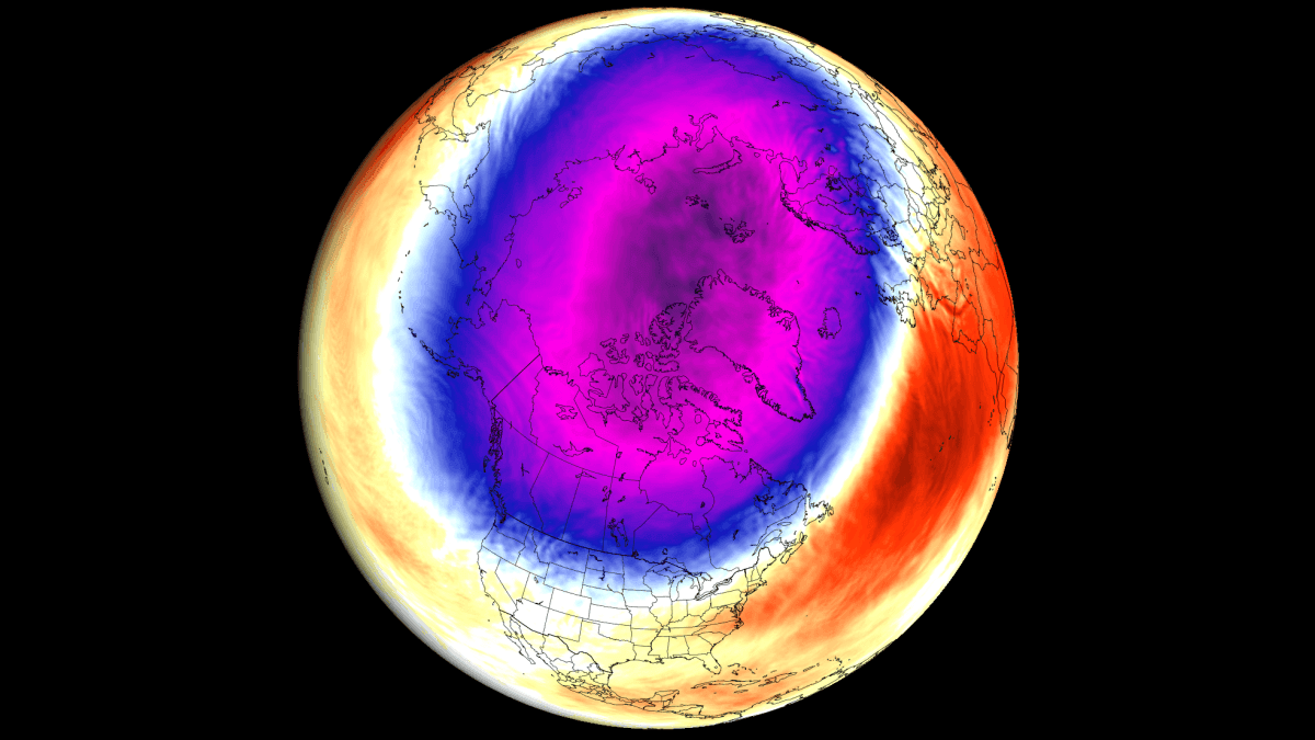
While the Polar Vortex remains a natural feature of our climate system, the convergence of three distinct global "background drivers"—a developing Super El Niño, a specific stratospheric wind pattern, and record-low Arctic sea ice—has created a meteorological environment primed for volatility.
Main Facts: Understanding the Polar Vortex
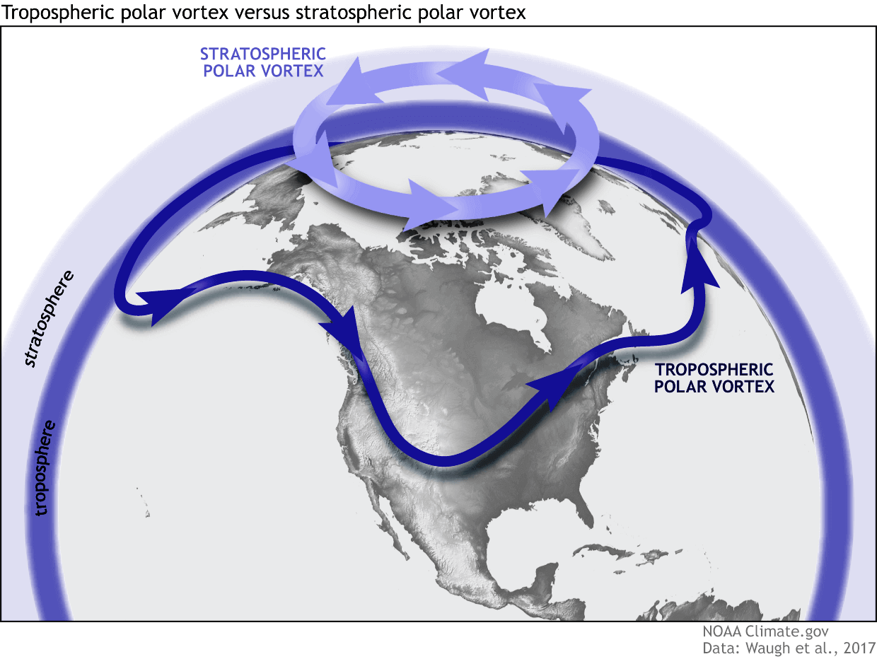
The Polar Vortex is not a storm in the traditional sense, but a large-scale, persistent cyclone of cold air trapped by a belt of strong winds known as the polar night jet. It exists in two distinct layers: the troposphere, where we experience our daily weather, and the stratosphere, sitting roughly 30 to 50 kilometers above the surface.
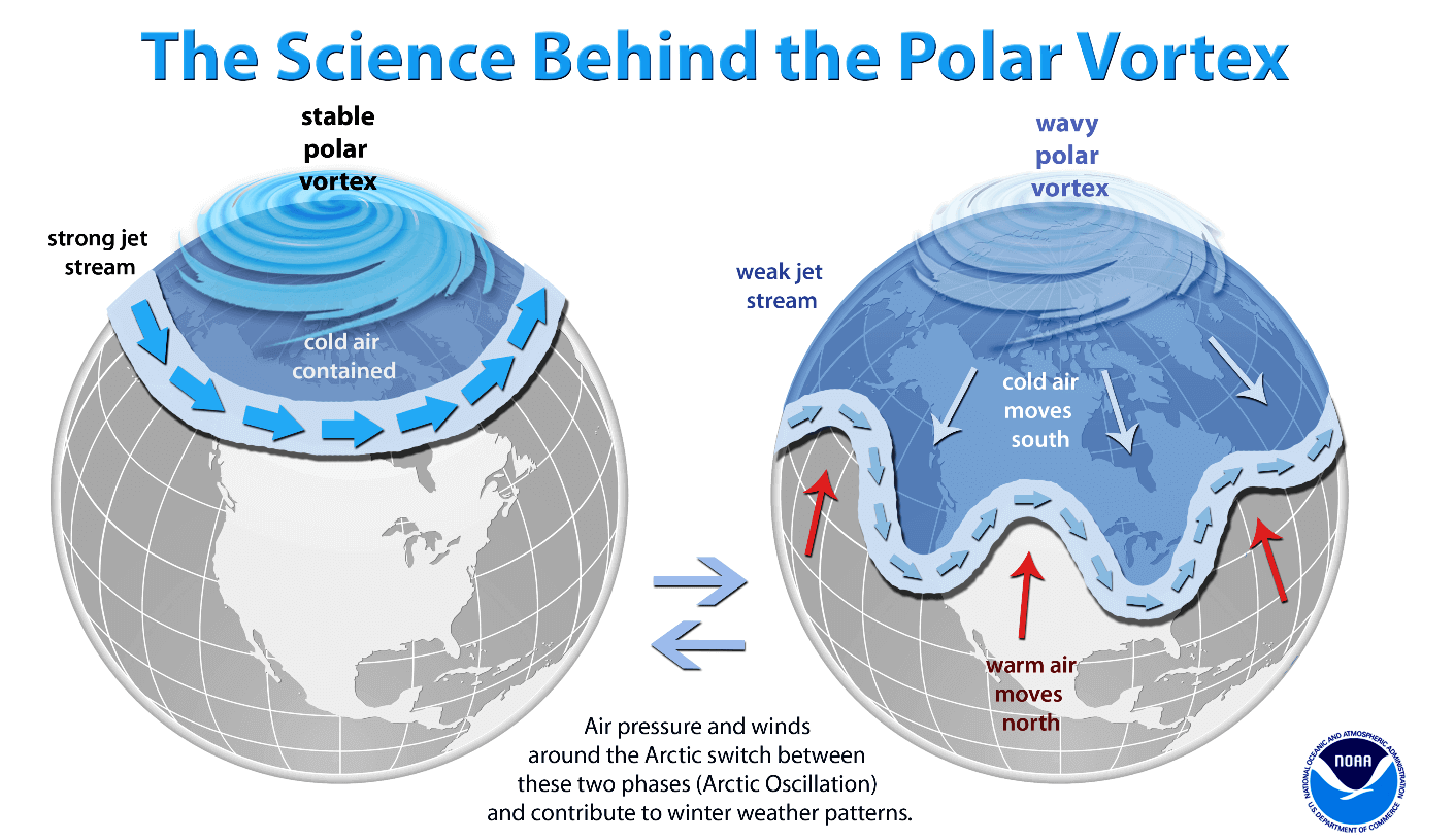
In a "stable" state, the vortex acts as a containment vessel, locking frigid Arctic air within the polar circle. However, when the vortex weakens or experiences a "Sudden Stratospheric Warming" (SSW) event, the polar jet stream becomes wavy and distorted. This breakdown of the "polar wall" allows massive plumes of Arctic air to break free, spilling southward into the mid-latitudes, often resulting in prolonged, severe cold snaps and significant snowfall in densely populated regions of the Northern Hemisphere.
Chronology of Emerging Signals
The current forecast for Winter 2026/2027 is built upon a timeline of observations beginning in the late summer and early autumn.
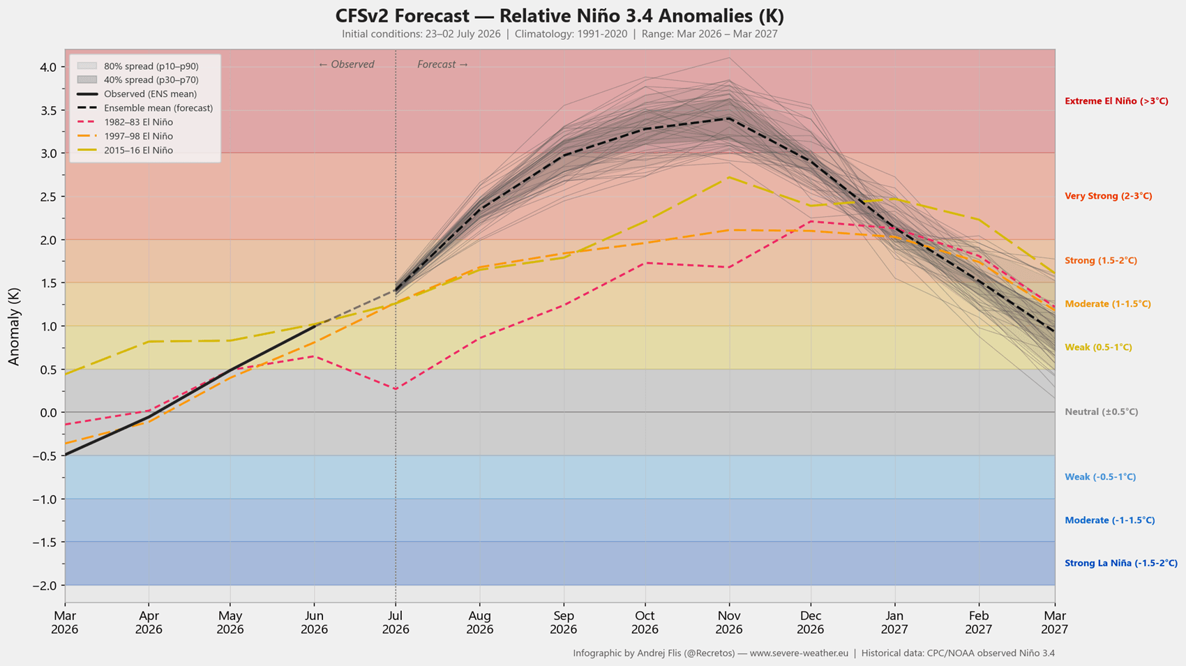
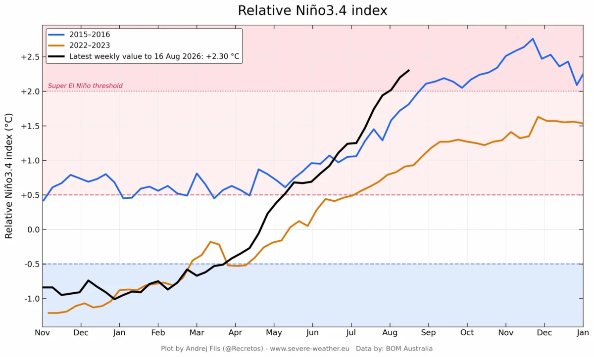
- July 2026: Initial monitoring of the NCEP CFSv2 model indicated the rapid intensification of an El Niño event in the Pacific.
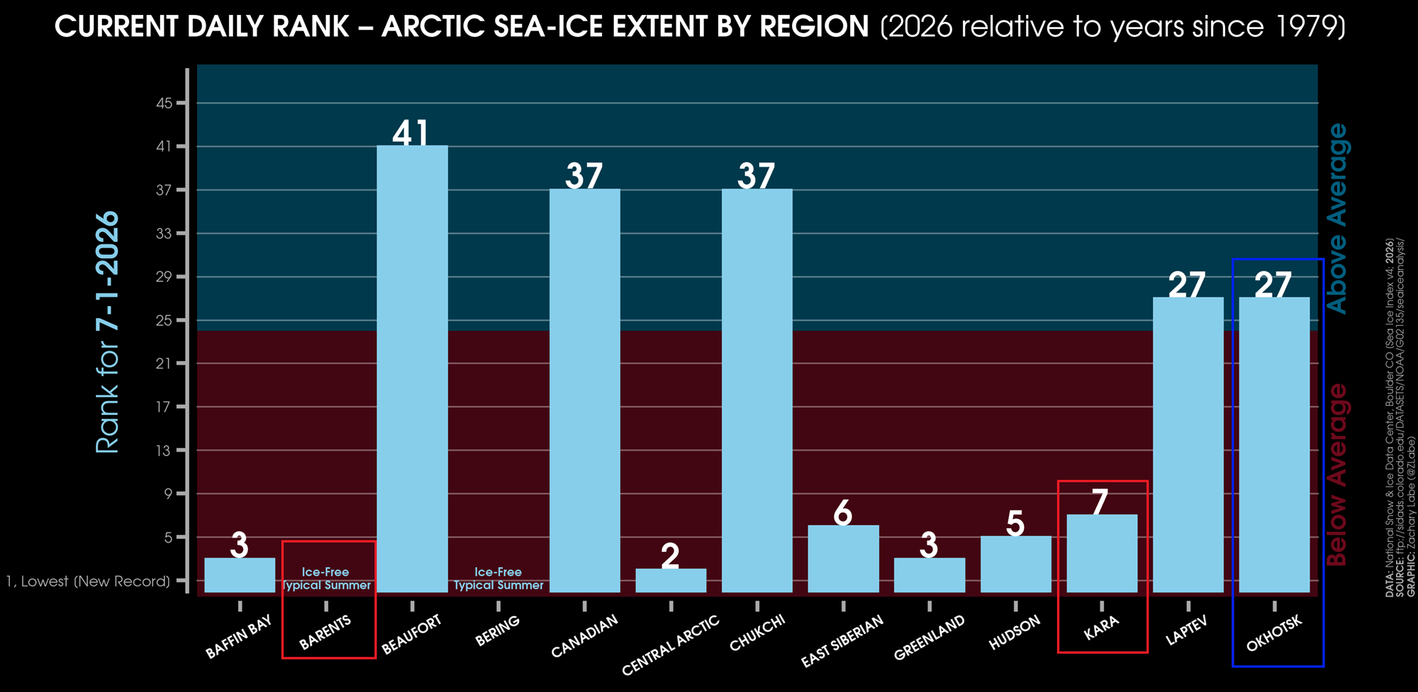
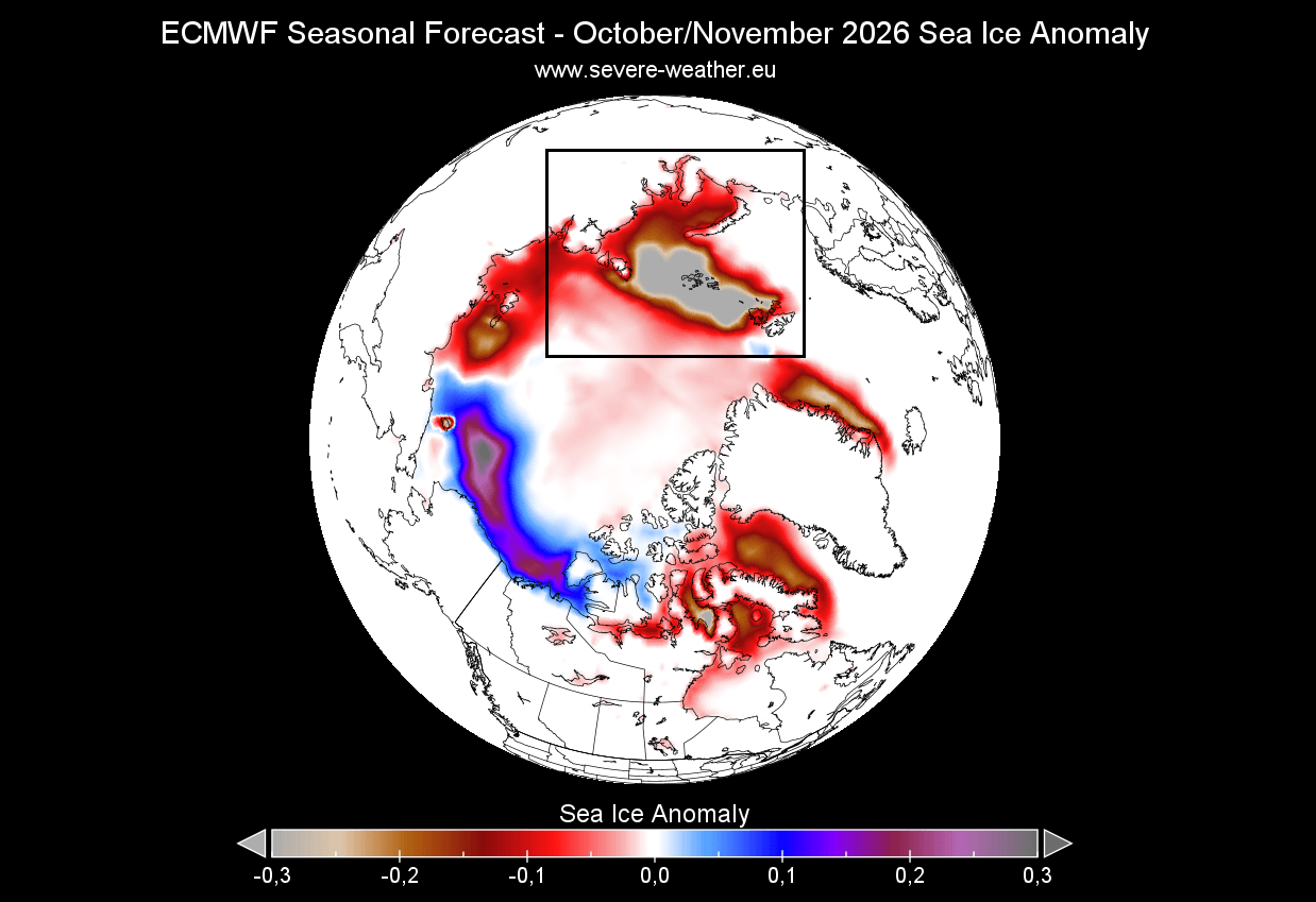
- August 2026: Satellite data confirmed that Arctic sea ice extent in the Barents and Kara Seas was significantly below the decadal average, a critical precursor for atmospheric pressure shifts.
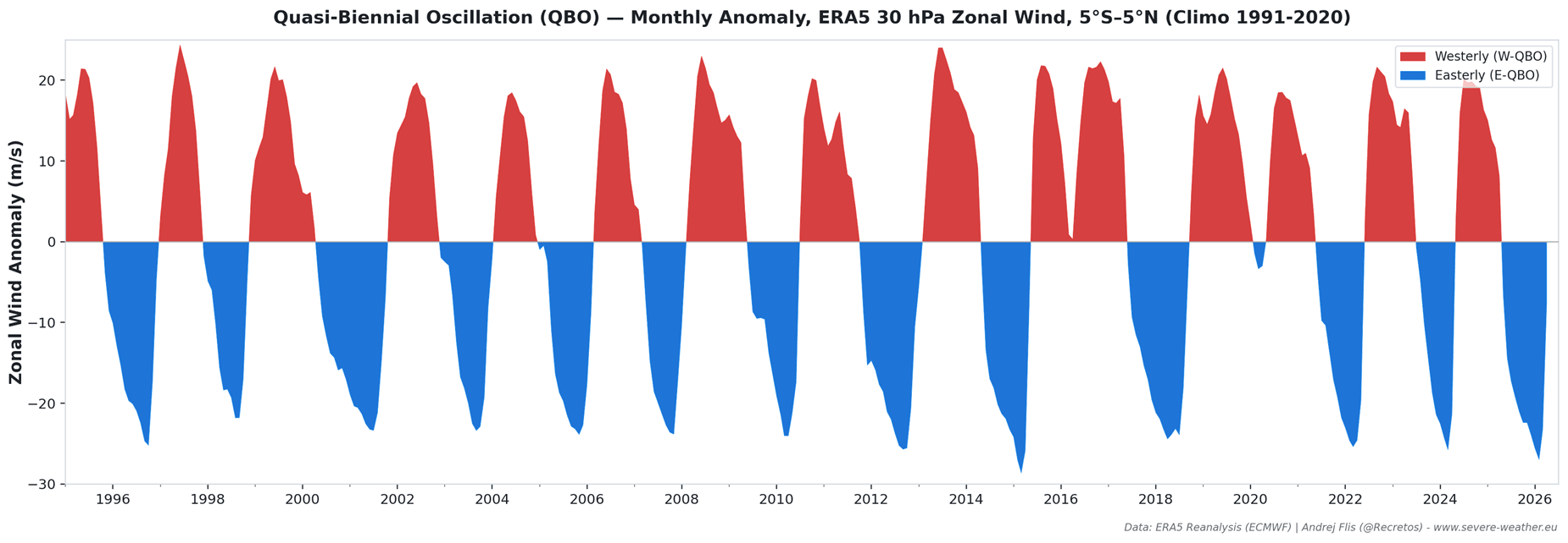
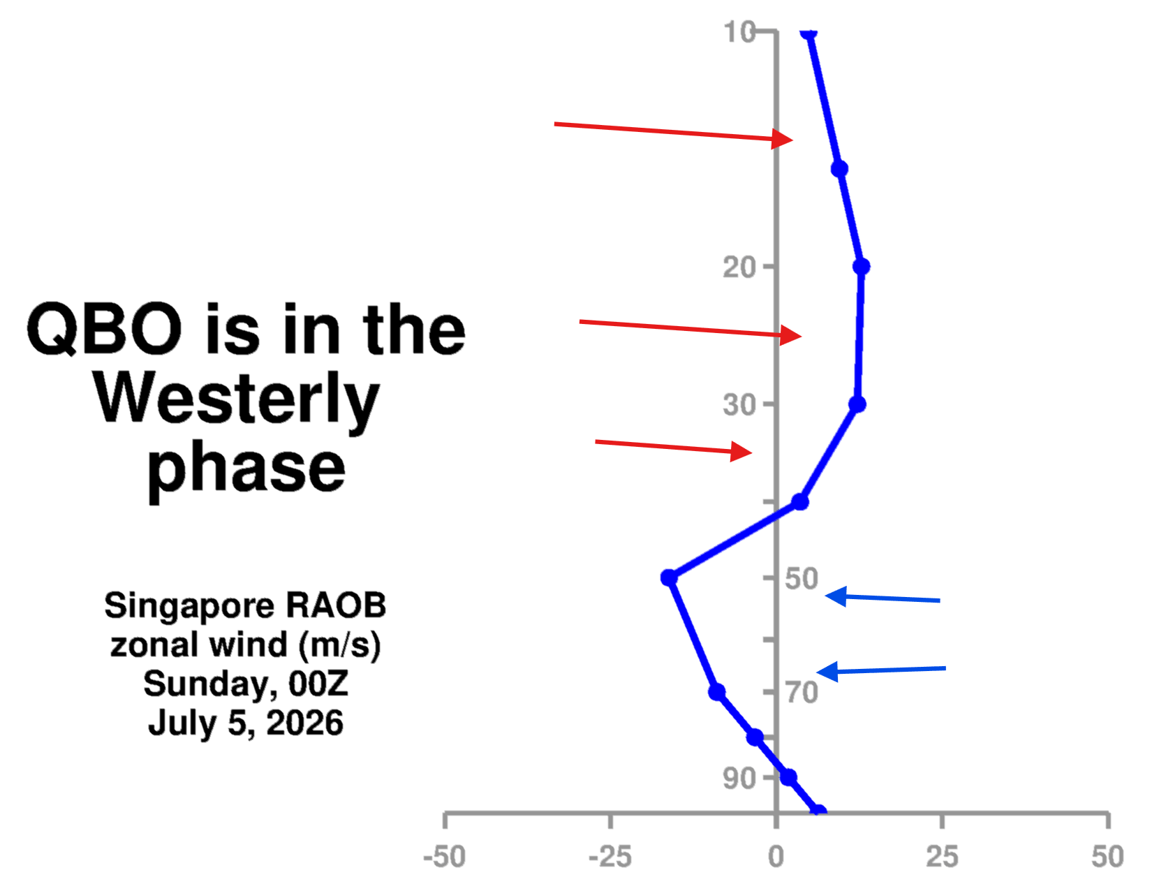
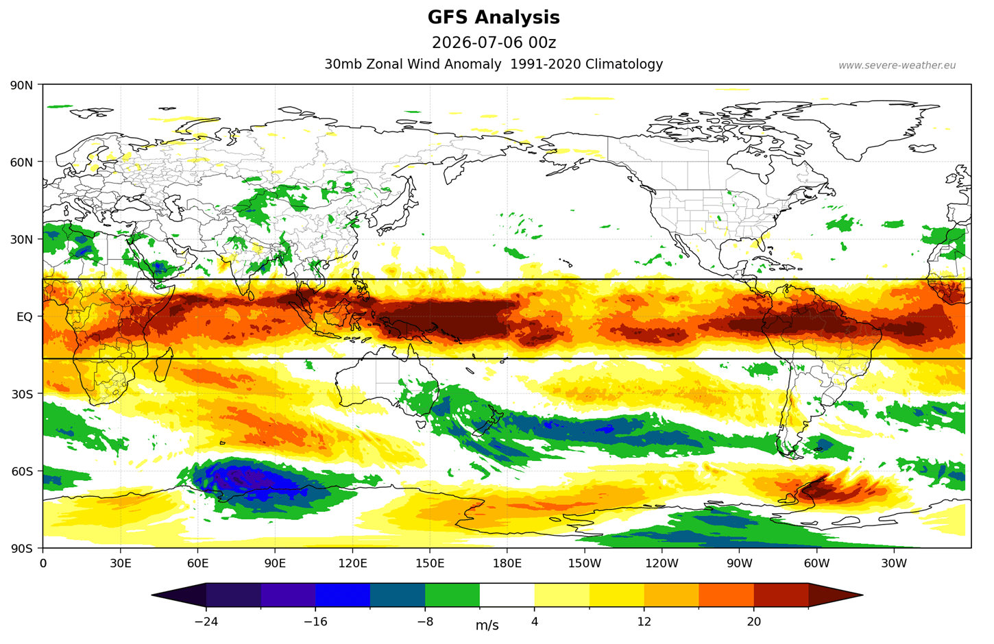
- September 2026: Stratospheric wind analysis, specifically tracking the Quasi-Biennial Oscillation (QBO), confirmed a westerly phase transition that, when combined with the ongoing El Niño, began showing a "weakening signal" for the stratospheric polar night jet.
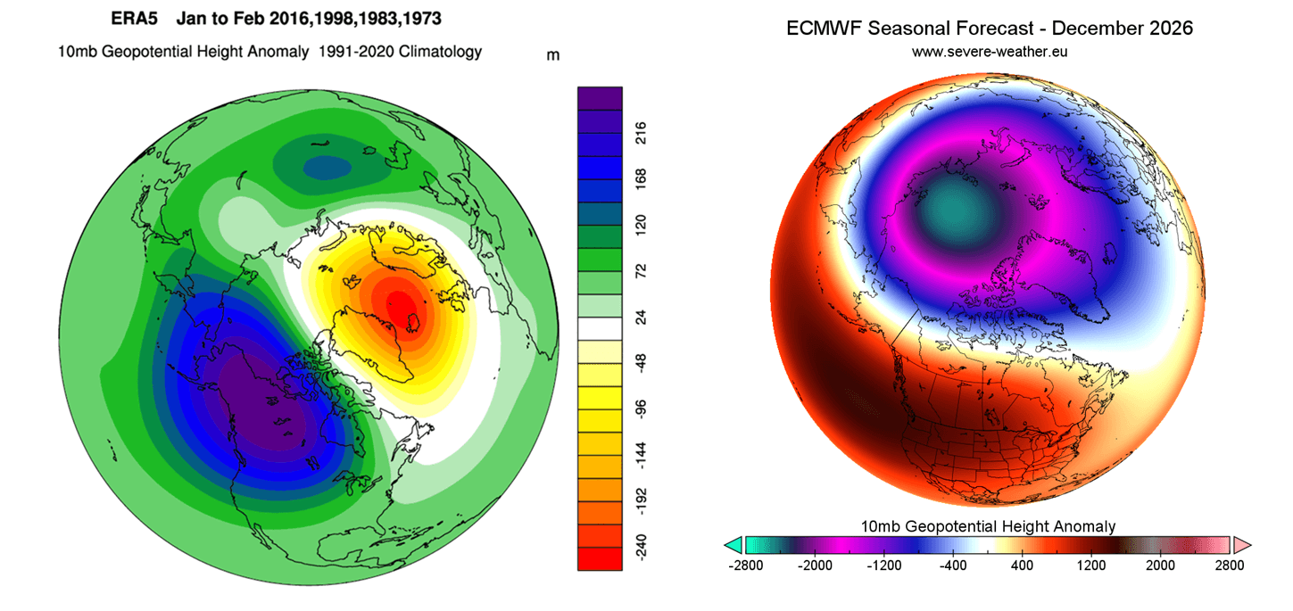
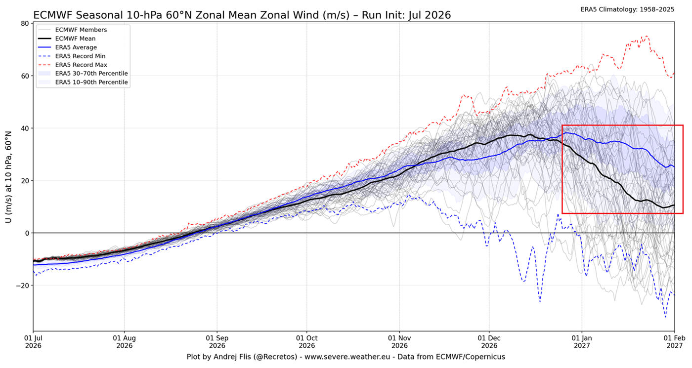
- October 2026–January 2027 Outlook: Current ensemble models from the European Centre for Medium-Range Weather Forecasts (ECMWF) now explicitly show a trend toward a weakened vortex strength compared to long-term historical averages, particularly as we head into the heart of mid-winter.
Supporting Data: The Trinity of Climate Drivers
The likelihood of a disrupted vortex is not based on guesswork, but on the alignment of three primary atmospheric and oceanic phenomena:
1. The Super El Niño Influence
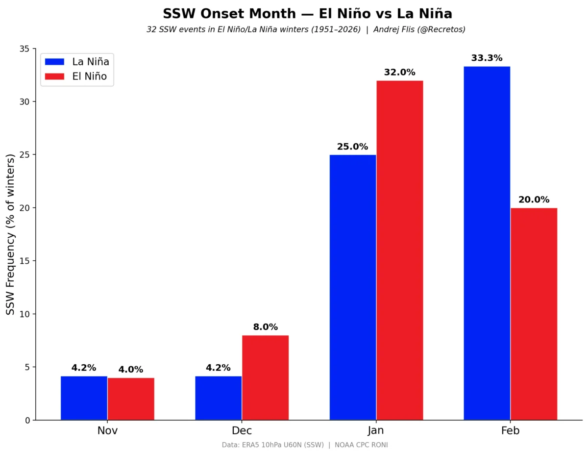
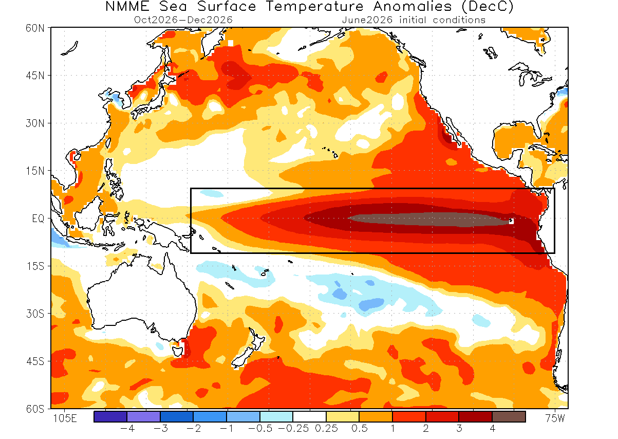
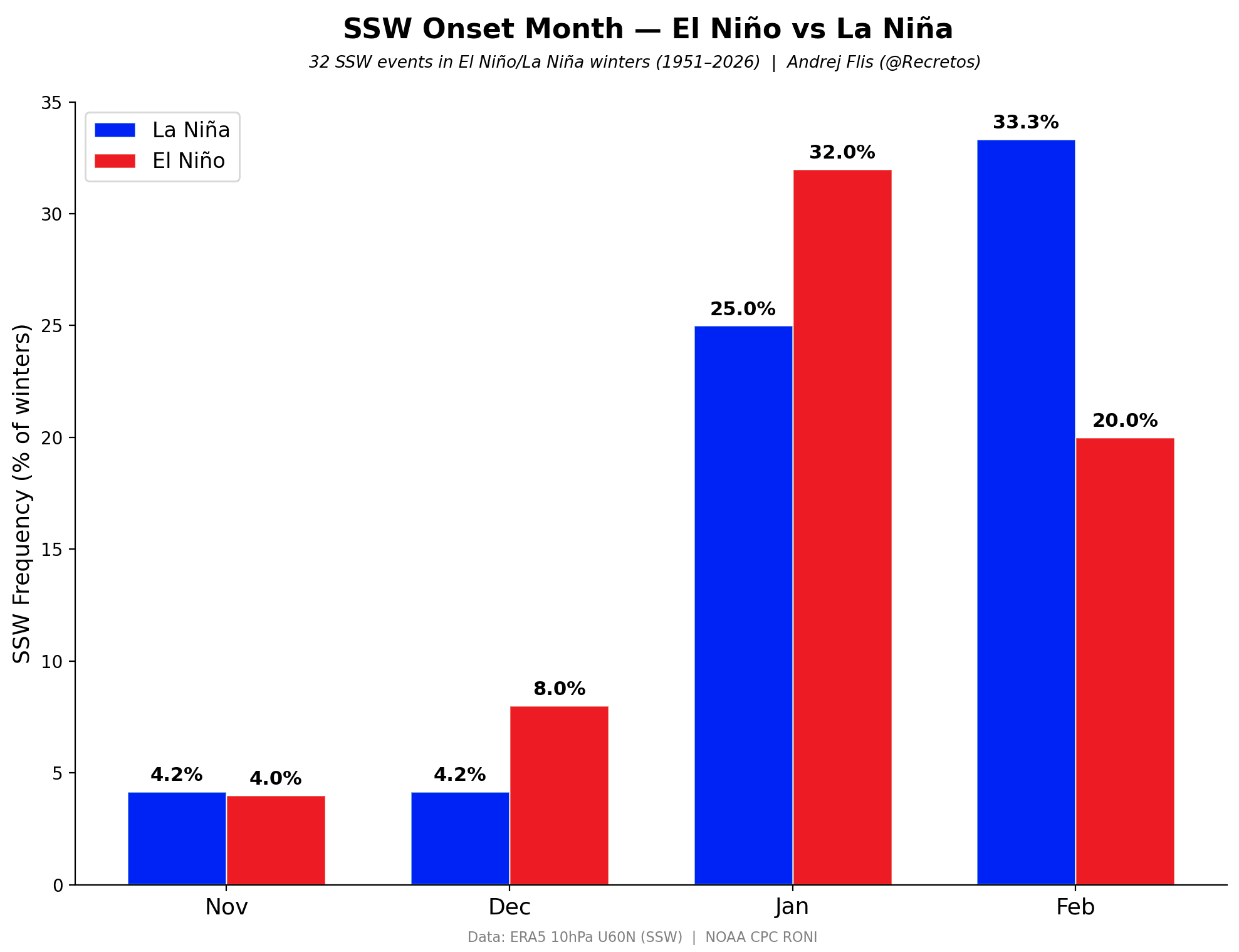
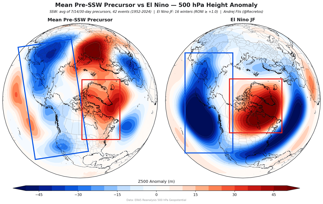
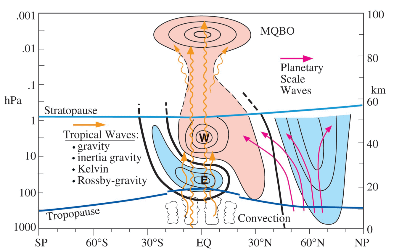
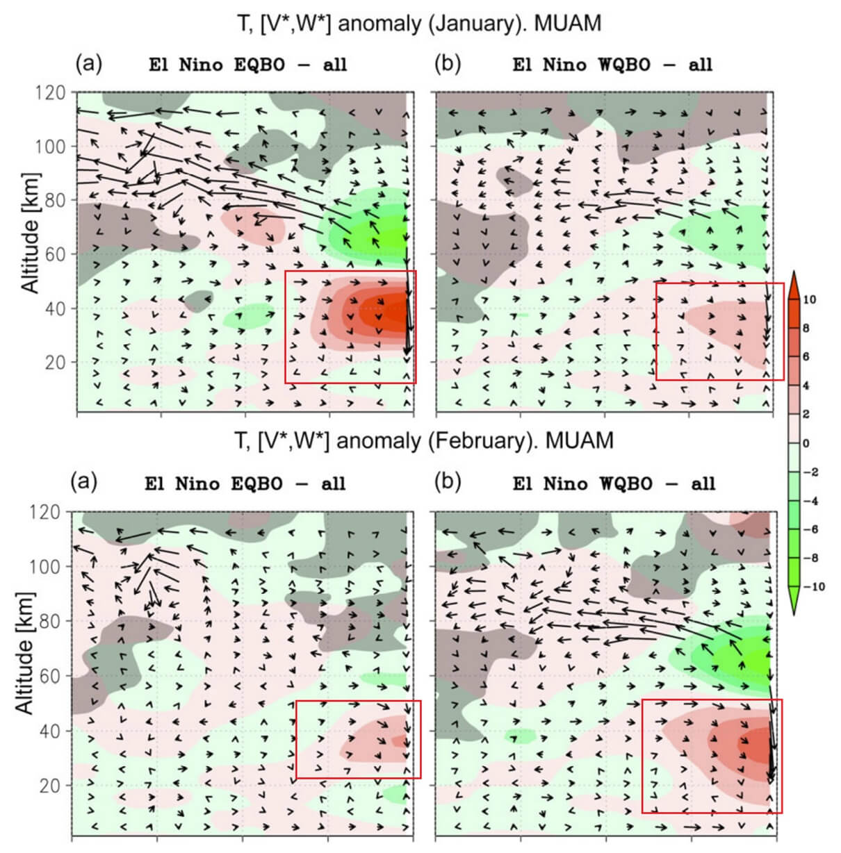
The Pacific Ocean is currently experiencing a "Super El Niño" event, with anomalies in sea surface temperatures reaching more than 4°C above the historical norm. Historically, Super El Niño years are statistically linked to an increased frequency of SSW events. This occurs because the massive release of heat from the Pacific creates planetary-scale waves—often called Rossby waves—that travel upward through the atmosphere, colliding with the Polar Vortex and physically distorting its structure.
2. The Quasi-Biennial Oscillation (QBO)
The QBO acts as the "heartbeat" of the tropical stratosphere, a rhythmic oscillation of wind direction. Currently, the atmosphere is in a "West QBO" phase. While a West QBO typically stabilizes the vortex, the extreme intensity of the 2026 Super El Niño is expected to override this stabilization. Research indicates that when these two forces conflict, the timing of vortex disruption is often delayed until mid-to-late winter, setting the stage for a "January surprise" of severe weather.
3. The Arctic Sea Ice Factor
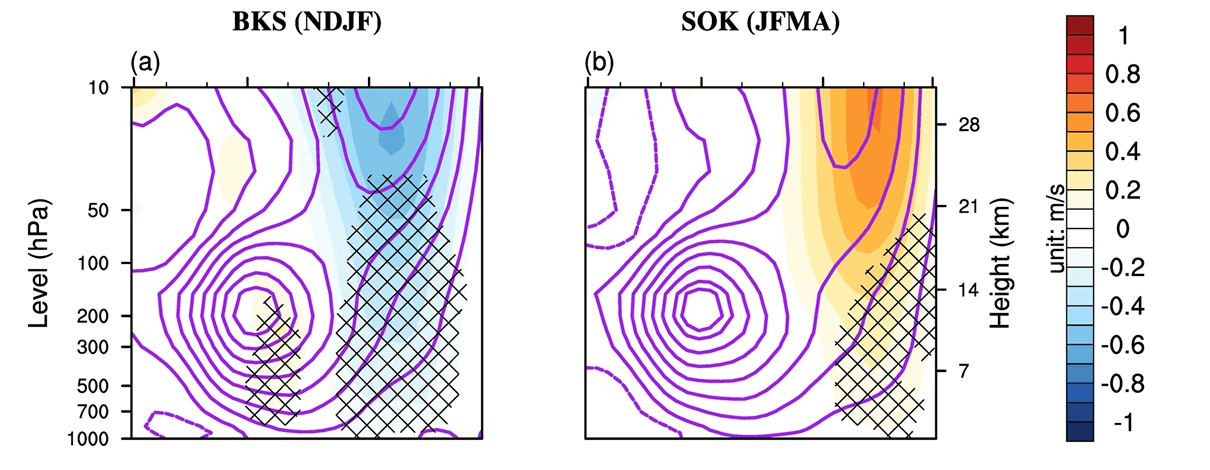
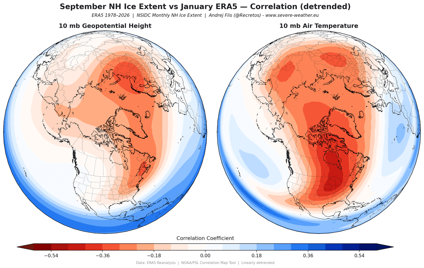
The state of the sea ice in the Barents and Kara Seas is a high-latitude indicator of vortex stability. Low ice coverage in these specific regions reduces the "albedo" (reflectivity) of the Arctic, allowing more heat to enter the atmosphere. This localized warming generates pressure anomalies that "push" against the Polar Vortex from below. With the Barents-Kara region showing a pronounced sea-ice deficit this year, the atmosphere is primed to send energy surges into the stratosphere, further destabilizing the vortex core.
Official Observations and Analytical Framework
Meteorological institutions, including the National Oceanic and Atmospheric Administration (NOAA) and the ECMWF, utilize complex 3D modeling to visualize these interactions.
The analytical consensus suggests that the 2026/2027 winter will not necessarily be "cold everywhere," but rather "highly dynamic." A weakened vortex does not mean the entire Northern Hemisphere freezes simultaneously; instead, it creates a "blocking pattern." This is where high-pressure ridges stall over the North Atlantic or the Pacific, forcing the jet stream into a deep, jagged meander.
Data from the January 2026 disruption serves as a primary case study for what is being anticipated. During that event, a "split" in the vortex core sent cold air cascading down into the central and eastern United States and northern Europe. The current models for 2027 show a striking similarity to the pressure anomalies observed in those months, suggesting that we may see a repeat of the "Polar Express" pattern—a series of intense, short-duration cold outbreaks separated by volatile, stormy transitions.
Implications: What to Expect at the Surface
If the forecast for a disrupted Polar Vortex holds true, the implications for the public and infrastructure are significant.
For North America:
The primary concern is the displacement of the polar core. Should the vortex split or shift toward the North American sector, we can expect:
- Increased Snowfall Frequency: Increased atmospheric instability will likely lead to more frequent "lake-effect" snow events and moisture-rich storm systems.
- Volatility: Rapid temperature swings are the hallmark of a disrupted vortex. Communities could experience record-breaking warmth followed by deep freezes within 48 to 72 hours.
For Europe:
The "blocking" effect mentioned above often results in "Scandinavian Blocking." This prevents mild Atlantic air from reaching the continent, allowing Siberian cold air to push deep into Western and Central Europe. This often results in prolonged periods of dry, bitter cold followed by significant winter storms as the cold air interacts with the warmer Mediterranean moisture.
Infrastructure and Energy:
Beyond the immediate weather, a disrupted vortex places strain on power grids. The "Polar Express" pattern, characterized by rapid shifts in demand for heating and the potential for icing on power lines, requires early preparation from energy providers.
Conclusion
The signals for Winter 2026/2027 are remarkably clear, even if the precise timing remains subject to the chaotic nature of the atmosphere. The "trinity" of the Super El Niño, the QBO wind phase, and record-low Arctic sea ice creates a high-probability scenario for a mid-winter vortex disruption.
While this does not guarantee a record-breaking winter, it significantly shifts the odds in favor of extreme, high-impact weather events. As the atmosphere continues to react to these major background drivers, the global meteorological community will continue to monitor the 10mb stratospheric pressure levels for the first signs of an imminent collapse. For those in the mid-latitudes, the coming winter promises to be anything but typical, requiring a heightened level of readiness for the dynamic, cold, and often unpredictable patterns that define a disrupted Polar Vortex.
Disclaimer: Meteorological forecasting at this range is subject to high levels of uncertainty. Readers are advised to follow local weather updates and official warnings as the winter season progresses.