A powerful "Super El Niño" is rapidly emerging as the primary architect of global weather patterns for the upcoming Fall and Winter seasons. Recent oceanic data confirms that warm anomalies in the equatorial Pacific are intensifying at a pace rarely seen in the historical record. This development is not merely a seasonal fluctuation; it represents a significant shift in the atmospheric engine that dictates temperature and precipitation extremes across the Northern Hemisphere.

As we transition from the typical instability of autumn into the more rigid climate patterns of winter, the influence of this Super El Niño is projected to amplify, creating a highly active and interconnected weather system. For North America and Europe, this suggests a season of significant volatility, characterized by shifted jet streams, altered storm tracks, and a potential for dramatic climatic departures from long-term averages.
The Science of the Super El Niño
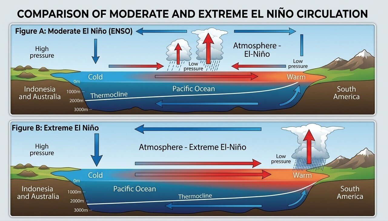
The El Niño Southern Oscillation (ENSO) is a periodic fluctuation in sea surface temperatures (SSTs) and air pressure across the equatorial Pacific. During a strong warm phase—or El Niño—the "Walker Cell," a critical tropical atmospheric circulation pattern, undergoes a fundamental transformation.
Typically, cool water rises in the eastern Pacific, while warmer water accumulates in the west. During a Super El Niño, this dynamic reverses or drastically intensifies: the thermocline deepens, and the central and eastern Pacific experience a massive influx of heat. This creates a pressure deficit in the eastern tropical Pacific and a high-pressure zone over the western Pacific, effectively acting as a "global thermostat" that transmits ripple effects through the mid-latitudes via atmospheric bridges.
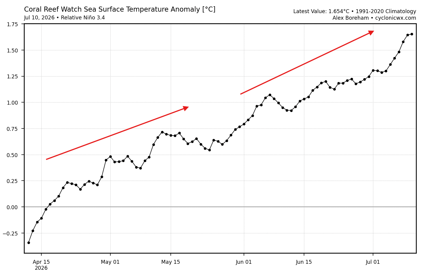
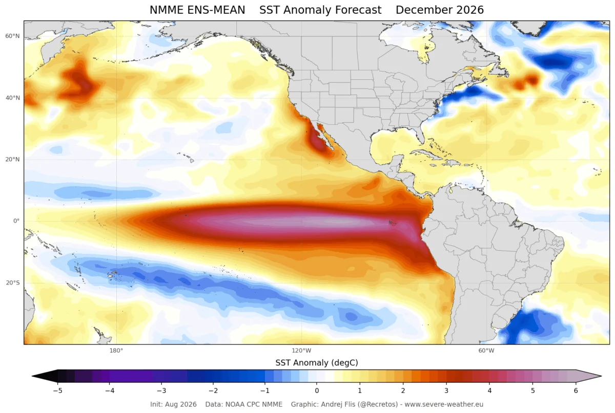
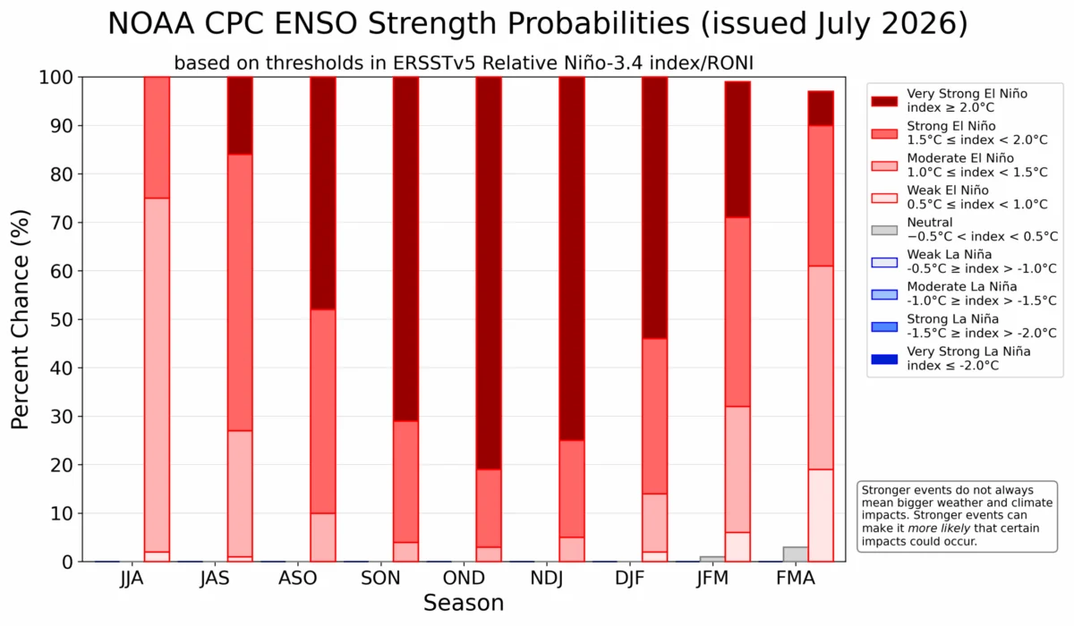
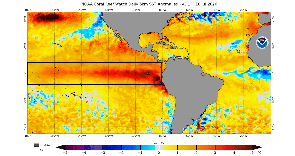
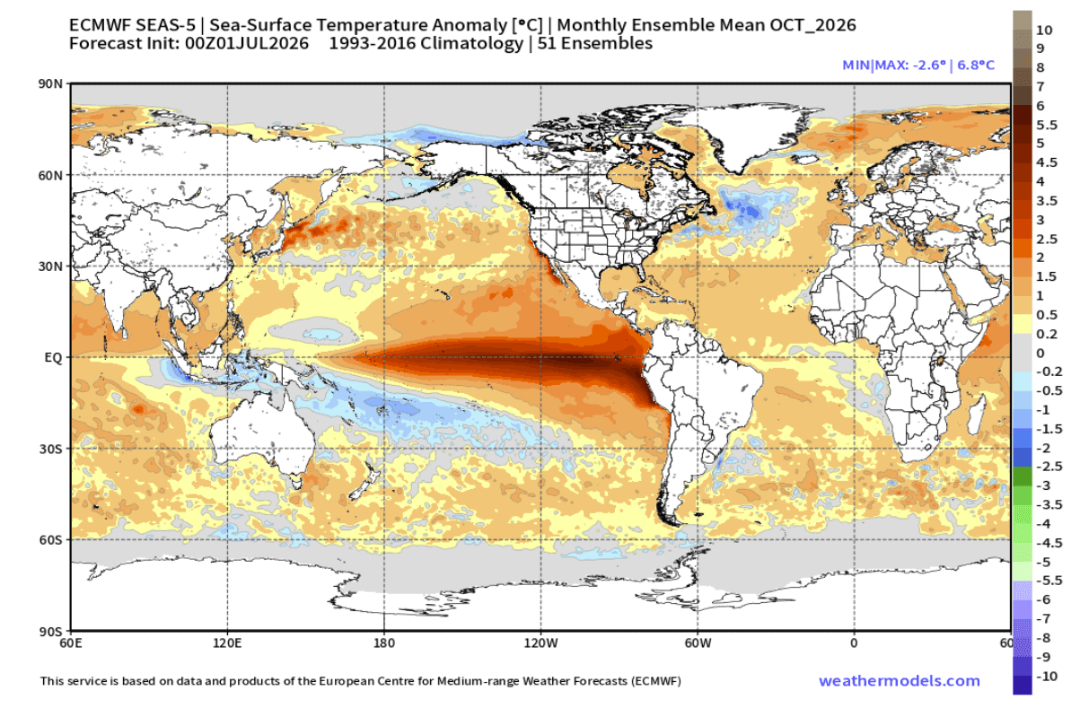
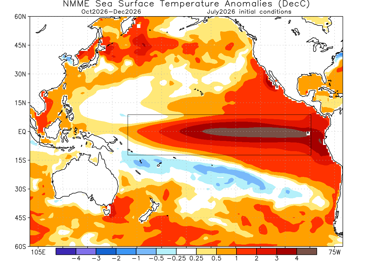
Current observations reveal that the ENSO region is already experiencing anomalies exceeding 3–4 degrees Celsius above the norm. To be classified as a "Super" event, seasonal values must remain sustained above the +2-degree threshold. Given the current trajectory of the warming trend, experts indicate that this event is not only likely to meet that criteria but may challenge existing records for intensity.
Chronology of Development: From Autumn to Mid-Winter
The development of this event is unfolding with unusual speed. Unlike standard El Niño cycles, which often build gradually throughout the autumn, the current data suggests that the atmospheric response is "front-loaded."
Early Autumn Indicators
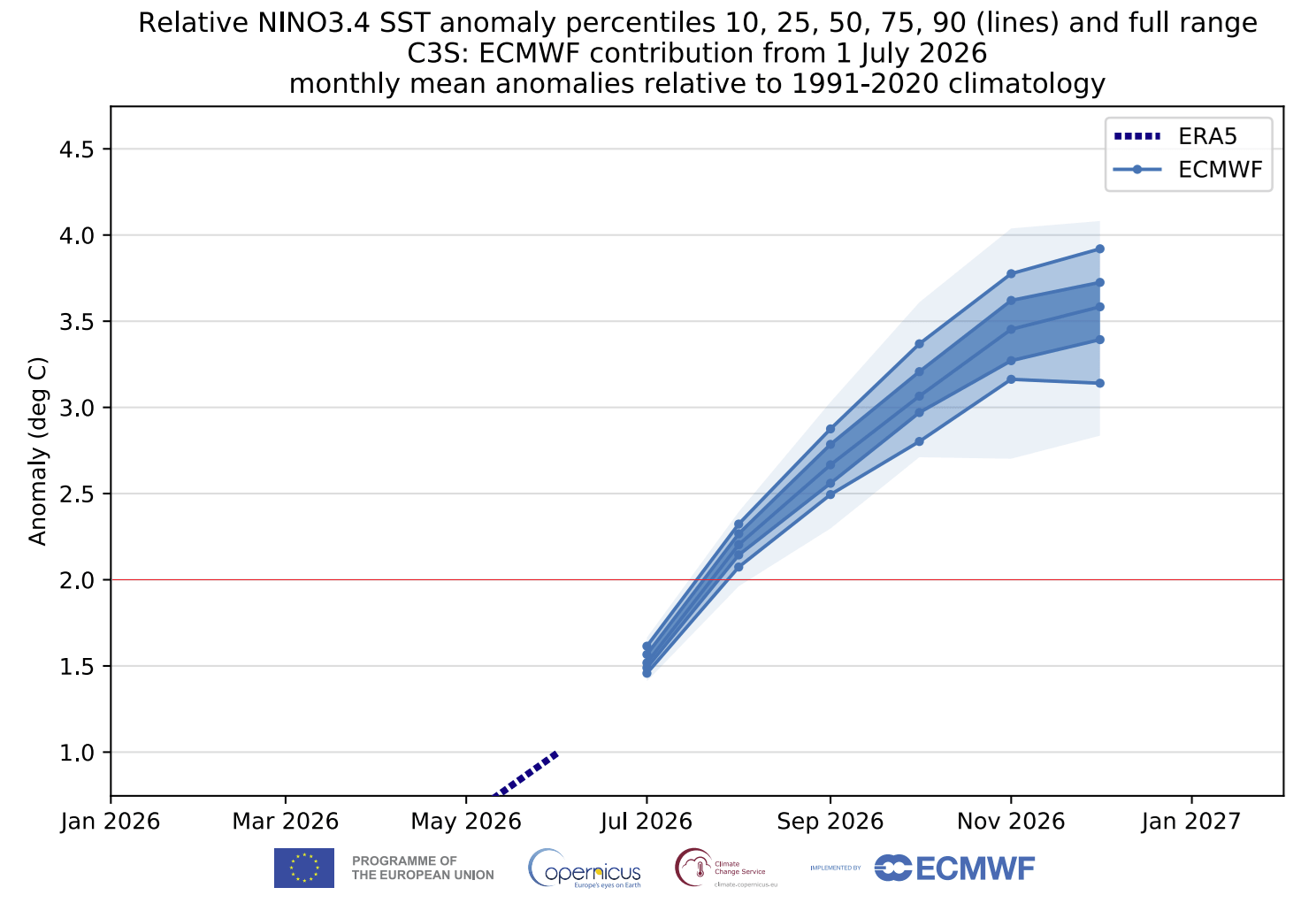
As we move into September and October 2026, the oceanic warming is already influencing the global circulation. Most seasonal models, including the European Centre for Medium-Range Weather Forecasts (ECMWF) and the North American Multi-Model Ensemble (NMME), show an unusually mature pressure pattern for this time of year. Specifically, we are seeing the establishment of high-pressure anomalies over Canada and a corresponding strengthening of the Pacific jet stream.
Late Fall and Early Winter Consolidation
By November, the patterns typically associated with the peak of winter are expected to be fully established. A persistent low-pressure storm track is forecasted to take shape across the southern United States, fueled by the enhanced moisture transport from the Pacific. Simultaneously, the North Atlantic is expected to host deep low-pressure systems, which will steer mild, moist air into Europe, potentially limiting early-season cold snaps across the continent.
Mid-Winter Peak (January 2027)
By January, the pattern is expected to become "locked in." The atmospheric configuration will likely feature a high-amplitude ridge over Canada—acting as a massive barrier to the polar jet stream—and a corresponding corridor of active, moisture-rich storm systems traversing the southern and eastern United States. This setup represents a classic Super El Niño signature, where the subtropical jet stream is pushed to its maximum potential.
Supporting Data and Predictive Models
The predictive confidence for the 2026/2027 season is bolstered by the consensus between the world’s leading climate modeling systems.
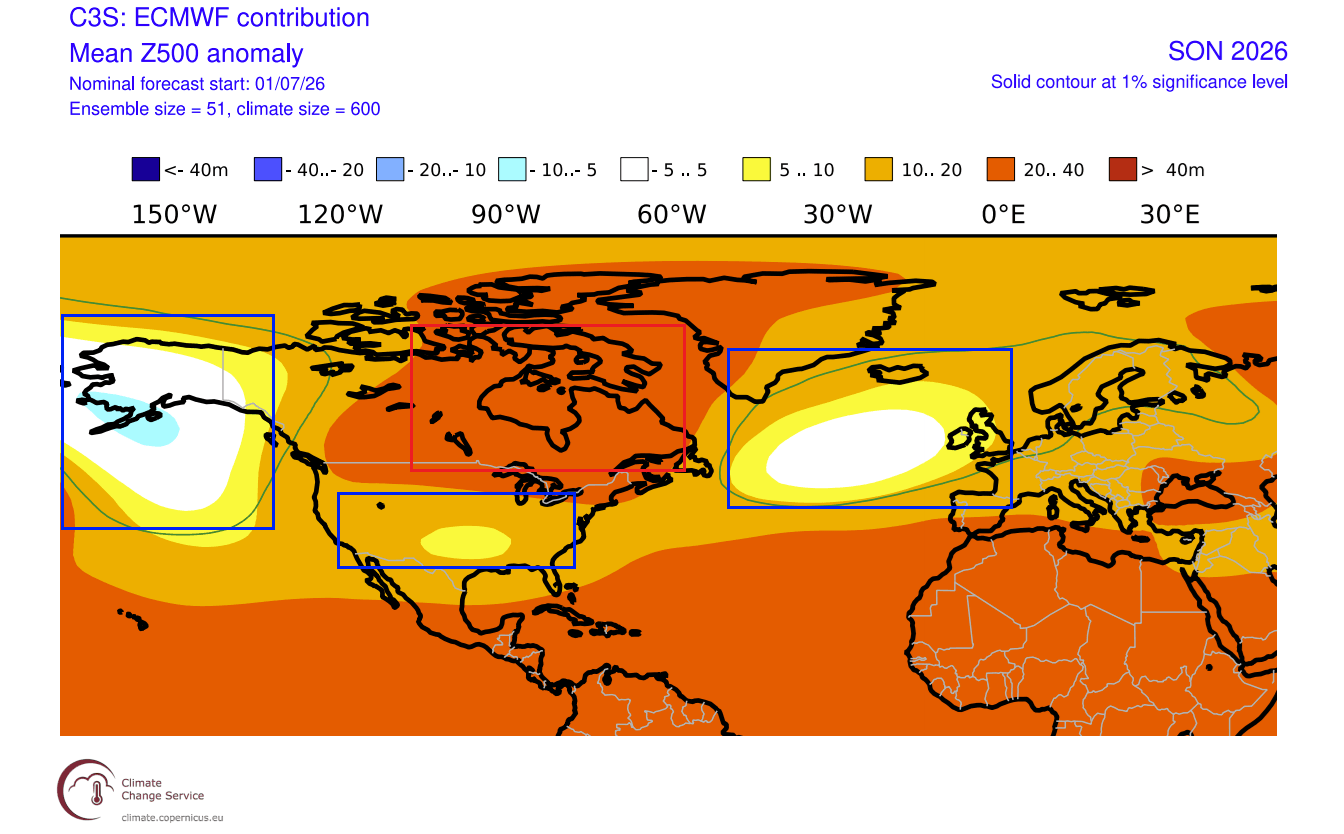
- ECMWF Analysis: The European model highlights a significant positive anomaly in sea-level pressure centered over Canada and Greenland. This "blocking" setup is crucial, as it forces the southward displacement of colder air, creating a high-contrast environment that can trigger intense winter storms when the cold air meets the moisture-laden southern jet stream.
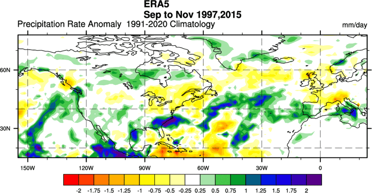
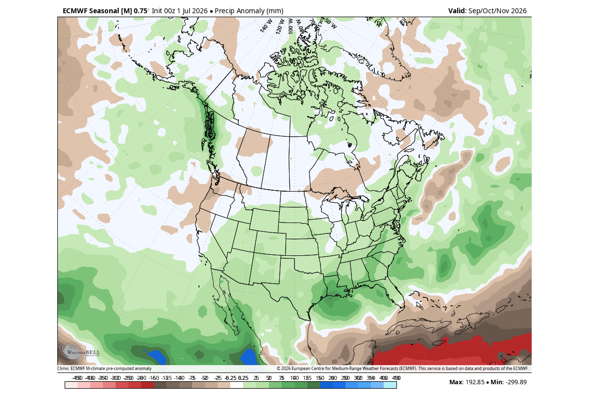
- NMME (North American Multi-Model Ensemble): By synthesizing multiple models, the NMME provides a comprehensive outlook that corroborates the ECMWF. It shows a strong alignment in precipitation patterns, with significant above-normal rainfall projected for the southern and southeastern United States, and notably drier conditions for the Pacific Northwest and parts of Canada.
- Oceanic Anomalies: Recent buoy and satellite data show peak temperature anomalies exceeding +6 degrees in specific pockets of the eastern Pacific, a staggering figure that underscores the "Super" classification of this event.
Official Outlooks and Institutional Consensus
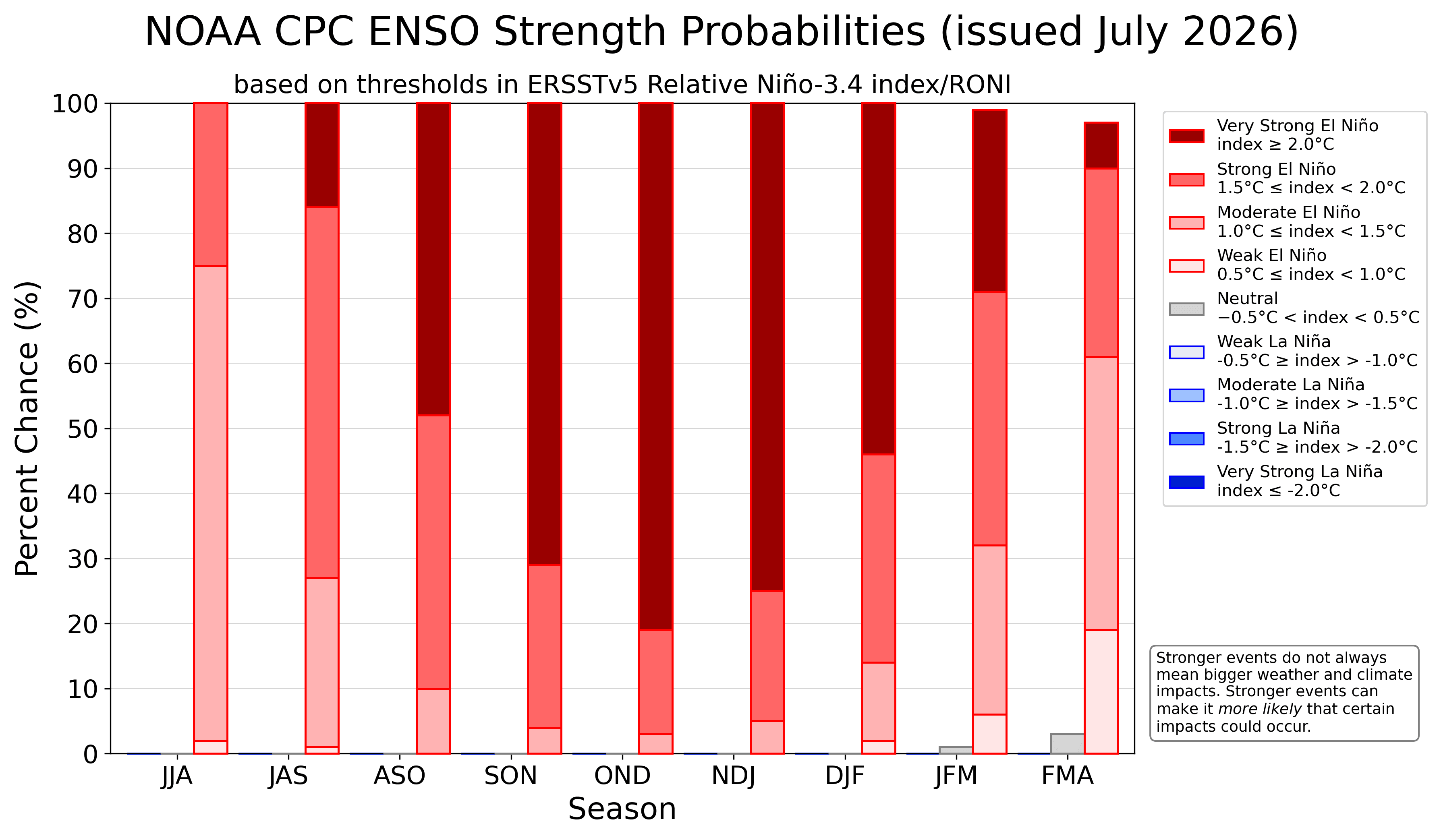
The National Oceanic and Atmospheric Administration’s Climate Prediction Center (NOAA CPC) has consistently updated its probability forecasts to reflect the increasing likelihood of an extreme event. Their latest outlook indicates an overwhelming statistical probability that the 2026/2027 season will conclude as one of the most intense El Niño events on record.
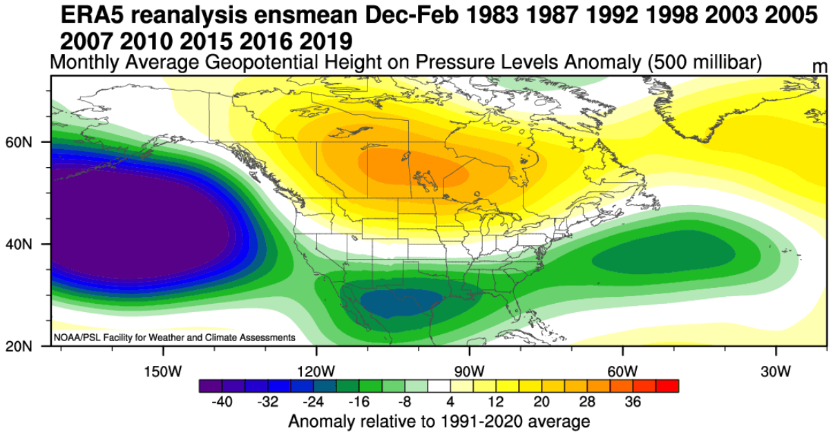
These institutions are closely monitoring the "relative ENSO index," which, even after accounting for recent climate warming trends, confirms that the raw anomalies are historically significant. While individual weather events (such as specific snowstorms) cannot be predicted months in advance, the statistical tendency for higher-than-average precipitation and temperature variance is now the official guidance provided to emergency management and agricultural sectors.
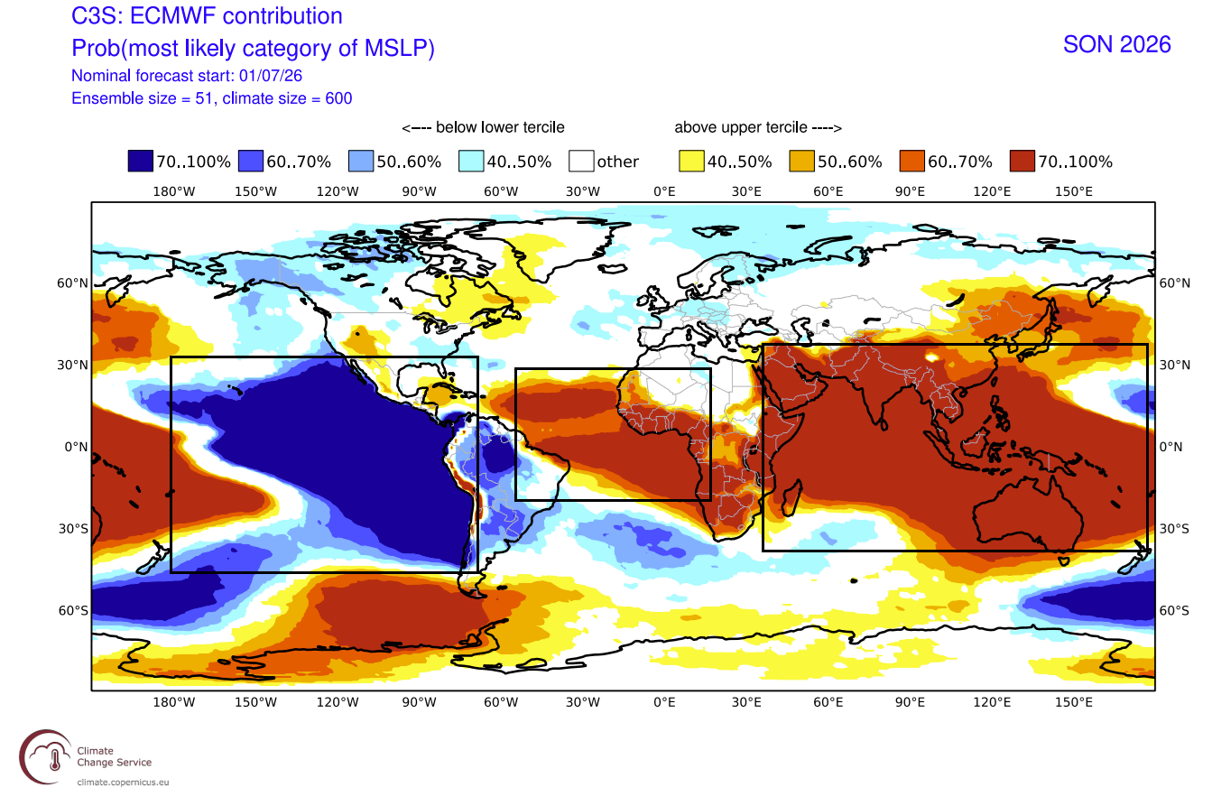
Implications for the 2026/2027 Season
North America: A Tale of Two Climates
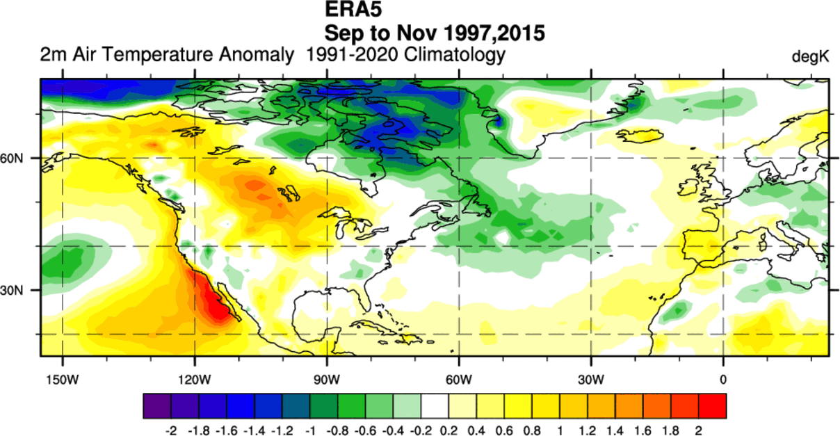
The primary implication for North America is the bifurcation of weather patterns. The northern tier of the United States and Canada will likely experience milder-than-average temperatures due to the persistent high-pressure ridging. However, the southern and central United States should prepare for a "high-octane" winter. The combination of a strong subtropical jet and an active storm track suggests an increased frequency of flooding, intense rainfall, and, should the cold air successfully penetrate from the north, significant winter storm events.
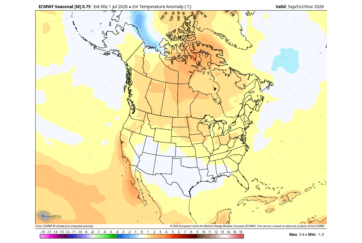
Europe: The Atlantic Influence
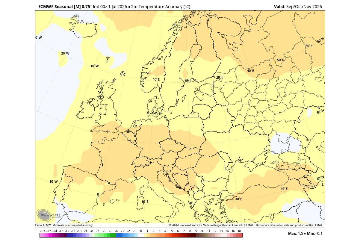
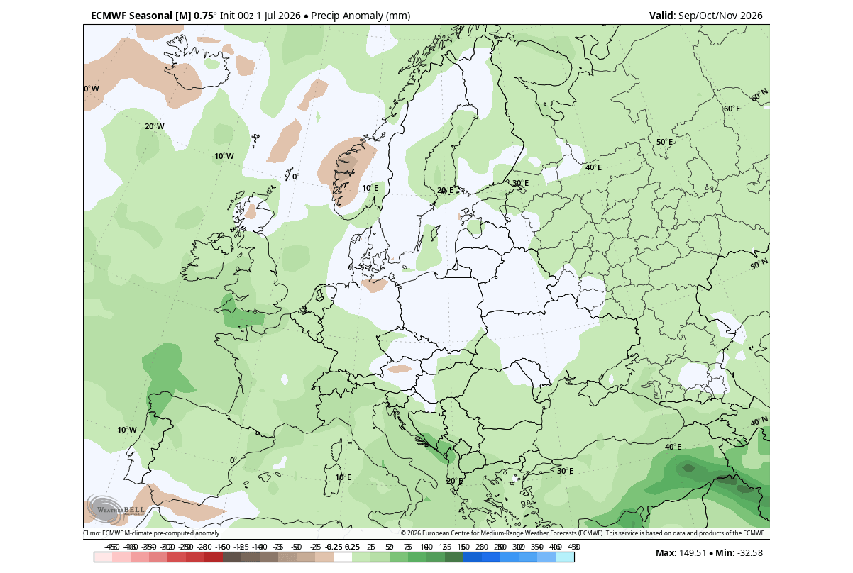
Europe’s climate, while not as directly affected by the Pacific ENSO as North America, remains subject to the "teleconnections" of the jet stream. The current models point to a dominant westerly flow. This will likely translate to a winter characterized by mild, wet, and windy conditions across Western and Central Europe. While this may reduce energy demand for heating, it significantly increases the risk of storm-related flooding and coastal erosion in regions bordering the Atlantic and North Sea.
The Wildcard: The Polar Vortex
Perhaps the most critical factor for late winter is the behavior of the Polar Vortex. The stratosphere, which sits above our weather systems, is currently being watched for signs of "Sudden Stratospheric Warming" (SSW).
Historical data confirms that Super El Niño events have a higher statistical correlation with Polar Vortex disruptions in December and January. If the vortex collapses, the "spillover" of frigid polar air into the mid-latitudes could fundamentally override the milder El Niño patterns. A weakened vortex essentially removes the "lid" from the Arctic, allowing record-breaking cold to sweep into regions that were otherwise expecting a mild season.
Conclusion
The 2026/2027 season is shaping up to be a defining moment in modern meteorological history. The emergence of a Super El Niño creates a global atmospheric environment where historical norms are being challenged by rapid, high-amplitude shifts.
For residents, businesses, and government agencies, the lesson is one of preparedness. The atmospheric "engine" has been primed for an active, intense, and highly variable winter. As the transition into the depths of the cold season continues, the interaction between the Pacific-driven storm tracks and the potential instability of the Polar Vortex will determine the final character of this historic season. Staying informed through real-time updates and seasonal monitoring will be essential as the world navigates the impacts of this formidable climate driver.