As the Northern Hemisphere transitions into the final quarter of 2026, atmospheric scientists are closely monitoring a climate driver of historic proportions: an rapidly intensifying "Super" El Niño. This event is not merely a transient ocean-surface warming; it is a profound restructuring of global atmospheric circulation that is already manifesting in unusually early, winter-like weather patterns. With ocean temperature anomalies in the tropical Pacific surging to levels that exceed previous record-setting events, the meteorological community is bracing for a season of extreme variability across North America and Europe.

Main Facts: The Anatomy of a Super El Niño
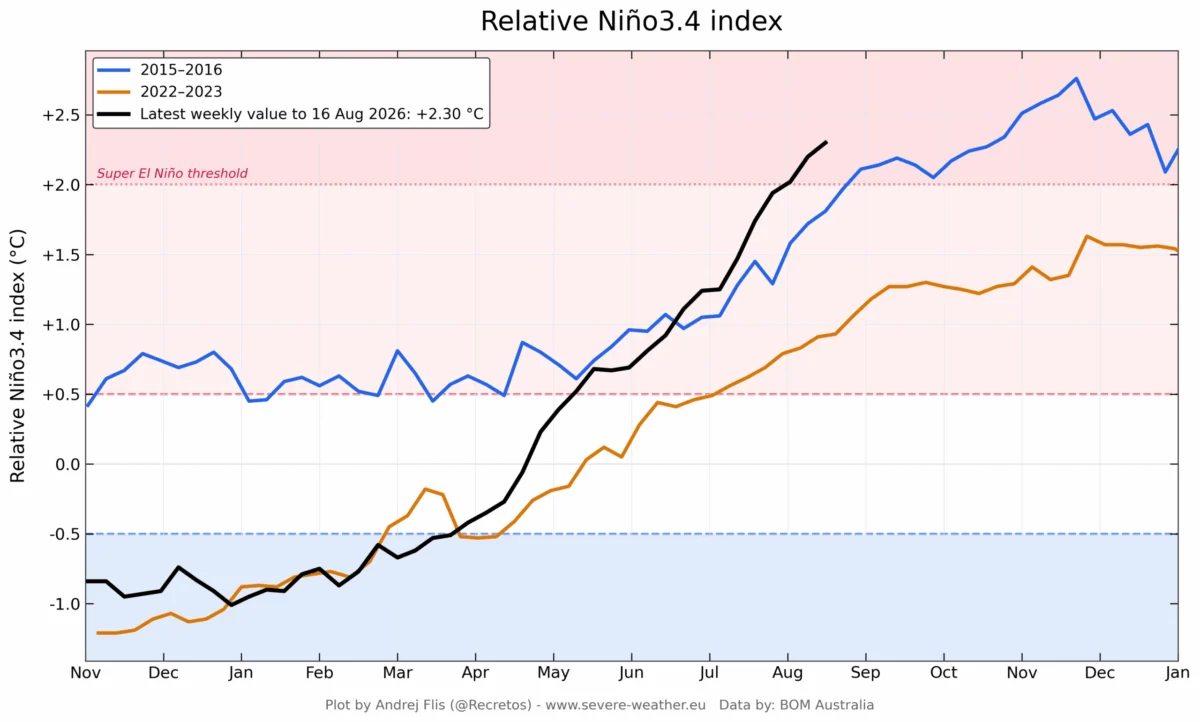
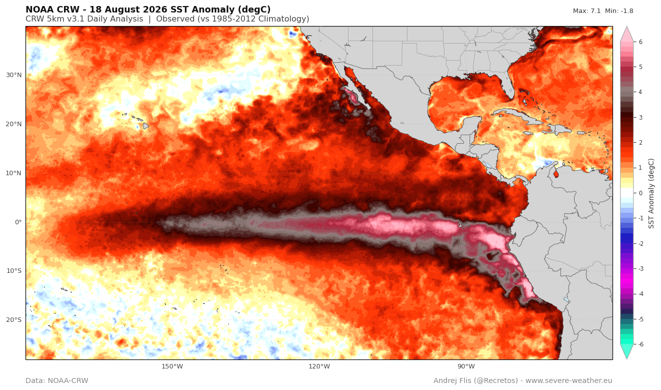
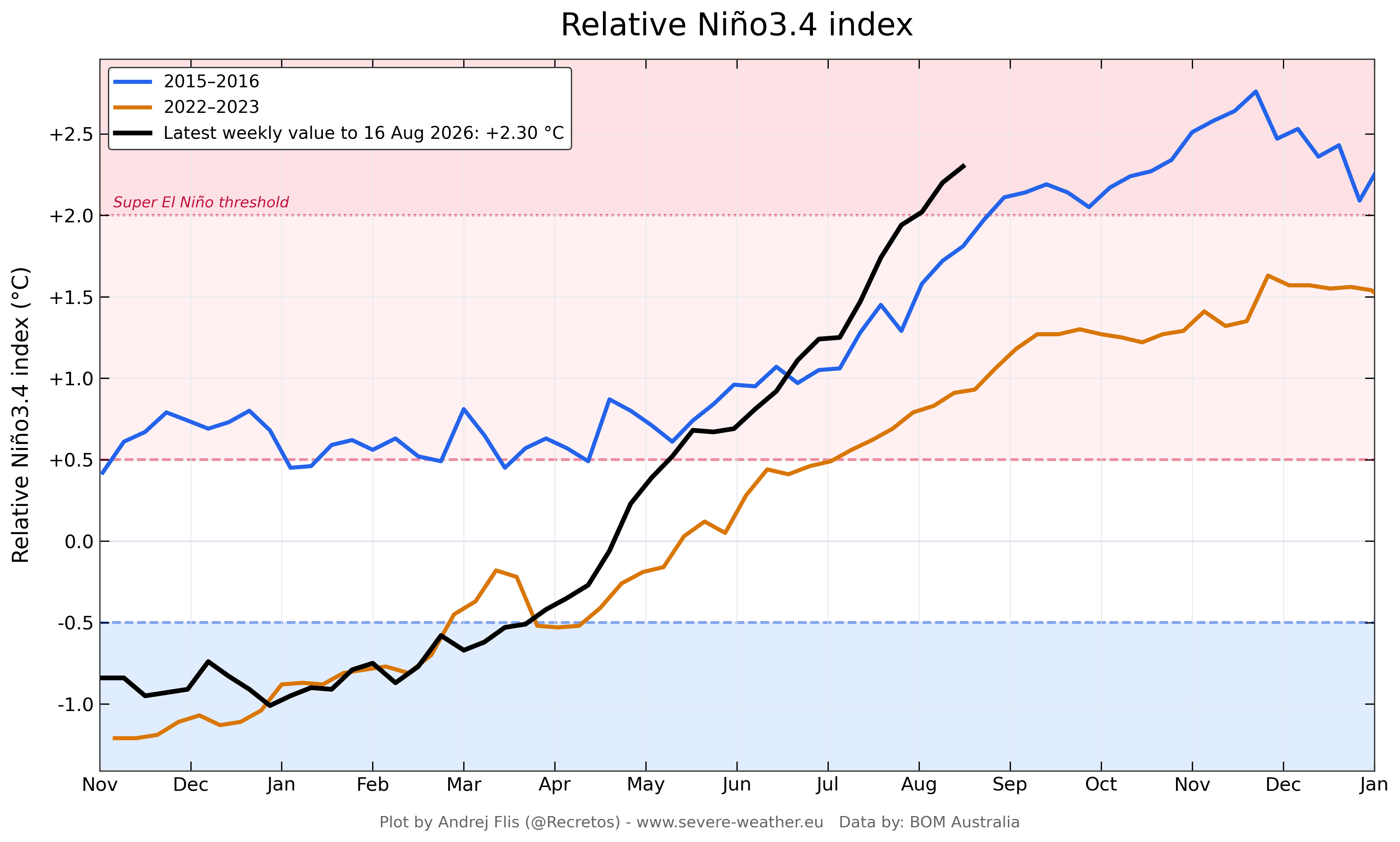
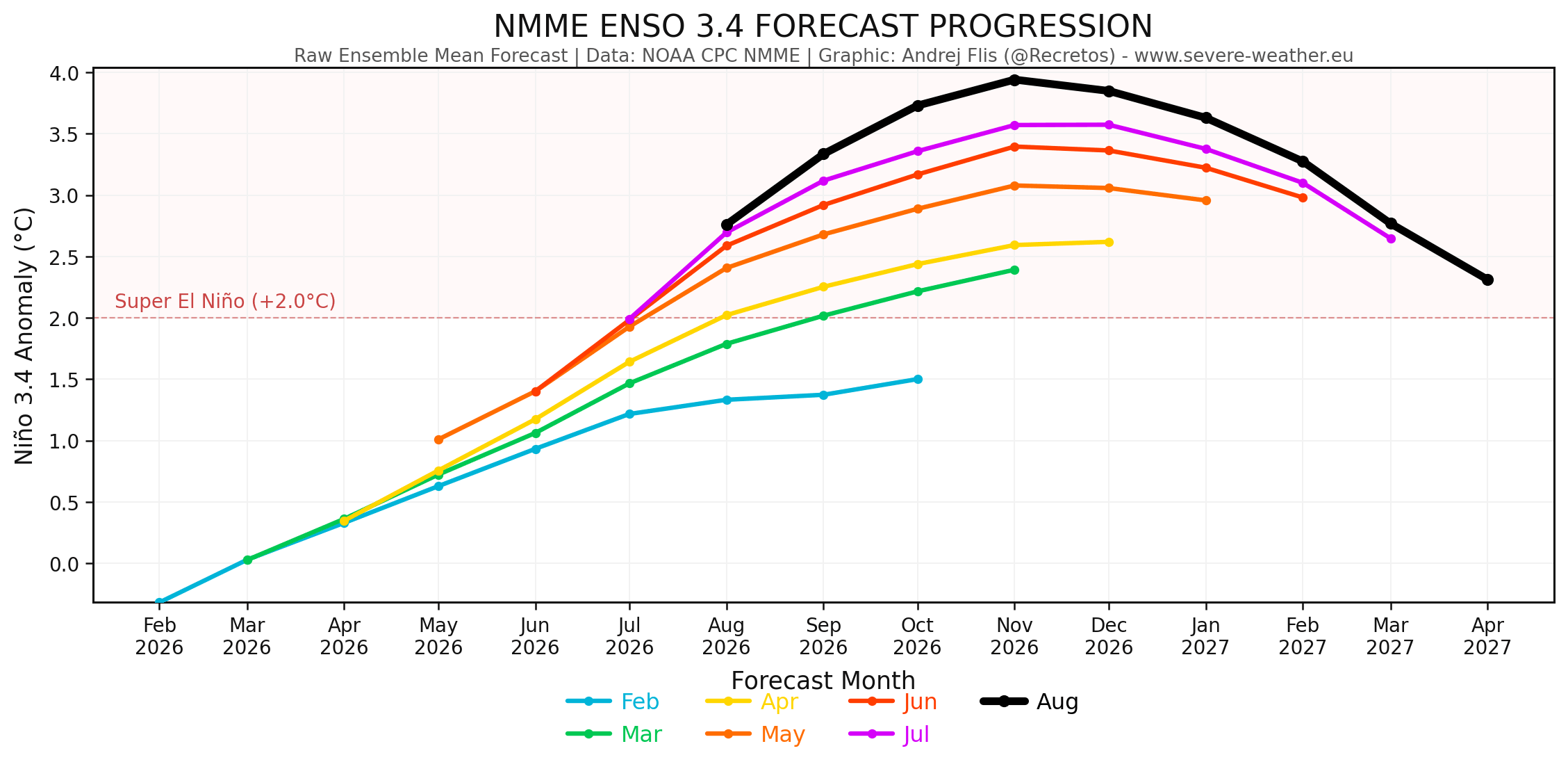
The current El Niño event is characterized by a significant positive anomaly in sea surface temperatures (SSTs) across the central and eastern Pacific. By definition, a "Super" El Niño requires sustained anomalies exceeding +2.0°C. Recent data indicates that the 2026 event has already breached this threshold with months of development still ahead, making it one of the most robust warm-phase events in decades.
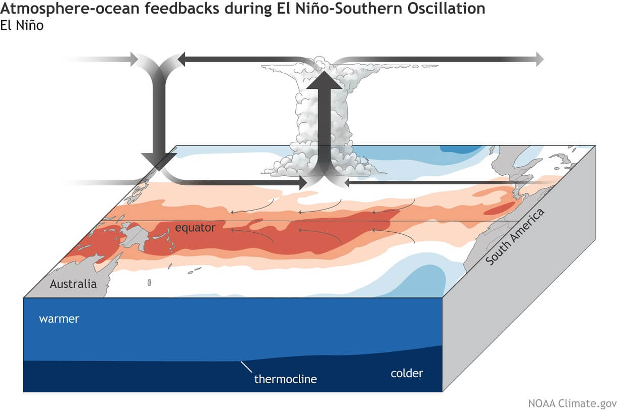
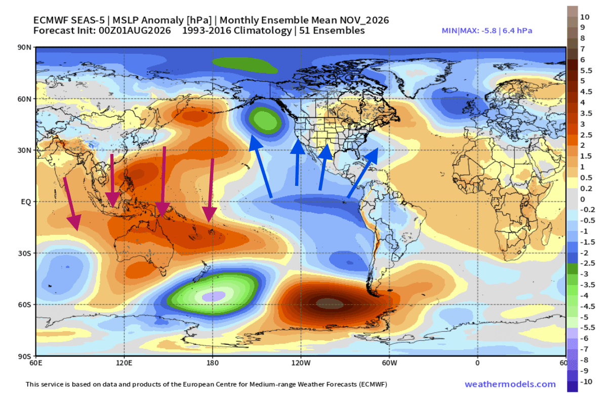
The mechanism driving this phenomenon is the "ocean-atmosphere feedback loop." As the Pacific warms, the Walker Circulation—a system of tropical air movement—is altered. Rising air in the central and eastern Pacific increases precipitation and suppresses surface pressure, while descending air over the western Pacific stabilizes conditions. This atmospheric bridge acts as a catalyst, projecting the ocean’s thermal energy into the mid-latitudes, effectively re-routing the jet streams that dictate seasonal weather for millions of people.
Chronology of Development
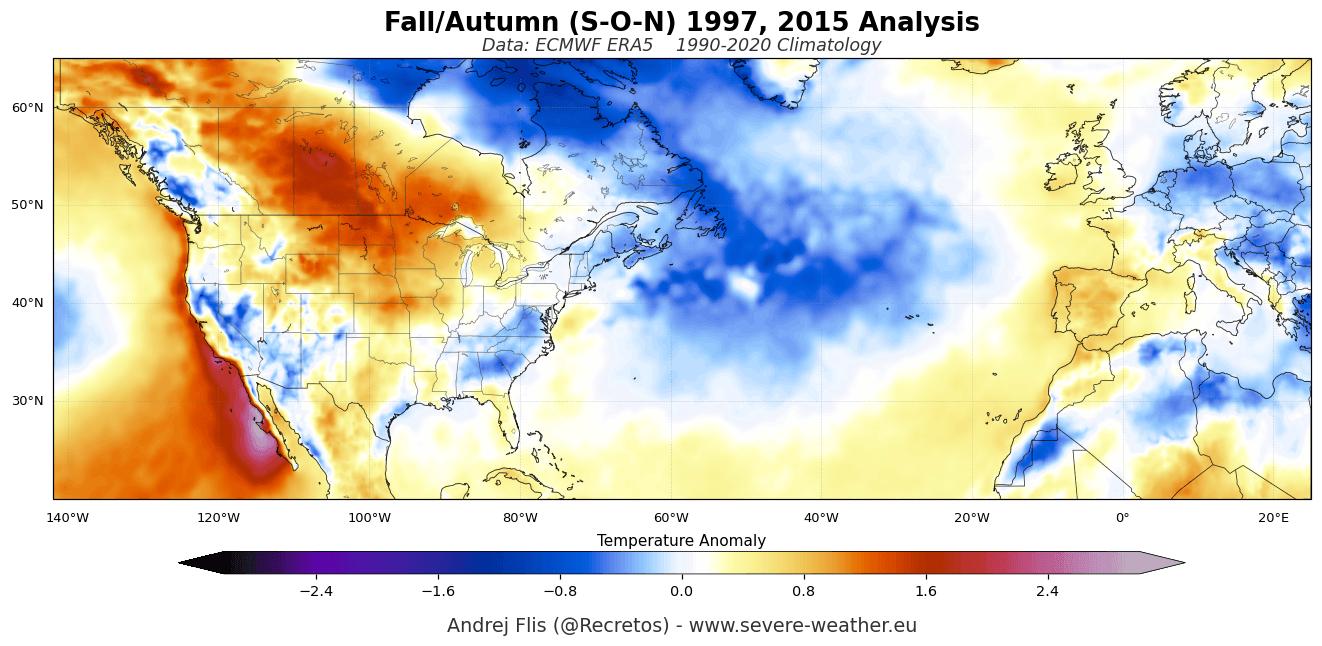
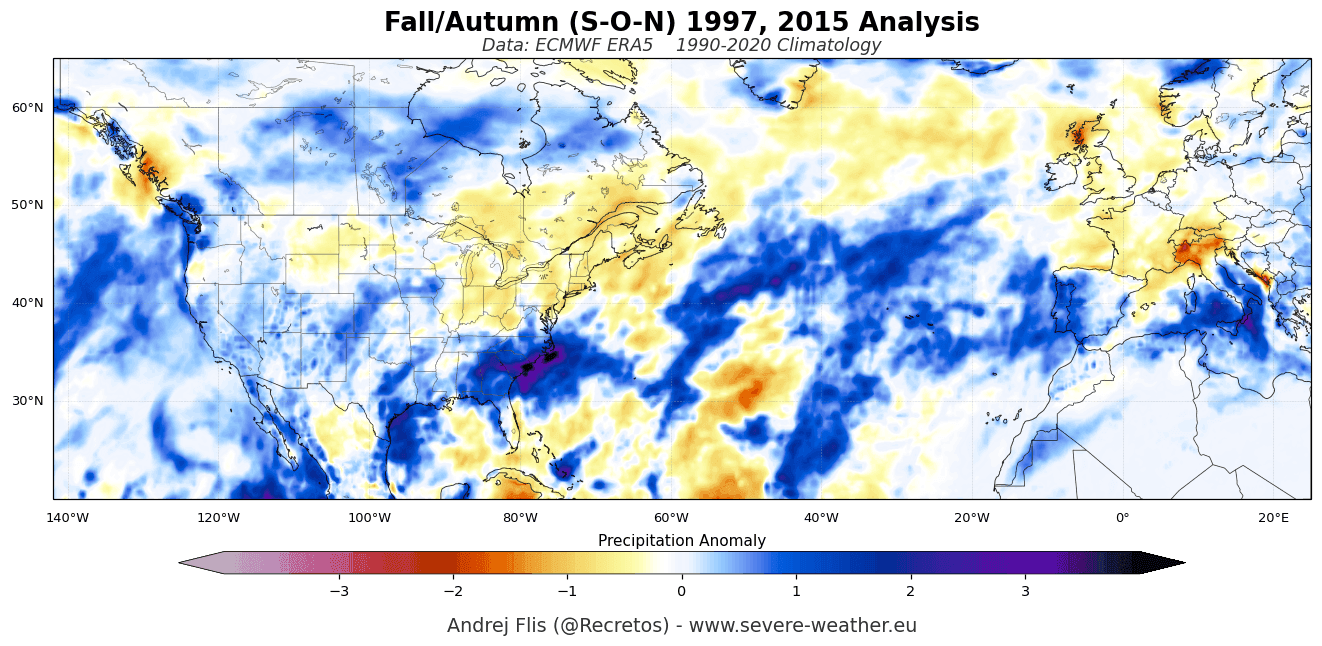
The trajectory of this Super El Niño has been nothing short of aggressive. Comparisons to the historic 2015 event show that current August-to-October warming rates are outpacing previous records.
- Initial Phases: Throughout early 2026, multi-model ensembles, including the ECMWF and NMME, began flagging a sustained warming trend.
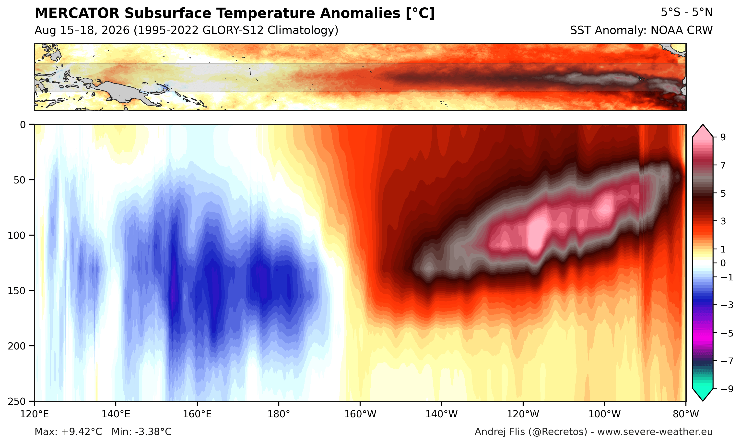
- The Kelvin Wave Surge: A powerful, eastward-moving subsurface Kelvin Wave—a deep-ocean warm pulse—has been identified in the top 250 meters of the Pacific. With anomalies peaking over 9°C (16°F) above normal, this subsurface reservoir acts as a fuel tank, ensuring the event remains "healthy" and potent well into the winter months.
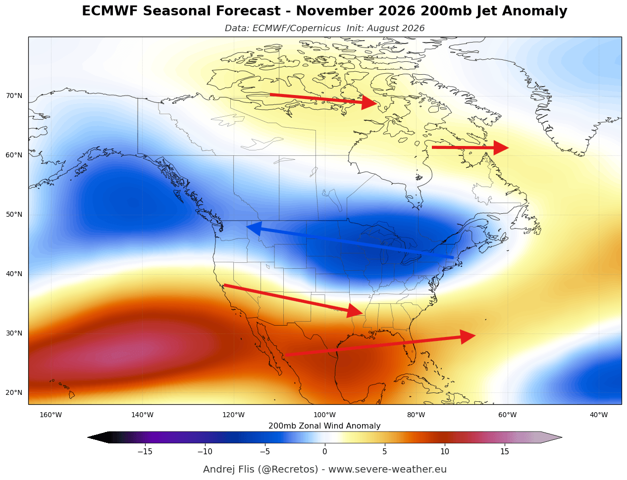
- Early Fall Transition: By late summer, the atmospheric response was already visible. Typically, the "winter-like" jet stream configuration—characterized by a split-flow pattern—does not emerge until late in the year. In 2026, this shift is already occurring, signaling a premature decoupling of the polar and subtropical jet streams.
Supporting Data and Model Consensus
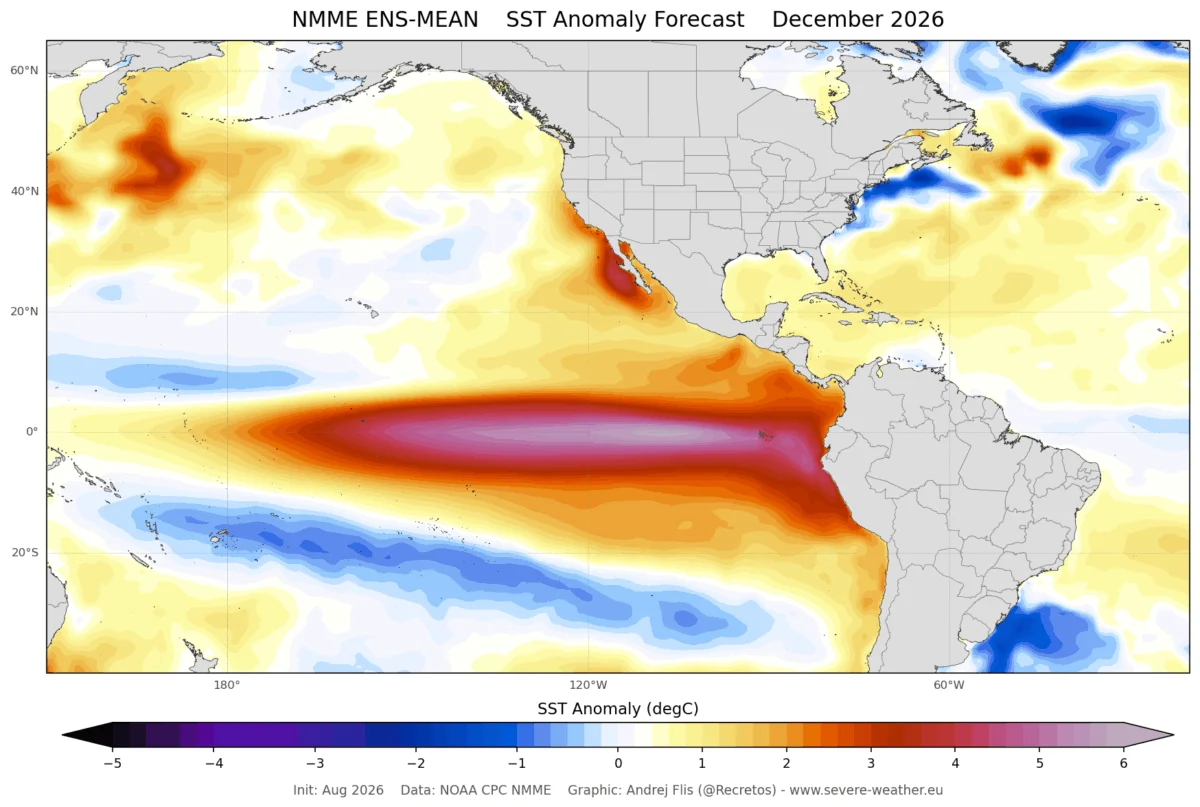
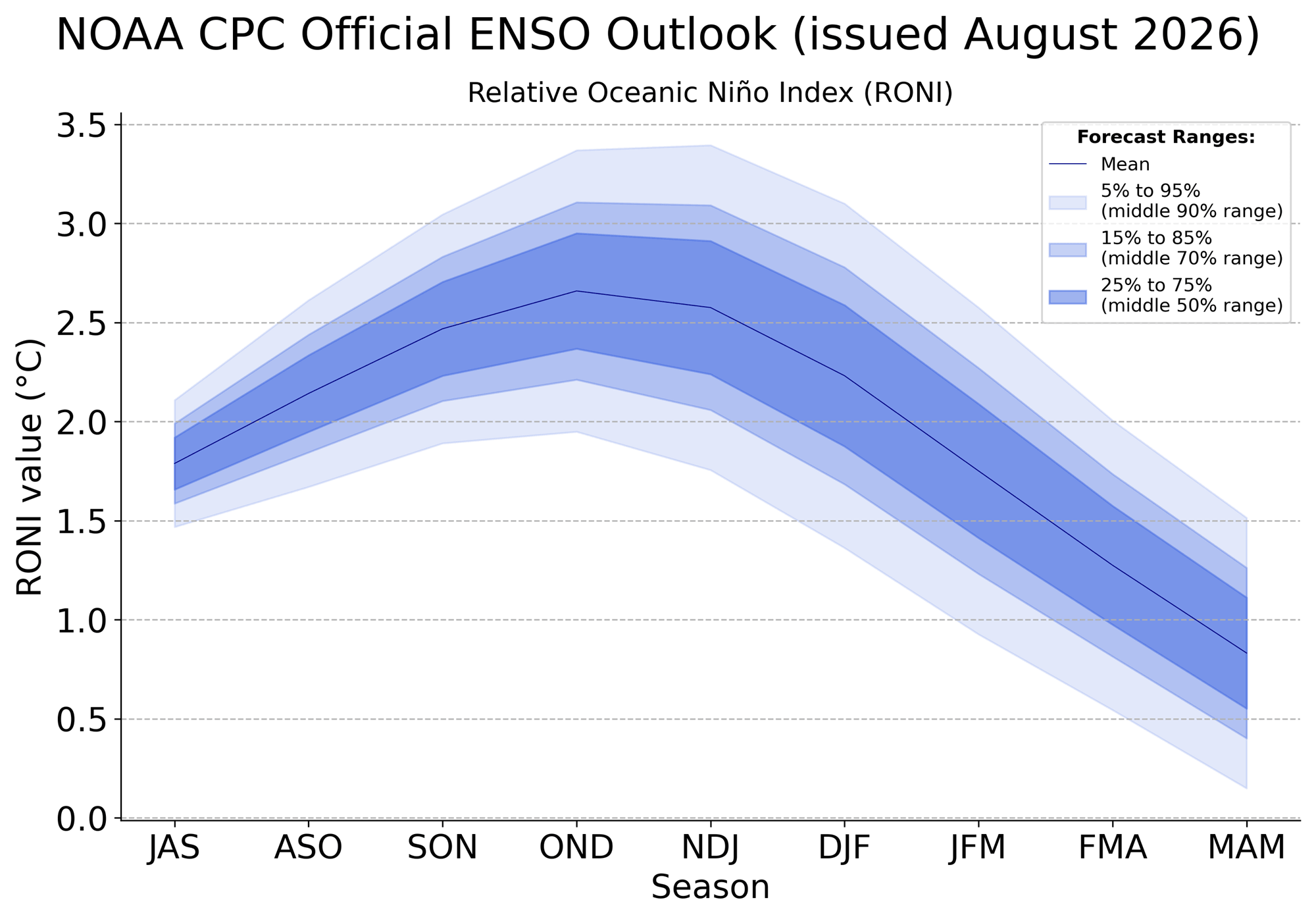
The confidence in this forecast is bolstered by the remarkable alignment of global weather models. The National Oceanic and Atmospheric Administration (NOAA) Climate Prediction Center (CPC) outlook reflects an average forecast significantly above the +2.0°C threshold. Some of the more aggressive model runs, including the NMME, suggest a peak anomaly approaching +4.0°C, a level that would cement this event in the record books.
The ECMWF Analysis
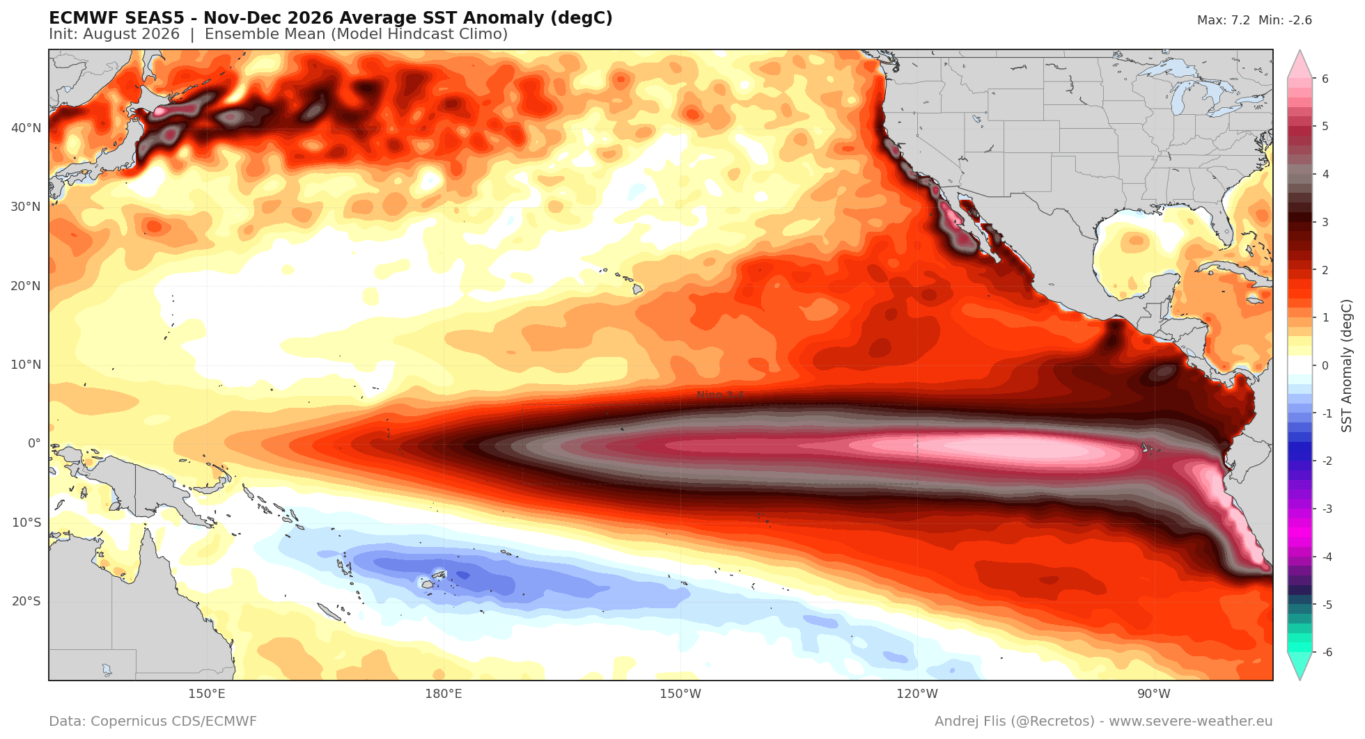
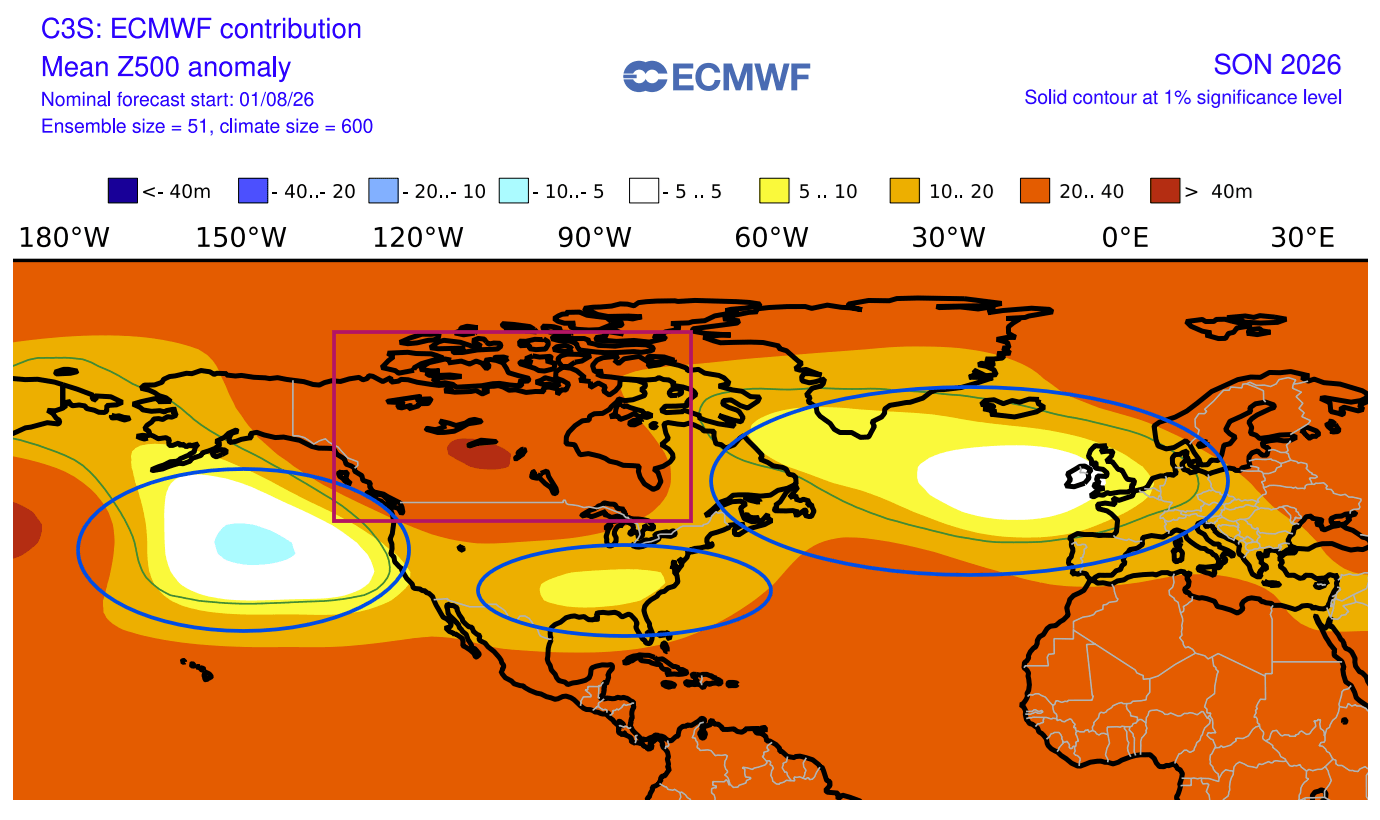
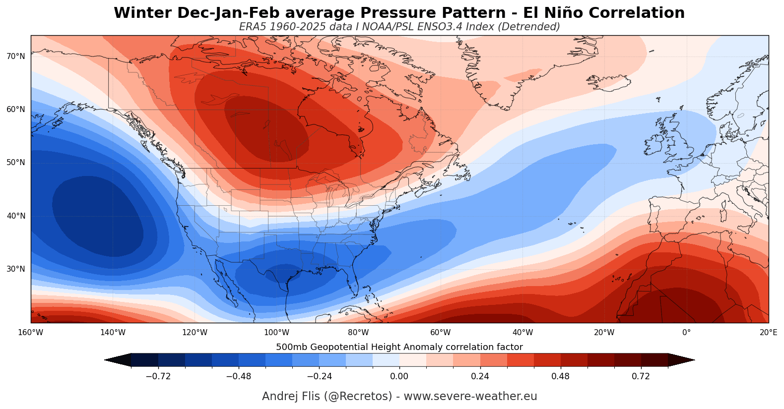
The European Centre for Medium-Range Weather Forecasts (ECMWF) provides a sobering look at the Eastern Pacific (EP) nature of this event. Because the primary warming is concentrated in the eastern basin, the "teleconnection" to North America is more pronounced. EP-based El Niños typically generate a more vigorous North Pacific pressure response, facilitating increased moisture transport into the southern United States.
Subsurface Thermal Dynamics
The subsurface temperature analysis is perhaps the most critical indicator of longevity. The current downwelling Kelvin Wave is pushing toward the South American coast, rising to the surface and reinforcing the surface-level anomalies. This process ensures that the "heart" of the El Niño remains vibrant, providing a continuous thermal supply that will influence the atmosphere long after the initial fall cooling begins.
Implications for North America and Europe
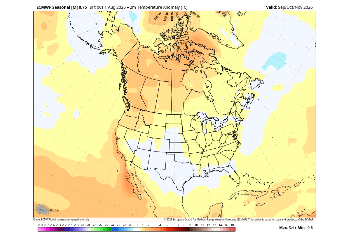
The projected winter pattern for 2026/2027 is a study in contrasts. The high-pressure anomaly centered over Canada is expected to act as a "meteorological boulder," diverting the polar jet stream and allowing for warmer-than-average conditions across much of Western and Central Canada.
The United States: A Split-Flow Winter
For the United States, the forecast points to a classic "split-flow" regime. The northern tier will likely experience the influence of the Canadian high-pressure zone, while the southern half of the country will be subject to a supercharged subtropical jet stream. This configuration typically results in:
- Increased Precipitation: The southern and southeastern U.S. can expect higher-than-normal rainfall, as the Pacific jet stream funnels moisture-rich systems across the region.
- Variable Snowfall: While the general pattern is "mild," the intensity of the southern storm track means that areas in the Southern Plains and higher elevations of the U.S. West may see intermittent, heavy snowfall events driven by high-energy moisture influxes.
Europe: The Atlantic Factor
Europe’s fate is tied to the North Atlantic. The low-pressure systems generated by the shifted Pacific jet stream will likely cascade across the Atlantic, driving a persistent westerly flow. This brings a high probability of warmer, moister air into the continent. While this limits extreme cold, it significantly increases the potential for storminess and heavy rainfall across western and central European nations.
The Polar Vortex: A High-Risk Variable
No discussion of winter 2026/2027 is complete without addressing the Polar Vortex. The Polar Vortex, a massive cyclonic structure in the stratosphere, acts as a containment vessel for polar air.
Evidence suggests that Super El Niño events increase the frequency of "Sudden Stratospheric Warming" (SSW) events. When the vortex is hit by large-scale atmospheric waves—often amplified by the very El Niño conditions we are seeing—it can weaken or collapse.
If the Polar Vortex undergoes a major disruption in January 2027, the result would be a total breakdown of the containment of arctic air. Unlike the general "mild" winter forecast, a collapsed vortex would allow for severe, erratic cold spills into the mid-latitudes, regardless of the overall El Niño trend. Recent ECMWF and UKMO model runs show a notable deceleration of stratospheric winds in the late December-January period, suggesting that a disruption event is not just possible, but potentially likely.
Conclusion: A Winter of Extremes
The 2026/2027 season is poised to be defined by the "Super" label attached to the current El Niño. The primary takeaway for residents of the Northern Hemisphere is that the predictable, linear trends of past winters may not apply.
The combination of a powerful, Eastern Pacific-based El Niño and the potential for a destabilized Polar Vortex suggests a winter characterized by "whiplash"—periods of mild, moist conditions interrupted by intense, high-energy storm systems or sudden arctic outbreaks. As the atmospheric forcing continues to evolve, maintaining awareness of the latest, high-resolution model data will be essential for managing the impacts of this significant climate anomaly.
This is not a typical winter; it is a complex, large-scale climate event that will command the attention of meteorologists and emergency management officials well into the spring of 2027.