The second half of September 2026 is witnessing a dramatic meteorological shift across Eastern Europe, as a robust, high-pressure blocking ridge in the North Atlantic forces a massive displacement of polar air southward. After a period of unseasonably warm weather, the region is bracing for a rapid thermal collapse that will usher in the first true indicators of the upcoming winter season, including sub-zero temperatures and high-altitude snowfall.
The Synoptic Setup: An Atmospheric Corridor of Cold
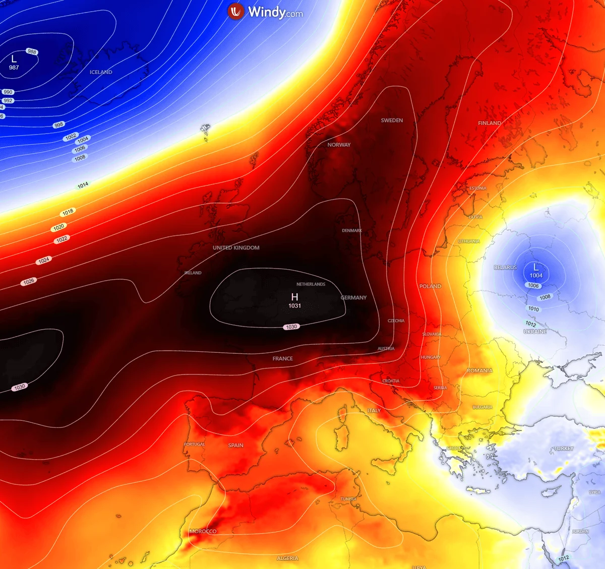
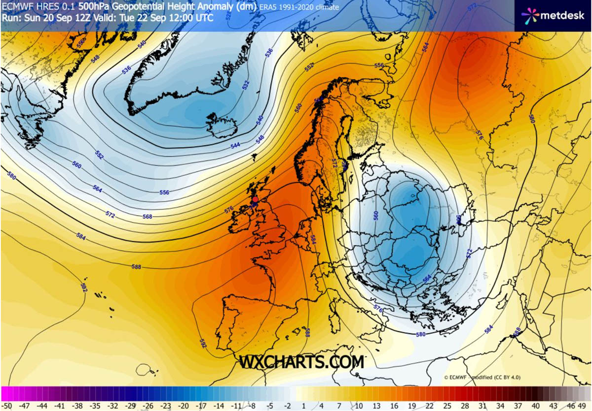
The primary catalyst for this abrupt transition is an upper-level atmospheric blocking pattern. A powerful ridge of high pressure has established itself over Western and Northern Europe, effectively acting as a dam that forces the jet stream to buckle. This "meridional flow"—a north-to-south transport of air—is creating a direct atmospheric corridor that allows dense, frigid air of Arctic origin to spill deep into the heart of Eastern Europe, the Balkan Peninsula, and eventually the Black Sea region.

Meteorologically, this is a classic "blocking" scenario. While Western Europe remains sheltered under the influence of the ridge, enjoying higher-than-average temperatures, the eastern half of the continent is being carved out by a deep-trough system. This dichotomy is creating a stark thermal divide across the continent.
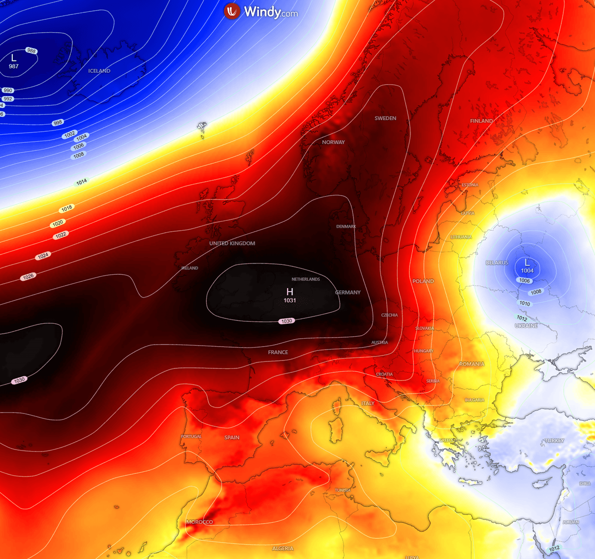
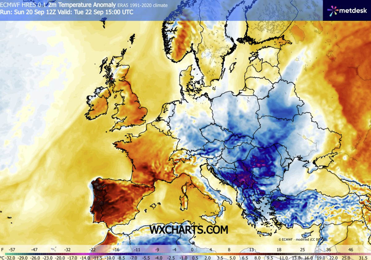
By Tuesday, the surface manifestation of this high-pressure system will expand significantly, funneling cold, dry air across Scandinavia, Central Europe, and down into the lower latitudes. The resulting temperature anomalies are profound, with models indicating deviations of 10 to 15°C below the long-term seasonal averages for this time of year.
Chronology of the Cold Intrusion
The transition is not gradual; it is a sharp, front-driven event.
- Tuesday, September 22 (The Onset): The cold front makes landfall across the northern reaches of Eastern Europe. Residents in the Baltic states and Poland will experience the first tangible drop in temperatures, as the Arctic air mass moves rapidly south. By midday, the front will begin its push into the central Balkans, impacting Serbia, Romania, and Bulgaria.
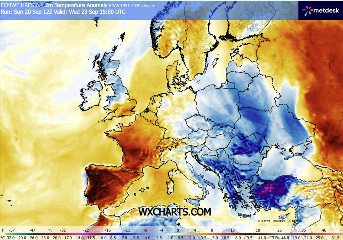
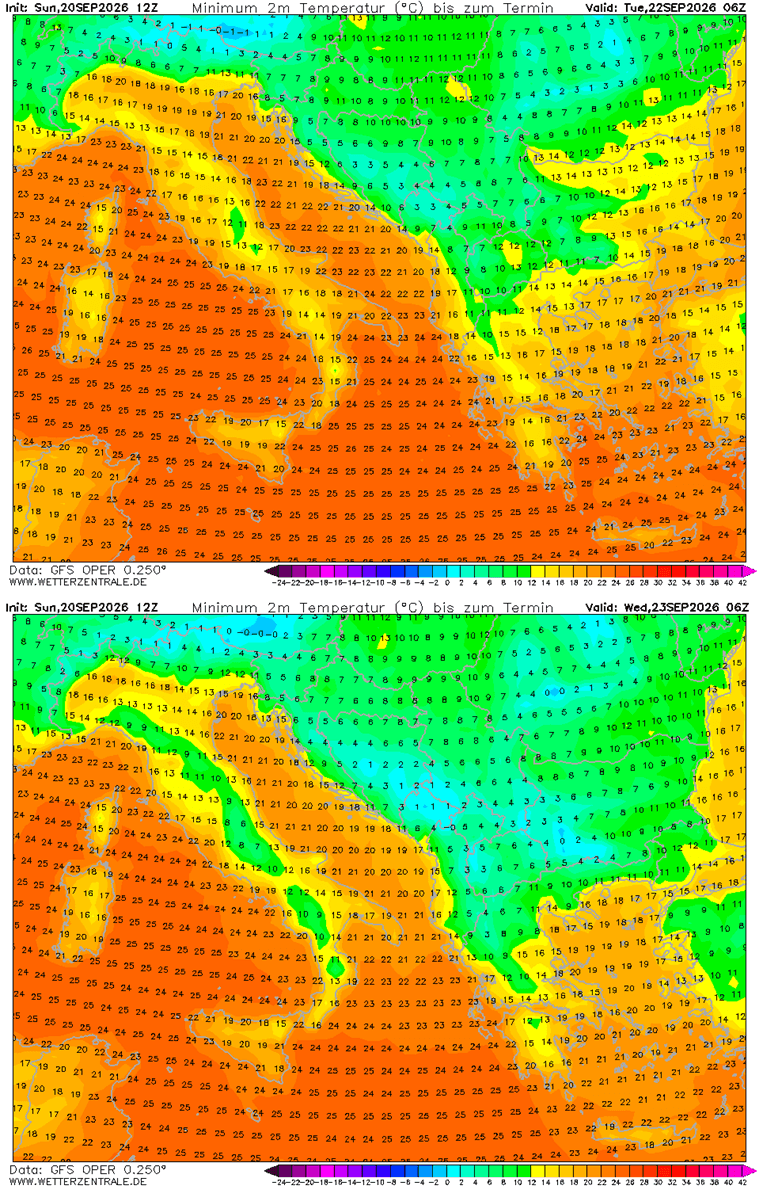
- Wednesday, September 23 (The Peak): The core of the polar air mass will reach its southern limit. The Balkan Peninsula, Greece, and northwestern Turkey are expected to see the most significant thermal anomalies during this 24-hour window. Morning frost is anticipated in low-lying valleys and agricultural basins, where calm winds and clear skies will allow heat to escape rapidly from the surface.
- Thursday, September 24 (The Plateau): While the most aggressive push of the Arctic air begins to lose its intensity, the secondary effects—namely, lingering low temperatures and early-season frost—will persist. The cold will have fully permeated the Black Sea region, affecting coastal temperatures in Turkey.
- Late Week (The Recovery): Towards the end of the week, the blocking ridge over the Atlantic will begin to shift eastward. This will allow the high-pressure system to migrate into Central and Eastern Europe, effectively cutting off the polar pipeline and allowing temperatures to slowly moderate toward more seasonal norms.
Supporting Data and Meteorological Analysis
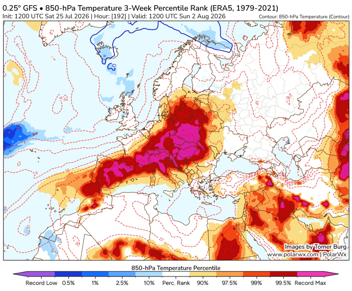
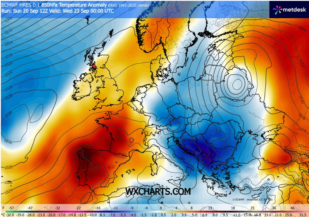
The current weather models, including data from high-resolution global forecast systems, reveal a significant departure from the late-summer norms. The 850 hPa temperature anomaly maps—which track temperatures at approximately 1,500 meters altitude—show a massive "blue pool" of cold air tracking across the eastern half of the continent.
In Bulgaria, Greece, and Western Turkey, the deviation is particularly striking. Mid-week, these regions are projected to be 12–16°C colder than the historical average. For many of these areas, which are currently experiencing a lingering tourist season, this shift is not just a statistical anomaly but a tangible disruption to outdoor activities.
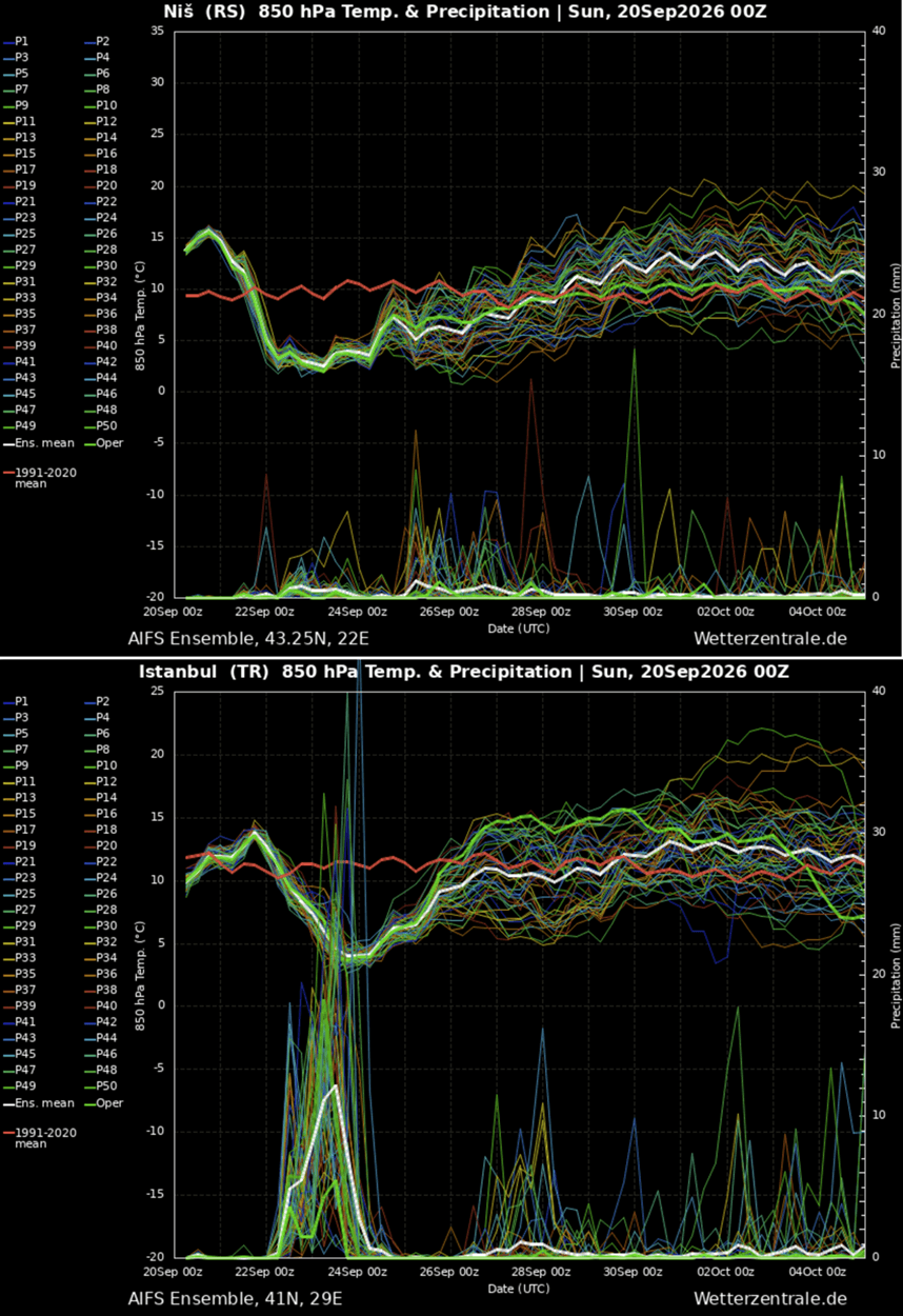
The meteogram charts for cities like Niš, Serbia, and Istanbul, Turkey, provide a clear visual representation of the "thermal cliff." The curves show a vertical drop in temperature, confirming the speed at which the polar air mass arrives. Once the initial front passes, the lack of cloud cover (due to the high-pressure nature of the system) will cause nighttime temperatures to plummet into the low single digits, setting the stage for the first ground frosts of the 2026 season.
Implications for Agriculture, Infrastructure, and Tourism
The sudden onset of sub-zero temperatures poses significant risks, particularly to the agricultural sector.
Agricultural Vulnerability
Farmers in the low-lying basins of the Balkans and the Carpathian regions are on high alert. The first frost of the season can be devastating for late-harvest crops that have not yet been brought in. The rapid transition from a warm, late-summer environment to freezing conditions leaves little time for hardening, potentially damaging sensitive vegetation and late-season fruits. Agricultural experts in the affected regions are advising immediate protective measures, such as covering sensitive crops, to mitigate the impact of the unexpected frost.
The Tourism Dilemma
The tourism industry, currently in the final weeks of its peak season in the Aegean and Mediterranean, faces an abrupt end to the "summer" experience. Tourists in Greece and Turkey who were anticipating mild autumn sun will find themselves contending with temperatures more typical of late October or November. While the cold snap is temporary, it represents a definitive shift in the travel dynamic, necessitating a rapid pivot in expectations for outdoor operators.
Infrastructure and Energy
Energy providers are preparing for an uptick in heating demand. While not yet deep-winter, the sudden transition will likely cause a surge in residential heating usage across Eastern Europe. Furthermore, for the higher elevations of the Carpathians and the Northern Balkans, the drop in freezing levels—the altitude at which air temperature reaches 0°C—will trigger the first notable snowfalls of the season. This may lead to localized traffic disruptions on high-mountain passes as travelers are caught off guard by early-season wintry conditions.
Official Responses and Long-term Outlook
National meteorological services across the affected regions have issued preliminary alerts, focusing primarily on the risks of frost and the rapid drop in nighttime temperatures. While no emergency-level alerts have been declared for wind or precipitation, the focus remains on the "thermal shock" to the population and the environment.
Looking at the broader meteorological picture, the pattern is part of a larger, more complex "dipole" effect currently dominating the European continent. While Eastern Europe grapples with the polar blast, the Western European ridge continues to sustain abnormally warm conditions.
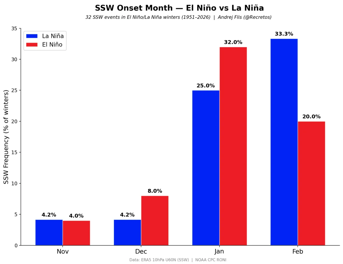
Long-term trends suggest that this configuration will remain in place until the final days of September. However, climatologists note that the appearance of such strong meridional flow patterns early in the autumn can be an indicator of a highly dynamic winter to come. Recent reports suggest that a new polar vortex is emerging over the North Pole, and researchers are closely monitoring whether this will lead to significant stratospheric warming events later in the season—a phenomenon that could disrupt winter weather patterns across the Northern Hemisphere.
As the region moves toward the end of September, residents are encouraged to monitor local weather updates. While this specific Arctic intrusion will be brief, it serves as a stark reminder that the transition into the colder half of the year is officially underway, and the season of extended summer warmth is effectively over.
Data sources: Meteorological imagery provided by WetterZentrale and WXcharts. This report is based on current European numerical weather prediction models and is subject to updates as the weather system evolves.