Main Facts: A Cascade of Destruction
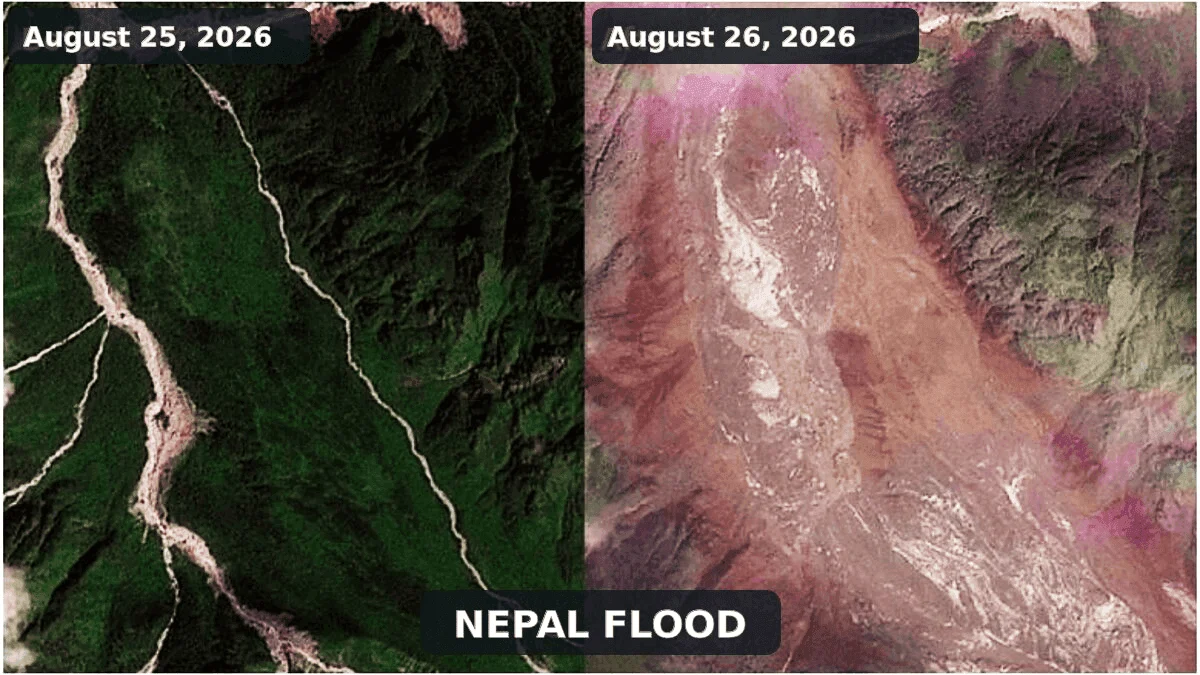
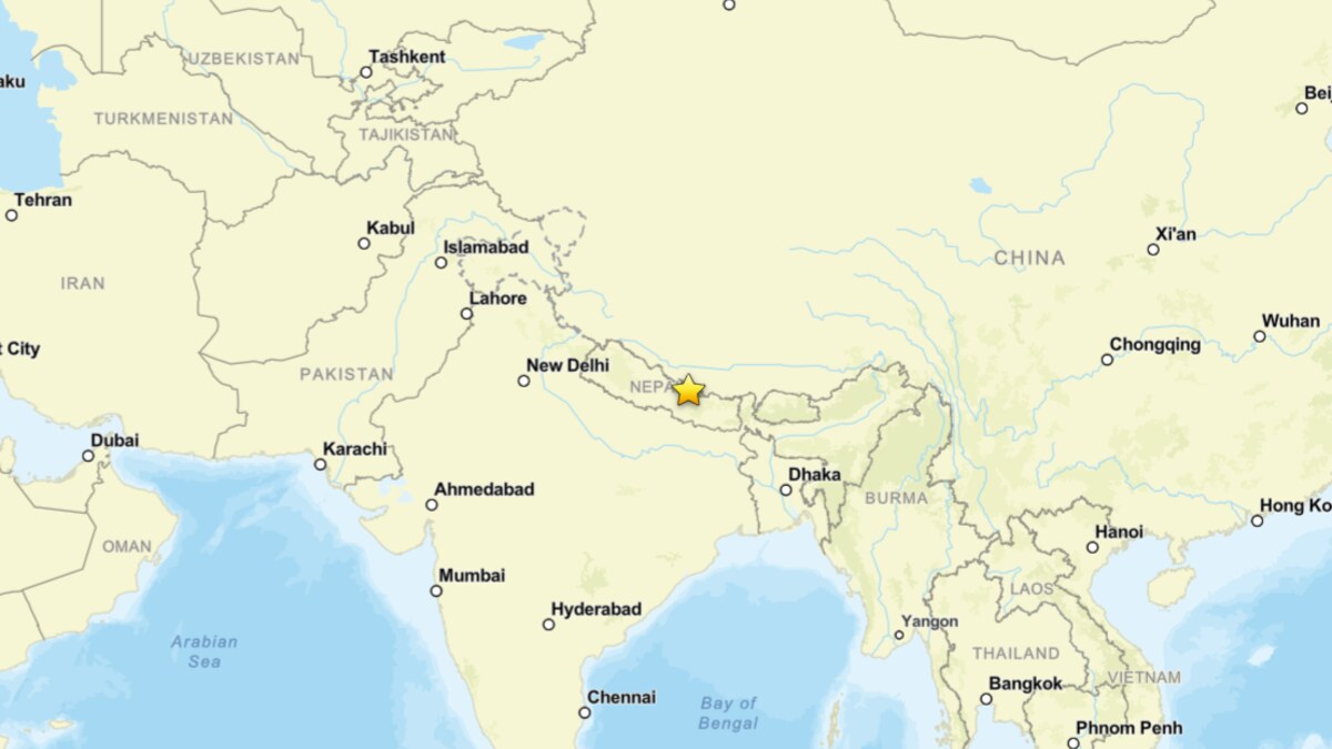
On August 26, 2026, a catastrophic geophysical event tore through the high-altitude valleys of the Nepal-Tibet border, fundamentally altering the landscape of the Bhote Koshi and Trishuli river systems. What began as a localized slope failure in the upper Lhende Khola transformed within minutes into a lethal torrent of ice, pulverized rock, and mud. The resulting debris flow surged downstream, obliterating infrastructure, homes, and hydropower installations, leaving a trail of devastation that has claimed at least 160 lives, with hundreds more officially listed as missing.
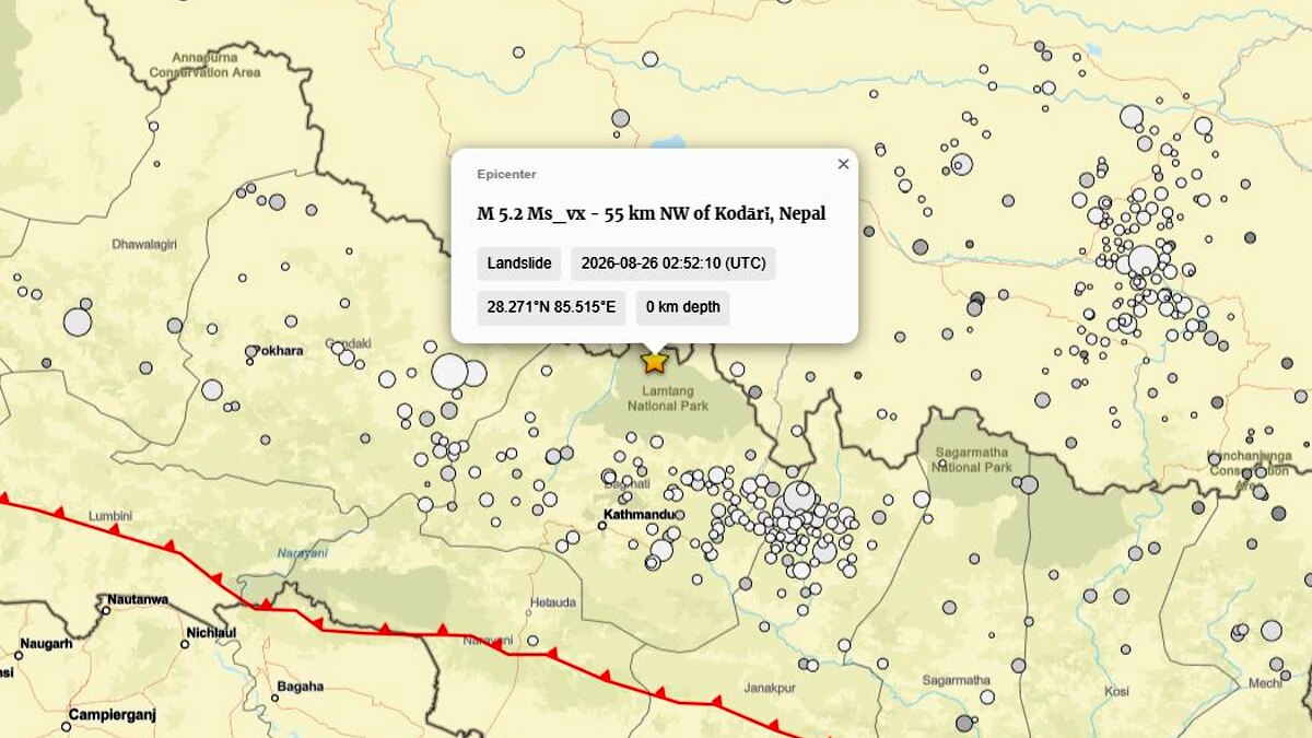
While initial reports—fueled by confusion and the sheer scale of the destruction—suggested a Glacial Lake Outburst Flood (GLOF) or a tectonic earthquake, subsequent scientific analysis has clarified the nature of the disaster. The U.S. Geological Survey (USGS) has officially reclassified a seismic signal originally logged as a magnitude 4.4 earthquake into a magnitude 5.2 landslide. This pivotal reclassification confirms that the seismic shaking was not the cause of the disaster, but rather the acoustic and kinetic signature of the collapse itself. The event stands as a stark reminder of the volatile nature of high-mountain cryospheric processes in an era of rapid environmental change.
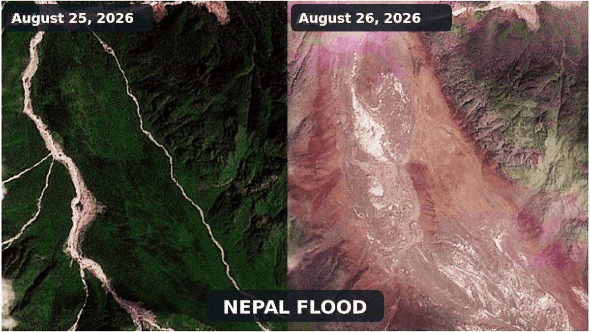
Chronology of the Event
The disaster unfolded with terrifying speed, leaving little time for warning or evacuation.
Early Morning, August 26: The upper Lhende Khola, a steep, glacierized tributary near the international border, reached a critical instability threshold. A massive volume of glacier ice and bedrock, weakened by long-term environmental factors, detached from the mountainside.
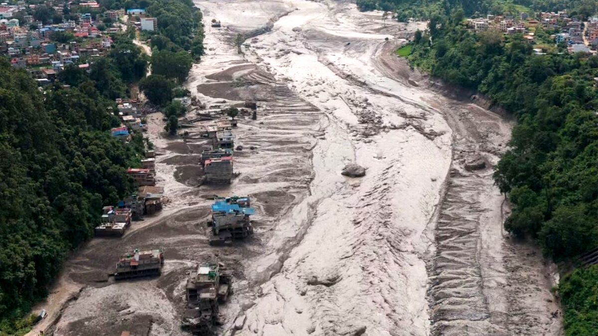
The Collapse: The cascading mass—a volatile mixture of fragmented ice, boulders, and sediment—raced down the narrow valley. Upon reaching the riverbed of the Lhende Khola, the avalanche deposited millions of cubic meters of material, effectively creating an unstable, permeable natural dam.
The Breach: Water rapidly accumulated behind this debris pile, exerting immense hydrostatic pressure. Within approximately 30 minutes, the dam failed. The sudden release of impounded water, combined with the scouring of the riverbed, transformed the surge into a high-energy debris-rich flash flood.
Downstream Impact: The flood pulse propagated rapidly into the Bhote Koshi and Trishuli river systems. Witnesses and hydrologic monitors reported water levels rising by as much as nine meters in under half an hour. By the time the surge reached populated settlements, it had become an unstoppable force of liquid earth, sweeping away critical road networks, bridges, and hydroelectric projects that served as the lifeline for the remote region.
Supporting Data and Geophysical Evidence
The scientific reconstruction of this event relies on a synthesis of seismic data, high-resolution satellite imagery, and comparative modeling.
The Seismic Reclassification
The USGS event page (us7000tbwb) serves as the primary evidence for the mechanism of the failure. The initial detection of a magnitude 4.4 earthquake was a classic case of automated seismic systems misidentifying the long-period, low-frequency signal of a massive, sliding mass as a tectonic slip. The subsequent reclassification to a magnitude 5.2 landslide confirms that the gravitational potential energy of the collapsing mountain was the sole driver of the ground motion. This is a crucial distinction: in tectonic events, the earth ruptures; in this instance, the earth simply fell.
Avalanche Dynamics vs. GLOFs
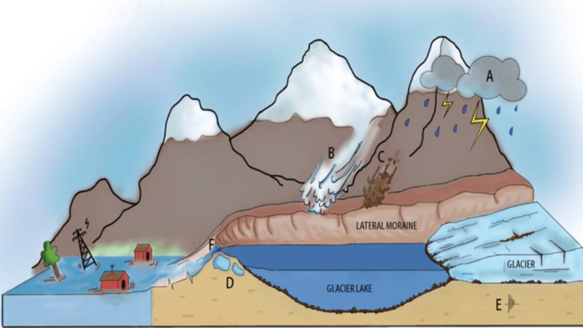
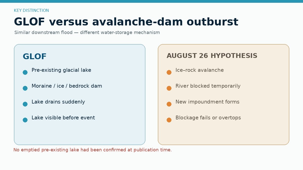
There is a clear scientific distinction between this event and a GLOF. A GLOF requires the pre-existence of a stable glacial lake that breaches its moraine or ice dam. In this case, satellite observations from the International Center for Integrated Mountain Development (ICIMOD) indicate that the flood originated from an avalanche-induced obstruction of the Lhende Khola. While a small, temporary lake formed behind the debris, it was a secondary byproduct, not the primary source. This distinction is vital for future mitigation, as it shifts the focus from monitoring static lake volumes to assessing the stability of steep, glacierized slopes.
Comparative Case Studies
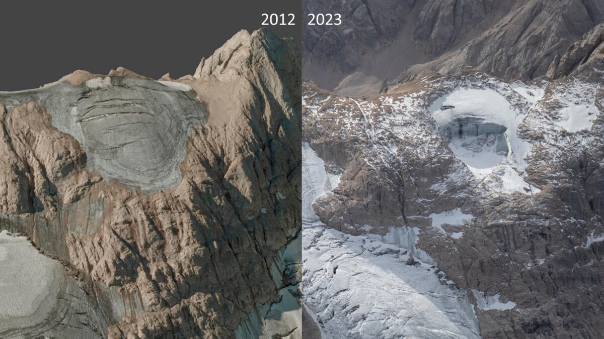
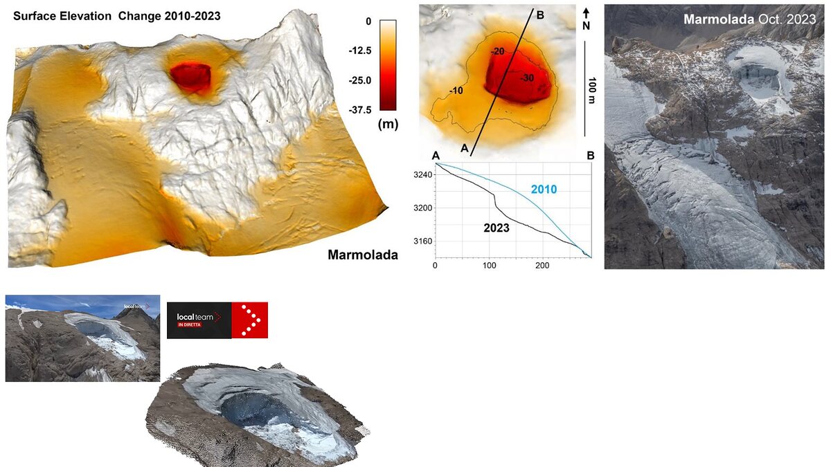
The Nepal event shares harrowing similarities with the 2025 Blatten disaster in Switzerland, where a 9.5-million-cubic-meter rock and ice avalanche buried a village and dammed the Lonza River. The 2022 Marmolada glacier collapse in Italy serves as another parallel, demonstrating how high-altitude ice bodies can fail even in the absence of a seismic trigger, driven by internal water pressure and basal melting. These precedents illustrate that the "domino effect"—where rockfall loads a glacier, which then triggers an avalanche, which then dams a river—is becoming a recurring, predictable pattern in high-mountain regions.
Official Responses and Humanitarian Crisis
As of late August 26, the humanitarian situation remains dire. Rescue operations led by Nepalese and Chinese authorities are hindered by the total destruction of access roads and bridges. With communication lines severed and the terrain buried under meters of mud and debris, the initial death toll of 160 is widely expected to rise as search-and-rescue teams reach more isolated settlements.
International scientific bodies, including ICIMOD, are coordinating with local governments to assess the risk of secondary surges. A primary concern remains the material still trapped in the upper Lhende Khola. Hydrologists warn that if the remaining debris dam fails, a second, perhaps equally destructive, surge could descend the valley. Official warnings have been issued for all downstream communities to remain at high ground until the integrity of the debris dam is verified via drone and satellite monitoring.
Implications: The Changing Himalayan Baseline
The August 26 disaster serves as a sobering case study on the intersection of climate change and human infrastructure.
The "New Normal" in the High Mountains
While scientists are cautious about attributing this single event directly to climate change—as slope failures are driven by local geological and mechanical conditions—the background context is undeniable. The Hindu Kush Himalayas are experiencing unprecedented warming. This rise in temperature leads to the degradation of mountain permafrost, which acts as the "glue" holding fractured rock masses together. Simultaneously, glacier thinning reduces the support for hanging ice, while increased meltwater infiltrates deeper into rock joints, raising pore-water pressure and facilitating failure.
Challenges for Transboundary Governance
The catastrophe has exposed a critical gap in transboundary disaster management. Environmental hazards do not respect national borders, yet the monitoring and warning systems currently in place are largely siloed. The rapid movement of a flash flood across the Nepal-Tibet border highlights the need for:
- Integrated Monitoring: A unified network of sensors capable of detecting both seismic signatures of landslides and hydrological shifts in river levels.
- Real-time Data Sharing: A formal protocol for the immediate, automated sharing of satellite and seismic data between Nepal and China.
- Infrastructure Resilience: A total reassessment of the location and engineering standards for hydropower and transport infrastructure in high-risk Himalayan valleys.
Future Mitigation and Research
Moving forward, the focus must shift from reactive disaster management to proactive hazard mapping. This requires high-resolution digital elevation models to identify "at-risk" slopes—areas where glacier retreat has left behind unstable rock walls or hanging glaciers. Furthermore, the "cascade" model of disasters (rockfall -> avalanche -> damming -> flood) must be integrated into all regional planning documents.
The tragedy on the Nepal-Tibet border is a grim indicator of the challenges ahead. As the global climate continues to warm, the "cryosphere" is undergoing a state of permanent transition. For the millions living in the shadow of the world’s highest peaks, the lessons learned from the Lhende Khola disaster are not just academic—they are a matter of survival. Understanding the physical chain of these events is the only path toward developing the early warning systems necessary to prevent such a high toll in the future.