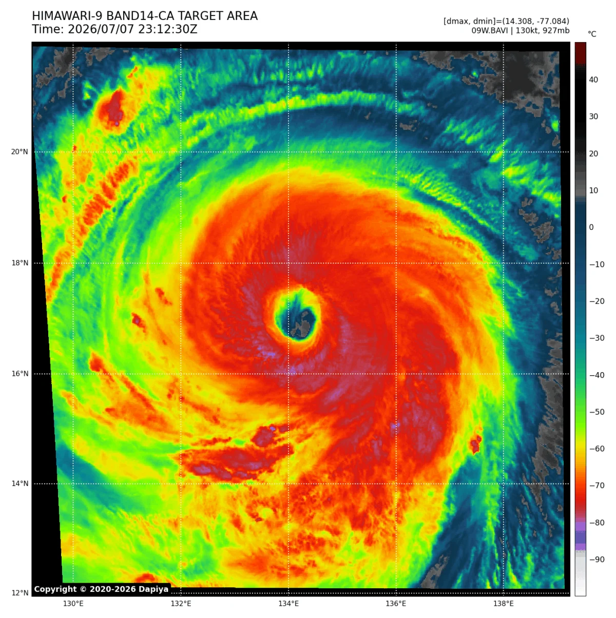
The world’s meteorological community is currently tracking a climate phenomenon of unprecedented scale. As we head toward the winter of 2026/2027, the equatorial Pacific has entered a state of rapid intensification, confirming the arrival of a "Super El Niño." This event is not merely a seasonal variation; new oceanic and atmospheric data suggest it is on track to become one of the most powerful and significant El Niño events recorded in over a century.
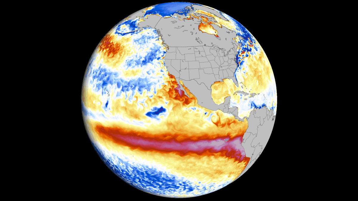
Characterized by record-breaking westerly wind bursts and a profound collapse of the Pacific trade winds, the 2026 event is effectively "locking" the global atmosphere into a stationary wave pattern. This shift is expected to dominate global weather circulation for months, influencing temperature and precipitation trends well into the spring of 2027.
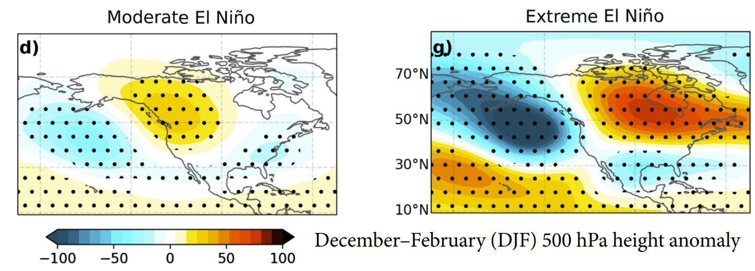
The Mechanics of a Super El Niño: A Global Game-Changer
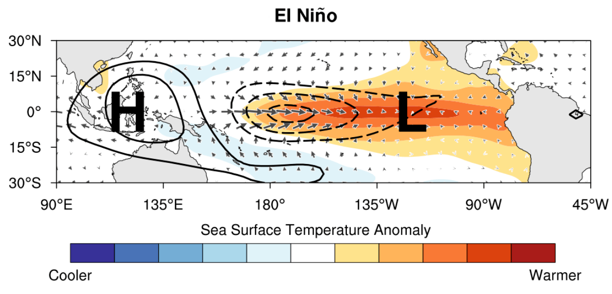
El Niño is formally defined as an anomalous warming of ocean temperatures in the central and eastern Tropical Pacific, driven by complex feedback loops between the sea surface and the overlying atmosphere. While standard El Niño events occur periodically, "Super" events are rare, typically manifesting only once every decade or less.
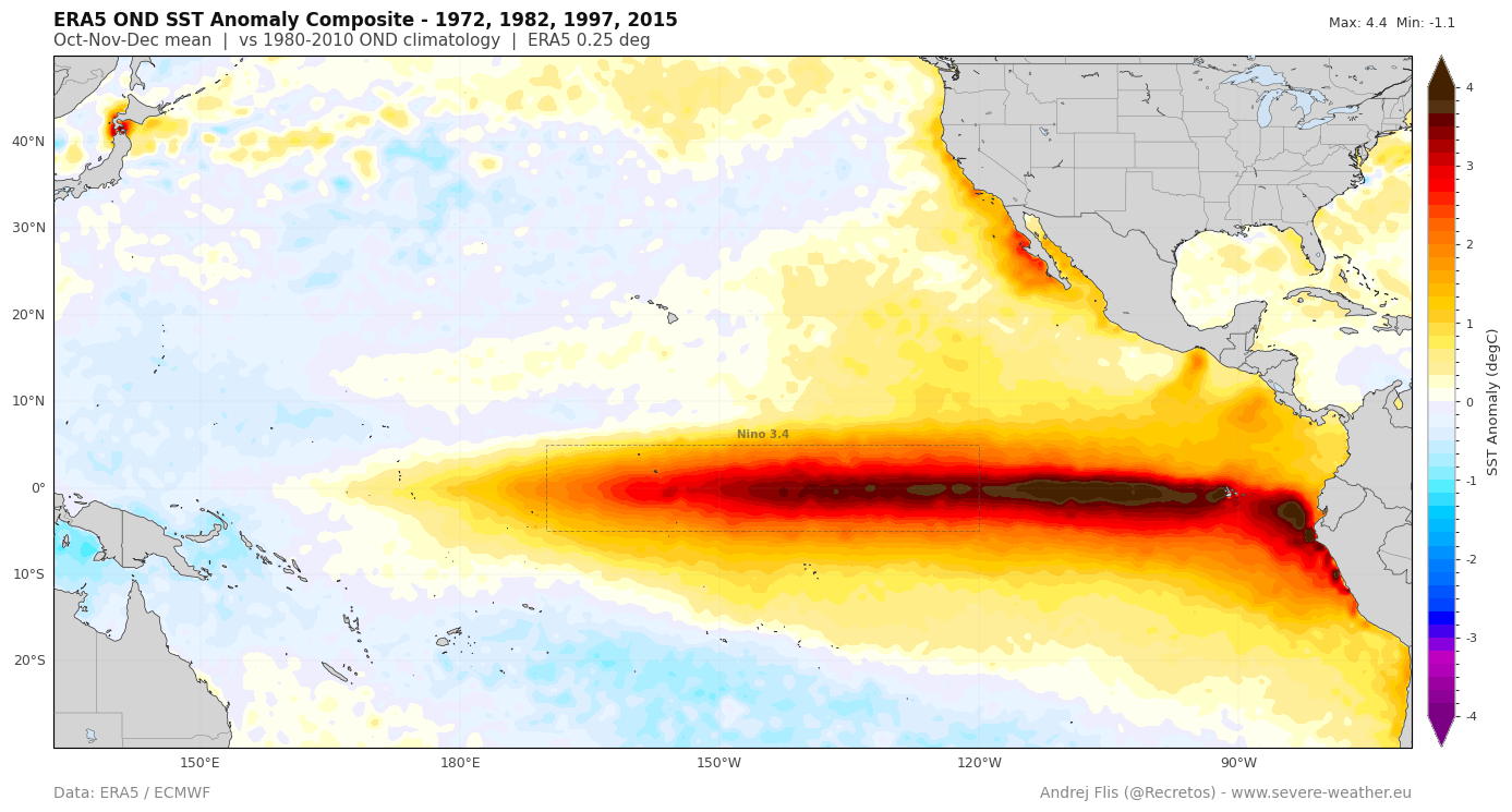
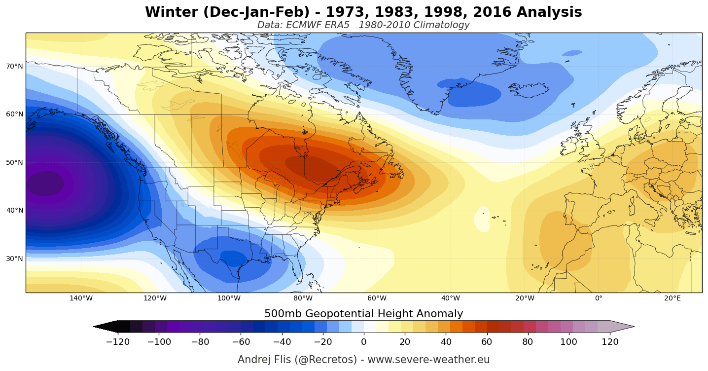
The distinction between a moderate event and a Super El Niño lies in the intensity of the atmospheric response. A moderate event might result in subtle shifts in the jet stream; however, the 2026 event is driving an aggressive reconfiguration of global circulation. This has triggered a deeper Pacific trough and a reinforced Canadian ridge, creating an "atmospheric highway" that will dictate weather patterns across North America, Europe, and Asia.
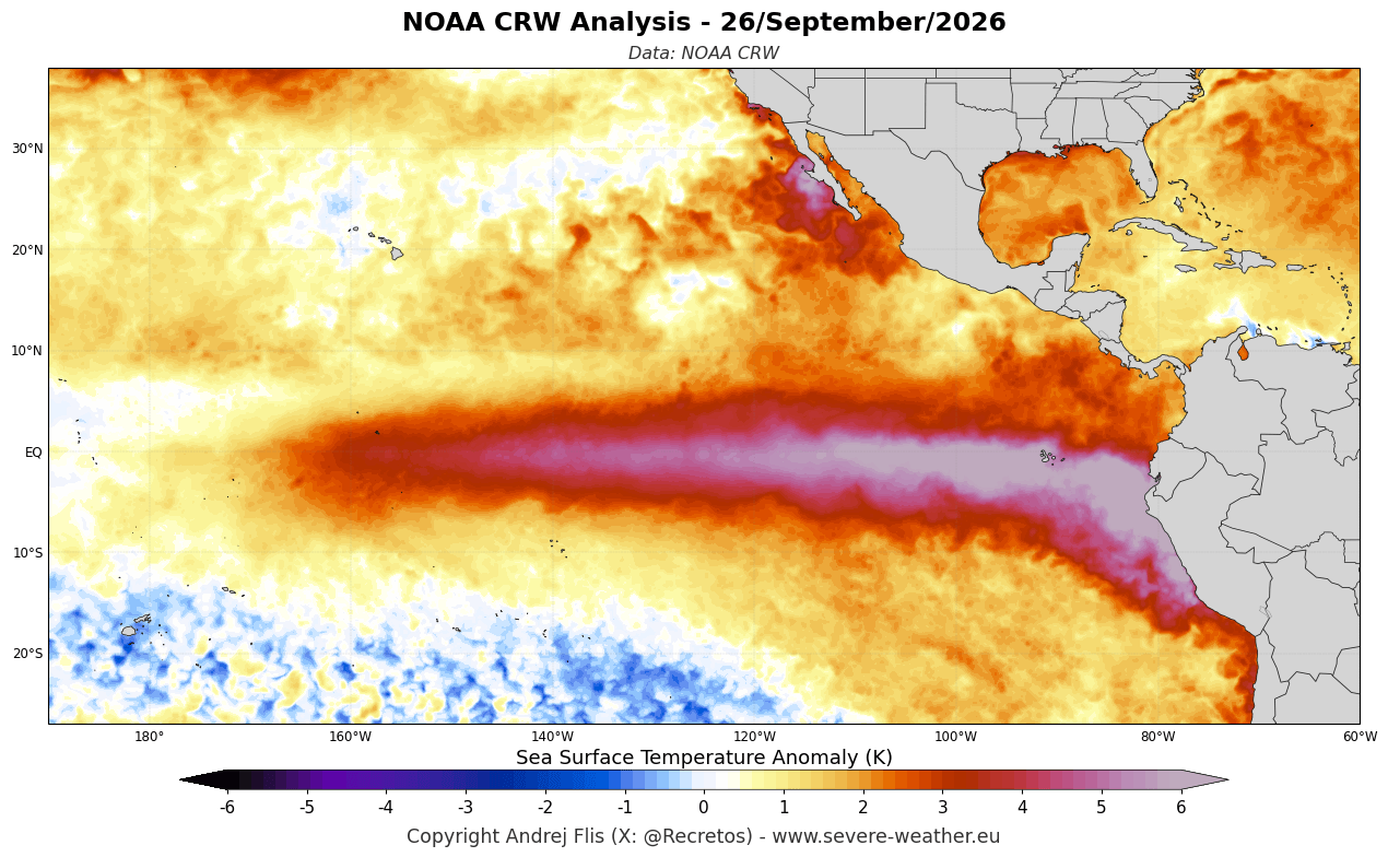
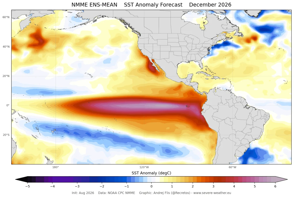
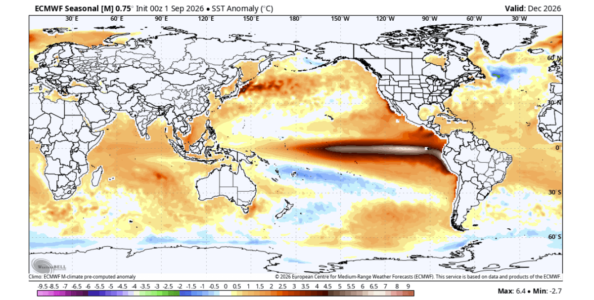
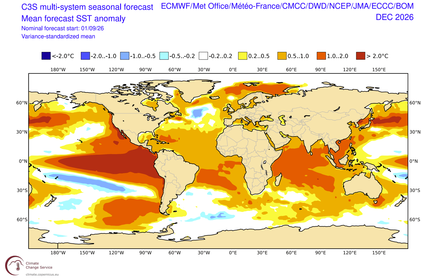
Current analysis reveals that we are witnessing a thermal anomaly where peak temperatures in the eastern Pacific are exceeding +4°C (+7°F) above normal. This magnitude of heat, situated in close proximity to the North American continent, guarantees significant, direct impacts on seasonal weather patterns for the coming winter.
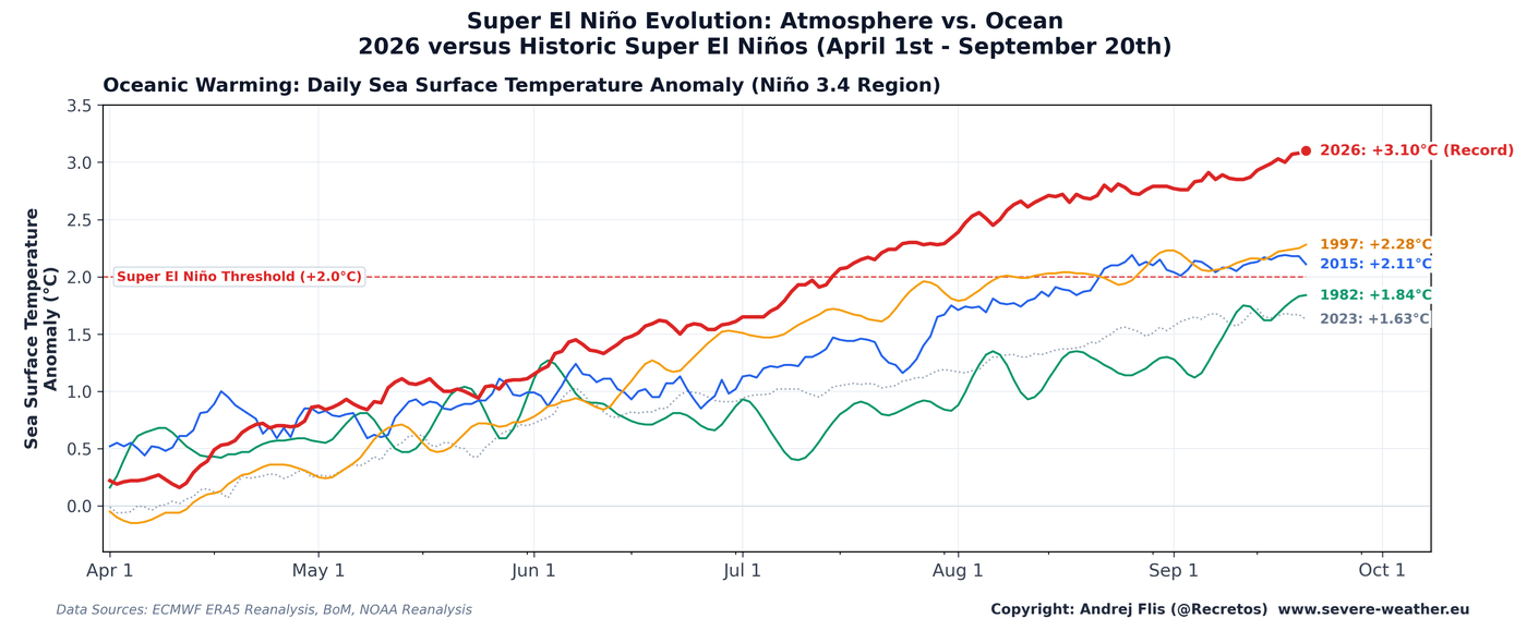
Chronology of Intensification: From Summer Surge to Winter Peak
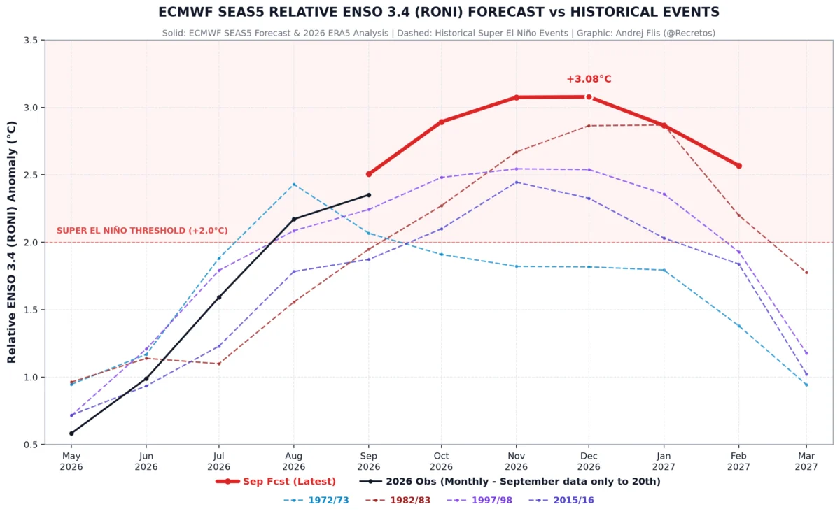
The rapid development of the 2026 Super El Niño began in early summer and has since accelerated beyond the trajectory of previous major events, including the historically significant 2015-2016 cycle.
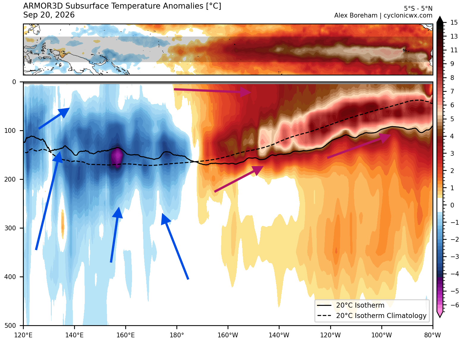
Summer 2026: The Initial Signs
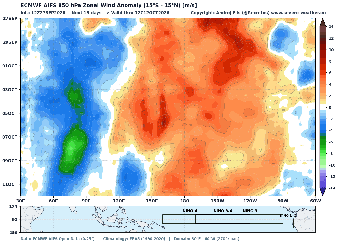
By early July, meteorologists observed an uncharacteristic weakening of the trade winds. In a typical neutral state, these winds blow from east to west, keeping warm surface waters banked against the western Pacific. In July and August 2026, the Pacific witnessed its strongest low-level westerly wind anomalies in 86 years of record-keeping. This "trade wind collapse" acted as the primary catalyst, allowing the accumulated warmth in the western Pacific to surge eastward.
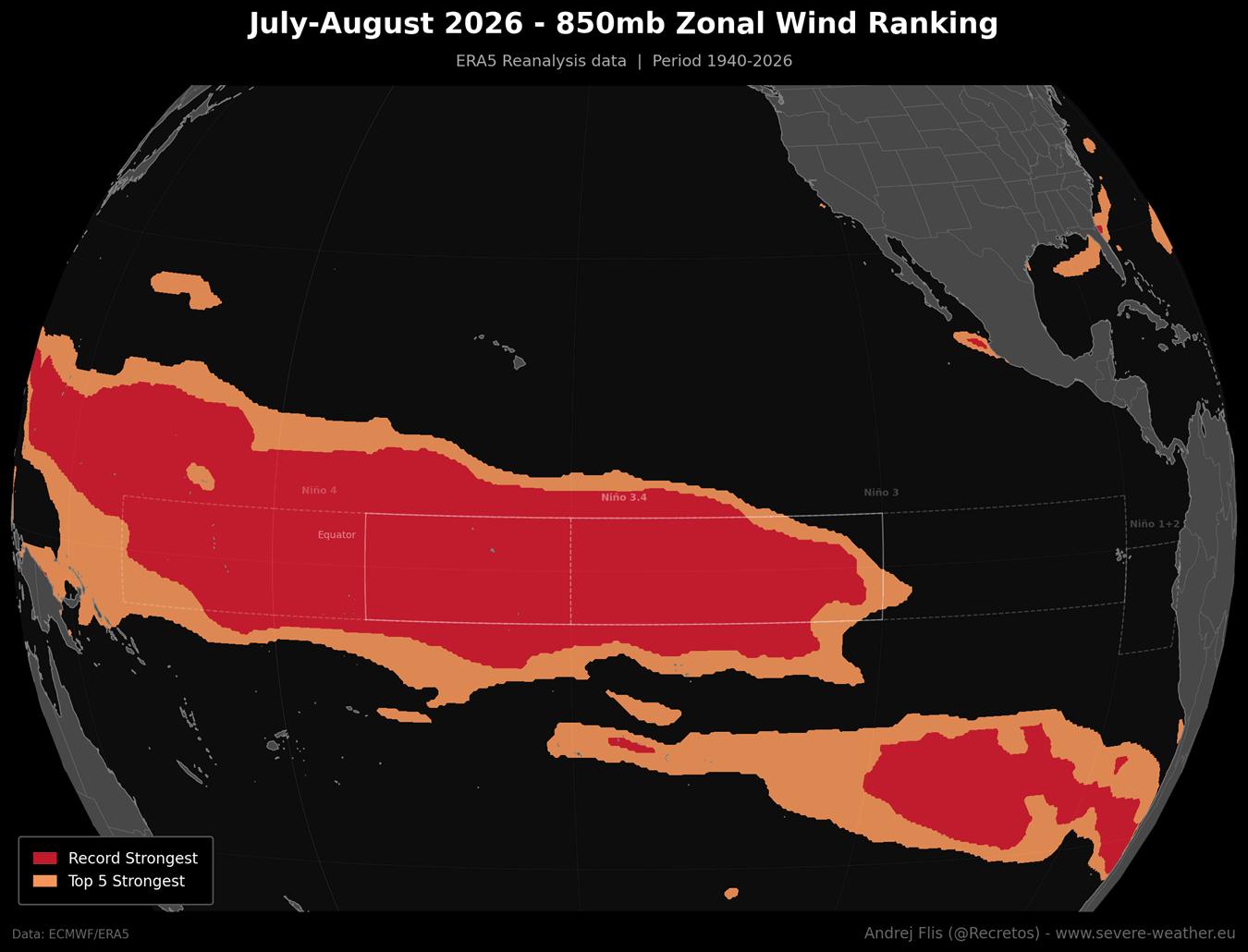
Autumn 2026: The Kelvin Wave Engine
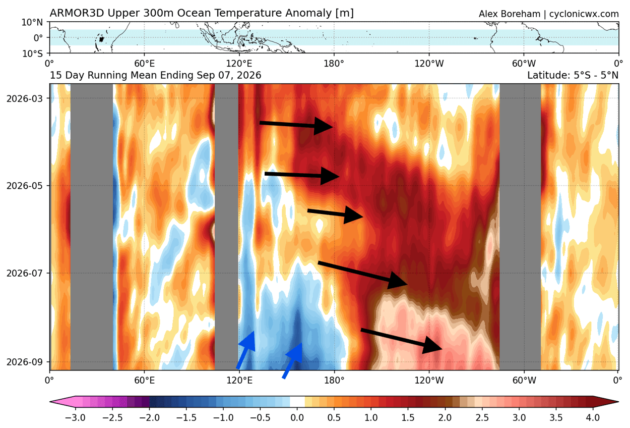
The true power driving this phenomenon lies beneath the surface. Analysis of ocean heat content down to 300 meters confirms the presence of a massive, deep-reaching downwelling Kelvin Wave. With subsurface temperature anomalies peaking at over 10°C (18°F) above normal, this "engine" has been steadily rising and spreading eastward. This is not just a surface anomaly; it is a fundamental reversal of the Pacific’s thermal structure.
Winter 2026/2027: The Anticipated Peak
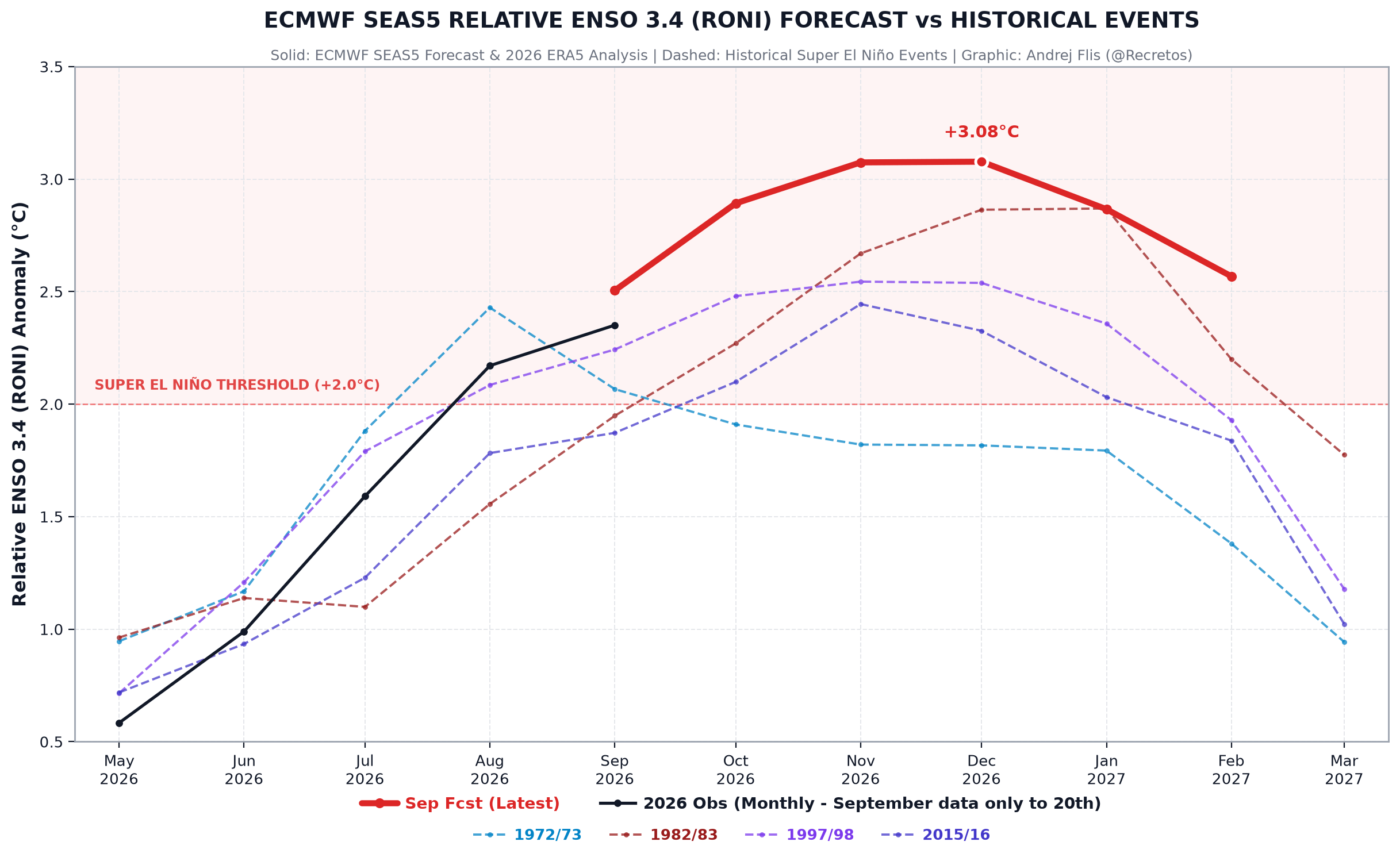
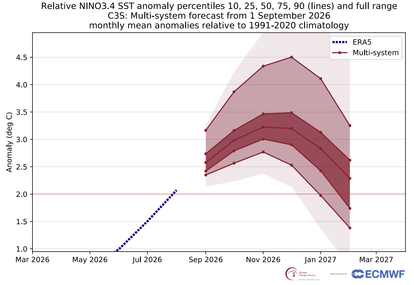
Latest multi-model ensemble forecasts from the ECMWF (European Centre for Medium-Range Weather Forecasts) suggest that the event will reach its absolute zenith between November and December 2026. Projections indicate that the monthly anomaly may exceed +3°C (+5.4°F) on the normalized scale, a threshold that has not been breached by any El Niño event since reliable records began in the 1800s.
Supporting Data: The Evidence of Extremes
The scientific community relies on the Multivariate ENSO Index (MEI) to gauge the state of the Pacific. Recent data for the July-August period produced an MEI value of +2.5—the highest reading for that specific bimonthly window since the NOAA record began in 1979.
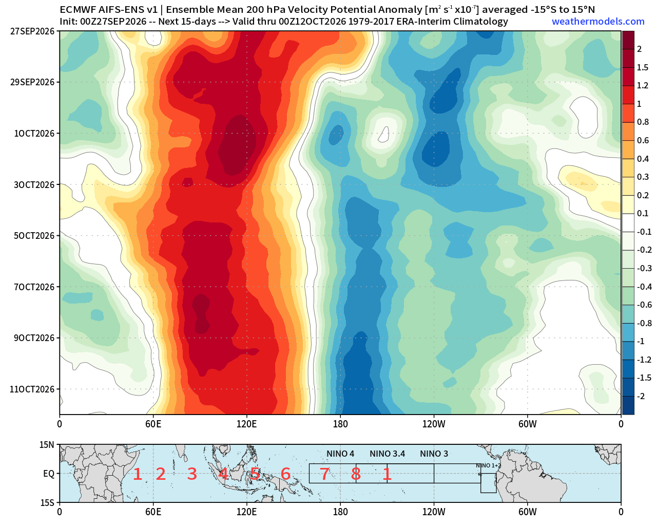
Furthermore, global sea surface temperature maps illustrate that the Super El Niño anomalies now encompass over 10% of the global ocean surface. This sheer scale ensures that the atmospheric ripple effects are global. The formation of an "atmospheric standing wave" has been confirmed by velocity potential anomalies, which show high-pressure sinking air over the Indian Ocean and deep low-pressure rising air over the central Pacific. This fixed pattern acts as a stationary anchor for the global jet stream, forcing extreme weather outcomes in distant regions.
Regional Implications: What to Expect
The reconfiguration of the jet stream creates a distinct set of winners and losers regarding winter weather.
North America
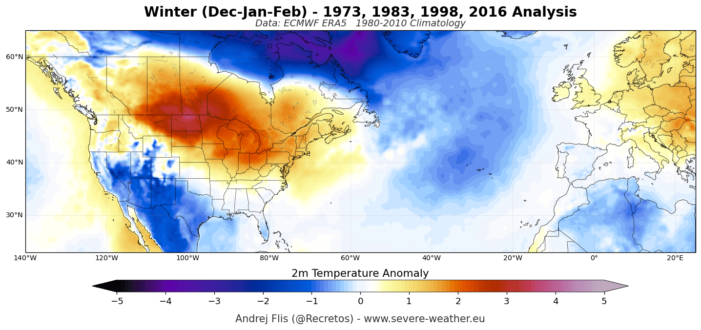
For the United States and Canada, the primary impact will be the development of an amplified, split jet stream. The deep low-pressure system in the North Pacific will likely force a massive high-pressure ridge to build over Canada and the northern United States.
- The Northern Tier: Expect temperatures significantly above historical averages, with a potential reduction in traditional deep-freeze events.
- The Southern Tier: The "atmospheric highway" created by the jet stream will drive an active, moisture-laden storm track across the southern United States. This will likely lead to increased precipitation, potential flooding, and a more erratic, storm-prone winter for these regions.
Europe and Asia
In Europe, the dominant westerly flow is expected to drive above-average temperatures across much of the continent. The stationary wave pattern typically suppresses the influence of frigid polar air masses, leading to a milder, if wetter, winter. In Asia, the Walker cell shift often results in altered monsoon timing and varying precipitation risks that local meteorological agencies are currently monitoring with high alert.
Official Responses and Long-Range Forecasting
Global climate agencies, including NOAA and the WMO, have been tracking the 2026 event with extreme vigilance. Because we are entering "uncharted waters" with an event of this magnitude, there is a consensus that historical analogies are becoming less reliable.
Governmental bodies are emphasizing that while the average trends point toward a warmer northern winter and a wetter southern winter, the variability—the potential for sudden, extreme weather events—is heightened by the sheer energy content of this Super El Niño. Emergency management agencies are advised to prepare for the compounding effects of a volatile, high-energy atmosphere.

Conclusion: A Winter Like No Other
The 2026/2027 winter season is poised to be defined by the influence of the most intense El Niño event in over a century. The combination of record-breaking ocean temperatures, a powerful subsurface Kelvin wave, and a collapsed trade-wind regime has created a "perfect storm" of climatic drivers.
As the world prepares for the peak in late 2026, the emphasis remains on observation and adaptive planning. Whether through the lens of agriculture, energy demand, or disaster preparedness, the global community must recognize that this Super El Niño is not merely a forecast—it is a current, unfolding reality that will leave an indelible mark on the climate records of the 21st century.
For those seeking localized impacts, detailed regional forecasts for states, provinces, and countries can be accessed via the Winter Forecast Explorer, which synthesizes the latest ECMWF and multi-model ensemble data to provide granular, high-resolution outlooks.