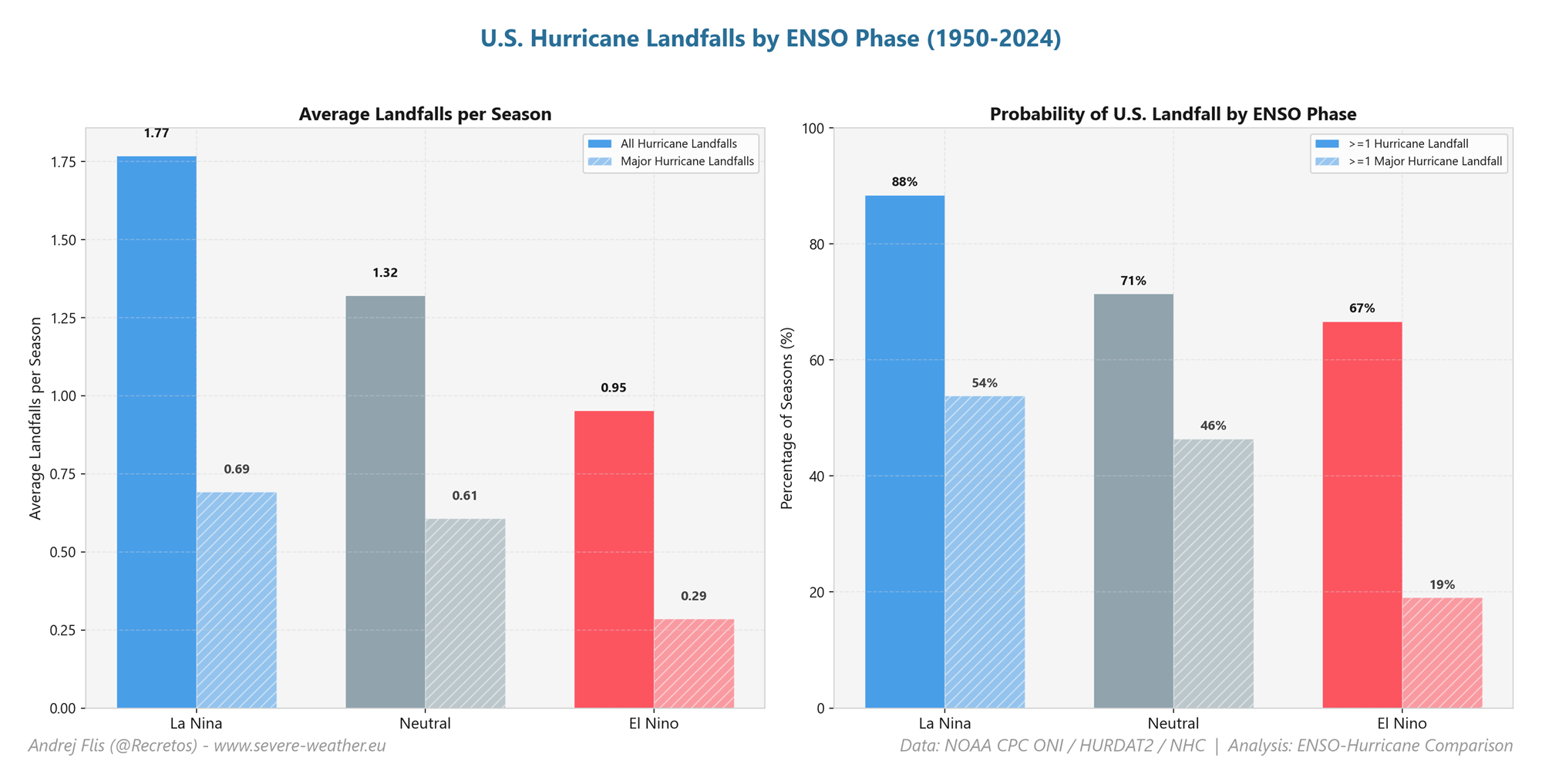
In a meteorological phenomenon that is capturing the attention of climate scientists globally, the tropical Atlantic and Pacific Oceans have entered a state of synchronized anomaly. A rare Atlantic Niña has emerged in the Atlantic basin, appearing in tandem with a powerful Super El Niño currently intensifying in the Pacific. While these two phenomena occupy different oceans and exhibit opposite temperature signatures, they are acting in concert to create a formidable "atmospheric shield" over the United States, significantly suppressing the potential for hurricane development for the remainder of the 2026 season.
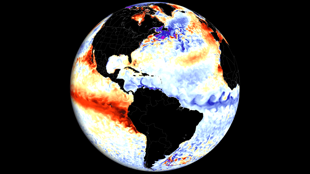
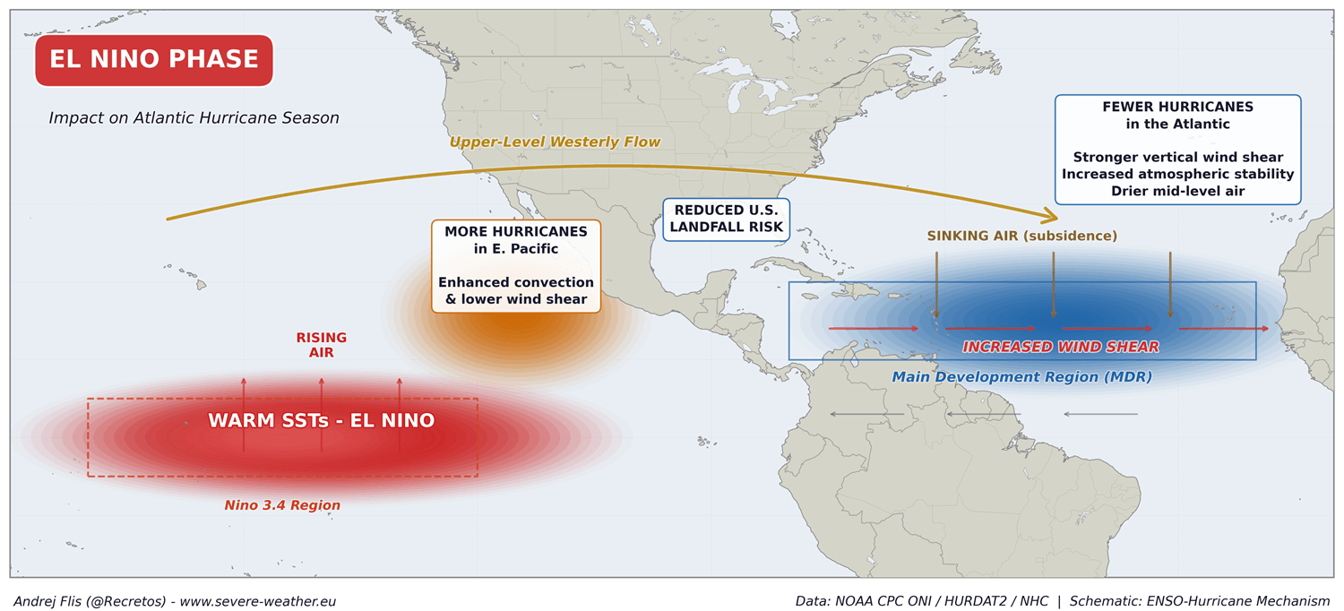
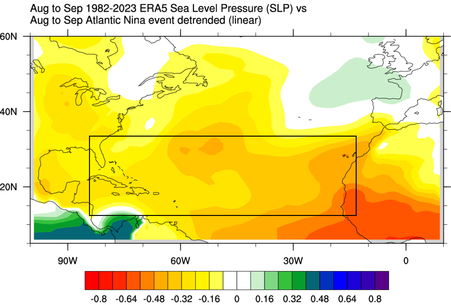
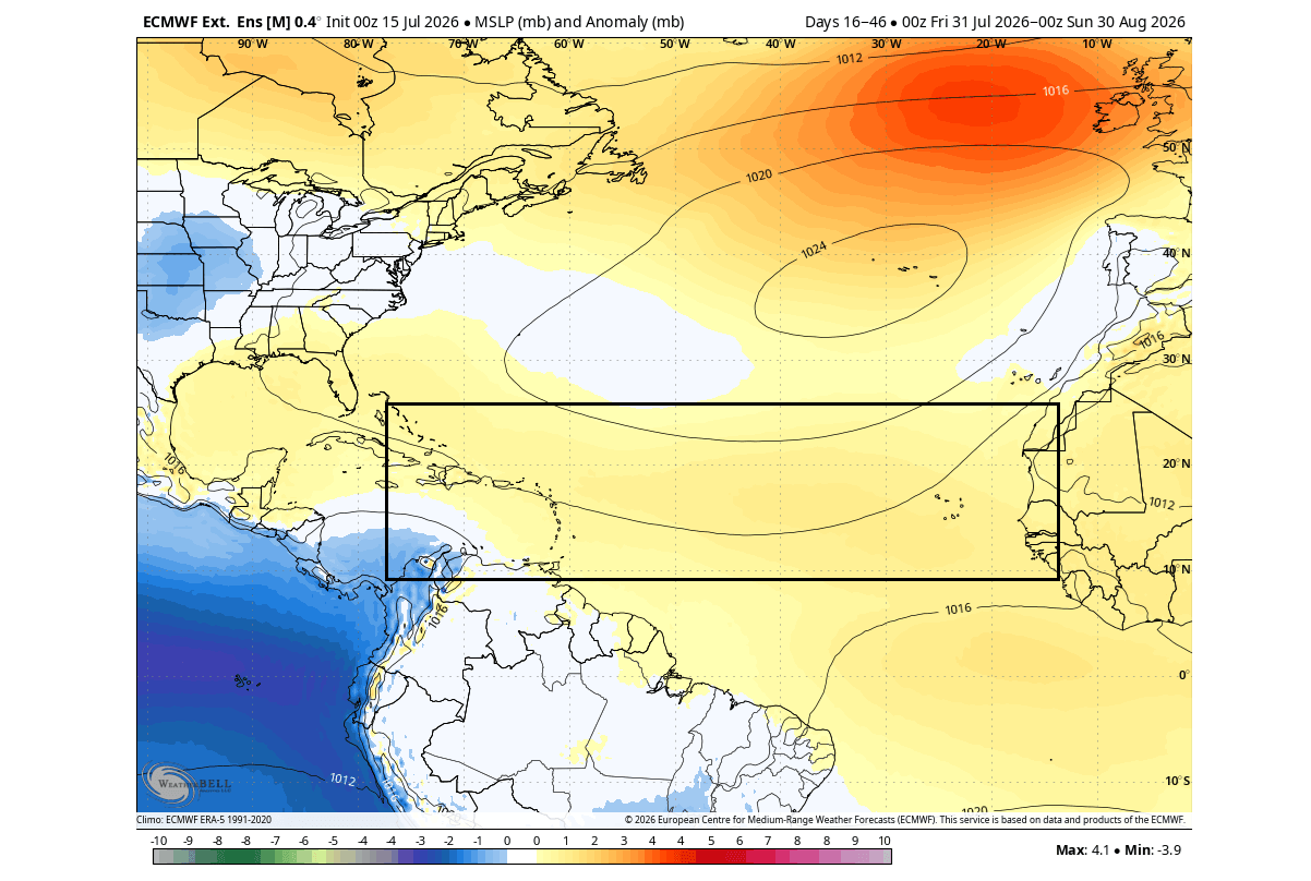
This convergence of oceanic forces is producing a hostile environment for tropical cyclone formation, characterized by increased vertical wind shear, sinking air, and heightened atmospheric pressure across the Main Development Region (MDR). As we progress through the heart of the hurricane season, the implications of these anomalies extend far beyond the tropics, offering critical clues about the impending 2026/2027 winter, the behavior of the jet stream, and the potential stability of the Polar Vortex.
The Mechanics of a Global Climate Shift
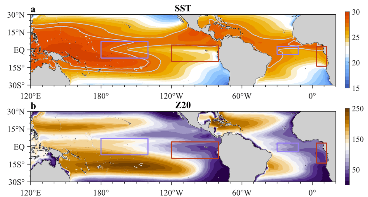
Ocean anomalies serve as the primary engine for global weather patterns. The thermal state of the Pacific, governed by the El Niño-Southern Oscillation (ENSO), dictates climate trends on a planetary scale. Simultaneously, smaller but potent regional oscillations, such as the Atlantic Niña, exert localized control over hurricane genesis.
The Atlantic Niña: A Rare Cold Anomaly
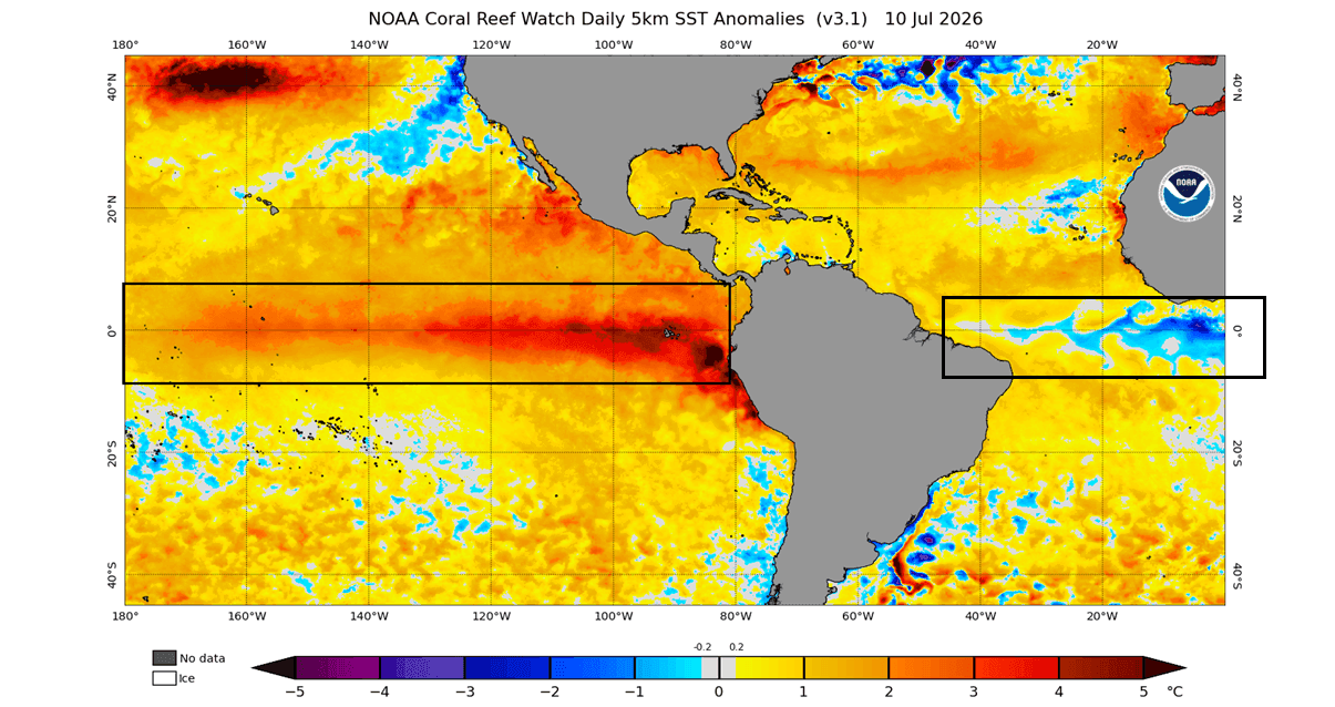
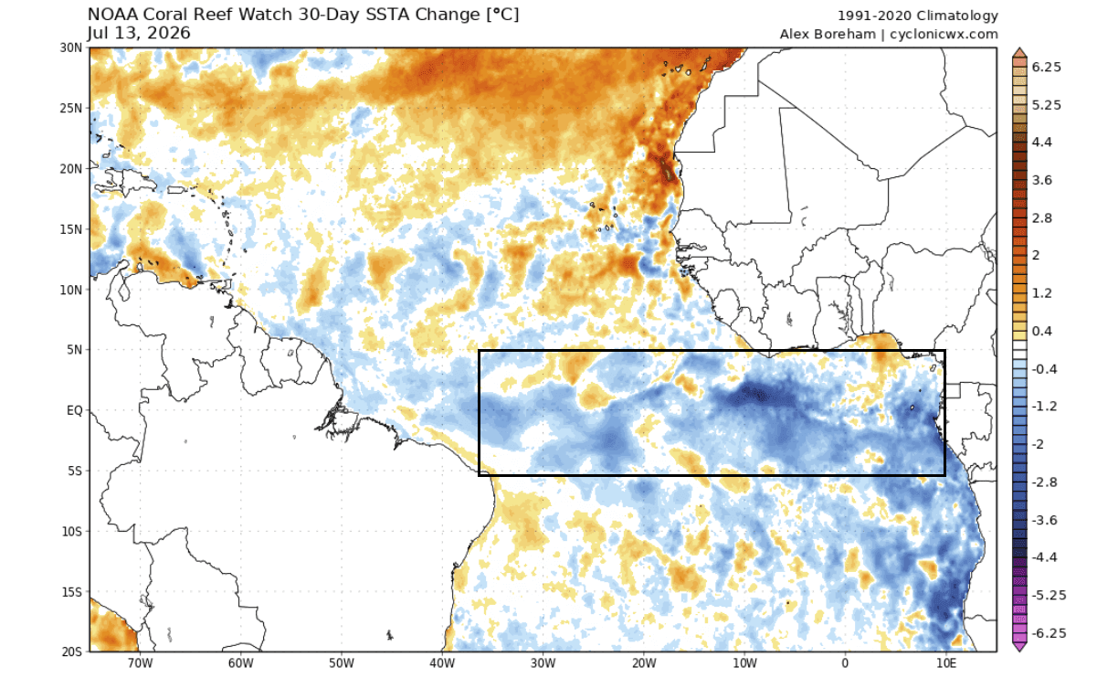
The Atlantic Niña is a recurring, though relatively infrequent, cooling of the equatorial Atlantic. When trade winds intensify, they trigger "upwelling," a process where deep, colder water is pulled to the surface. If current cooling trends hold—with seasonal anomalies dipping below -0.5 degrees Celsius—the 2026 event will be recorded as only the sixth such occurrence in over 40 years of reliable historical data. Current analysis from NOAA’s Coral Reef Watch (CRW) indicates that temperatures in the affected region are 1 to 3 degrees Celsius below normal, effectively choking off the fuel supply for tropical disturbances.
The Pacific Super El Niño
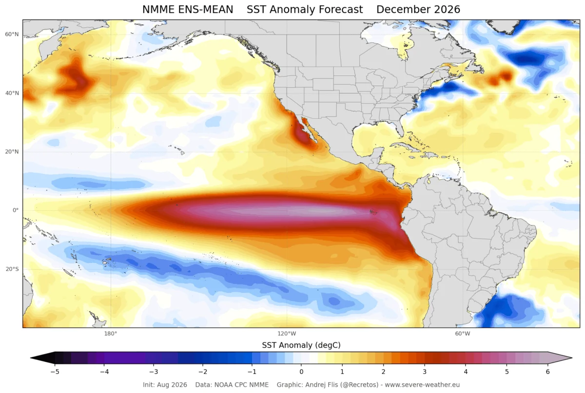
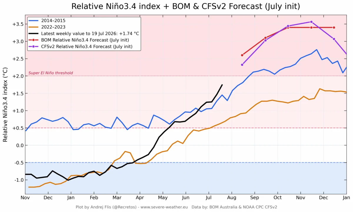
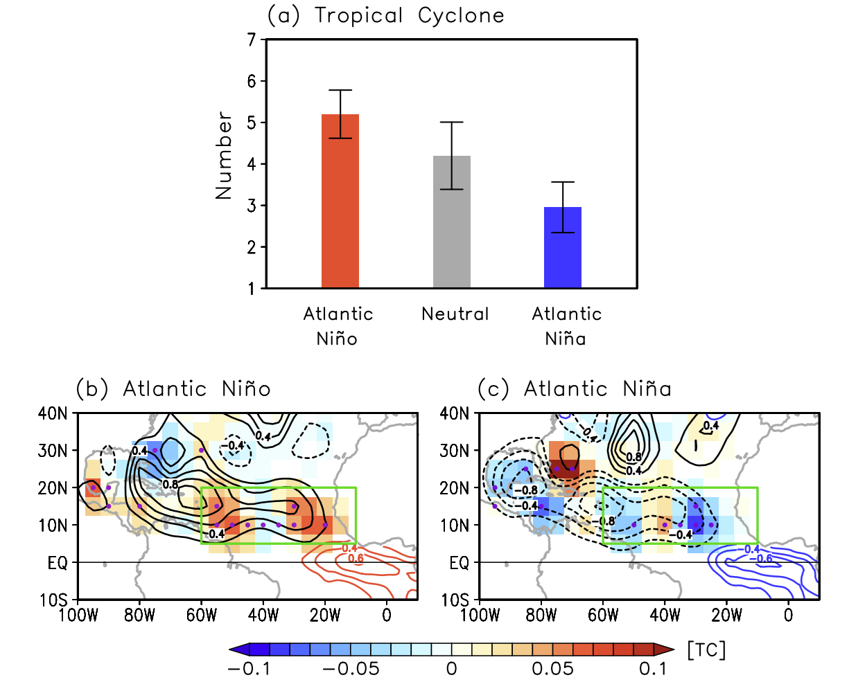
In the Pacific, the situation is even more dramatic. A rapidly developing Super El Niño is currently witnessing peak anomalies in the eastern Pacific reaching 3 to 4 degrees Celsius above historical norms. This is a remarkably fast onset, signaling a major reorganization of the tropical atmosphere. While an Atlantic Niña acts to cool the tropical Atlantic, the Super El Niño alters the global "Walker Circulation," creating an atmospheric bridge that reinforces stability over the Atlantic.
Chronology: From Trade Winds to Atmospheric Shield
The development of these conditions is not coincidental; it is a manifestation of the Earth’s interconnected climate system.
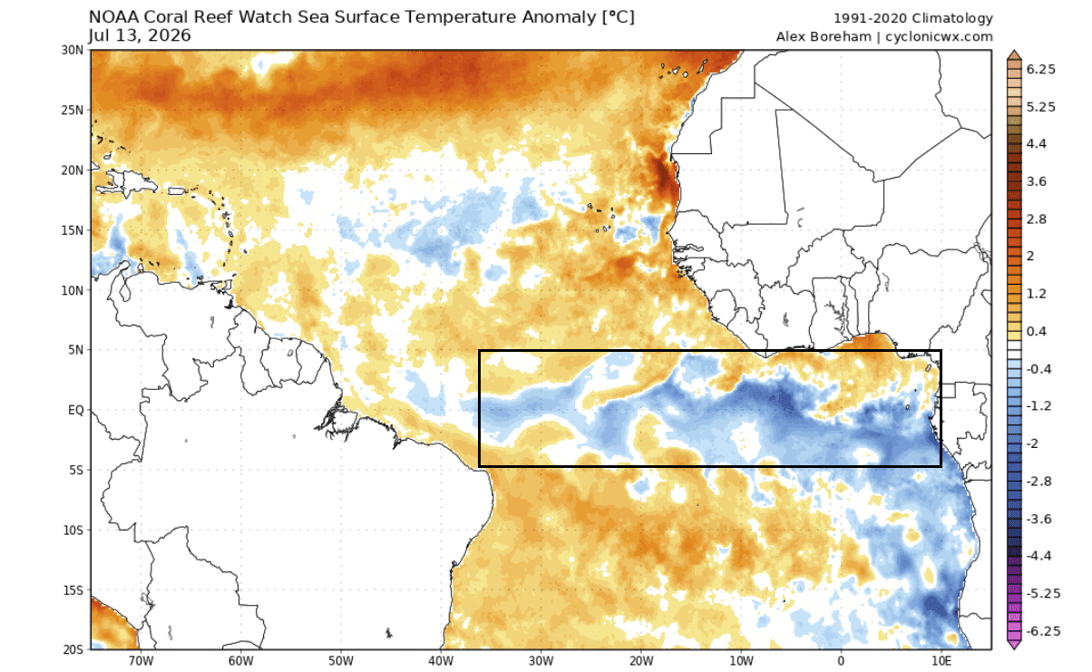
- Early Summer (June–July): Strengthened easterly trade winds near the equator initiated the cooling of the central Atlantic, while a concurrent weakening of trade winds in the Pacific allowed warm waters to migrate eastward, signaling the birth of the Super El Niño.
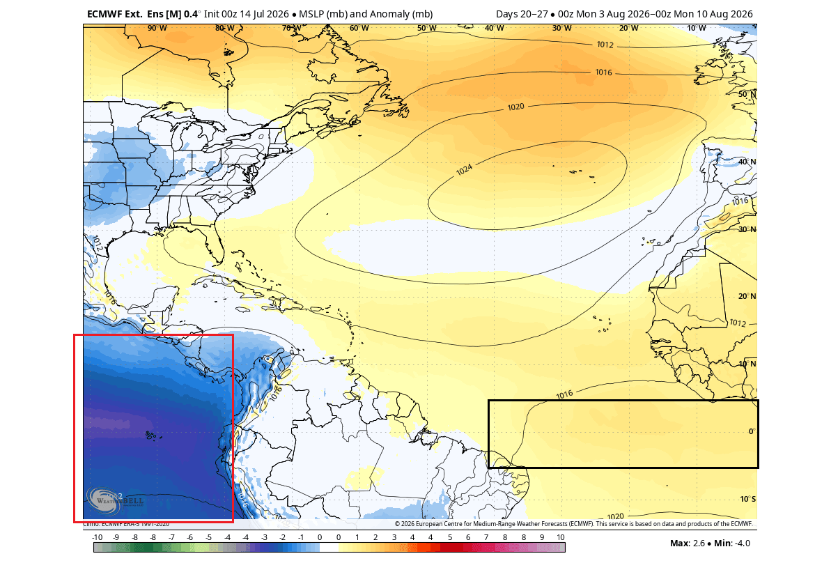
- Mid-Summer (August): The temperature contrast became distinct. High-pressure ridges began to anchor themselves over the Atlantic MDR, while a deep, low-pressure system established itself over the Pacific, acting as an "atmospheric vacuum" that draws storm activity away from the Atlantic.
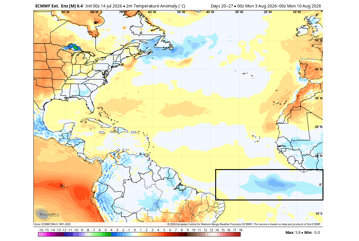
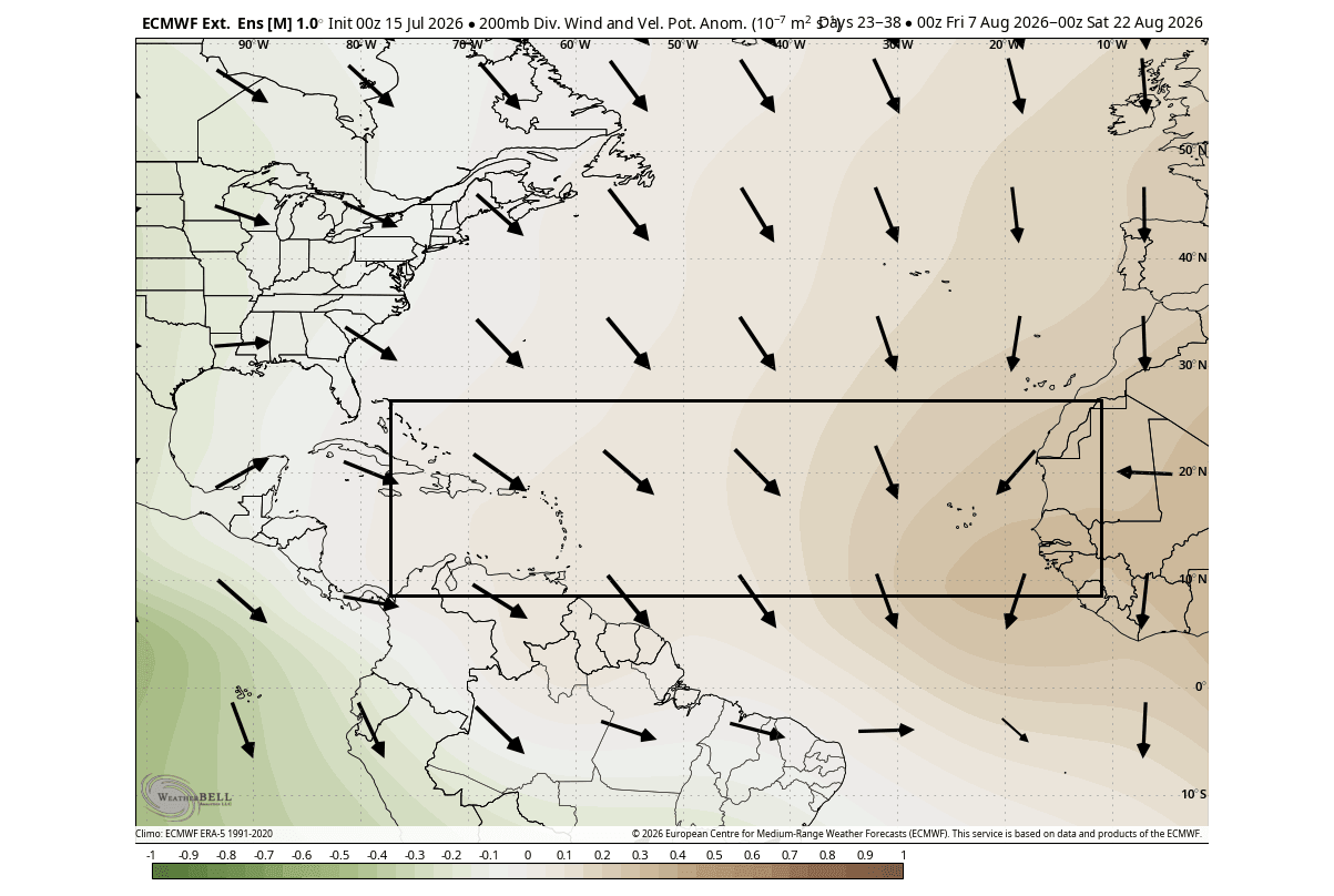
- Late Summer/Early Fall (Forecasted): Predictive models from the ECMWF suggest that this pressure configuration will persist through the peak of the hurricane season, maintaining an environment that is physically inhospitable to cyclogenesis.
Supporting Data: Why the Risk of Landfall is Reduced
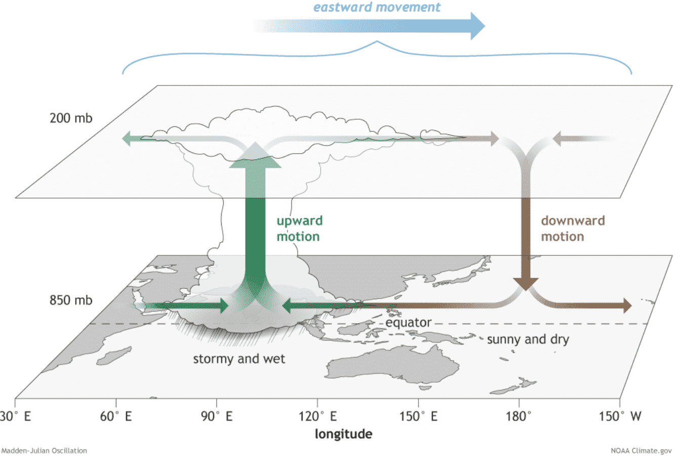
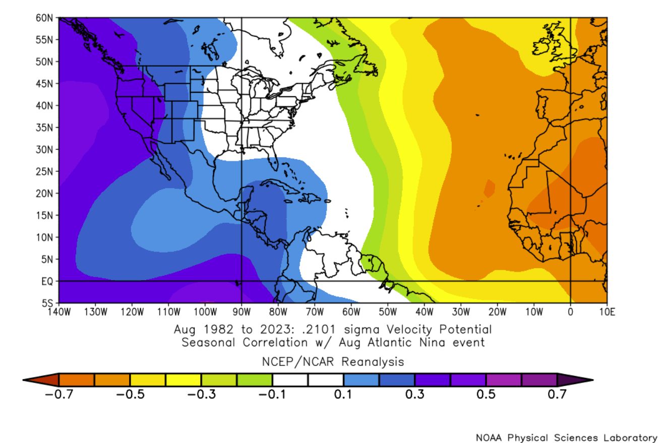
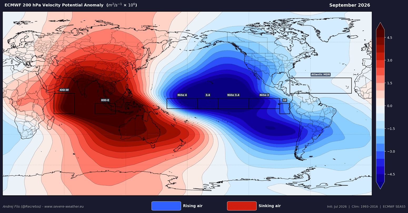
The "atmospheric shield" is best understood through the lens of Velocity Potential—a metric that maps where air is rising (promoting storm growth) and where it is sinking (suppressing cloud formation).
Suppressed Convection
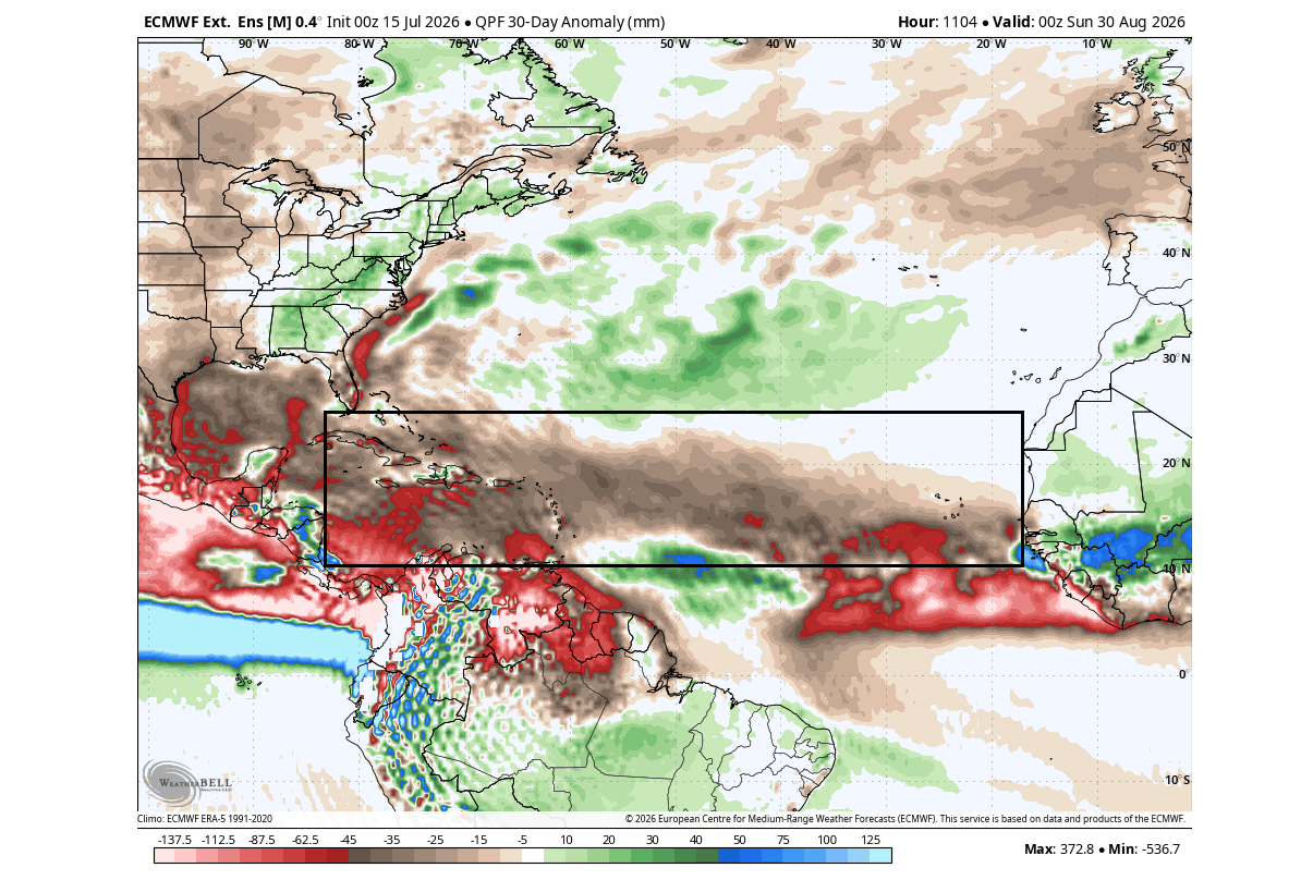
During a typical active hurricane season, the MDR is characterized by rising motion and low pressure. However, the current model data shows a pronounced sinking motion (subsidence) over the tropical Atlantic. Sinking air acts as a "lid" on the atmosphere, preventing the vertical development of thunderstorms required to organize into tropical depressions.
Wind Shear and Moisture
Data analysis confirms that the interaction between the Atlantic Niña and the Pacific El Niño generates significant vertical wind shear—the change in wind speed and direction with height. Strong shear effectively "decapitates" nascent tropical systems before they can consolidate. Furthermore, mid-level dry air, a byproduct of this high-pressure setup, further inhibits the moisture-heavy environment that hurricanes require to thrive.
Landfall Projections
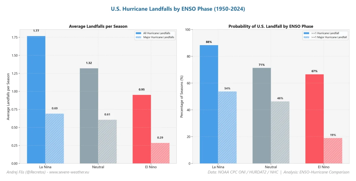
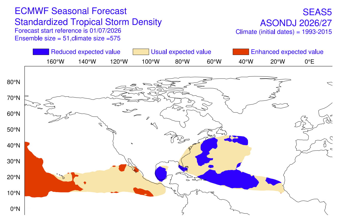
Colorado State University (CSU), under the leadership of Dr. Philip Klotzbach, has released updated projections for 2026. The data is clear: from the Texas coastline to the shores of Newfoundland, the statistical risk of a landfalling hurricane is significantly lower than the long-term average. While the Accumulated Cyclone Energy (ACE) index—a measure of total seasonal intensity—is forecasted to be well below normal, experts remind the public that even in suppressed years, the risk is never zero. The 1992 season, which saw the devastating Hurricane Andrew, serves as a sobering historical reminder that a quiet season does not preclude a catastrophic event.
Official Perspectives and Meteorological Consensus
Meteorological agencies, including NOAA and the National Hurricane Center (NHC), are monitoring these indicators with high precision. The current consensus is that the coupling of these ocean anomalies creates a "double-jeopardy" for hurricane formation. The Pacific influence, through its massive energy release and teleconnection patterns, forces a displacement of the jet stream that makes the Atlantic environment inherently less favorable.
The scientific community emphasizes that this is not merely a statistical anomaly but a physical state shift. The "shield" is not a wall, but a regional change in thermodynamic properties that makes the tropical Atlantic act like a desert rather than a nursery.
Long-Range Implications: Winter 2026/2027 and the Polar Vortex
Perhaps the most compelling aspect of a quiet 2026 hurricane season is its potential role as a harbinger for the upcoming winter. Historical data reveals a fascinating correlation between suppressed tropical activity and winter patterns in the Northern Hemisphere.
The Polar Vortex Connection
Studies suggest that global atmospheric states which suppress Atlantic hurricanes often correlate with a warmer winter stratosphere. When the stratosphere warms, it frequently leads to a "weak" or disrupted Polar Vortex.
A strong Polar Vortex acts like a spinning top, keeping freezing Arctic air locked near the poles. A weak or collapsed vortex, conversely, allows that cold air to spill southward, leading to extreme winter weather events across the United States, Canada, and Europe. If the current trends hold, we may be looking at a winter characterized by volatile jet stream patterns and an increased frequency of "Arctic outbreaks" in mid-latitudes.
Predicting the Winter Pattern
The connection is built on the same "common factors" that drive the El Niño and the Atlantic Niña. As the tropical atmosphere settles into this new configuration, the ripple effects travel toward the poles. If the 2026 hurricane season concludes as one of the quietest on record, it will serve as a strong indicator that the atmosphere is primed for a more variable, potentially colder winter in the Eastern and Central United States.
Conclusion: A Global System in Flux
The emergence of a rare Atlantic Niña alongside a Super El Niño provides a masterclass in the interconnectedness of our planet’s climate. For the remainder of 2026, the United States finds itself under an atmospheric shield that offers a rare reprieve from the typical intensity of the hurricane season.
However, as we look ahead, the implications of this quiet period suggest that the "atmospheric debt" may be repaid in the winter months. The potential for a weakened Polar Vortex and the subsequent shifts in the jet stream remain the primary focus for seasonal forecasters. As we continue to monitor the interaction between these massive ocean anomalies, one thing remains clear: the state of the tropics in September is far more than a forecast for the coastline—it is a foundational indicator for the climate challenges of the coming winter.
This analysis will be updated regularly as new observational data from the Atlantic and Pacific basins becomes available.