In a rare and meteorologically significant convergence, the tropical oceans are currently hosting two of the most influential climate anomalies simultaneously. A rare Atlantic Niña—the cold-water counterpart to the more common El Niño—has emerged in the Atlantic basin, while simultaneously, a powerful Super El Niño continues to intensify across the Pacific.
While these two phenomena appear to be polar opposites on a map, their combined atmospheric footprint is pushing in the same direction. Together, they are effectively constructing an "atmospheric shield" over the Atlantic, creating a hostile environment for tropical cyclone development. As meteorologists analyze the latest forecast data, the signals point toward a suppressed hurricane season, with higher pressure, increased wind shear, and sinking air across the primary development regions.
The Global Ocean-Atmosphere Connection
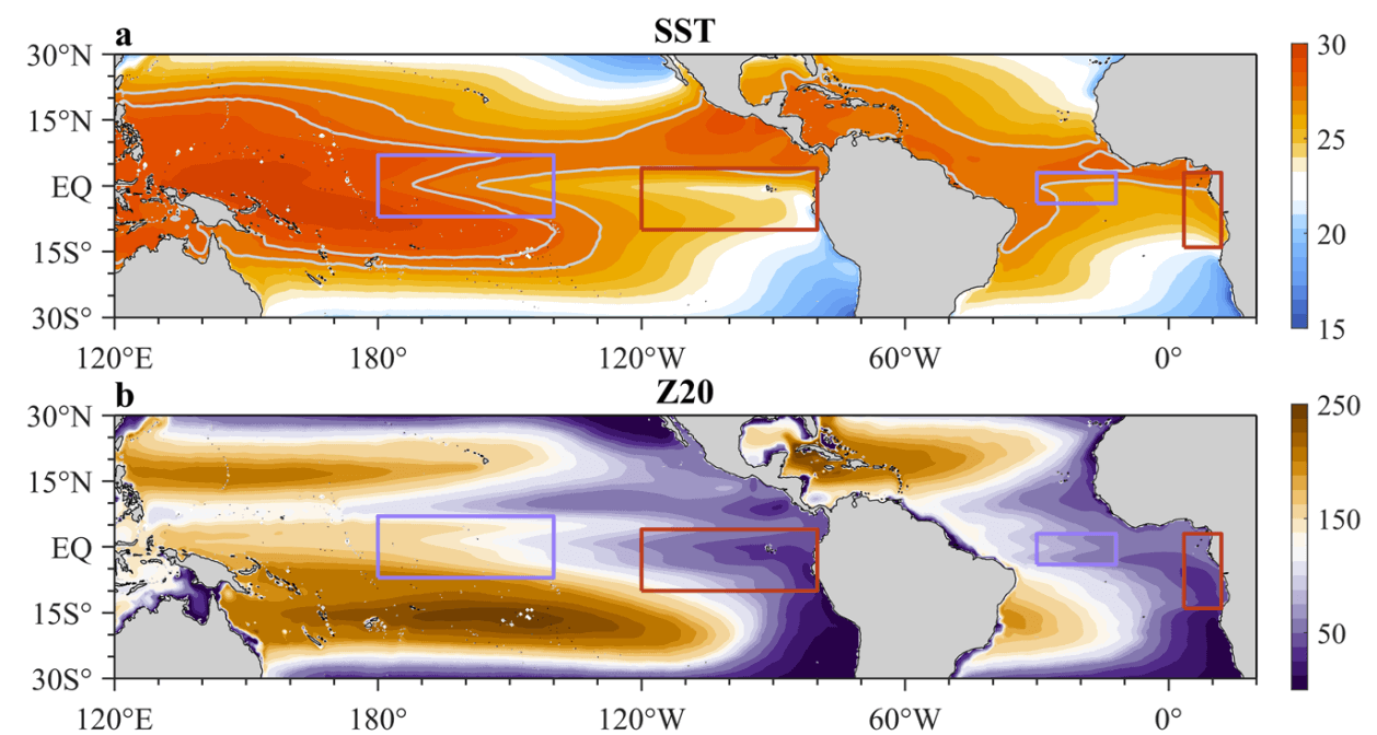
Oceanic anomalies do not exist in isolation; they are the primary engines of our global weather system. While Atlantic temperature fluctuations have an immediate impact on the intensity and frequency of hurricanes, the massive Pacific-based ENSO (El Niño-Southern Oscillation) events act as global climate drivers, influencing weather patterns from the Fall through the following Spring.
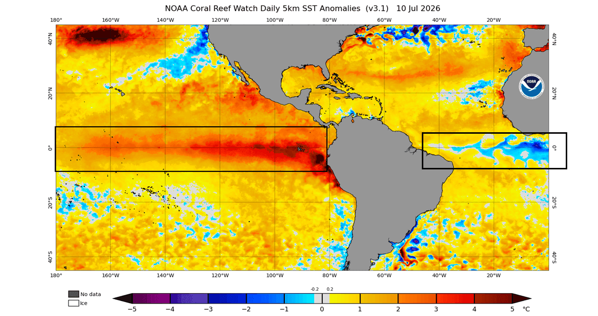
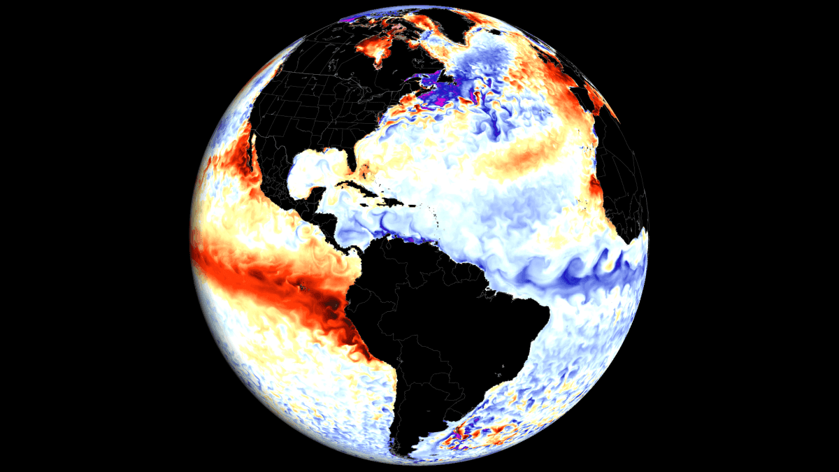
Currently, the equatorial Pacific is dominated by strong El Niño anomalies, with temperatures in the eastern sectors already trending 3–4 degrees Celsius above the historical norm—an unusually rapid onset for this time of year. Simultaneously, a swath of cooler-than-normal water has materialized in the central Atlantic, marking the onset of an Atlantic Niña.
These events are primarily governed by the trade winds—the consistent easterly currents that circle the Earth near the equator. When these winds intensify, they trigger "upwelling," pulling deeper, colder water to the surface, which characterizes the Niña phase. Conversely, when trade winds weaken, warm water pools in the Pacific, fueling the El Niño phenomenon. The resulting ocean temperatures act as a barometer for the atmosphere, providing researchers with vital clues about what to expect from the global climate in the coming months.
A Chronology of Cooling: The Development of the Atlantic Niña
The emergence of the 2026 Atlantic Niña is a relatively rare event. Historical records spanning over four decades indicate that strong summer-time Atlantic Niña events occur infrequently. Should the current cooling trend persist and remain below the -0.5 degree threshold, the 2026 event will officially become only the sixth of its kind in the last 40 years.
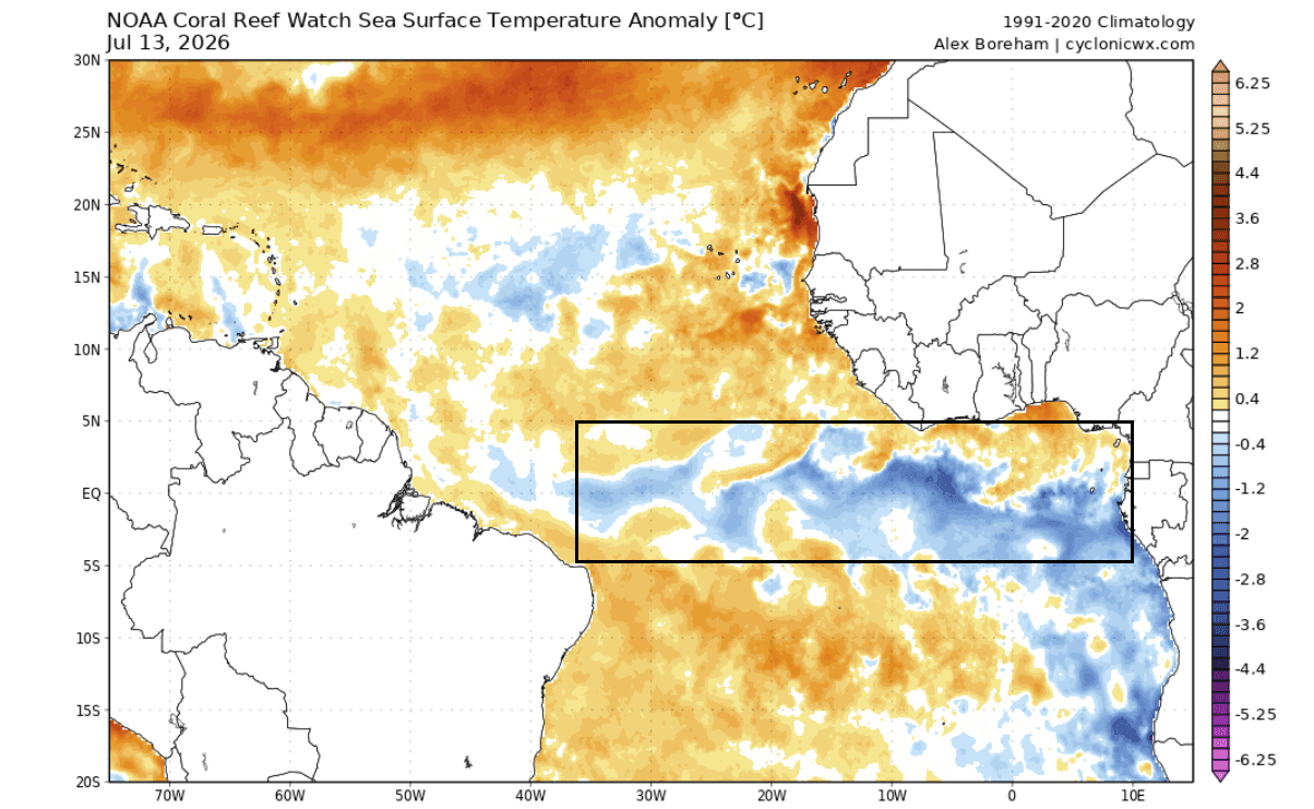
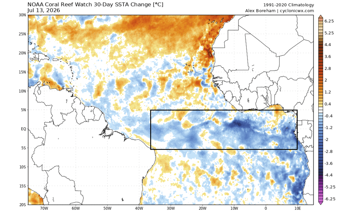
Data from the NOAA Coral Reef Watch (CRW) reveals a broad, cooling trend across the tropical Atlantic, with temperatures in critical regions dipping 1–3 degrees Celsius below the seasonal average. Over the past 30 days, this cooling has intensified, particularly in the equatorial regions where trade winds are most robust.
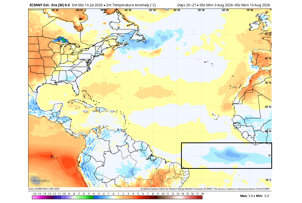
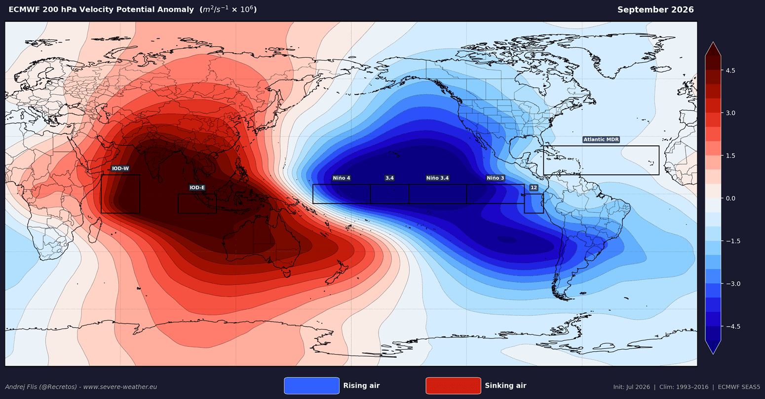
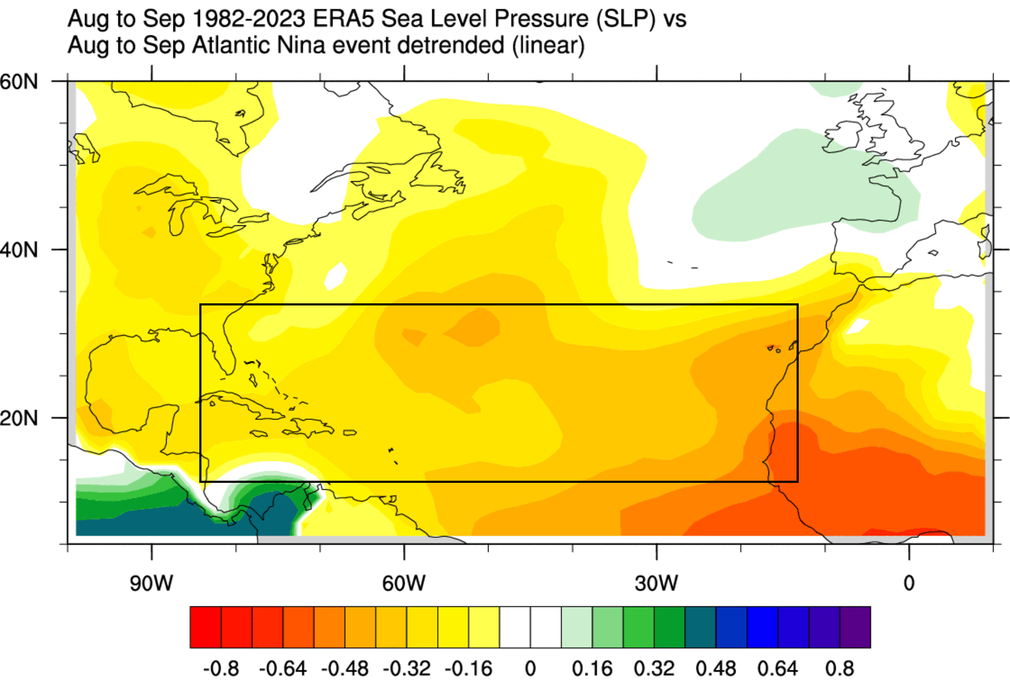
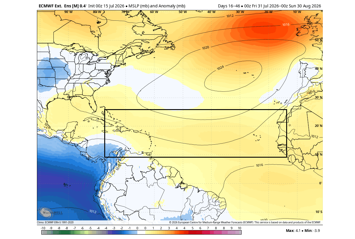
Meteorological models from the European Centre for Medium-Range Weather Forecasts (ECMWF) corroborate these findings, projecting a sustained negative anomaly that is expected to linger through late August. When juxtaposed with the surging 4-degree anomalies in the Pacific, the global pressure map reveals a stark contrast: a deep, low-pressure anomaly over the Pacific, balanced by a stable, high-pressure zone over the Atlantic. This pressure differential is the hallmark of a system designed to inhibit hurricane formation.
Supporting Data: Velocity Potential and Atmospheric Circulation
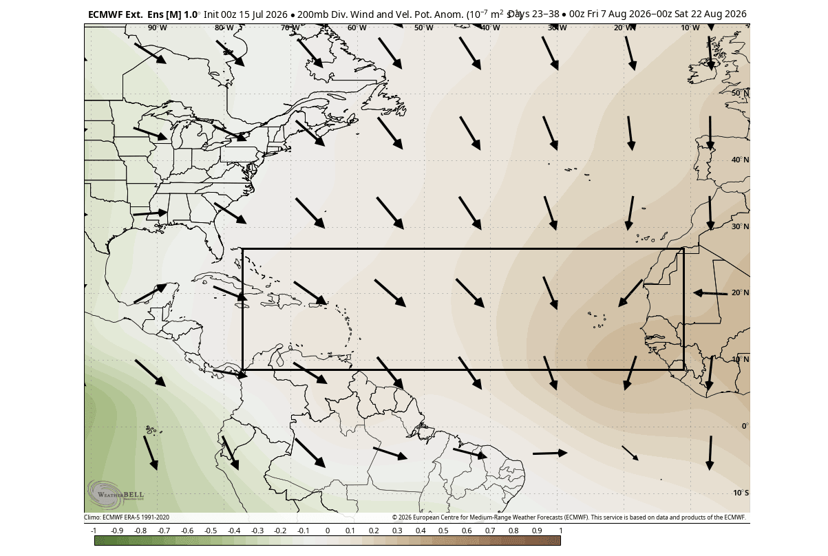
To understand why this "shield" is so effective, we must look at the Velocity Potential—a metric used to track the rising and sinking of air on a global scale.
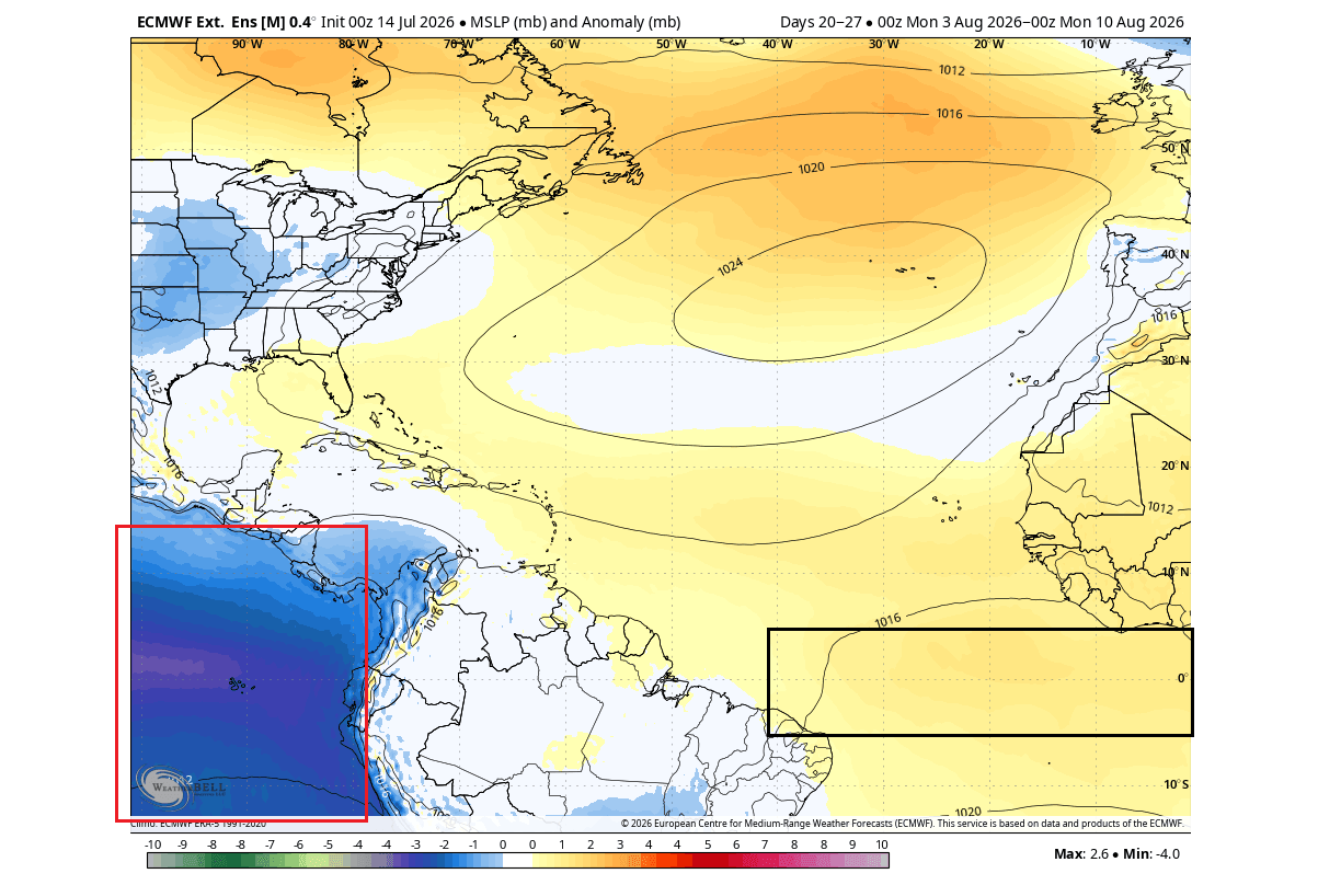
In meteorology, rising air (associated with low pressure) is the catalyst for cloud formation, rainfall, and tropical storm development. Conversely, sinking air (associated with high pressure) suppresses these processes, creating stable, dry conditions that are lethal to budding hurricanes.
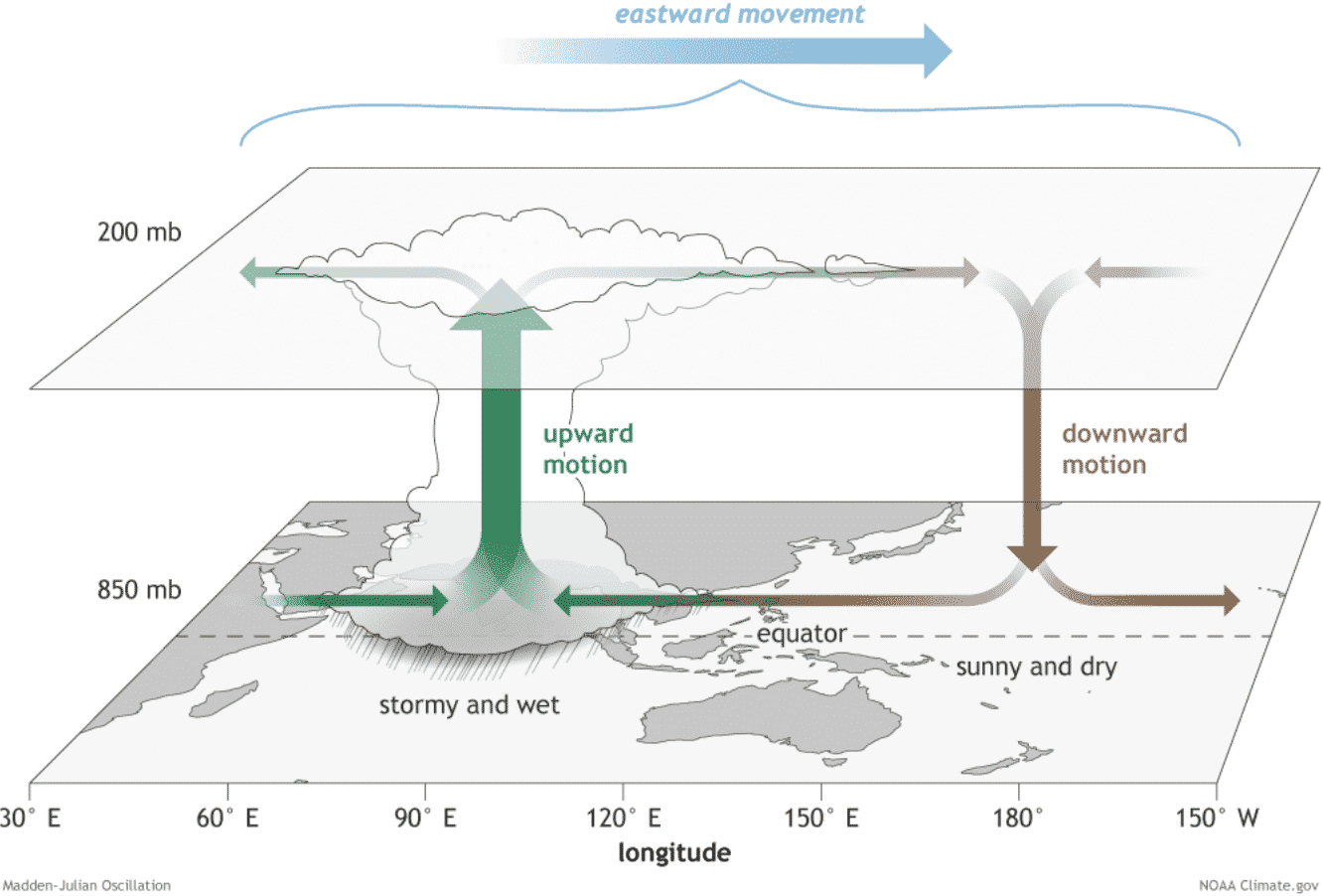
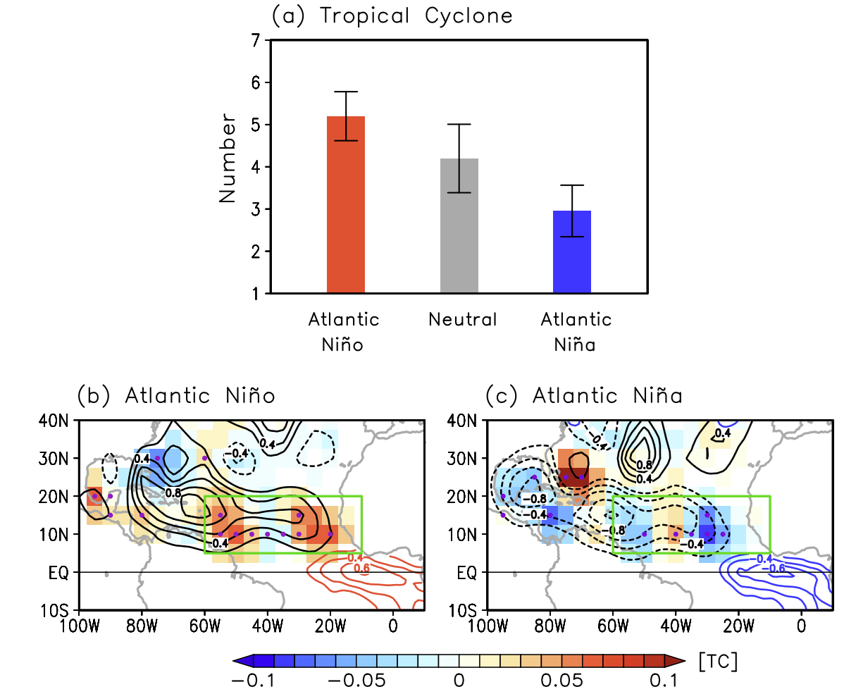
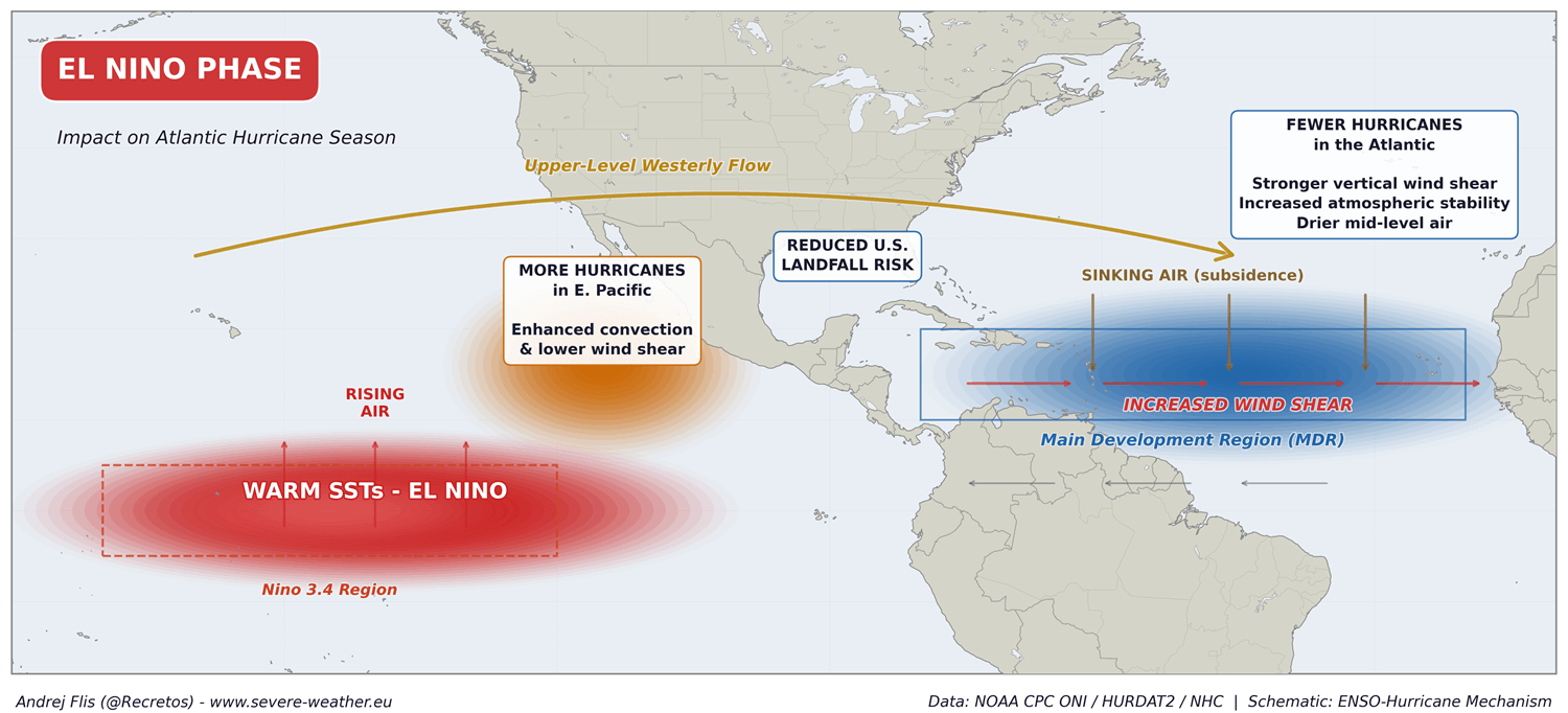
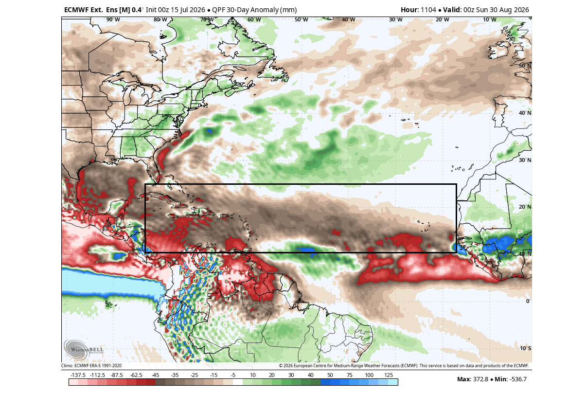
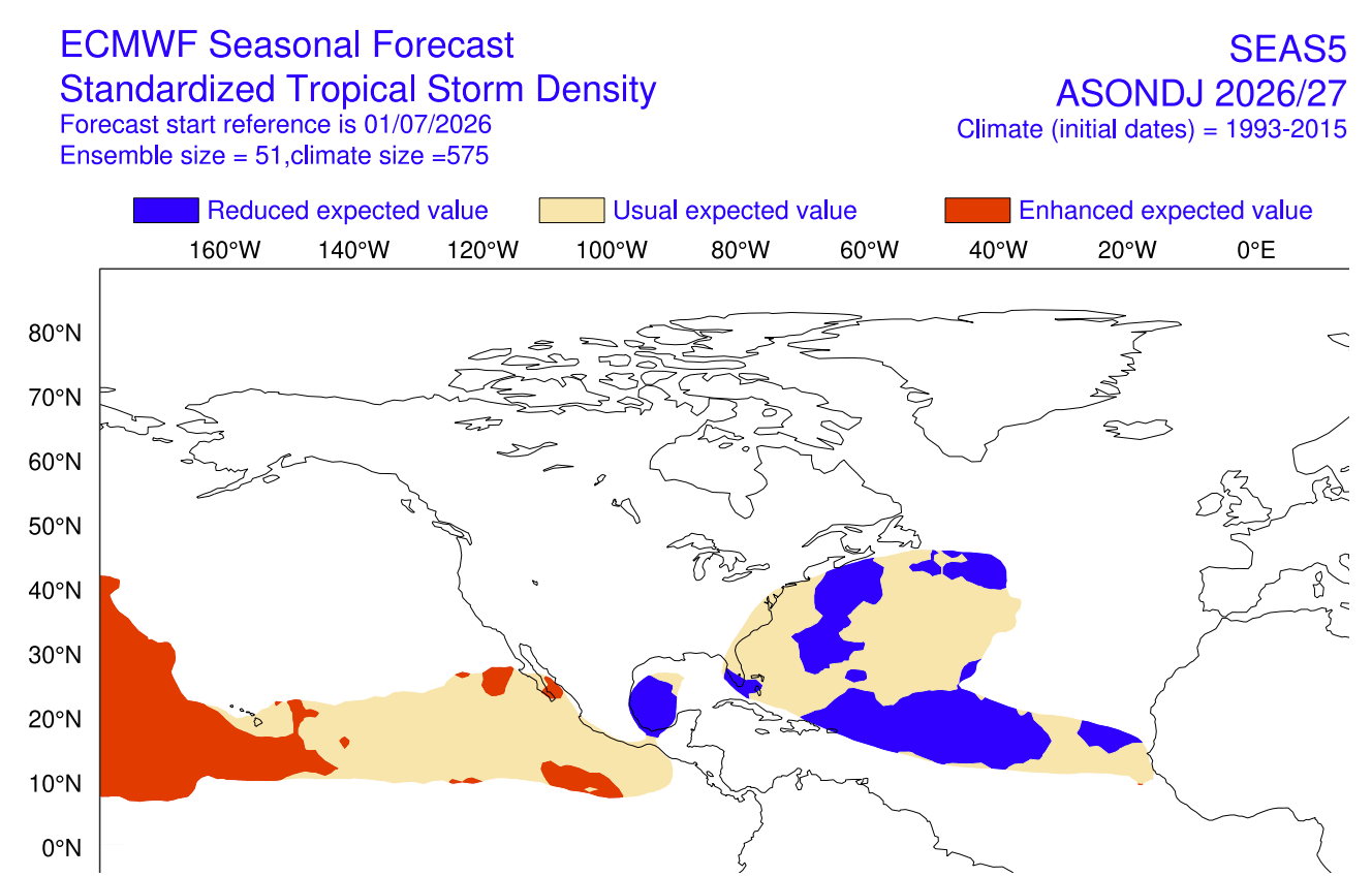
During a typical Atlantic Niña event, the atmosphere exhibits strong sinking motion over the Atlantic. This is compounded by the Pacific Super El Niño, which promotes rising air in the Pacific, effectively pulling the atmospheric energy away from the Atlantic’s "Main Development Region" (MDR). The MDR is essentially the nursery for Atlantic hurricanes; when it is subjected to suppressed convection and sinking air, the potential for tropical systems to organize and intensify drops significantly.
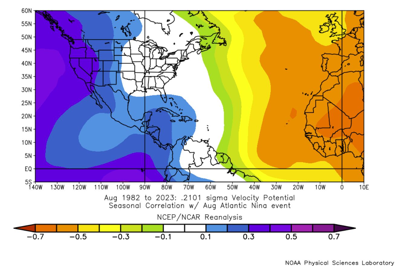
Furthermore, El Niño events are known to increase vertical wind shear—the change in wind speed or direction with height. High wind shear effectively decapitates developing tropical cyclones, preventing them from reaching maturity. When combined with the drier, more stable mid-level air provided by the Atlantic Niña, the environment becomes hostile to even the most persistent tropical waves.
Official Forecasts and the Risk of Landfall
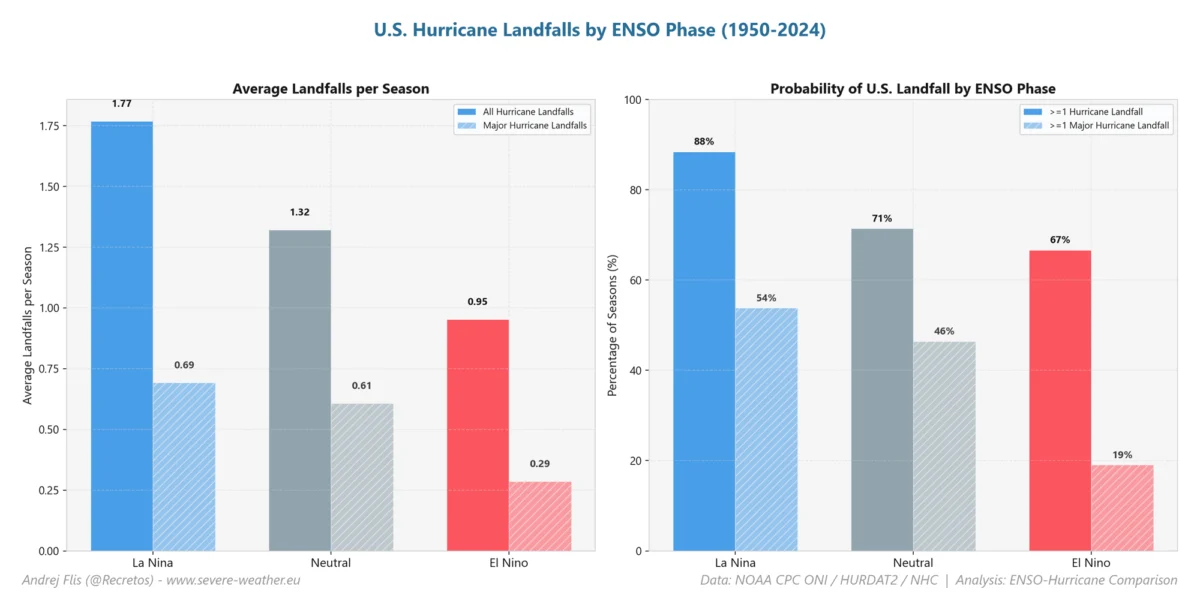
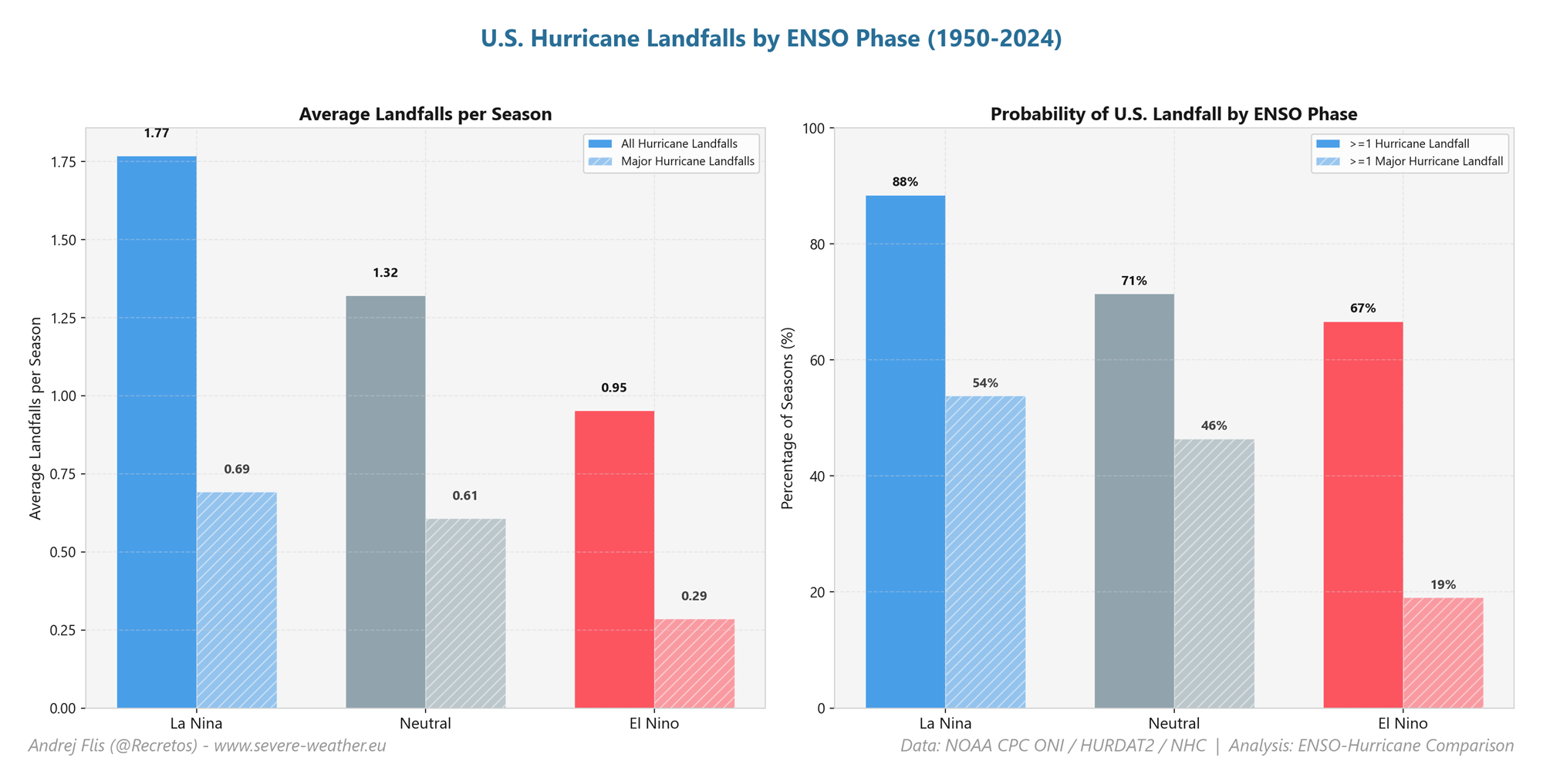
The latest seasonal outlooks, including those from the Colorado State University (CSU) tropical monitoring project led by Dr. Philip Klotzbach, emphasize a suppressed environment for the 2026 season. By comparing current probabilities against long-term historical averages, the data suggests that the hurricane landfall threat for the United States and southeast Canada is significantly lower than in a typical year.
Every coastal county from the Texas border at Brownsville up to the Canadian Maritimes is currently under a below-normal threat assessment. However, experts are quick to add a vital caveat: a lower risk is not a zero risk.
History is replete with examples of devastating storms occurring during "quiet" years. In 1992, an El Niño-suppressed season saw the arrival of Category 5 Hurricane Andrew. This serves as a sobering reminder that all it takes is one system to find a localized weakness in the atmospheric shield for a season to turn catastrophic.
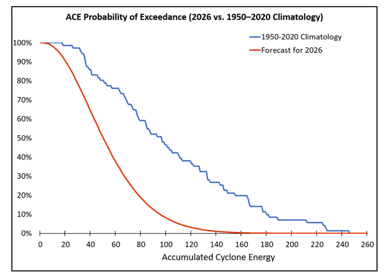
The Accumulated Cyclone Energy (ACE) index, which measures the total intensity and duration of storms throughout a season, is currently forecasted to remain well below the historical mean. While tropical systems will undoubtedly form, the consensus is that they will struggle to maintain longevity or intensity as they traverse the Atlantic.
Implications for Winter 2026/2027
Beyond the immediate concerns of the hurricane season, the current climate anomalies offer a window into the upcoming winter. There is a strong statistical correlation between a quiet, El Niño-influenced hurricane season and the behavior of the Polar Vortex in the following months.
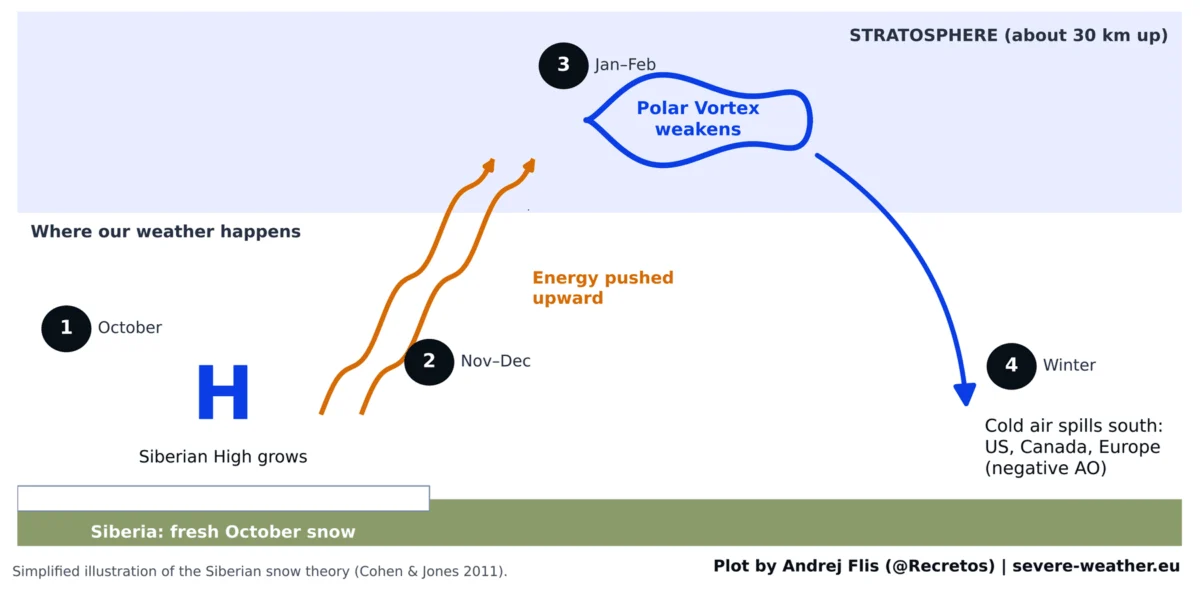
Following a slow hurricane season, data often points toward a warmer-than-normal stratosphere and a weaker, more prone-to-disruption Polar Vortex. When the Polar Vortex weakens, the jet stream becomes more erratic, failing to contain the frigid air of the Arctic. This allows polar air to spill into the mid-latitudes, often leading to severe winter outbreaks across the United States and Europe.
While the hurricane season does not "cause" the winter weather, both are responding to the same global atmospheric drivers. A weak Polar Vortex creates a disrupted jet stream pattern, which is the primary mechanism for the high-impact winter weather events that define a cold, snowy winter.
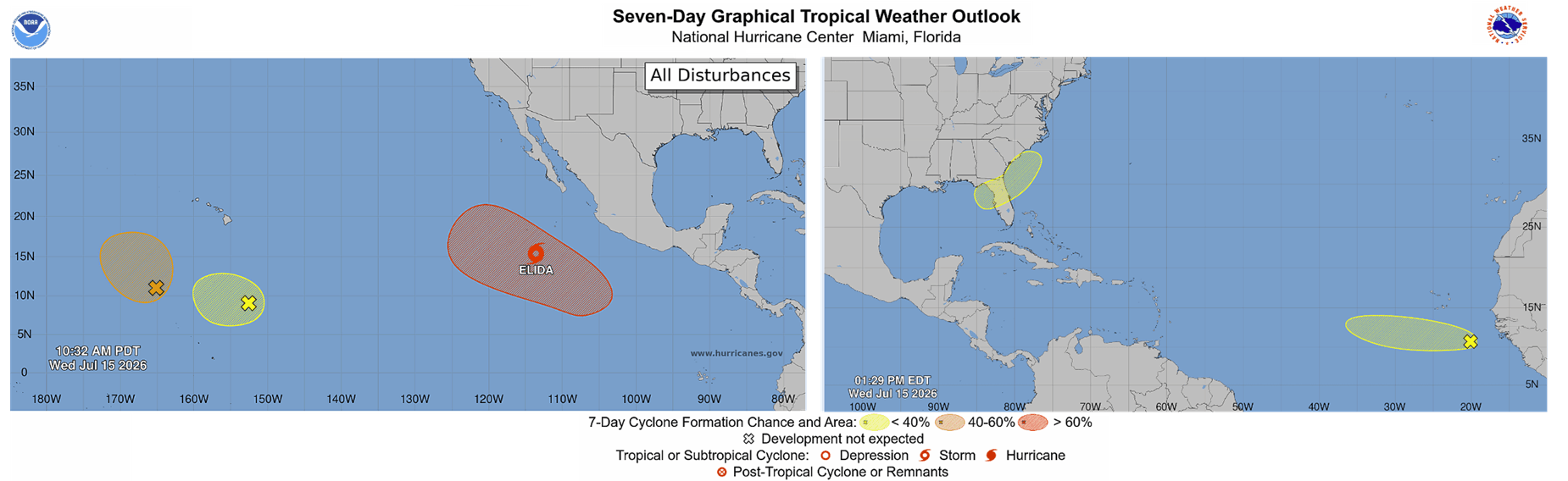
As we move through the remainder of the summer and into the fall, monitoring these trends remains critical. The atmosphere is currently in a state of delicate balance; the "atmospheric shield" currently protecting the United States from tropical threats may well be the precursor to a winter season defined by volatility and cold-air outbreaks.

Conclusion: A Window into Global Climate Dynamics
The simultaneous arrival of a rare Atlantic Niña and a Pacific Super El Niño provides a masterclass in global climate connectivity. By suppressing the tropical activity of the Atlantic, these anomalies are not merely affecting the summer months; they are seeding the atmosphere with the patterns that will likely dominate the global weather system into 2027.
While the reduced risk of hurricane landfalls is a positive development for coastal communities, the broader implications of these climate signals serve as a reminder of the Earth’s complex, interconnected nature. As we continue to track the evolution of these oceanic anomalies, the focus will shift from the tropical nursery of the Atlantic to the polar stratospheric conditions that will dictate the winter landscape. For now, the "atmospheric shield" remains firmly in place, offering a reprieve from the storms of the Atlantic, even as it prepares the stage for the winter to come.