As the Northern Hemisphere transitions from autumn into the deep freeze of winter, meteorologists have turned their eyes toward the stratosphere. A new Polar Vortex is currently organizing over the North Pole, exhibiting a rapid cooling trend and a significant pressure drop. While initial data suggests the vortex is beginning the season with more intensity than last year, long-range climate models are painting a complex and potentially volatile picture for Winter 2026/2027.

The emerging consensus among seasonal forecasters points toward a mid-winter slowdown of this atmospheric engine. Coupled with the development of a powerful "Super El Niño" in the Pacific, the upcoming winter may deviate significantly from the norm, with implications for energy markets, infrastructure, and public safety across the United States, Canada, and Europe.
The Engine of Winter: Understanding the Polar Vortex
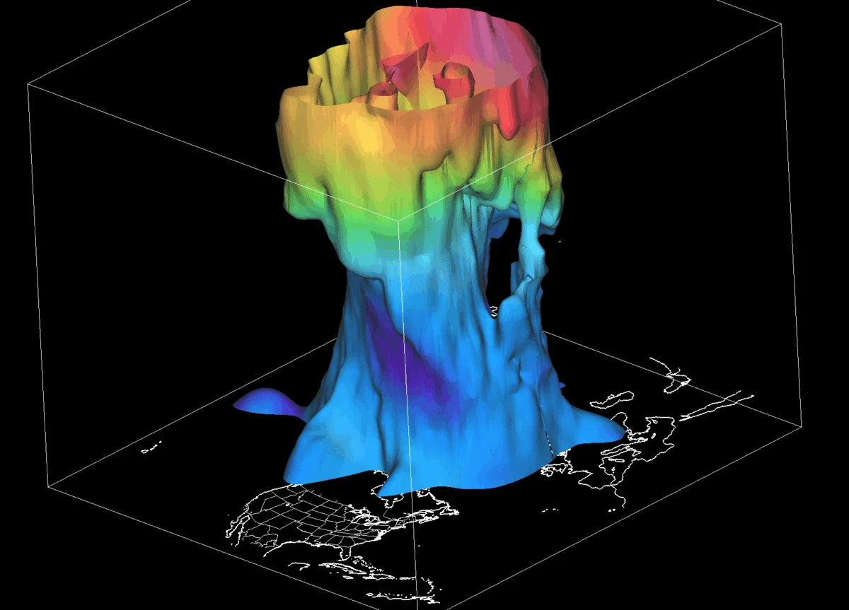
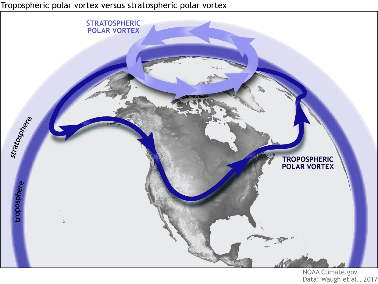
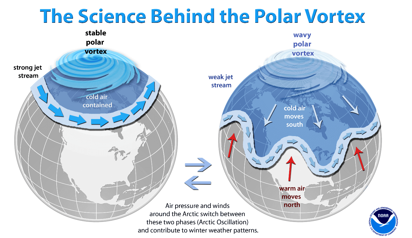
To grasp the stakes of the coming season, one must first understand the Polar Vortex. It is not a single storm, but rather a massive, persistent, and large-scale cyclone that circles the North Pole. It acts as a planetary "fence," trapping frigid Arctic air within the polar circle.
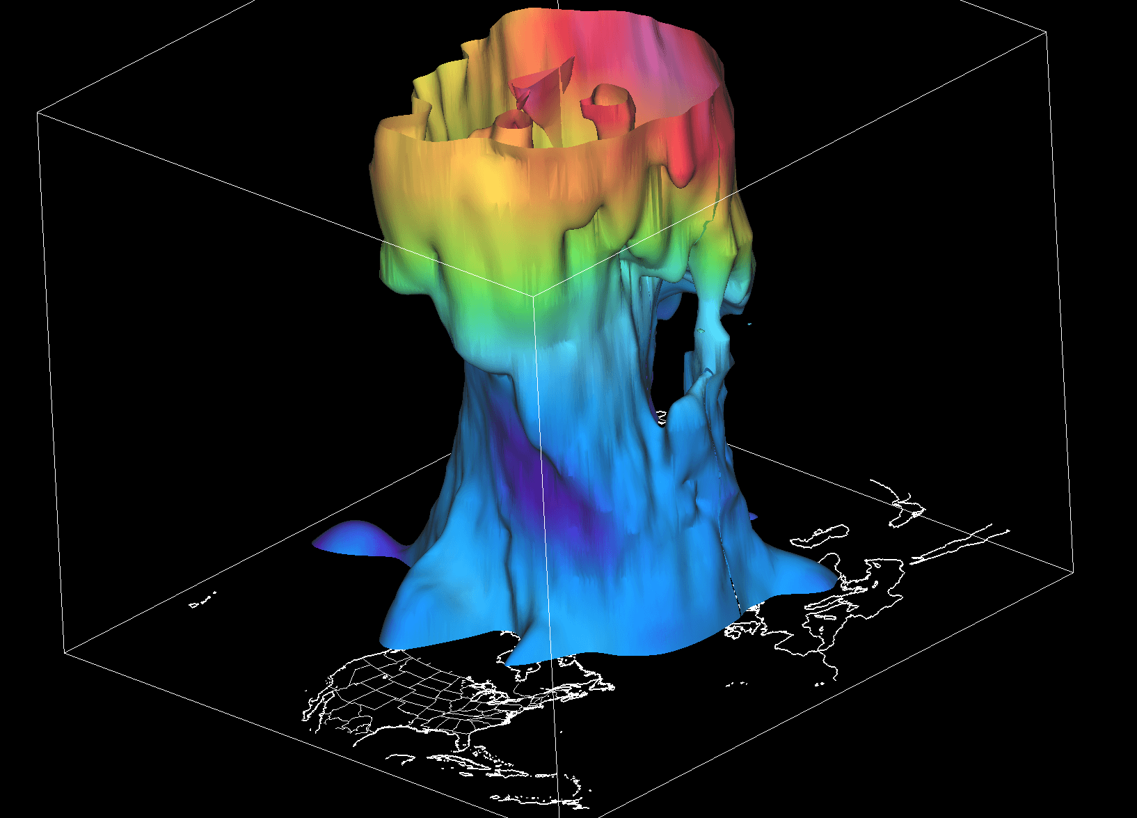
This circulation exists in two distinct layers: the stratosphere (the upper, more stable, and symmetrical layer) and the troposphere (the lower, more chaotic layer where we experience daily weather). The interaction between these two is critical. While the stratospheric vortex is often shielded from the surface, it influences the jet stream—the high-altitude river of air that dictates the movement of weather systems. When the vortex is strong, it keeps the jet stream tight and northern, bottling up the cold. When it weakens or becomes "wobbly," the jet stream meanders, allowing arctic air to spill deep into the mid-latitudes.
Chronology of the 2026/2027 Development
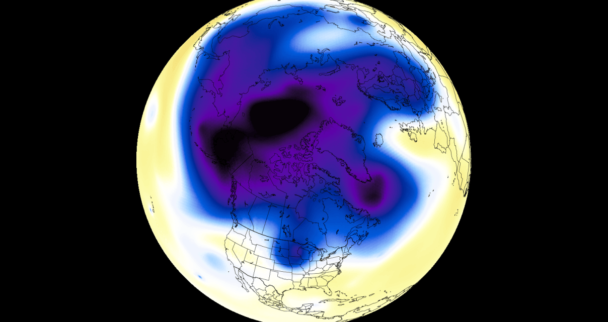
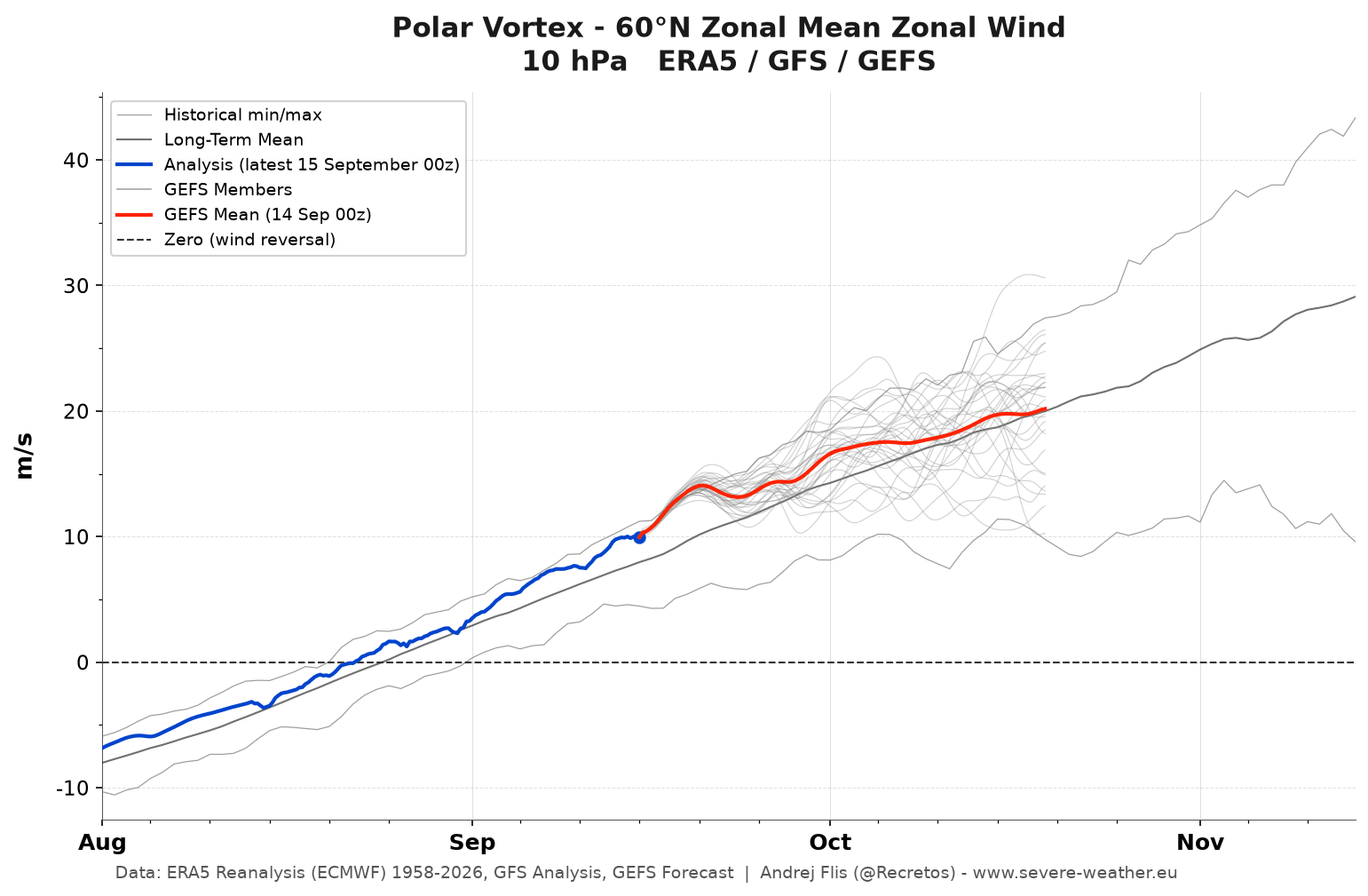
The formation of the Polar Vortex typically begins in late August, as the polar region enters the long darkness of the polar night. This loss of solar heating creates a steep temperature gradient between the pole and the tropics, driving a drop in atmospheric pressure and the birth of a cyclonic wind flow.
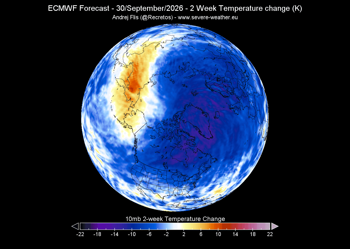
- September 2026: Initial data shows a standard, healthy development of the stratospheric vortex. Temperatures are cooling at the 10mb level (approximately 30km altitude), with a closed low-pressure core taking shape.
- October–November 2026: Forecasts indicate the vortex will continue to consolidate. The "stratospheric night jet"—a ring of high-speed winds—is expected to organize, marking the transition into full winter mode.
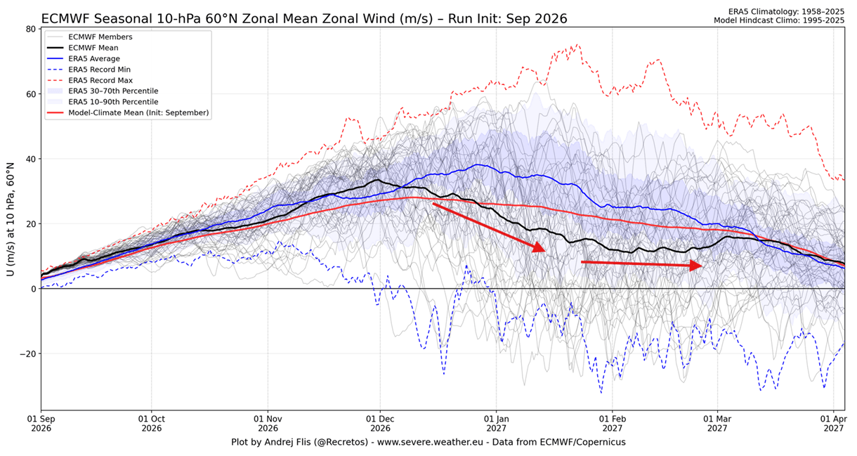
- December 2026: The early winter period is expected to remain relatively stable. However, signs of potential stress begin to appear in ensemble models.
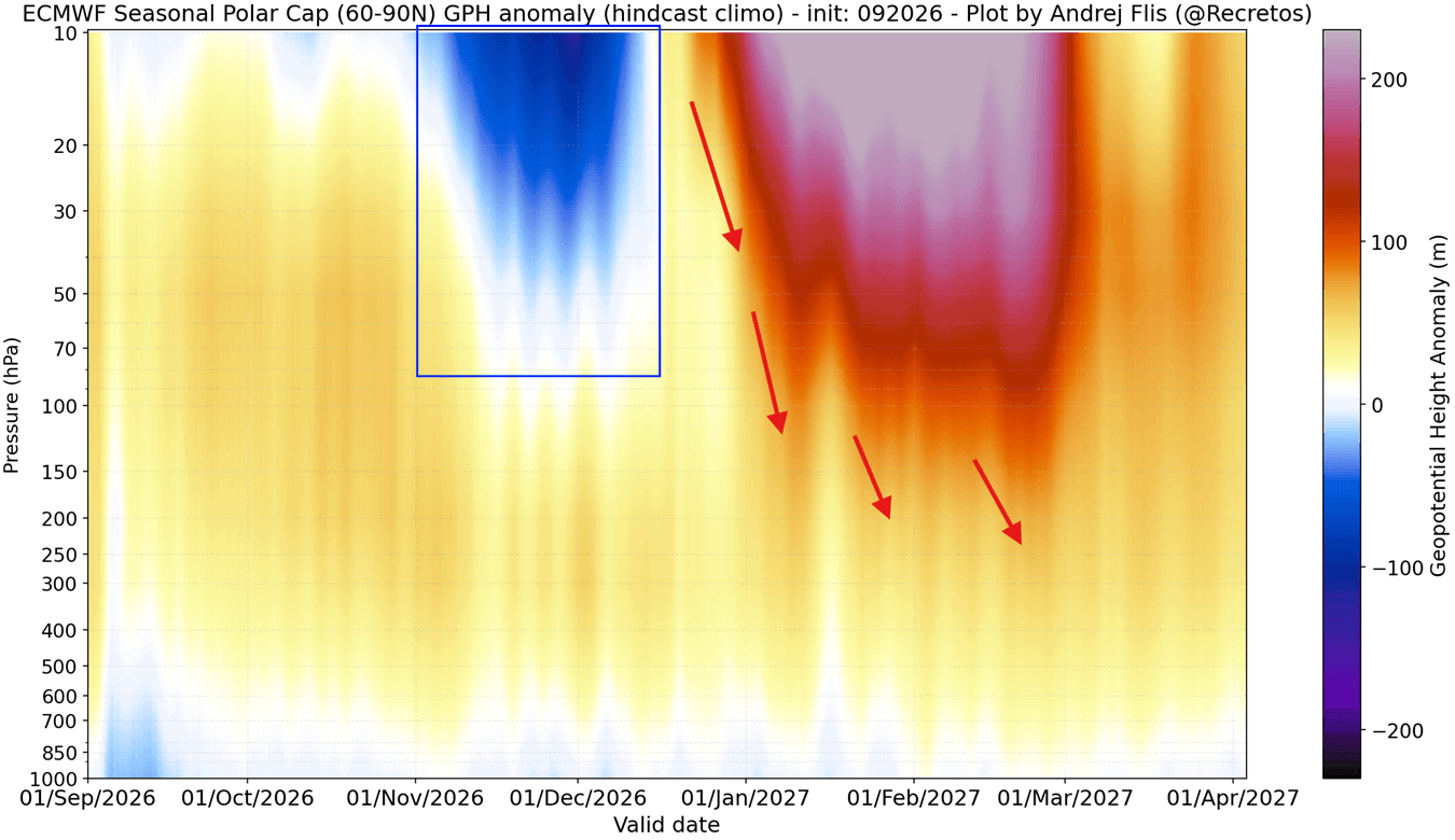
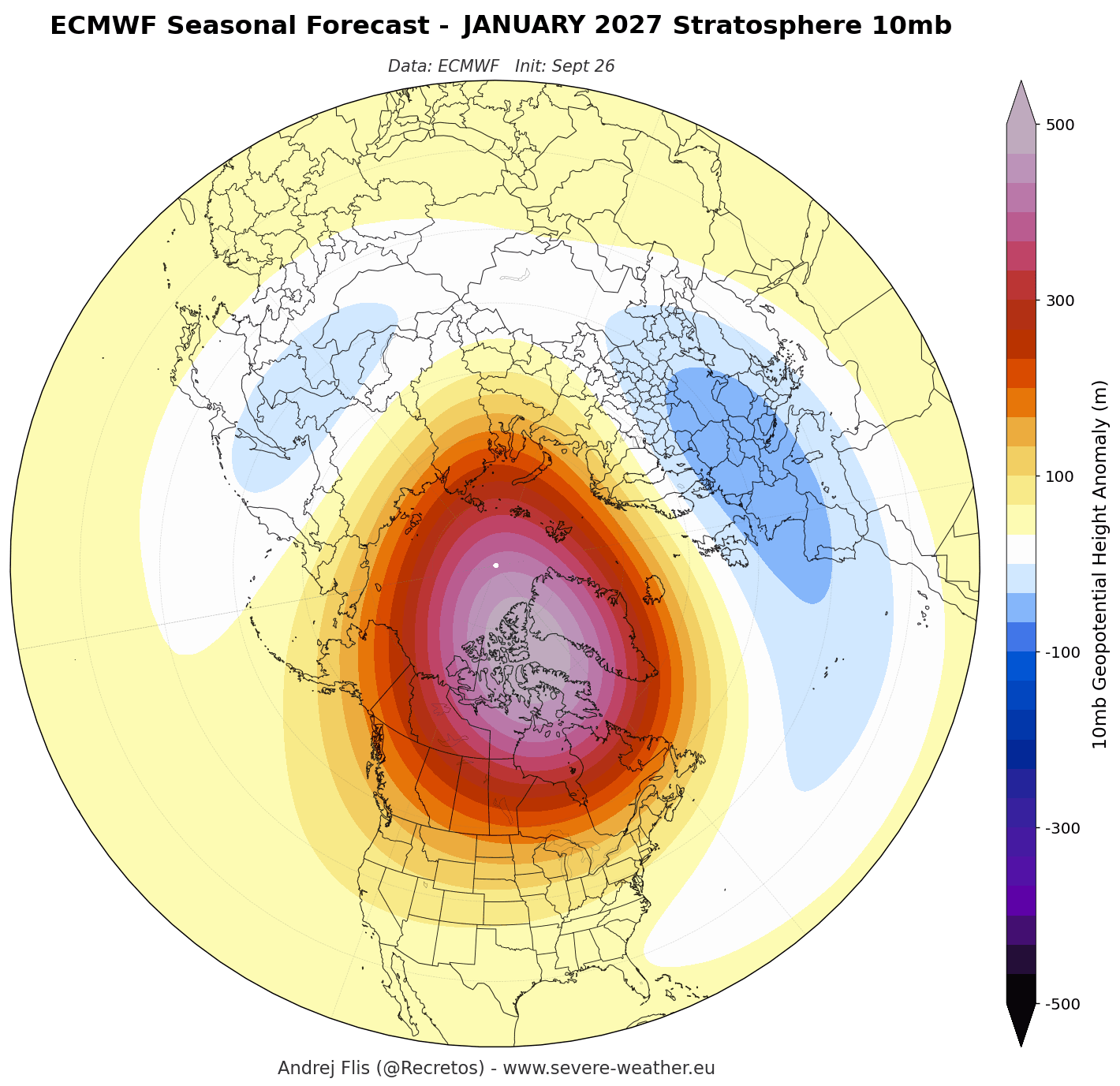
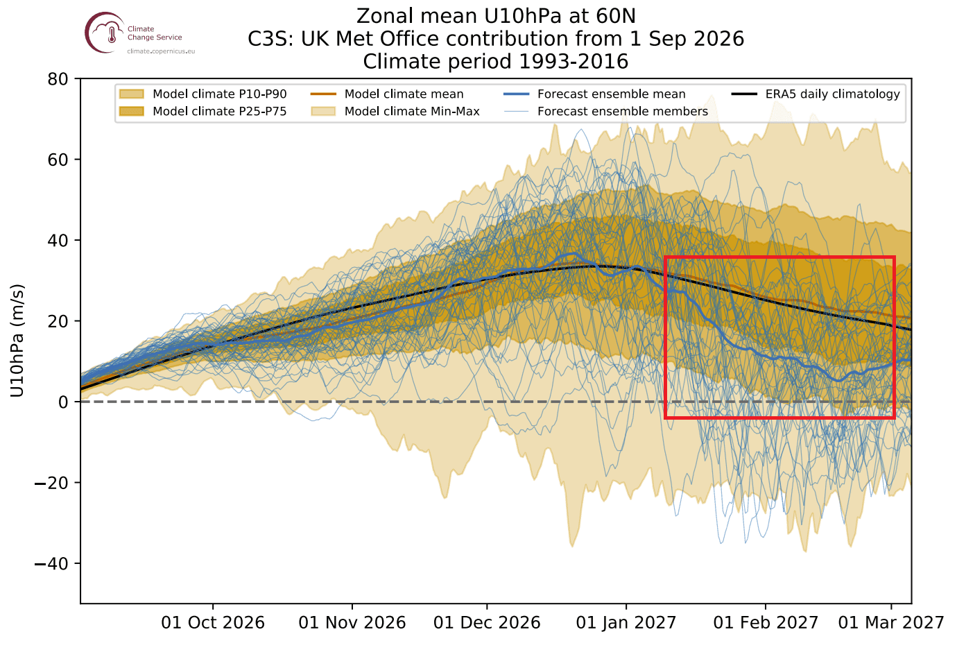
- January–February 2027: This is the projected "inflection point." Multiple seasonal models, including the ECMWF (European Centre for Medium-Range Weather Forecasts) and UKMO, indicate a deceleration of the zonal winds. This signal suggests a significant disruption in the stratospheric flow, potentially leading to a weakening of the vortex precisely when it should be at its peak.
Supporting Data: The Super El Niño Influence
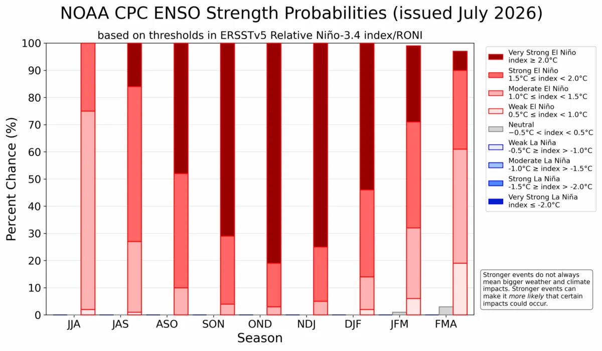
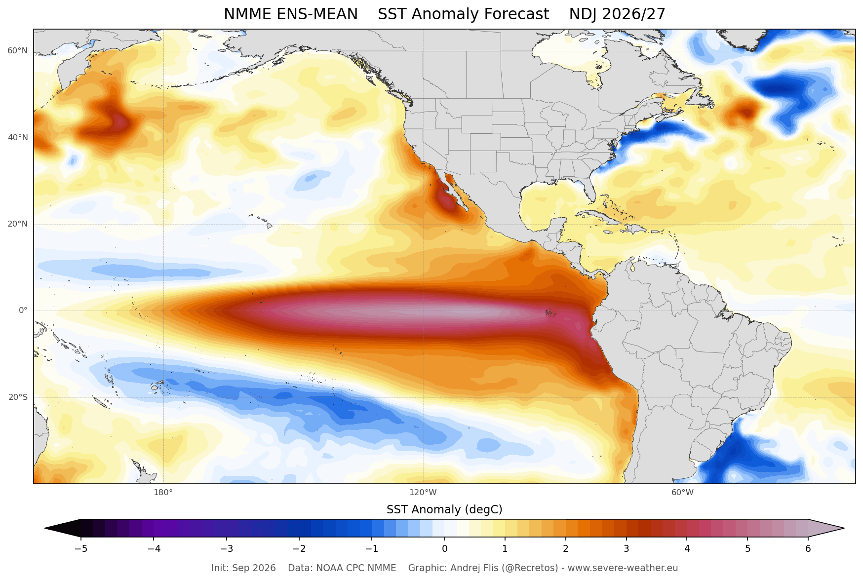
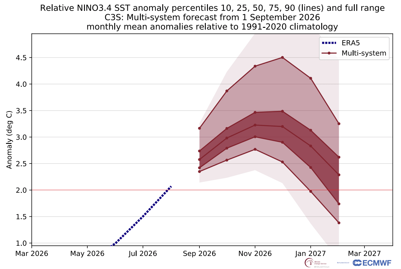
Perhaps the most significant variable this year is the development of a Super El Niño event in the Pacific. Ocean temperature anomalies in the tropical Pacific are forecasted to exceed +2°C, placing this event among the strongest recorded in the last several decades.
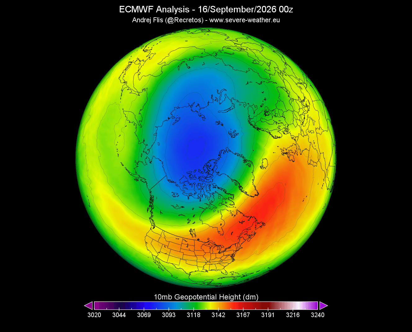
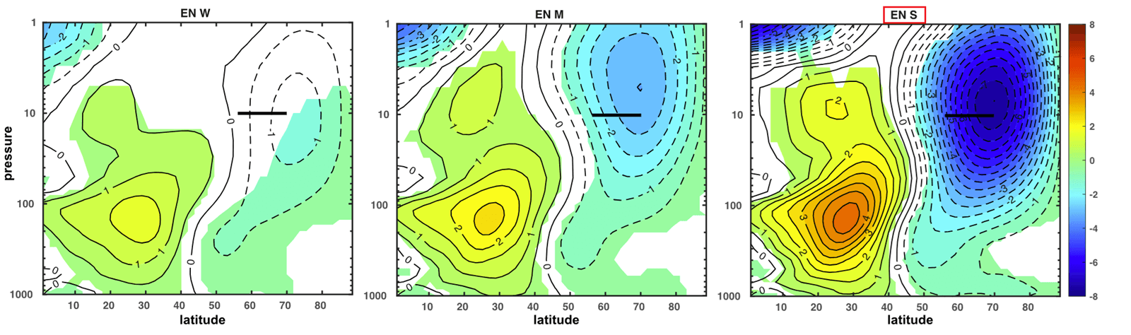
Scientific studies have consistently linked strong El Niño events to atmospheric wave activity that can propagate upward from the troposphere into the stratosphere. This "planetary wave" activity acts as a destabilizing force for the Polar Vortex. The data shows a clear correlation: during past Super El Niño years, the stratosphere frequently experiences a "deceleration event."
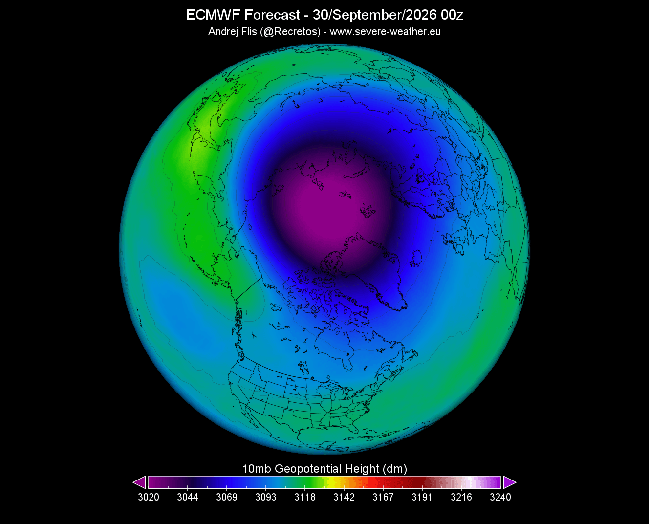
The mechanism is atmospheric: the El Niño-driven tropical circulation alters the global pressure distribution, creating anomalous high-pressure zones over the North Pacific and Greenland. This pressure configuration forces energy into the stratosphere, which can "bump" the vortex, causing it to displace from the pole or, in extreme cases, split into two separate cores.
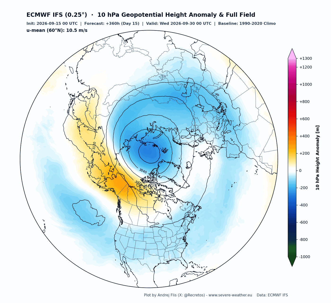
The "Collapse" Scenario: Sudden Stratospheric Warming (SSW)
The most extreme manifestation of a vortex disruption is a Sudden Stratospheric Warming (SSW) event. In this scenario, temperatures in the stratosphere spike by several tens of degrees in a matter of days. This warming destroys the vortex’s structural integrity.
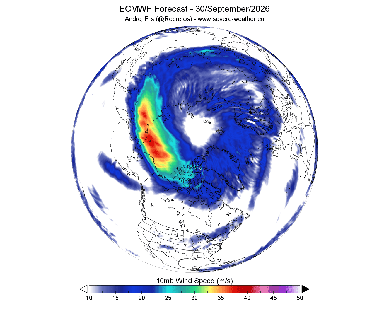
When the vortex undergoes a "collapse" or significant displacement, the consequences for the surface are usually delayed by 10 to 30 days. The atmospheric "memory" of this event translates into a fractured jet stream, which often triggers:
- The "Polar Express": Deep, sustained Arctic outbreaks across the central and eastern United States and southern Canada.
- European Cold Spells: Significant snowfall and freezing temperatures pushing into northern and central Europe.
- Blocking Patterns: Persistent high-pressure systems that lock in cold air, leading to multi-week periods of extreme winter weather.
Historically, displacement events (where the vortex moves away from the pole) have a different, often more sluggish impact than "split" events, which can cause more abrupt and violent shifts in weather patterns.
Implications for North America and Europe
The long-range forecast for Winter 2026/2027 suggests that the "stability" of the early season may be deceptive. If the current model trends regarding the Super El Niño hold, the mid-to-late winter period will be characterized by high volatility.
For the United States and Canada, this implies a high risk for late-season cold outbreaks. While a warm start is common during El Niño years, the potential for a mid-winter vortex disruption introduces a "wildcard" that can undo seasonal warming trends in just a few days. Historically, such disruptions have led to record-breaking energy demand and travel disruptions.
For Europe, the impacts are similarly significant. A disrupted vortex often forces the North Atlantic Oscillation (NAO) into a negative phase, which is frequently associated with cold, easterly winds bringing Siberian air masses into the heart of the continent.
Expert Analysis and Official Monitoring
The meteorological community is exercising caution. While the signals for a mid-winter disruption are robust, the chaotic nature of the atmosphere means that exact timing remains impossible to predict at this range.
"We are seeing the early warning signs of a very dynamic winter," says the lead analyst at Severe Weather Europe. "The combination of a strong start to the vortex followed by a predicted mid-season breakdown is a setup we have seen in previous high-impact years. The Super El Niño acts as an amplifier, making the system more sensitive to these disruptions."
Government agencies, including NOAA and the Copernicus Climate Change Service, continue to monitor the 10mb pressure levels and the zonal wind speeds. As we approach December, these institutions will provide updated seasonal outlooks that integrate real-time satellite data with the evolving ENSO (El Niño-Southern Oscillation) state.
Conclusion: Preparing for Volatility
The Winter 2026/2027 season is shaping up to be a test of climate model accuracy. Residents of the Northern Hemisphere should prepare for a season that may be defined by its "bumpy" nature—a transition from a strong, cold-trapping start to a potentially chaotic mid-winter period.
Whether the vortex experiences a full "collapse" or merely a series of structural deformations, the message from the current data is clear: the atmospheric conditions are ripe for significant winter weather events. As always, the best approach is to monitor regional, short-to-medium-range forecasts as the season progresses, as these will provide the necessary detail on how the large-scale stratospheric signals will manifest at the local level.