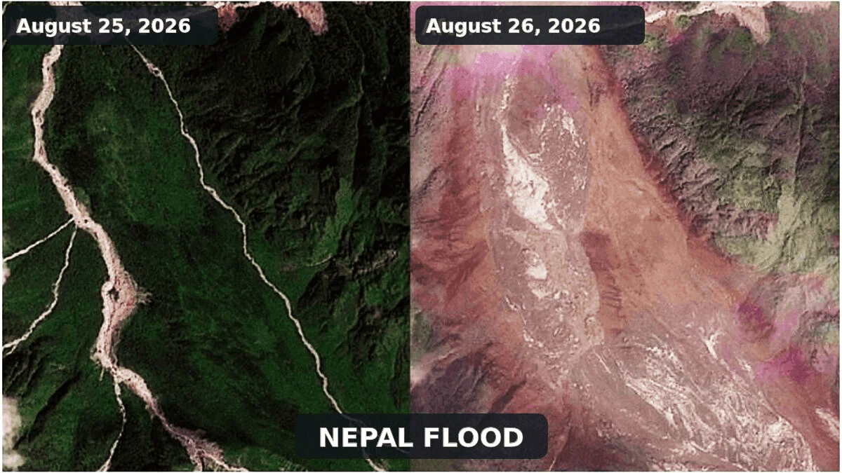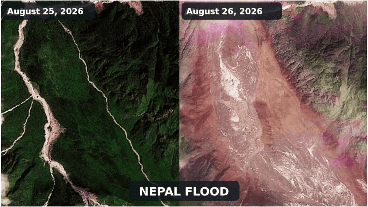
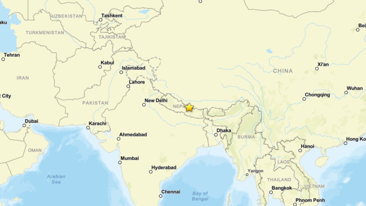
On August 26, 2026, the transboundary Bhote Koshi-Trishuli river system became the site of a violent, high-magnitude disaster. A massive surge of water, mud, and boulders tore through the steep, narrow Himalayan valleys along the Nepal-Tibet border, obliterating infrastructure, burying remote settlements, and claiming at least 160 lives. As rescue operations continue amidst treacherous terrain, scientific analysis has begun to peel back the layers of this tragedy, revealing a complex, multi-stage geophysical cascade that challenges initial assumptions about the nature of the event.
Main Facts: The Anatomy of a Mountain Cascade
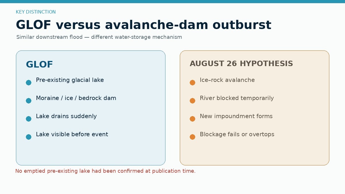
The disaster originated in the upper reaches of the Lhende Khola, a vital tributary of the Bhote Koshi. Satellite imagery and seismic data have coalesced into a primary hypothesis: a catastrophic ice and rock avalanche detached from a high-altitude, glacierised slope. This massive volume of debris—a chaotic mixture of bedrock, glacier ice, and snow—descended with enough force to temporarily dam the river channel.
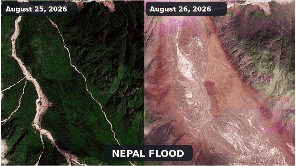
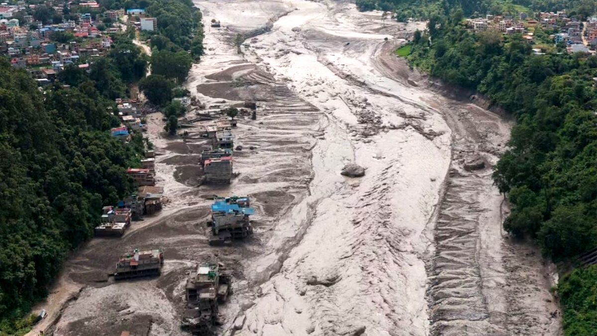
When this unstable, permeable dam inevitably failed, it unleashed a torrent of sediment-rich water downstream. The surge, which reportedly saw river levels on the Trishuli rise by nine meters in less than 30 minutes, acted as a "conveyor belt" for debris, scouring the riverbed and banks as it gained momentum.
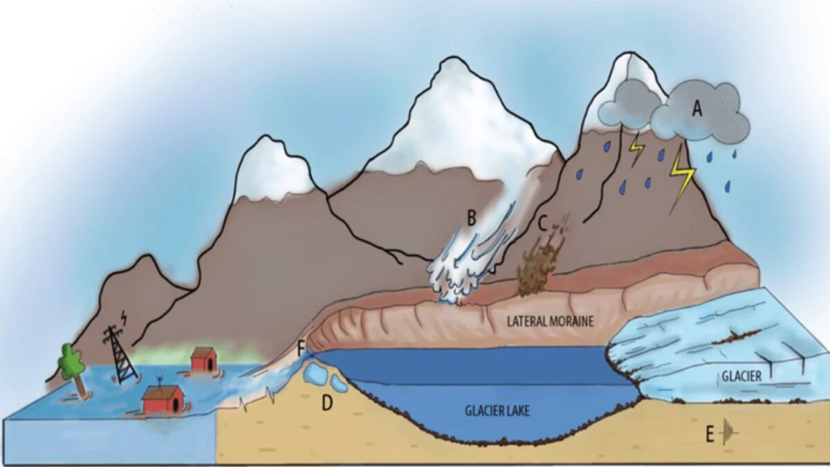
Crucially, experts have clarified that this event was likely not a Glacial Lake Outburst Flood (GLOF), as initially suspected. A GLOF requires the sudden drainage of a pre-existing lake, a phenomenon not supported by current evidence. Instead, this was a landslide-dam outburst flood—a distinct and equally dangerous process where the river itself is obstructed by a falling mass of mountain material, creating a short-lived, unstable reservoir that eventually bursts.
Chronology: From Seismic Misinterpretation to Reality
The timeline of the event is marked by a significant shift in scientific understanding.
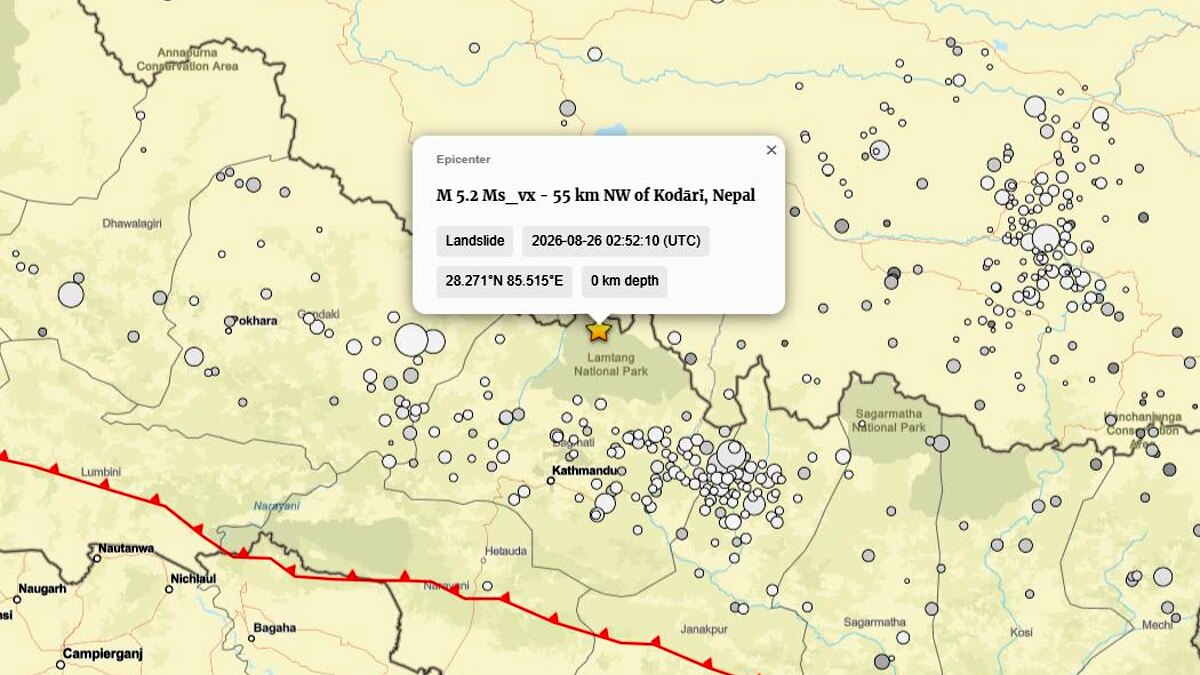
- Initial Alert: In the immediate aftermath, global seismic networks—specifically the U.S. Geological Survey (USGS)—recorded a signal that appeared to be a magnitude 4.4 earthquake near the border. In regions prone to tectonic activity, an earthquake is often the default culprit for large-scale slope failures.
- The Reclassification: As seismic analysts reviewed the waveforms, the interpretation changed. The USGS eventually reclassified the event (event us7000tbwb) as a magnitude 5.2 landslide. This means the shaking was not the cause of the disaster, but the result of the sheer volume of mass moving downslope. The earth didn’t quake to cause the slide; the slide was so powerful it caused the earth to quake.
- The Surge: Following the failure of the debris dam in the Lhende Khola, the flood wave propagated downstream through the Rasuwa district, arriving in populated areas with little to no warning.
- Ongoing Crisis: By the end of August 26, local authorities and international observers confirmed 160 deaths, with hundreds still missing. Access to the affected areas remains severely hampered by destroyed roads and severed communication lines, leading experts to fear the true casualty count may be significantly higher.
Supporting Data: Scientific Modeling and Comparative Analysis
To understand the magnitude of this disaster, geologists are drawing parallels to recent catastrophic events in the Alps, which serve as a "canary in the coal mine" for high-mountain stability.
The Marmolada and Blatten Precedents
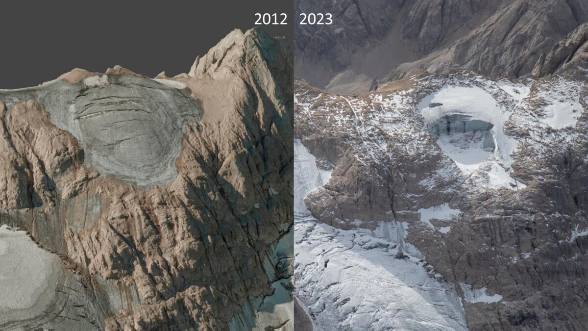
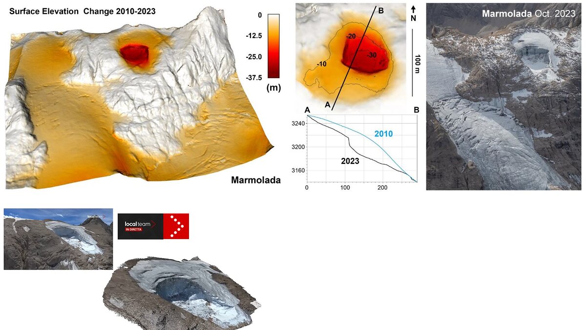
The 2022 collapse of the Marmolada Glacier in Italy, which claimed 11 lives, provided researchers with a blueprint for how ice-and-rock avalanches function in the absence of a seismic trigger. Like the Lhende Khola event, Marmolada was driven by a combination of hydrostatic pressure within crevasses, thermal stress, and reduced basal friction.
An even more striking parallel is the May 2025 disaster in Blatten, Switzerland. In that instance, 9.5 million cubic meters of material—mostly rock and ice—collapsed and dammed the Lonza River. The Blatten event, documented extensively by the Swiss Glacier Bulletin (GLAMOS), demonstrated the "domino effect" where progressive rock failure destabilizes a glacier, leading to a massive, combined collapse. The Lhende Khola disaster appears to follow this same cascading mechanical process.
The Role of Seismic Waveforms
The distinction between an earthquake and a landslide-generated seismic signal is critical. Tectonic earthquakes produce sharp, high-frequency signals. Landslides, conversely, produce longer-duration, lower-frequency signals caused by the friction and momentum of moving rock and ice. The USGS reclassification validates that the Himalayan event was a gravity-driven mass movement, not a subterranean tectonic shift.
Official Responses and Humanitarian Challenges
Governmental agencies in both Nepal and China have mobilized search and rescue teams, but the scale of the destruction has made their task monumental. Hydroelectric projects, which are essential to the regional economy, have been severely impacted, with facilities either buried under sediment or destroyed by the initial impact.
The international community, led by organizations such as ICIMOD (International Center for Integrated Mountain Development), is currently conducting high-resolution satellite analysis to determine if any remaining debris in the Lhende Khola poses a secondary threat. Because the original dam was composed of irregular, highly permeable material, there is a risk of a "secondary burst" if the remaining mass continues to impound water or if further rainfall destabilizes the channel.
Implications: A New Era of High-Altitude Hazards
The Nepal-Tibet disaster is a grim reminder of the changing nature of the world’s "Third Pole."
Climate Change and the Baseline
While it is premature to attribute this single event directly to climate change, the environmental baseline of the Himalayas is undeniably shifting. Longer periods of positive temperatures at extreme altitudes have led to:
- Permafrost Degradation: This weakens the "glue" that holds high-altitude rock joints together.
- Glacier Thinning: As glaciers retreat, they leave behind steep, unsupported valley walls.
- Increased Meltwater: Enhanced runoff penetrates deeper into mountain fractures, increasing water pressure and accelerating the failure of slopes that may have been stable for centuries.
The Transboundary Warning Gap
Perhaps the most urgent implication of this disaster is the challenge of transboundary communication. Natural hazards do not recognize political borders; a disaster beginning in Tibet can manifest as a deadly flood in Nepal within minutes. Current warning systems, which focus primarily on monitoring established glacial lakes, are inadequate for the rapid, unpredictable nature of avalanche-dam outburst floods.
There is a desperate need for a more integrated monitoring network. This would include:
- Automated Sensor Arrays: Real-time water-level and seismic sensors placed in high-risk, uninhabited tributaries.
- Early Warning Systems (EWS): Transboundary protocols that trigger immediate downstream evacuations based on automated detection of mass movements, rather than waiting for human confirmation.
- Infrastructure Resilience: Hardening critical infrastructure like bridges and hydropower plants to withstand higher sediment loads and flood peaks.
Conclusion: Understanding the Cascade
The August 26 catastrophe was not a freak occurrence, but a sophisticated, multi-process disaster. By shifting the focus from the simplistic label of a "GLOF" to a more accurate understanding of an "ice-and-rock avalanche-induced landslide-dam outburst," scientists are better equipped to model future risks.
The tragedy highlights that we are entering a period where the high mountains are becoming increasingly dynamic. The physical mechanics—the crumbling of permafrost, the acceleration of glacier ice, and the subsequent damming of river valleys—are becoming more frequent as the climate warms. For the communities living in the shadow of the Himalayas, the lesson is clear: the geography they rely upon is changing beneath their feet. Monitoring must evolve from static lake inventories to dynamic, real-time surveillance of these fragile mountain systems. As the rescue efforts conclude, the global scientific community must prioritize the development of these advanced warning frameworks to ensure that the next cascade does not result in such a devastating loss of life.