Every October, as the first frosts settle over the vast, windswept plains of Eurasia, a familiar debate reignites across meteorological forums and social media. The core question remains constant: Is the rapid expansion of snow cover across Siberia a definitive early-warning signal for a brutal, high-impact winter in the United States, Canada, and Europe?
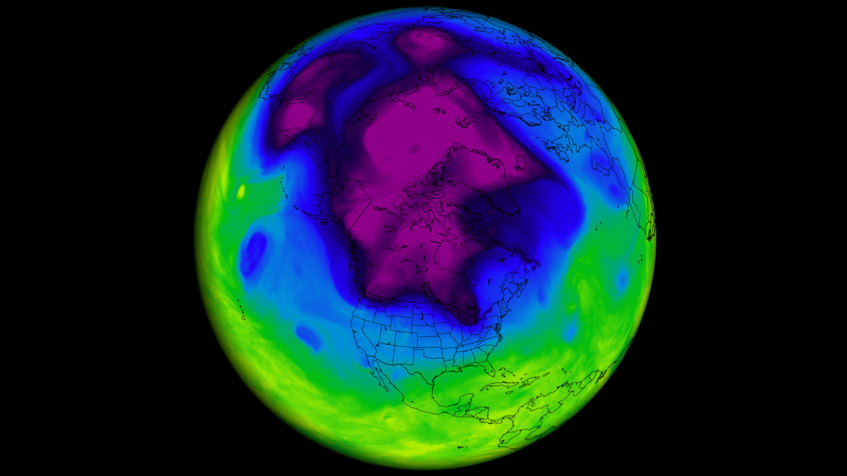
For over a decade, this "Siberian Snow Theory" has been the bedrock of long-range seasonal forecasting. Proponents suggest that the cooling effect of autumn snow acts as a precursor to a disrupted Polar Vortex, effectively "loading the dice" for extreme winter weather. However, as we look toward the 2026/2027 season, a comprehensive analysis of 47 years of climate data suggests that this once-reliable barometer may be losing its predictive power in a rapidly warming world.
The Genesis of a Meteorological Theory
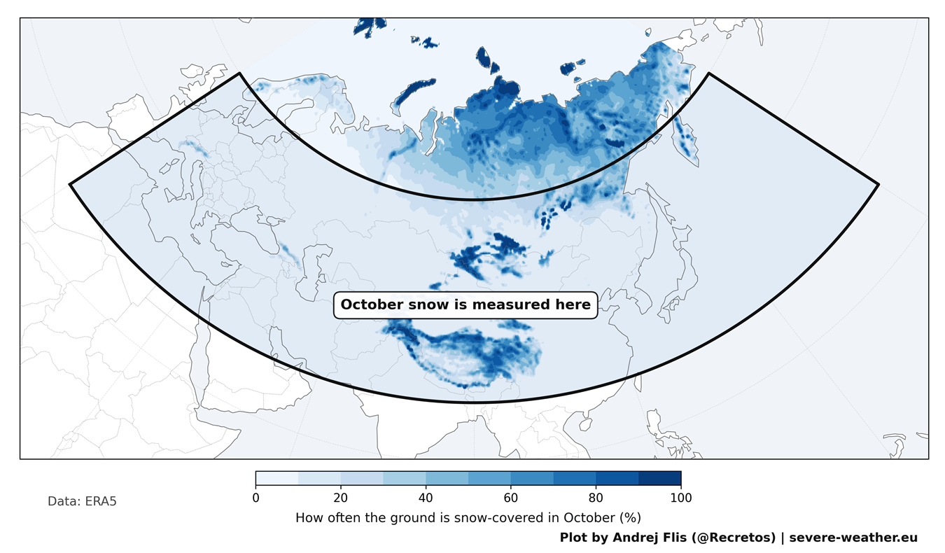
In 2011, climatologists Judah Cohen and Justin Jones published a seminal study that forever changed long-range forecasting. Their research identified a direct correlation between the rate of October snow cover expansion across Eurasia—stretching from Western Europe to the Pacific—and the state of the following winter’s Polar Vortex.
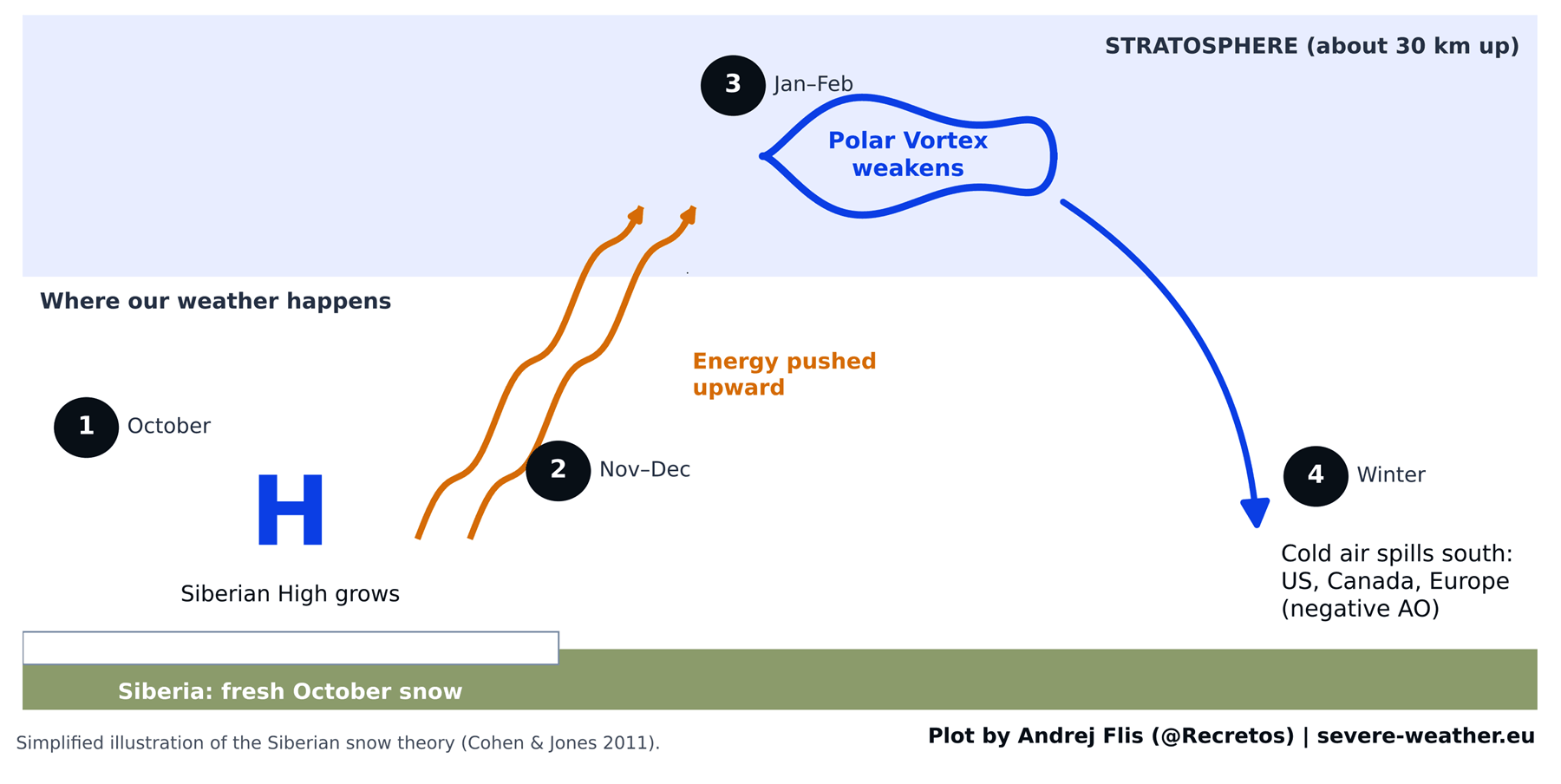
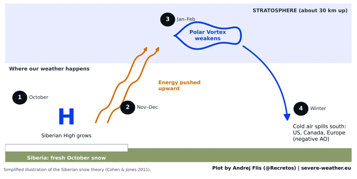
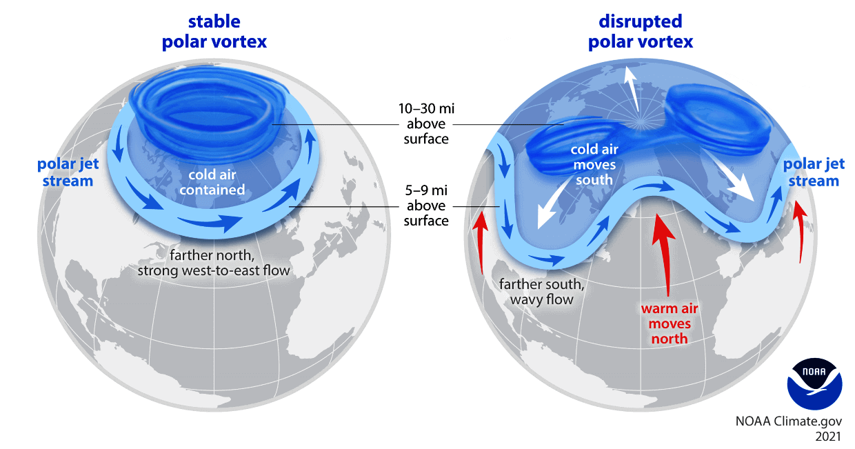
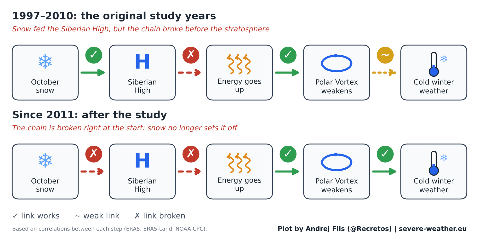
The logic is elegant in its simplicity: Fresh, extensive snow cover in Siberia enhances the Siberian High, a massive semi-permanent pressure system. This high-pressure buildup generates upward-propagating energy waves that travel 30 kilometers into the stratosphere. These waves can destabilize the Polar Vortex—a massive, circular atmospheric engine that traps the coldest air at the North Pole. When the vortex weakens or "stretches," the Arctic air is no longer contained, allowing it to spill southward into the mid-latitudes, bringing intense cold and heavy snowfall to North America and Europe.
A 47-Year Chronology: Testing the Signal
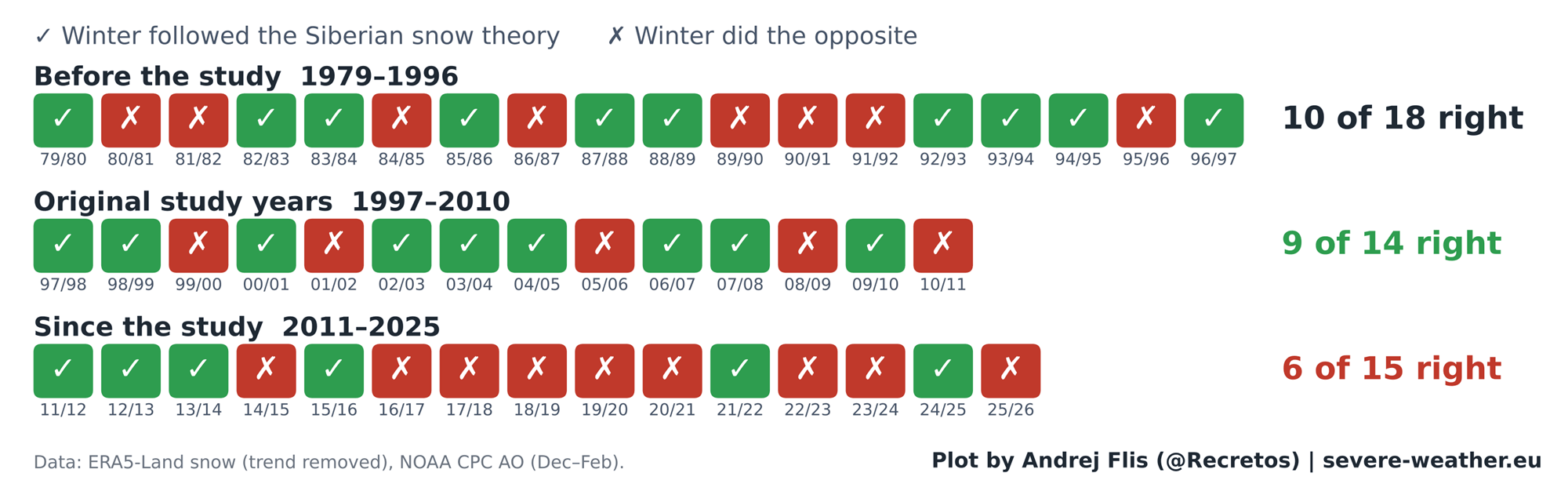
To determine if this theory still holds in the modern era, I conducted an exhaustive review of four distinct snow datasets covering the period from 1979 to 2025. By testing the hypothesis against 15 years of new data that did not exist when the original study was published, we gain a rare look at the durability of climate signals.
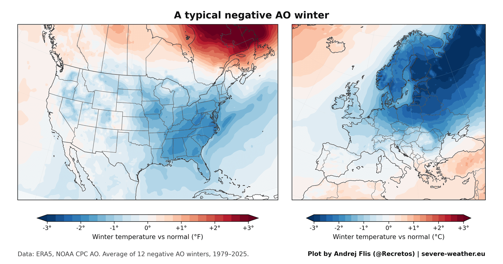
The Peak Years (1997–2010)
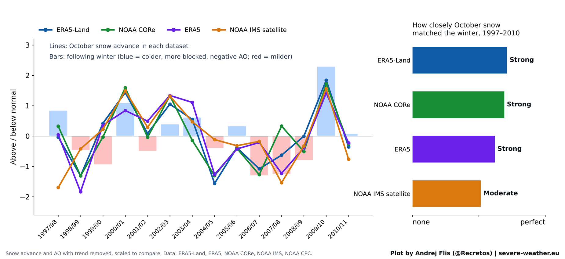
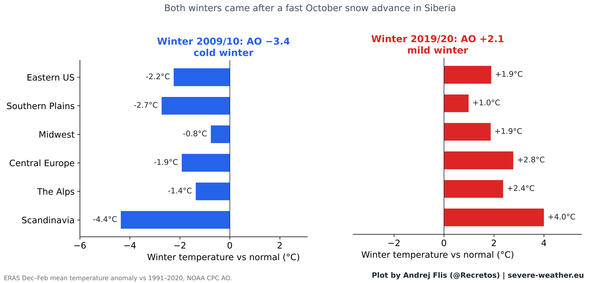
The period surrounding the 2011 study confirmed the theory’s brilliance. The data showed a robust, undeniable link between October snow trends and the subsequent winter’s Arctic Oscillation (AO). During these years, a fast snow advance was a highly accurate predictor of a negative AO phase, characterized by "wobbly" vortexes and severe winter outbreaks. The 2009/2010 winter, which featured a massive Siberian snow surge followed by historic snowstorms in the Eastern United States, served as the "poster child" for this atmospheric phenomenon.
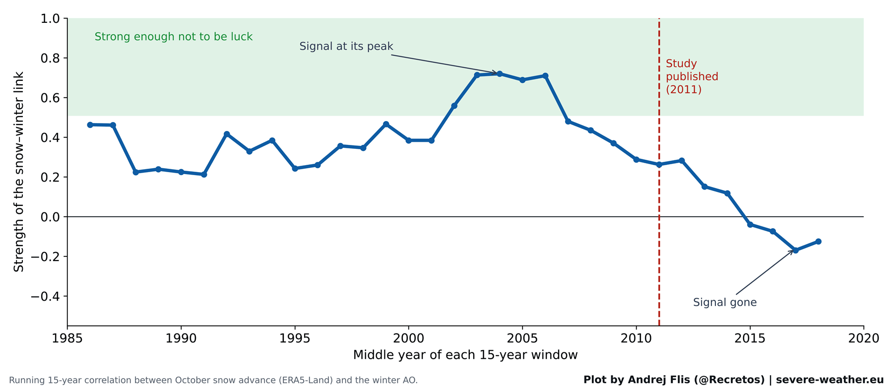
The Signal Decay (2011–2025)
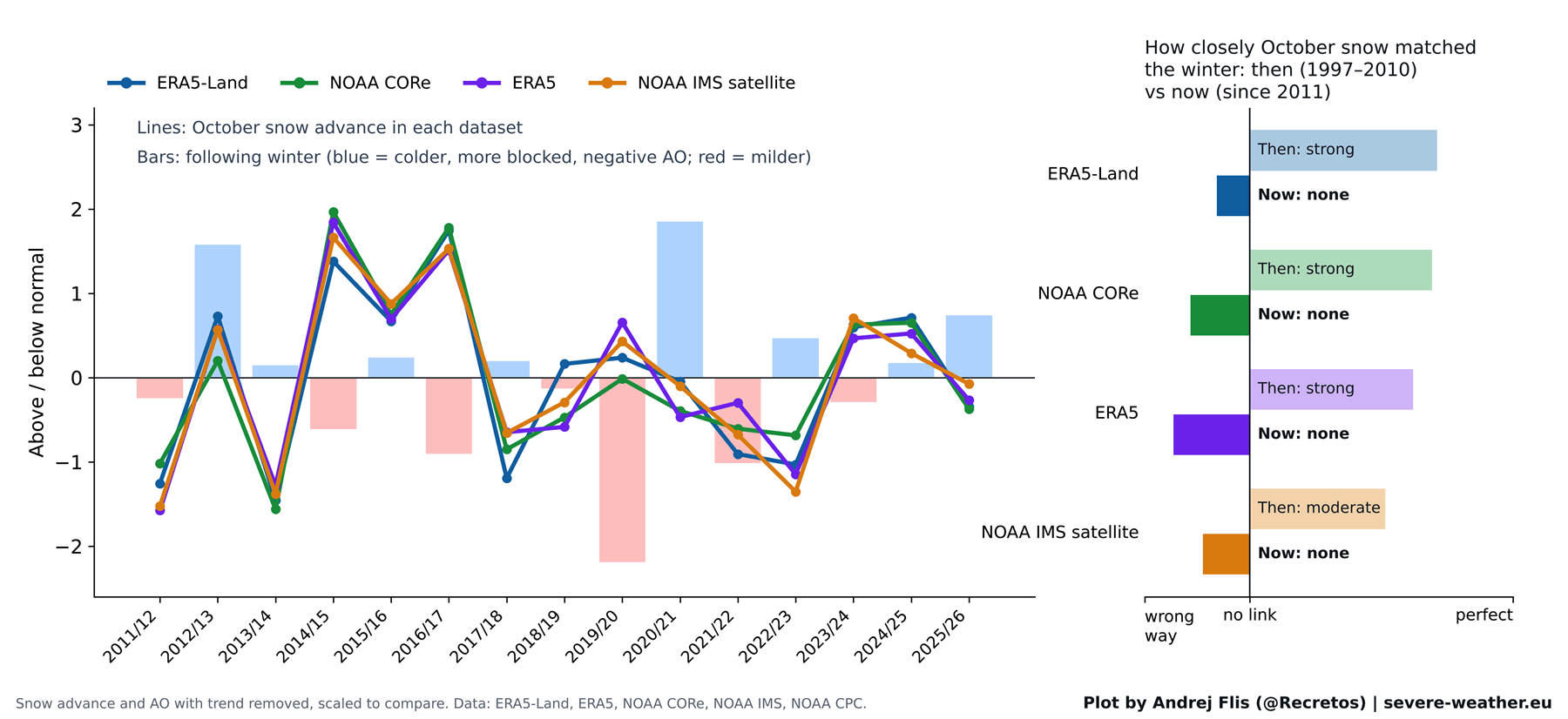
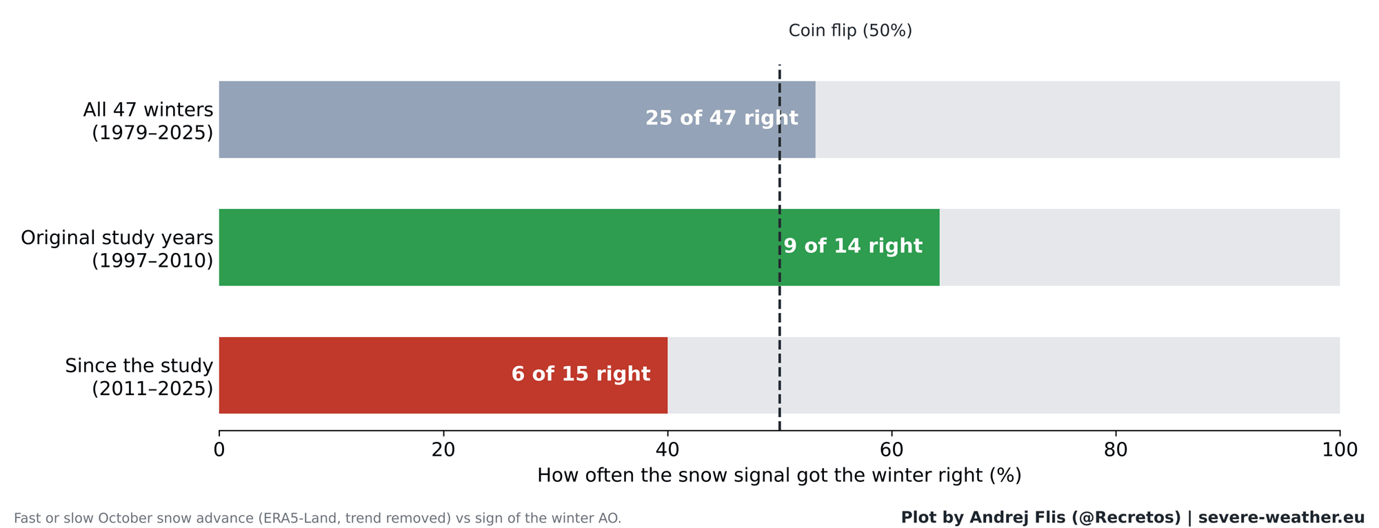
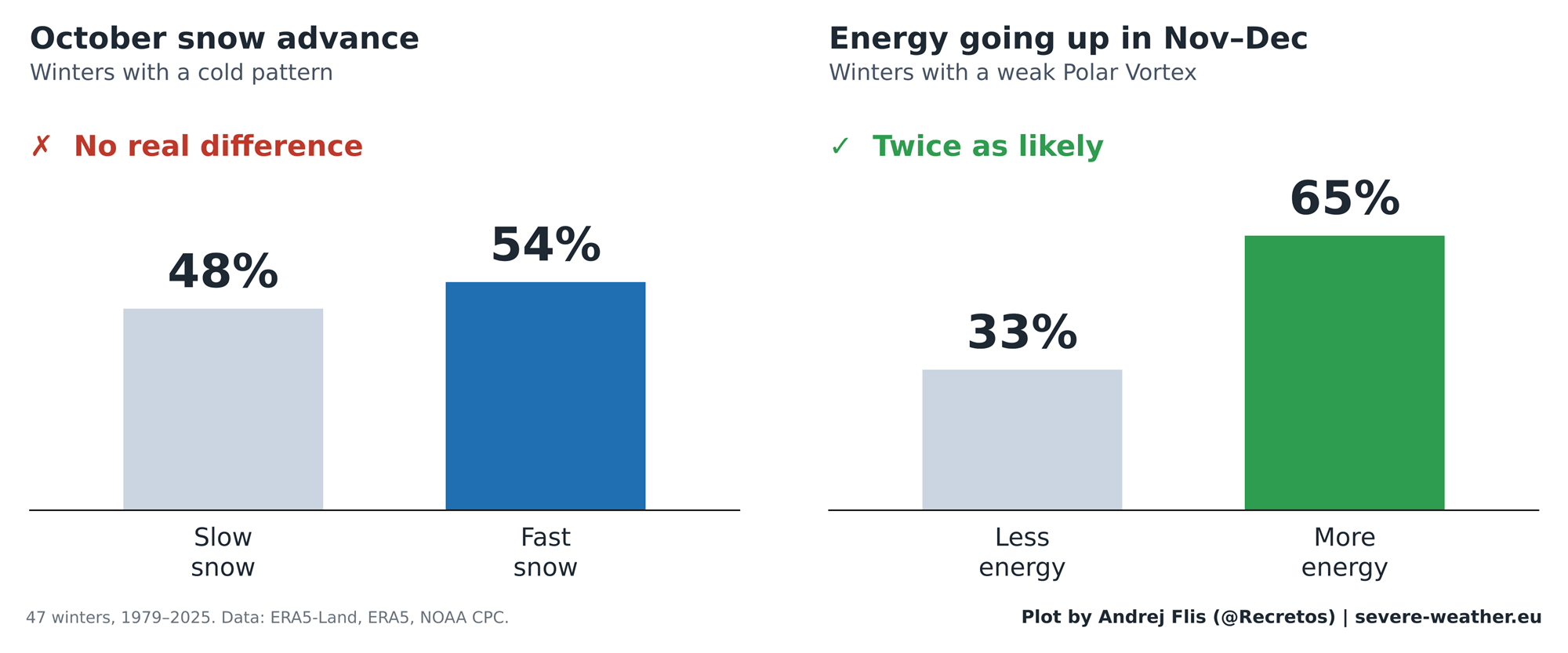
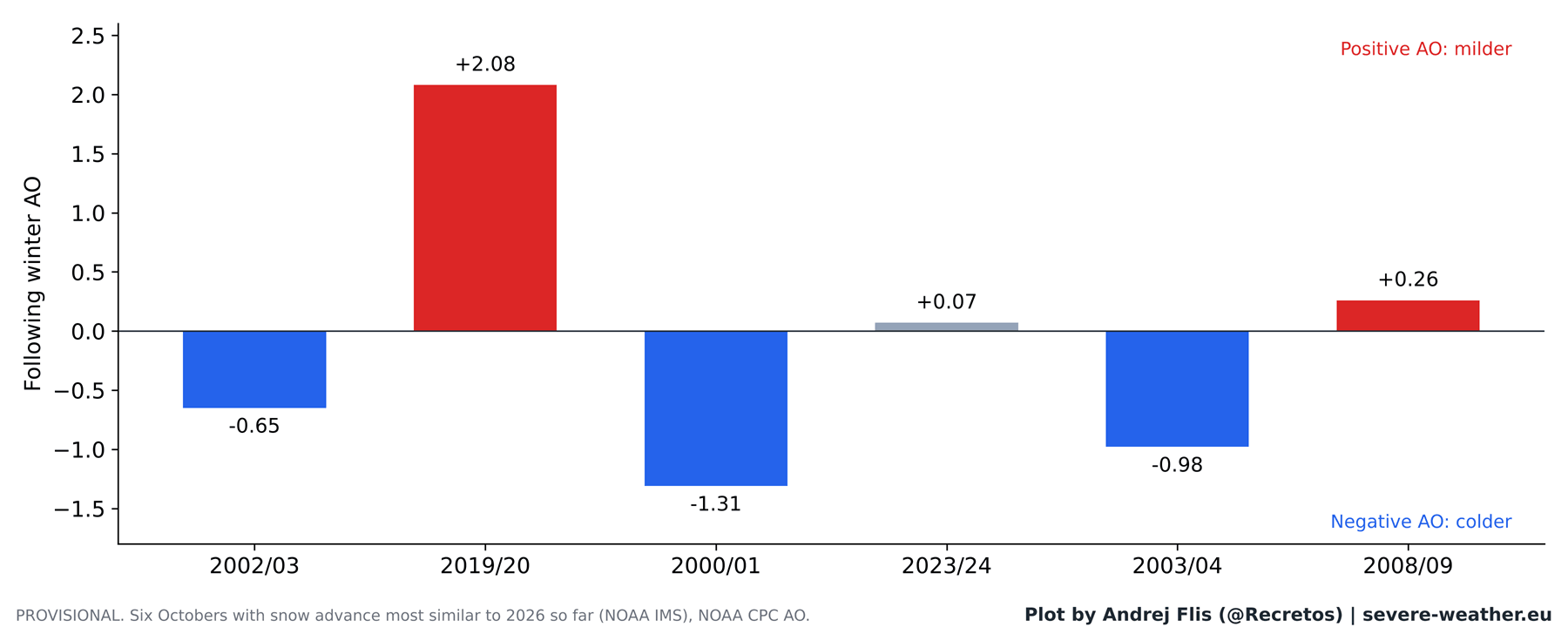
The data tells a different story for the years following 2011. The statistical correlation has steadily eroded, eventually turning into a "coin flip" scenario. In the 15 years since the study’s publication, the Siberian snow signal successfully predicted winter outcomes only six times—a success rate worse than chance. Furthermore, recent years have seen anomalous events, such as the 2019/2020 winter, which followed a rapid October snow advance yet produced one of the warmest, mildest winters on record across Europe and North America.
Supporting Data: Why the Link Fails
The breakdown of the theory is not necessarily a failure of physics, but a shift in atmospheric dynamics. My analysis of the "chain reaction" shows that while the stratosphere still reacts to energy moving upward from the surface, the October snow cover no longer reliably initiates this energy transfer.
Several factors may be contributing to this decoupling:
- Arctic Sea Ice Loss: The rapid disappearance of Arctic sea ice has fundamentally altered the thermal landscape of the high latitudes.
- Shift in the Siberian High: The Siberian High itself is behaving differently under a warming climate, often failing to translate local snow cover into the necessary stratospheric energy pulses.
- The "Lucky Streak" Hypothesis: It is increasingly plausible that the early success of the theory was amplified by a series of extreme, high-impact winters that created an illusion of a more consistent long-term pattern.
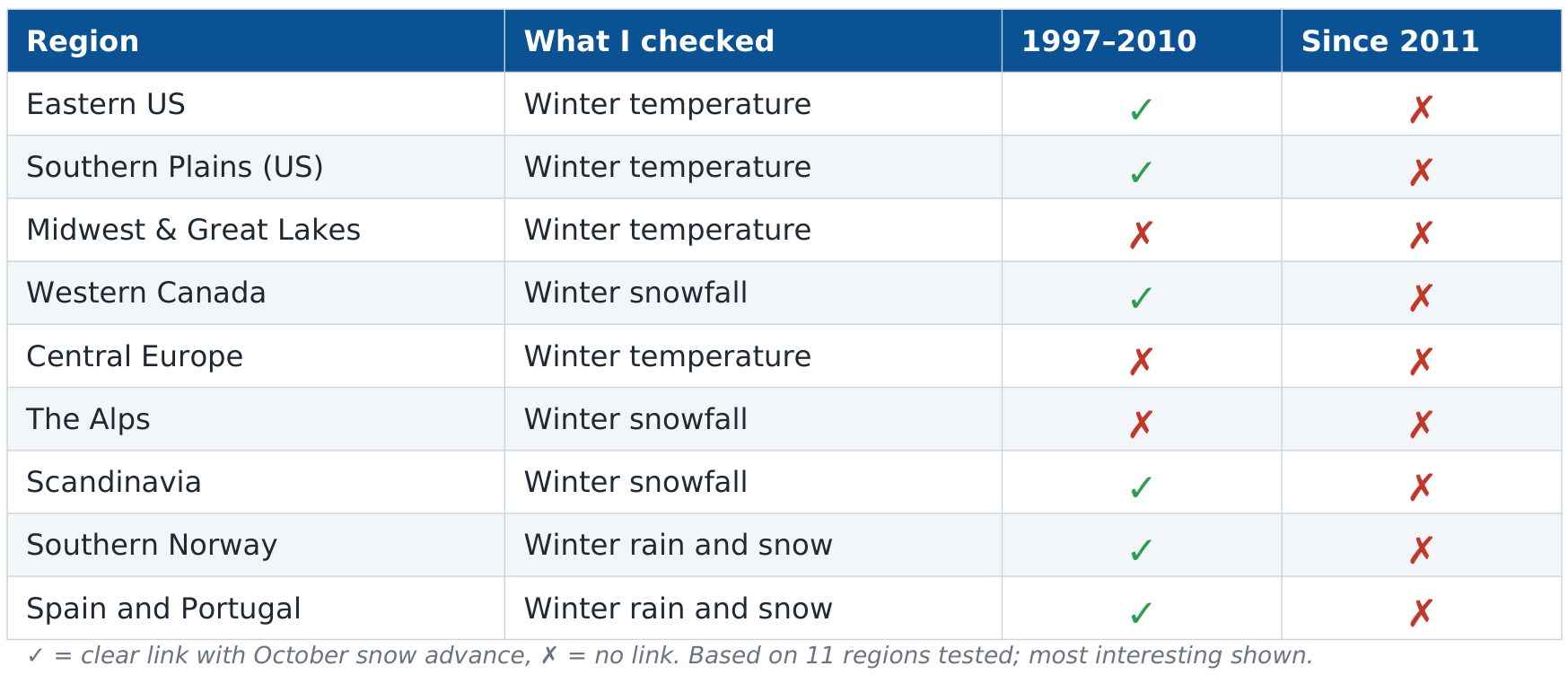
Regional analysis of 11 zones across North America and Europe confirms this degradation. Where once there was a predictable link—particularly in the Eastern United States—all regional connections have effectively vanished since 2011.
Official Meteorological Perspectives and Recent Findings
While the Siberian snow index has faded, meteorological focus has shifted toward more robust, large-scale drivers. The most significant of these is the current "Super El Niño," which is exerting a profound influence on the jet stream and the winter outlook for 2026/2027.
Recent simulation models from the ECMWF (European Centre for Medium-Range Weather Forecasts) suggest that the current Super El Niño will lead to a significant stratospheric deceleration of the Polar Vortex in the second half of winter. Unlike the localized snow-advance theory, this is a global-scale event. The data indicates that we should expect a weakened Polar Vortex by mid-January 2027, increasing the probability of a "Polar Express" pattern—where cold air is displaced southward.
Furthermore, a September 2026 study by Songmiao Fan and Judah Cohen suggests that while the simple "snow-to-winter" link may have weakened, the presence of Eurasian snow may still influence the geometry of the Polar Vortex (creating "stretched" patterns). This indicates that the field is moving away from simple linear correlations and toward complex, multi-variable modeling.
Implications for Winter 2026/2027
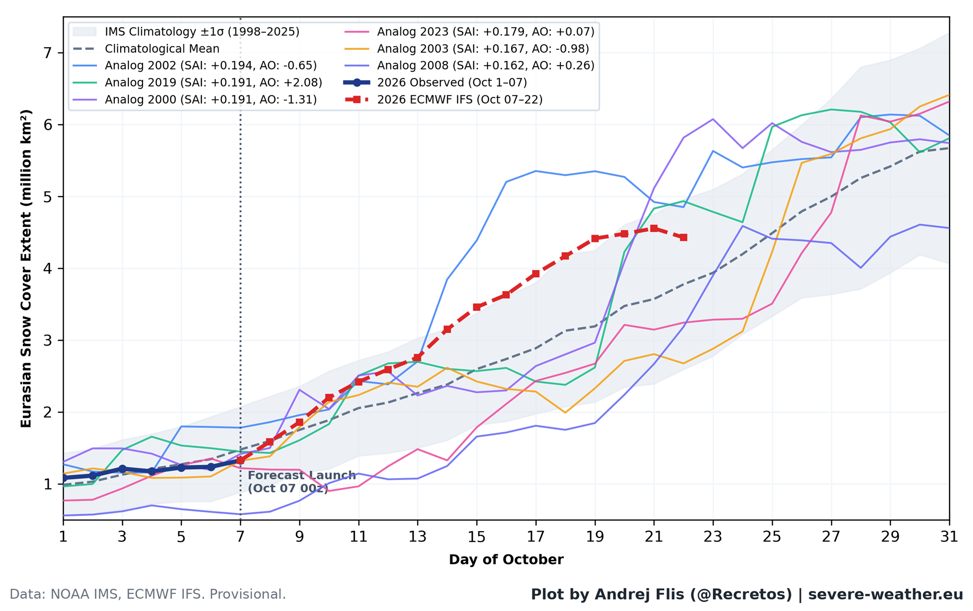
As we evaluate the prospects for the current season, we see that October 2026 began with slower-than-average snow growth, followed by a projected surge in late October. However, because the historical correlation has broken down, this snow surge should not be viewed as a standalone predictor.
The primary drivers for the coming months will be:
- Super El Niño Dynamics: The intense Pacific temperature anomalies will govern the jet stream, keeping the southern United States cooler and wetter due to persistent storm tracks.
- Stratospheric Warming Events: The focus has shifted from "snow on the ground" to "energy in the stratosphere." We are monitoring the transition of the Polar Vortex in December and January, as this remains the most reliable precursor for major cold-air outbreaks.
- Regional Variability: For Europe, the current forecast suggests a milder trend for much of the continent, with cold risks largely confined to the extreme north. Conversely, North America faces a higher likelihood of cold-air intrusion in the central and eastern states, driven by the anticipated weakening of the vortex in late winter.
Conclusion: A Shift in Predictive Methodology
The Siberian Snow Theory was an essential stepping stone in our understanding of the interconnected nature of our climate system. It forced meteorologists to look upward, connecting the snowy surface of Asia to the thin, turbulent air of the stratosphere.
However, as the climate enters a period of unprecedented change, reliance on static, decade-old indices is no longer sufficient. The modern era of weather forecasting requires a broader view—integrating the influence of the oceans, the shrinking ice caps, and the deep-layer dynamics of the stratosphere. While the Siberian snows will continue to fall each October, they no longer hold the keys to the winter kingdom. For the 2026/2027 season, the "Super El Niño" and the health of the stratospheric vortex are the true arbiters of the weather to come. We are no longer looking at a single signal, but at a complex, evolving symphony of global atmospheric forces.