

A significant atmospheric transformation is on the horizon. Global meteorological data, synthesized from the latest ensemble models of the European Centre for Medium-Range Weather Forecasts (ECMWF), the National Oceanic and Atmospheric Administration (NOAA), and the Australian Bureau of Meteorology (BOM), confirms that a powerful El Niño event is rapidly intensifying beneath the surface of the equatorial Pacific.

Meteorologists are currently describing this as a "Code Red" scenario. Projections suggest that the 2026-2027 El Niño could potentially evolve into the strongest such event in modern history, with the capability to surpass the legendary 1877-1878 event. As this massive subsurface oceanic engine prepares to release its stored energy into the atmosphere, the global climate community is bracing for a fundamental reorganization of weather patterns that will likely redefine seasonal expectations through 2027.
The Mechanics of the Deep: Subsurface Oceanic Dynamics
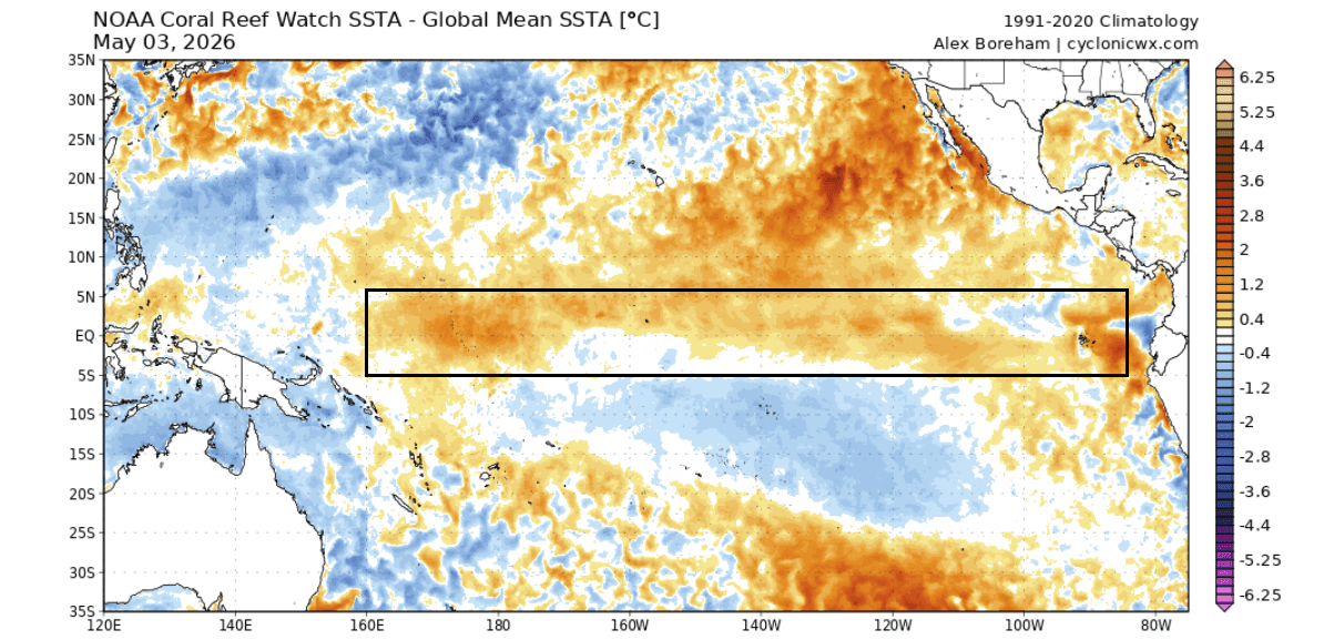
To understand the scale of the impending event, one must look below the surface. The El Niño Southern Oscillation (ENSO) is a periodic fluctuation in sea surface temperatures and air pressure across the equatorial Pacific. When the region shifts from its neutral or cold (La Niña) phase to a warm (El Niño) phase, it acts as a planetary "indicator light" for impending climate disruption.
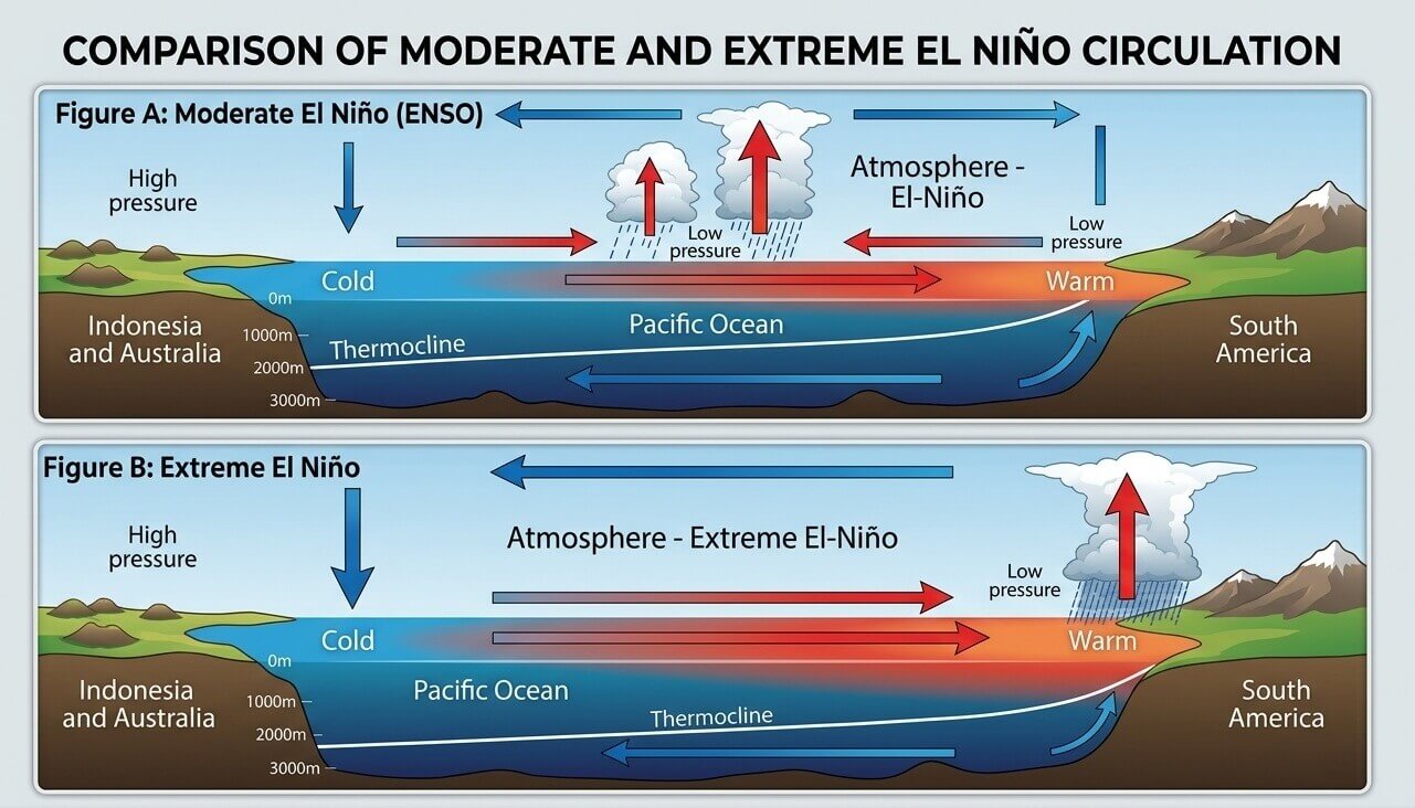
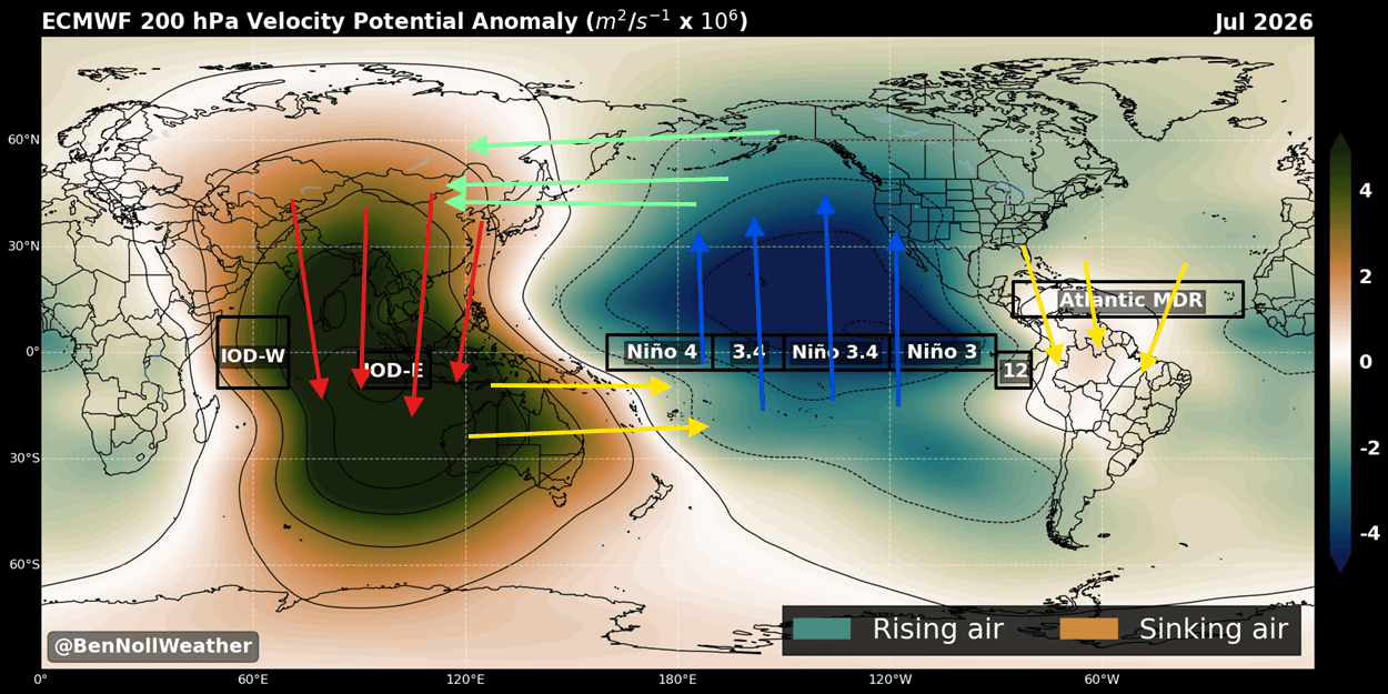
The current acceleration is being driven by a massive, highly energetic Kelvin wave. In recent weeks, this pulse of warm, subsurface water has surged eastward across the Pacific. As these warm waters rise to the surface, they act as a "release valve" for the energy accumulated in the western Pacific. This process fundamentally alters the Walker Cell—the tropical atmospheric circulation pattern—triggering a chain reaction that shifts pressure systems and jet streams across the mid-latitudes of the Northern and Southern Hemispheres.
Chronology of a Super Event
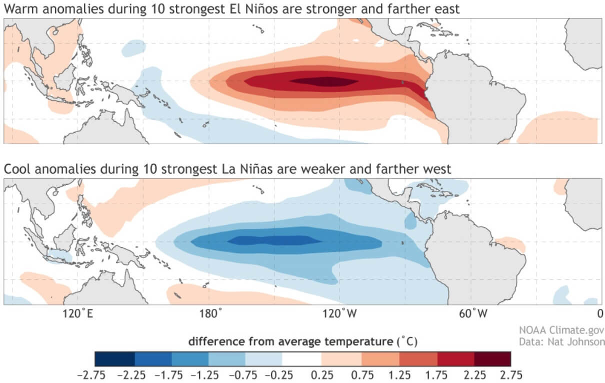
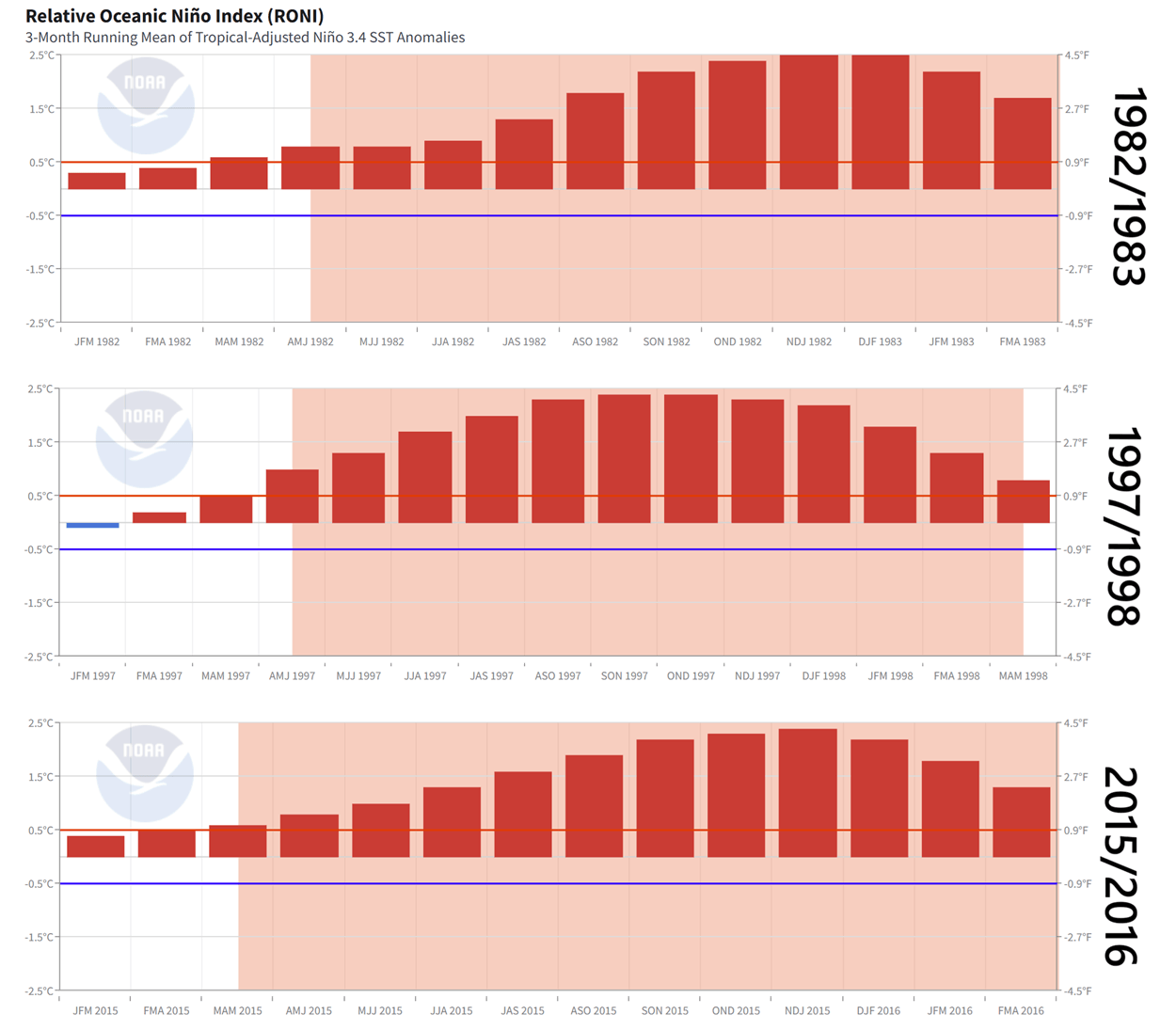
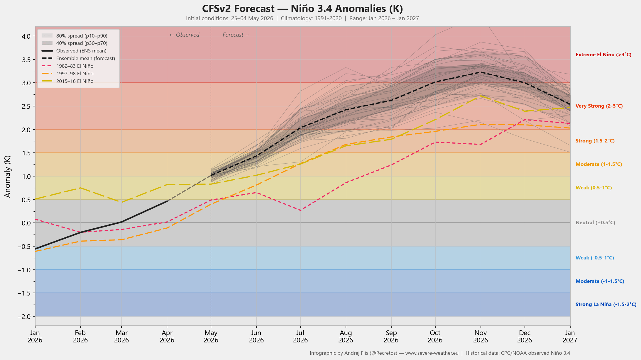
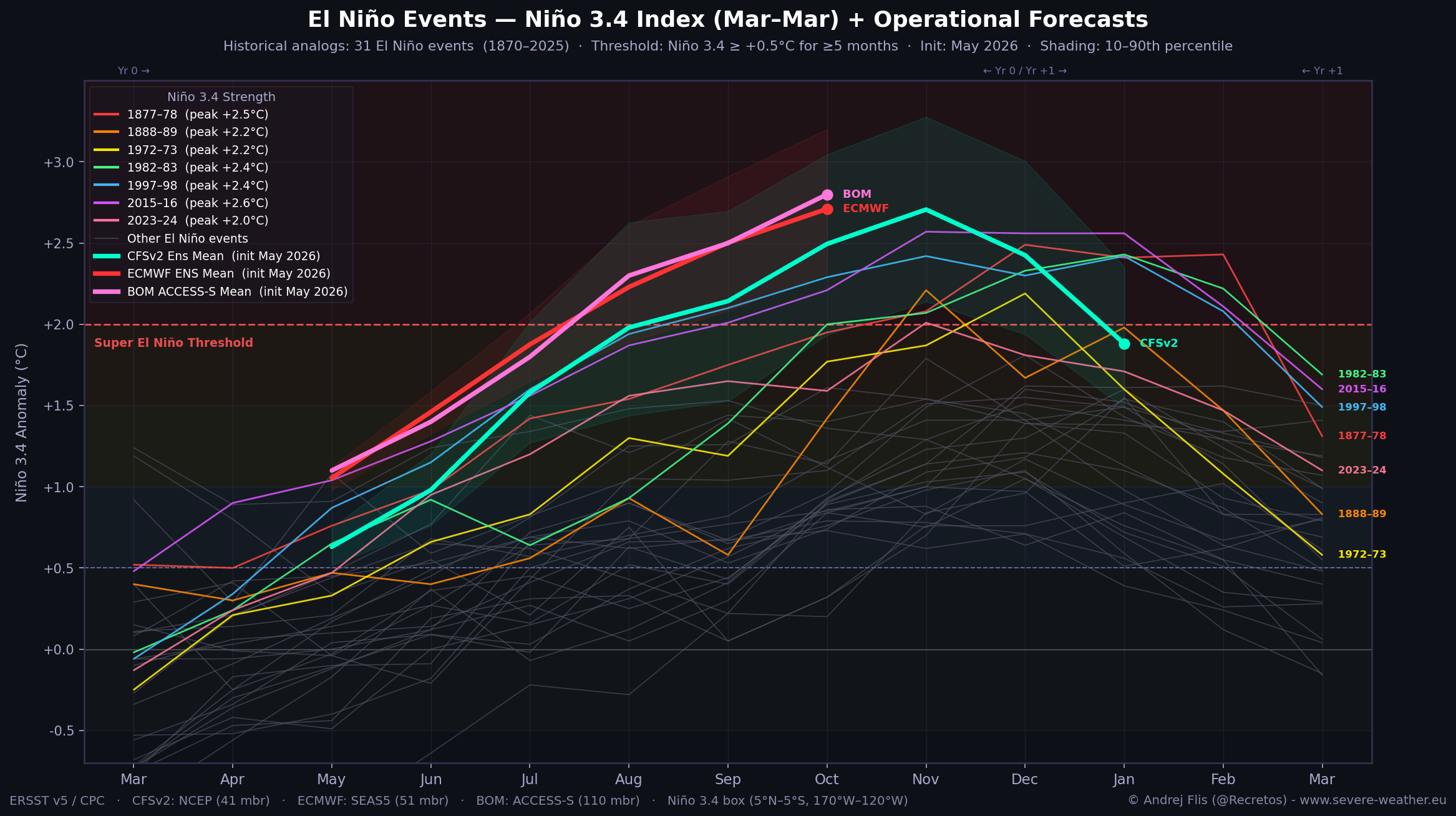
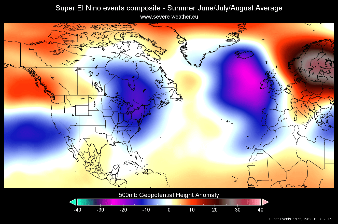
Super El Niño events are rare, occurring typically once per decade or less. The historical benchmarks—1982/83, 1997/98, and 2015/16—provide the roadmap for the current trajectory.
- Early 2026: Initial subsurface anomalies were detected in January. By spring, these anomalies began to align with historical Super El Niño signatures.
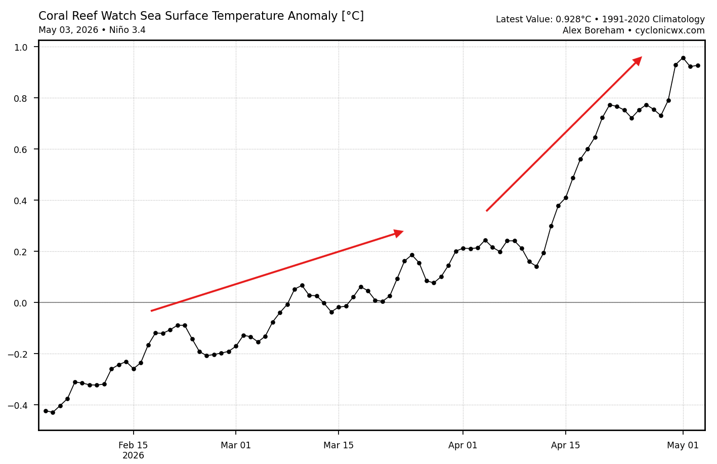
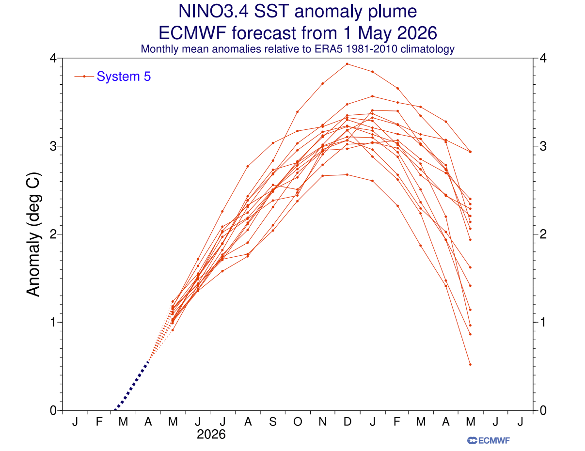
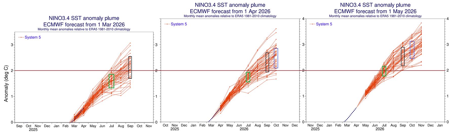
- May 2026: Data confirmed that the Kelvin wave had reached critical mass. The rate of temperature rise in the Niño 3.4 region began to exceed the thresholds established by previous record-breaking years.
- Summer 2026: Projections indicate the "Super" threshold—a sustained +2.0°C sea surface temperature anomaly—will be breached.
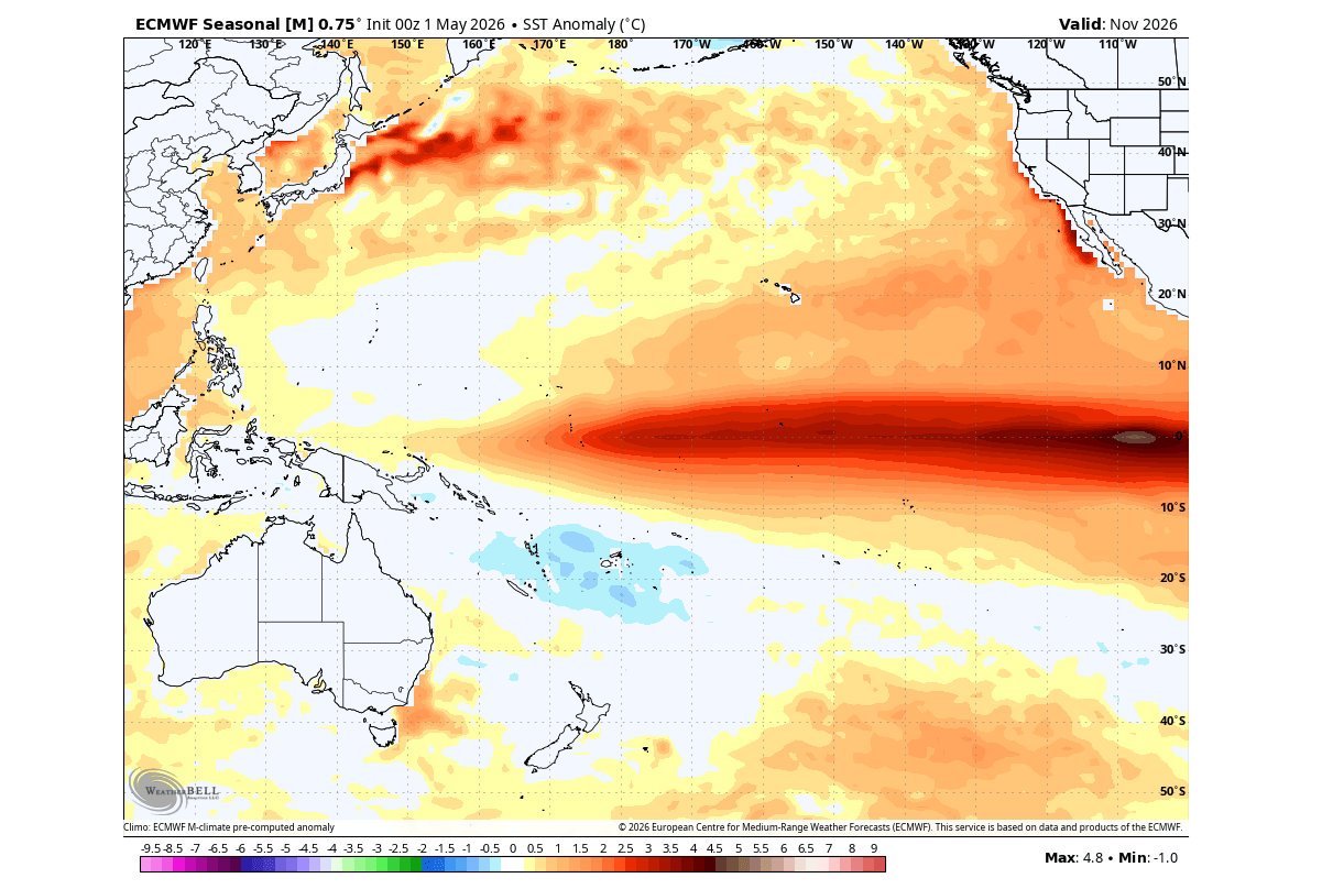
- Fall and Winter 2026/2027: Forecast models from the ECMWF and NOAA suggest the event will continue to gain strength, potentially peaking at +4.5°C in specific eastern regions by November.
This rapid development is unique in its consistency; every subsequent model run released over the last three months has trended toward a stronger outcome than the previous one, signaling a high level of confidence among global forecasting authorities.
Supporting Data and Model Consensus
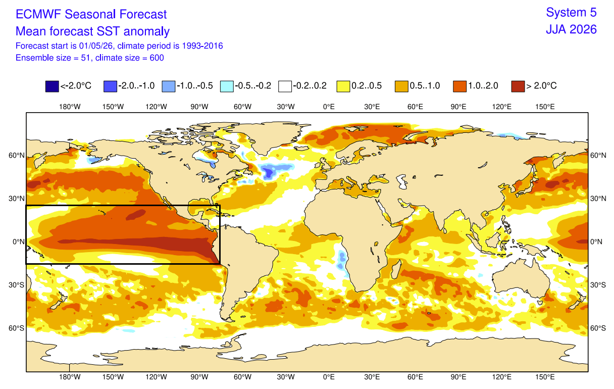
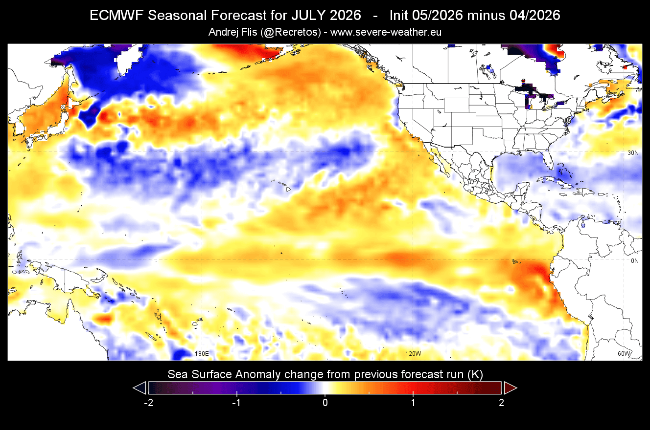
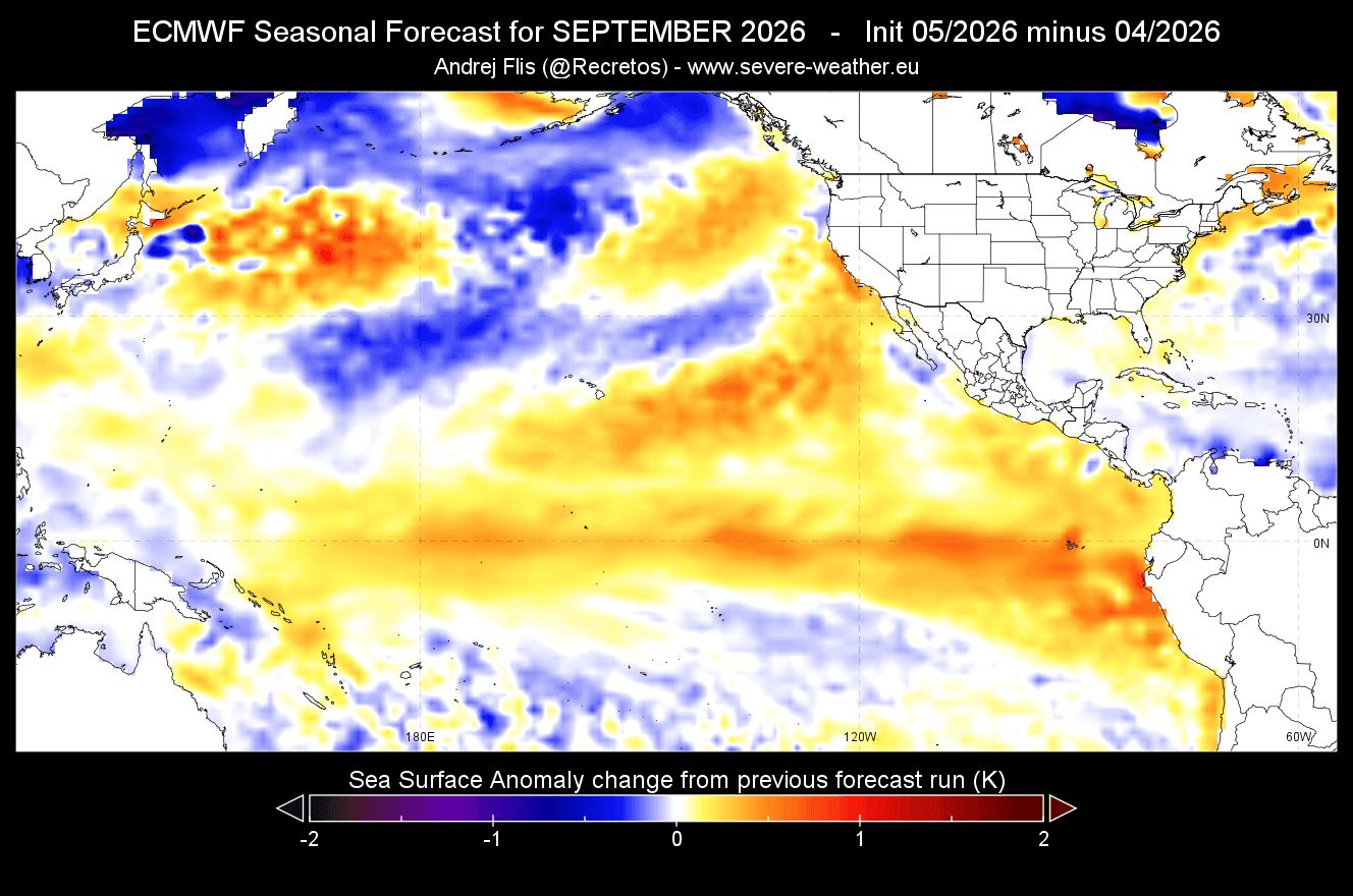
The convergence of global forecasting models is a rarity that warrants serious attention. The NOAA CFSv2 model, the ECMWF extended-range ensemble, and Australian climate data all point to an event that eclipses the anomalies observed in the 2015/16 cycle.
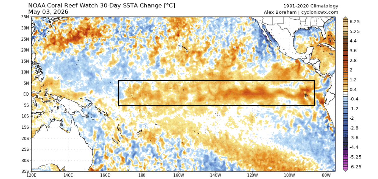
Subsurface monitoring shows that the western tropical Pacific remains anomalously warm, suggesting that the "fuel supply" for this El Niño has not yet been fully exhausted. The Kelvin wave, currently rising to the surface in the eastern Pacific, is being pushed by westerly wind bursts that show no signs of dissipating. Comparison plots between 2026 data and previous Super El Niños indicate that the current event is effectively "outpacing" the development of its predecessors.
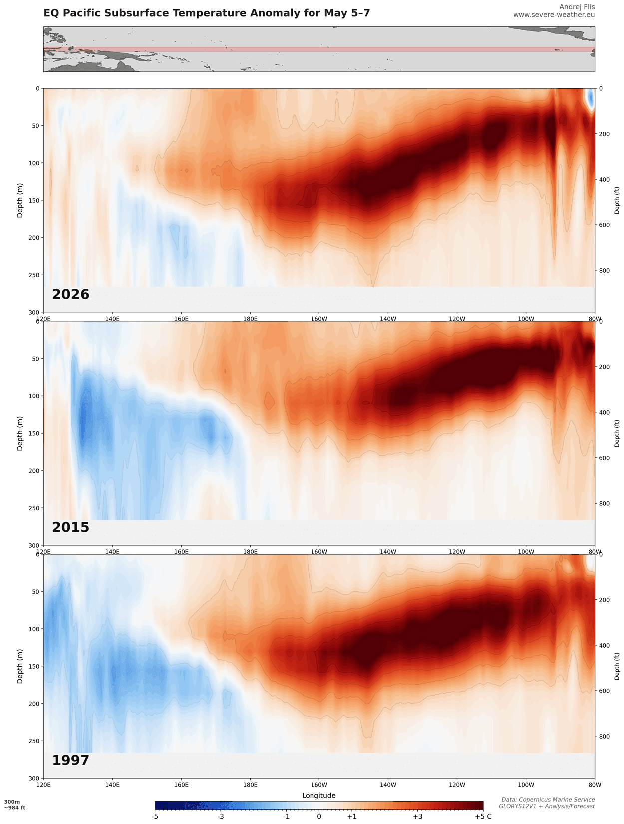
When comparing current trends to the last 155 years of climate records, the model consensus suggests that we are witnessing a phenomenon that could set a new historical precedent.
Official Projections and Scientific Implications
While individual models vary in their exact peak intensity, the collective message from major scientific institutions is clear: the 2026 event will be a major global weather driver.
A Super El Niño of this magnitude serves as a massive redistribution mechanism for global heat. By shifting the tropical rainfall and pressure patterns, it forces the jet streams to adopt new, often more volatile, configurations. Scientists are particularly concerned about the impact on the Walker Cell, as the intense heating in the central and eastern Pacific creates a "pull" on the global atmospheric circulation that can lead to extreme, persistent weather events.
The implications for 2026 and 2027 are far-reaching:
- Tropical Disruption: Enhanced convection in the central Pacific will likely lead to severe shifts in rainfall, threatening drought in some regions and flooding in others.
- Jet Stream Reorganization: The Pacific jet stream is expected to amplify significantly, which will likely result in increased storm activity across the southern United States and parts of Canada.
- European Weather Patterns: While the European continent is generally less susceptible to direct El Niño effects, the teleconnections suggest the potential for a high-pressure "blocking" pattern, leading to localized heat domes and shifts in moisture transport.
Global Implications: A Reshaping of the Seasons
As we move toward the latter half of 2026, the atmospheric response will become increasingly visible.
North American Outlook
For the United States and Canada, the emerging pattern suggests a split in weather regimes. The northern tiers of both countries can expect warmer-than-average conditions as the polar jet stream is pushed further north. Conversely, the southern United States is expected to face an unsettled autumn and winter, characterized by increased moisture and storm frequency driven by the amplified subtropical jet. This creates a high risk for flooding and severe weather in regions that may be unprepared for the rapid shift.
European Outlook
Europe is projected to experience the influence of a shifting North Atlantic pressure system. Early seasonal forecasts indicate that high-pressure zones may dominate the central and southern parts of the continent, leading to potential heat-dome events. Meanwhile, the northern and western regions may face increased storminess as the jet stream fluctuates.
The "Code Red" Reality
The term "Code Red" is not used lightly in meteorology. It signifies that the current climatic state is expected to deviate from standard seasonal norms by a margin that will impact agriculture, energy consumption, and infrastructure. The 2026-2027 event is expected to be more than just a temperature anomaly; it is a systemic shift in the Earth’s energy balance.
Conclusion: Monitoring the Peak
The path forward requires vigilant monitoring. As the Kelvin wave reaches its full potential and the atmospheric response intensifies through the autumn of 2026, the accuracy of long-range forecasts is expected to sharpen.
The global community is currently in a "wait and prepare" phase. While the history of El Niño provides a framework for understanding what is coming, the projected intensity of the 2026 event puts us in uncharted territory. By understanding the interplay between the deep-ocean heat pulse and the shifting atmospheric circulation, meteorologists and policymakers alike must begin to anticipate the cascading effects this Super El Niño will have on global weather into 2027.
Forecast and analysis imagery provided by major climate monitoring centers, including Copernicus EU, NOAA, and ECMWF, continue to be updated in real-time as the event develops. Stakeholders are encouraged to monitor these official channels for localized warnings and seasonal adjustments.