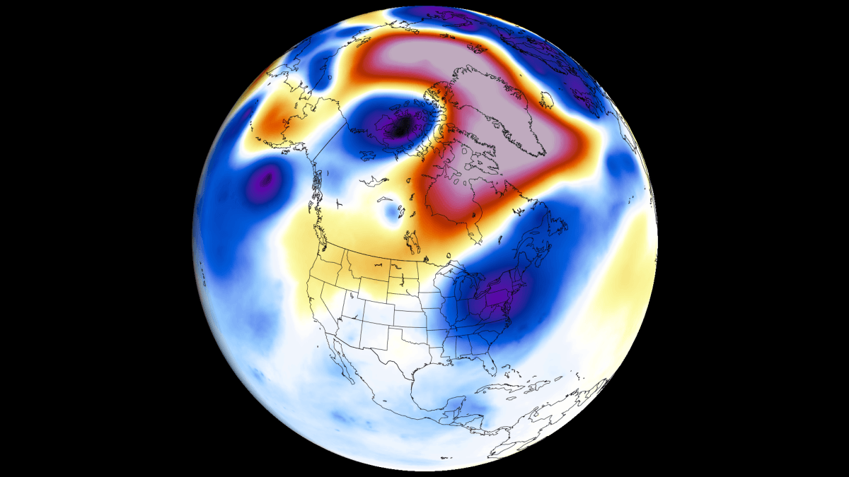
The Pacific Ocean is currently undergoing a dramatic thermal transformation that meteorologists and climate scientists are closely monitoring. A powerful Super El Niño is rapidly developing, with oceanographic data and atmospheric models signaling that the event is trending toward record-breaking intensity. As we move from the heat of late summer into the transition of autumn and the depths of winter, this phenomenon is already exerting a profound "atmospheric bridge" effect, fundamentally reshaping global pressure systems and jet stream dynamics.
Main Facts: A Climate Driver of Historic Proportions
At its core, El Niño is a climatic pattern characterized by anomalous warming of surface temperatures in the central and eastern equatorial Pacific. When these temperatures rise significantly above the long-term average, they alter the "Walker Circulation"—a massive atmospheric loop that governs tropical rainfall and wind patterns.
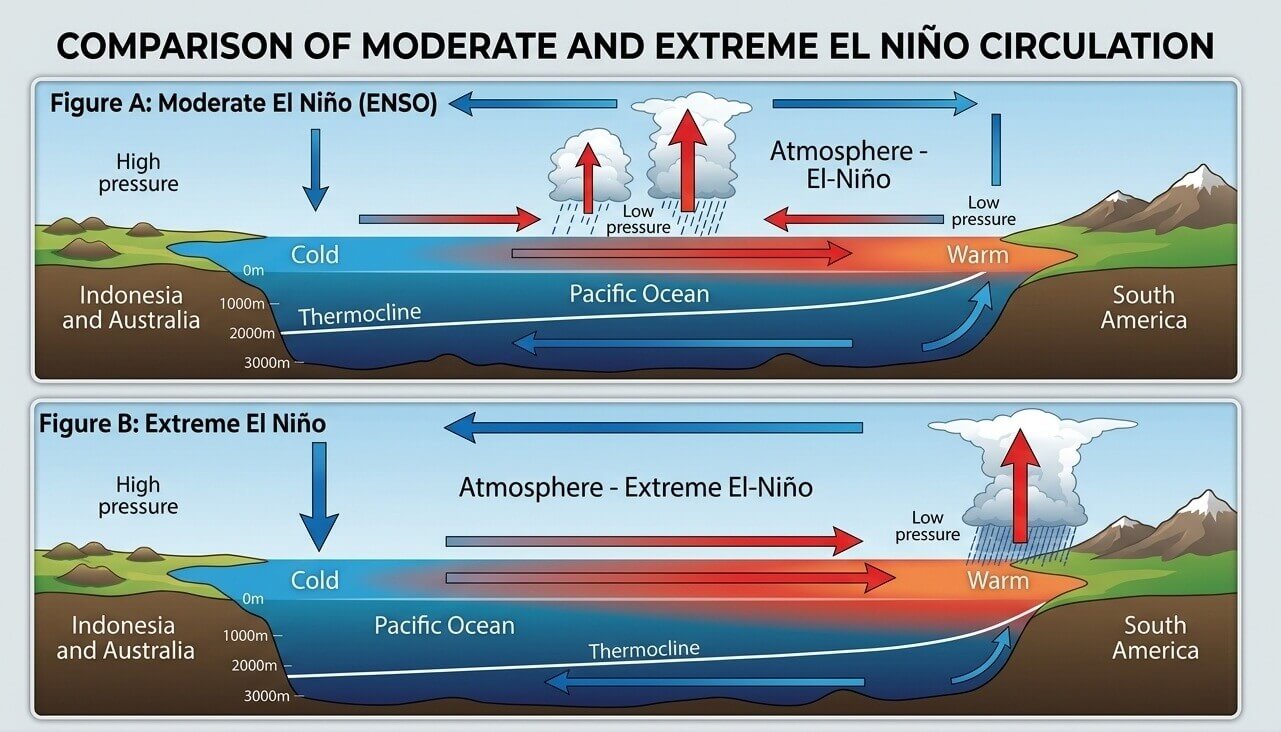
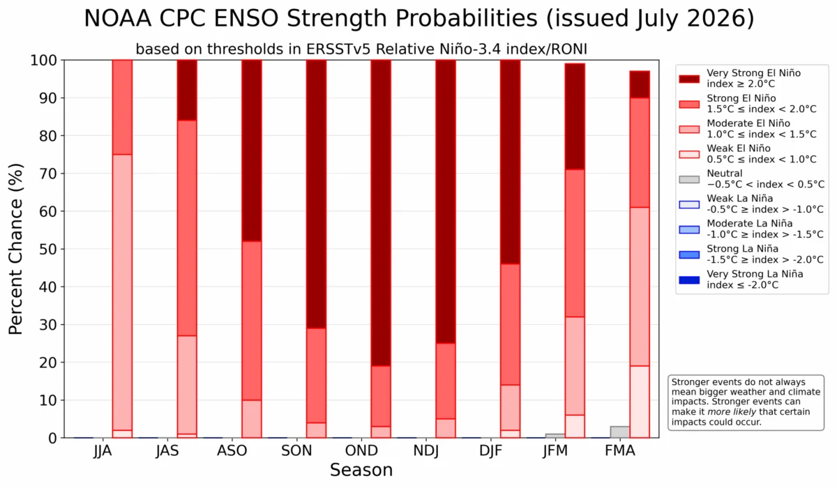
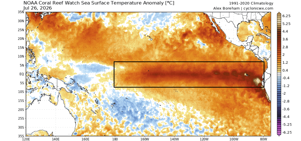
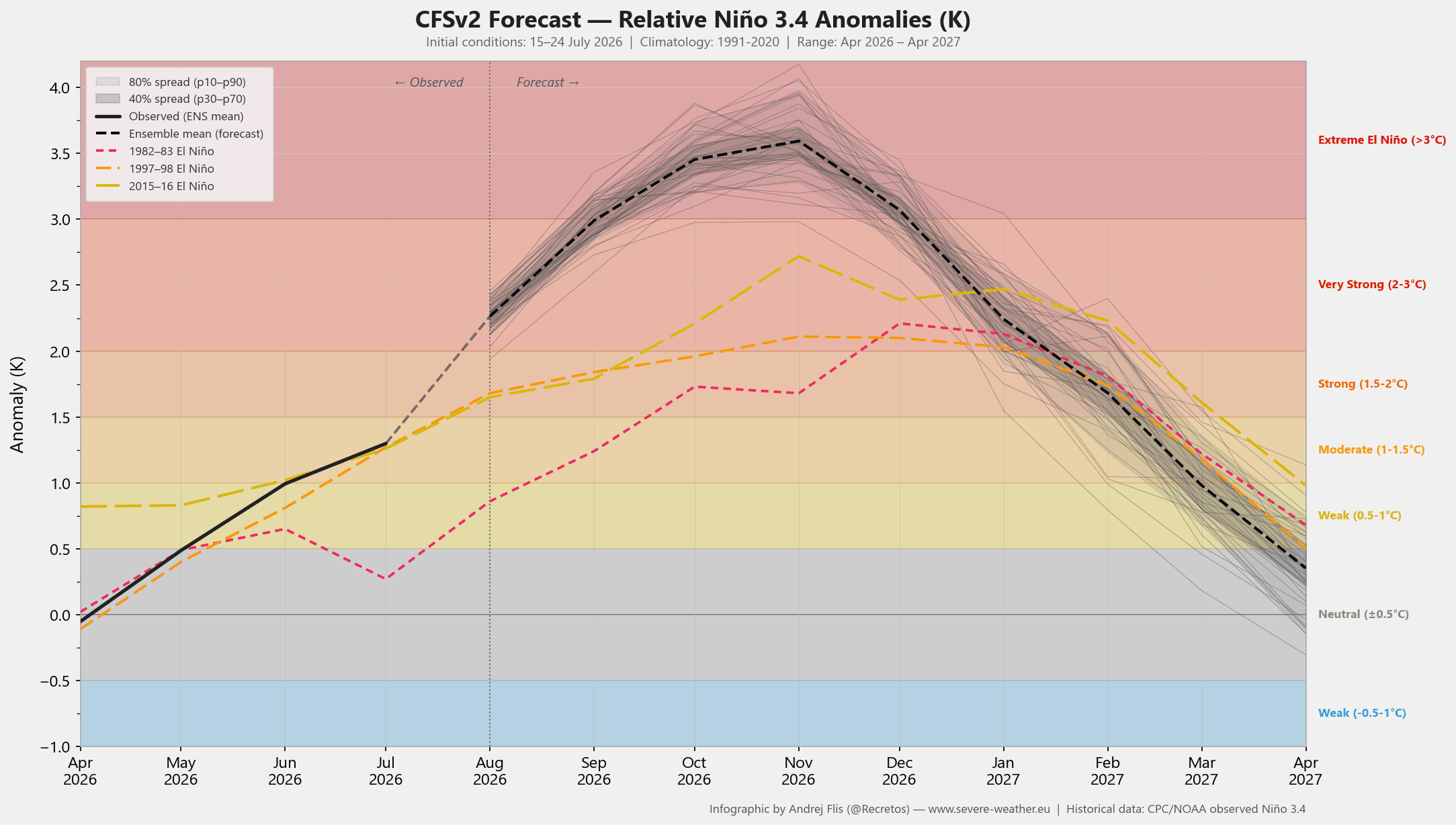
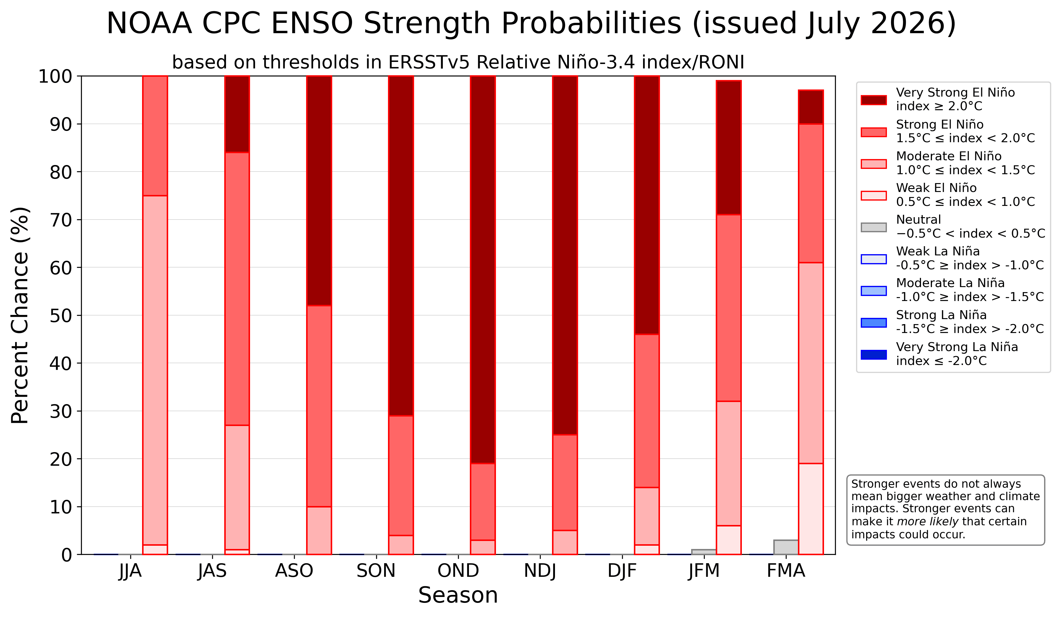
The current 2026 event is no ordinary fluctuation. Current ocean analysis shows peak anomalies in the main ENSO (El Niño-Southern Oscillation) regions reaching or exceeding +5 degrees Celsius above the norm. This rate of development has outpaced historical benchmarks for previous "Super" events, placing the 2026/2027 season on a trajectory that, if sustained, could see it enter the record books as one of the most intense climate drivers of the modern era. The NCEP CFSv2 model currently projects the anomaly to breach the +3-degree threshold, effectively locking the global atmosphere into a "Super El Niño" state that will dictate weather patterns for the remainder of the year and into early 2027.
Chronology of Development
The transition into this extreme climate phase has been marked by a series of distinct geophysical steps:
- Subsurface Priming (Early 2026): The event began deep beneath the ocean surface, where powerful "Westerly Wind Bursts" triggered the formation of a Kelvin Wave. This subsurface reservoir of warm water began its slow, inevitable migration toward the eastern Pacific.
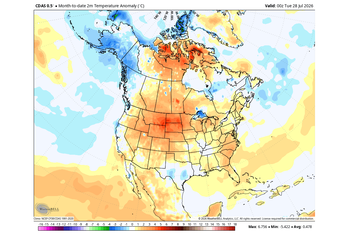
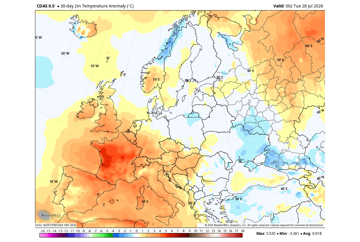
- Surface Emergence (Mid-Year 2026): As the Kelvin Wave surfaced, it began to disrupt the standard wind patterns. By July, the atmospheric response was already visible, with pressure patterns in North America and Europe shifting to mirror historical "Super El Niño" years.
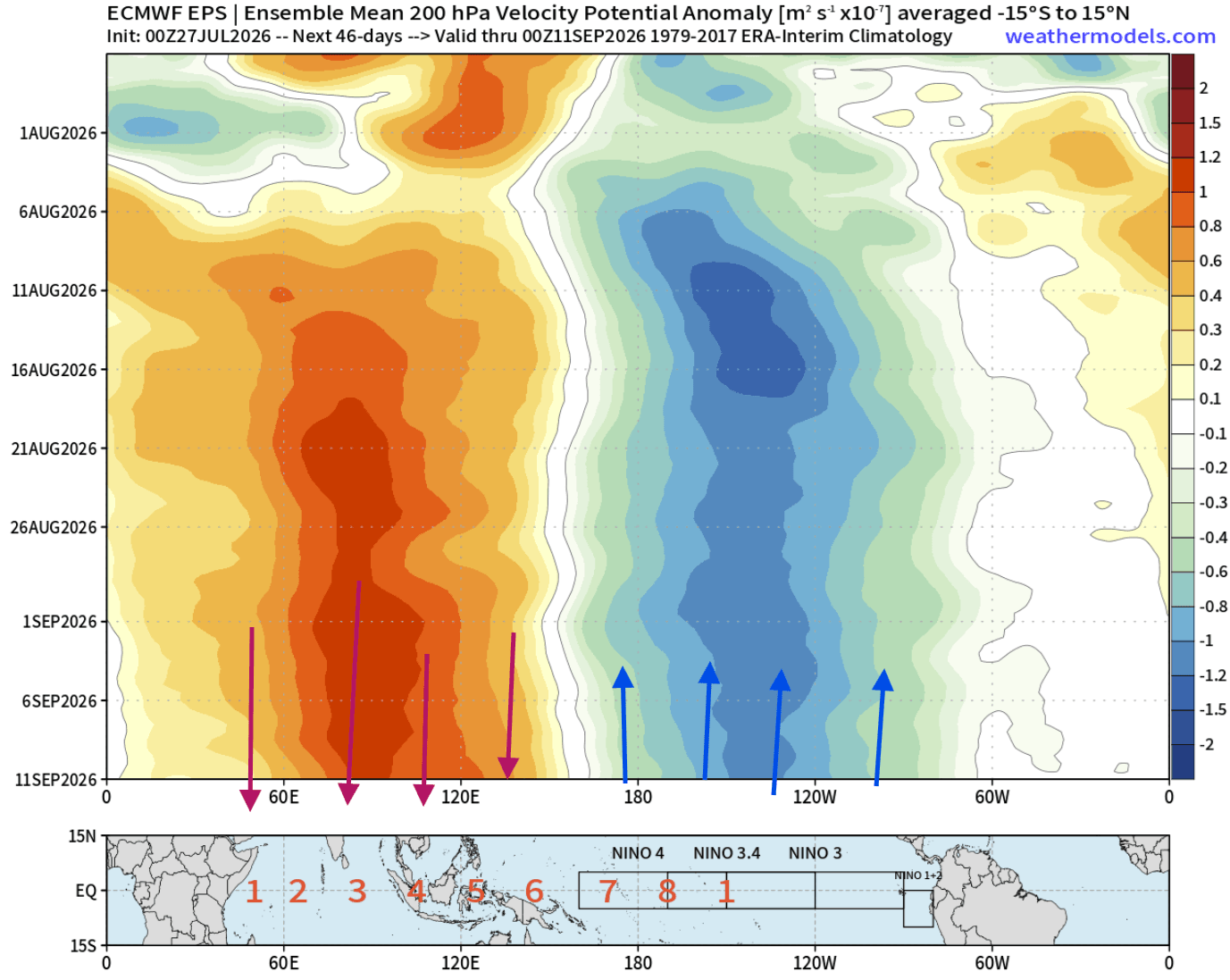
- August Consolidation: As we enter August, the Pacific is now locked into an "atmospheric standing wave." The feedback loop between the ocean and the atmosphere has strengthened, creating a persistent zone of rising air over the central Pacific and sinking air over the Indian Ocean.
- The Autumn-Winter Transition: Forecasts indicate that as we head into September and October, this "atmospheric bridge" will reach its maximum maturity. The jet stream will begin to split, creating a high-pressure block over Canada and an active, moisture-laden storm track across the southern United States.
Supporting Data: Modeling the Atmospheric Bridge
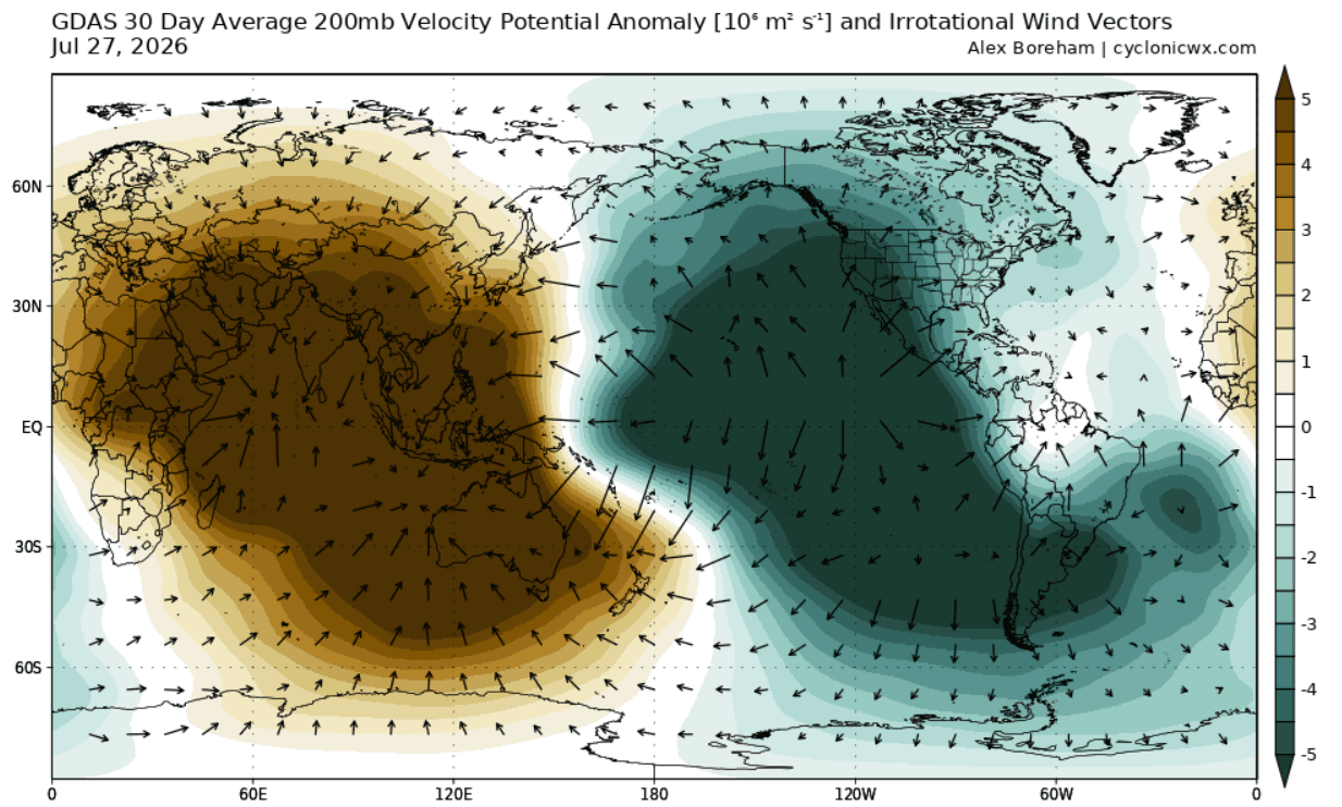
The predictive power of modern meteorology allows us to track this event with high precision. The "atmospheric bridge" refers to the way the tropical Pacific communicates its state to the mid-latitudes. Using Velocity Potential at the 200mb level (approximately 12 kilometers in altitude), scientists can observe the global "breathing" of the atmosphere.
Current GDAS (Global Data Assimilation System) analysis shows an immense, clear anomaly in the Walker Cell. The teal-shaded regions, representing rising air, are anchored firmly in the eastern Pacific, while brown-shaded regions of sinking air dominate the Indian Ocean. This confirms that the forcing is not merely a regional curiosity but a dominant global influence.
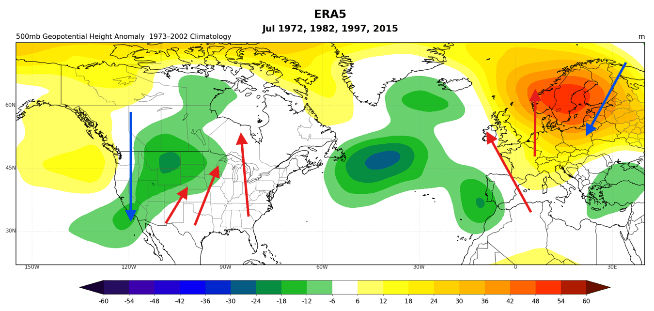
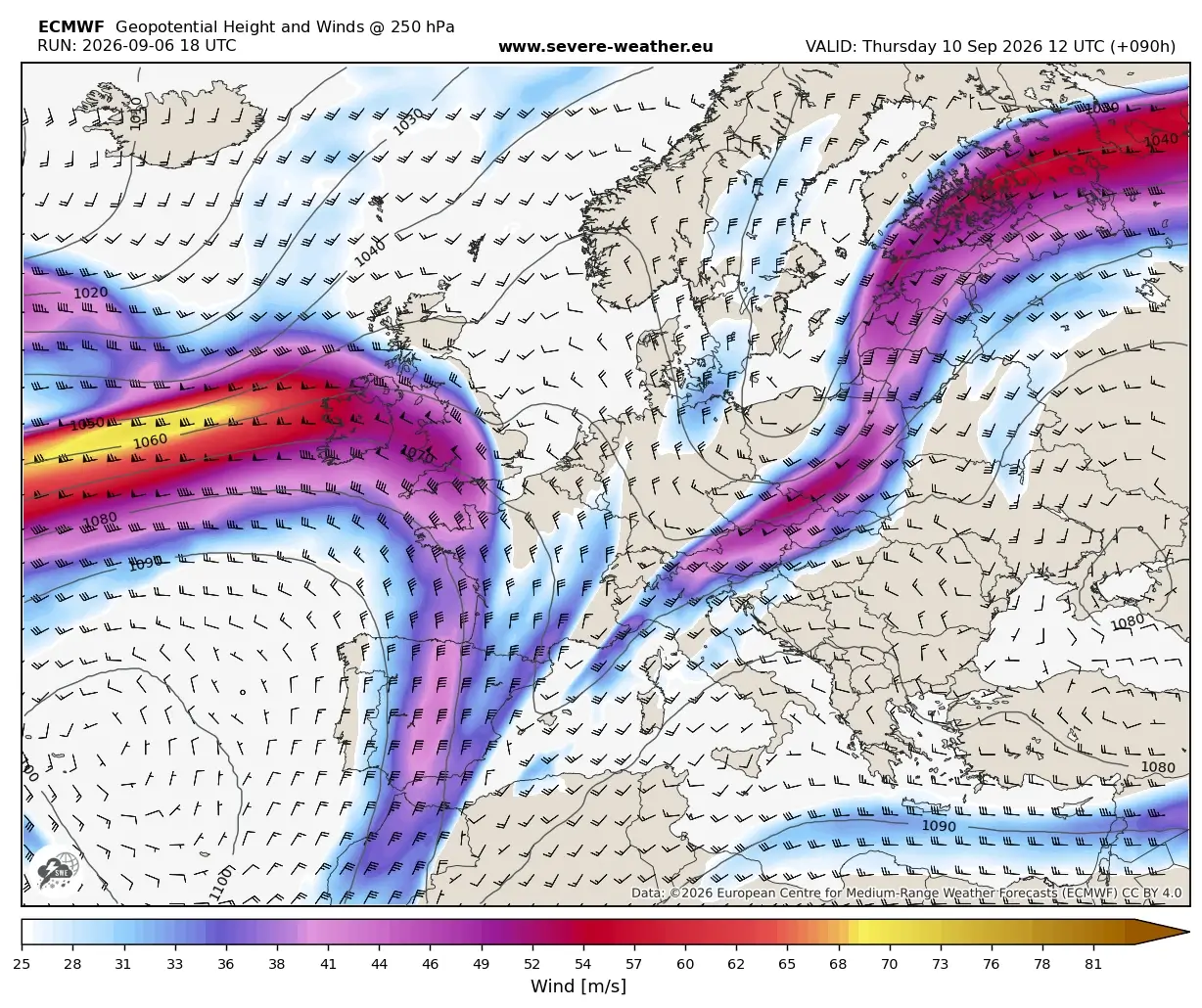
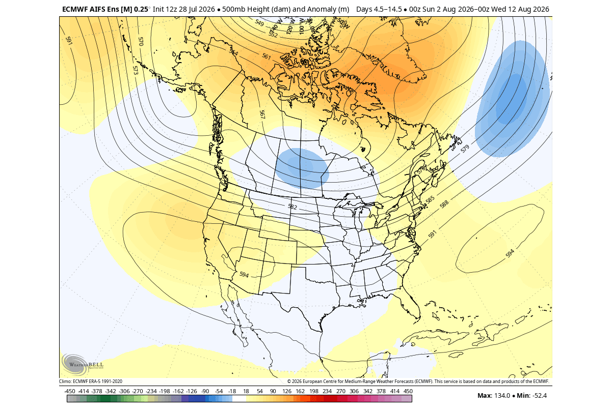
Furthermore, the ECMWF (European Centre for Medium-Range Weather Forecasts) ensembles have shown a persistent, high-confidence signal for the next few months. These models predict that the ridge over the western United States will continue to intensify, fueled by the subtropical jet stream’s response to the Pacific heat. By late August, the expectation is for a "troughing shift," where low-pressure anomalies will move into the eastern United States, bringing cooler, unsettled weather to regions that have previously been dominated by summer heat.
Official Perspectives and Scientific Context
While the data from NOAA (National Oceanic and Atmospheric Administration) and the CPC (Climate Prediction Center) highlight the extreme nature of this event, it is vital to understand the nuances. Not all El Niños are identical. The 2026 event is currently classified as an Eastern Pacific (EP) event.
Scientific studies suggest that the location of the warm anomaly acts as a "control knob" for the atmosphere. Because the primary warming is focused in the Eastern Pacific, it exerts a more direct influence on the North American jet stream. As the event reaches "Extreme" levels, the jet stream undergoes a profound "bifurcation" or split-flow pattern. This effectively locks the northern regions into a milder, high-pressure-dominated regime, while the southern tier of the United States becomes the target for frequent, high-impact storm systems.
Official outlooks from global climate agencies emphasize that while the Pacific is the engine, the global response is modulated by other internal climate variability. However, the sheer magnitude of a +3 to +5 degree anomaly creates a "signal-to-noise" ratio where the El Niño effect becomes the primary driver of seasonal weather, potentially overriding smaller-scale climatic fluctuations.
Implications for Global Weather Patterns
North America: The Winter Split-Flow
As we look toward the winter of 2026/2027, the implications for North America are significant. The projected "split-flow" pattern suggests:
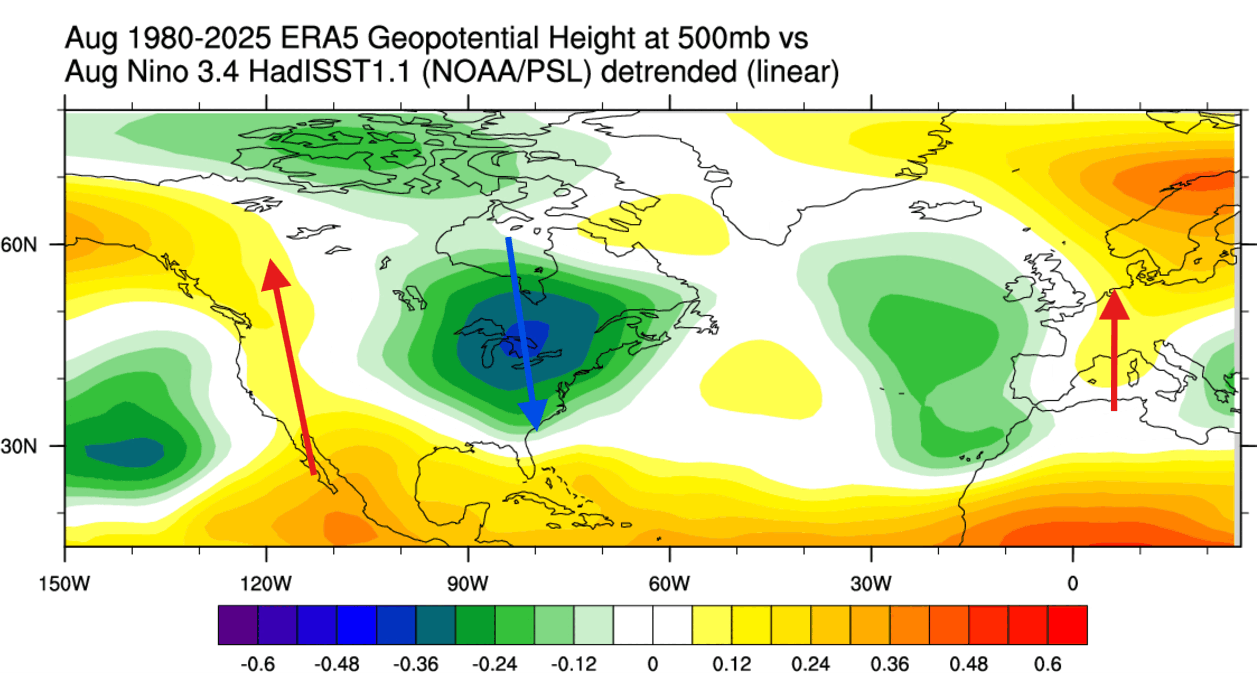
- Northern Tier: A high-pressure block is expected to suppress Arctic air outbreaks, leading to generally warmer and drier conditions across Canada and the Northern Plains. This reduces the traditional winter snowfall potential for these areas.
- Southern Tier: The southern United States and the Gulf Coast are projected to be in the crosshairs of an active Pacific jet stream. This will likely translate into increased precipitation, more frequent storm systems, and a higher risk of severe weather events during the winter months.
- The Transition: By January and February, the cooling footprint of the storm track is expected to expand, covering the Central and Eastern U.S. as cold air intrusions, once they do break through the block, become more frequent and impactful.
Europe: The Lags and the Influences
Europe’s relationship with El Niño is more complex and indirect. Because the continent is far from the Pacific, the influence is "lagged" and filtered through the North Atlantic Oscillation (NAO). Current data suggests that while the late summer and autumn may see high-pressure ridges moving eastward, the long-term winter pattern will likely feature a westerly flow from the Atlantic. This typically brings milder, moisture-heavy conditions to the continent, though the specific placement of the "blocking" highs in the north remains the deciding factor for whether individual countries experience snow or rain.
Conclusion: Preparing for an Anomalous Season
The 2026/2027 Super El Niño is not merely a weather forecast; it is a fundamental shift in the global energy budget. As the Pacific continues to act as an atmospheric engine, the resulting patterns—ranging from the high-pressure blocks in the north to the intensified storm tracks in the south—will define the upcoming agricultural, energy, and infrastructure challenges for the coming months.
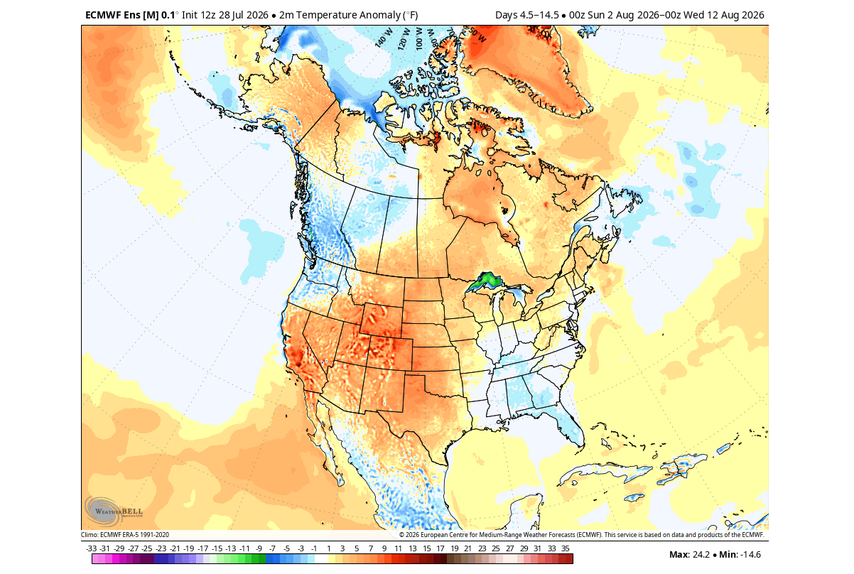
Meteorological agencies remain on high alert. With fresh data arriving in 10-day cycles, the ability to refine these projections will improve, providing clearer guidance on the timing and severity of cold air intrusions and precipitation events. Residents in the path of the projected storm tracks are encouraged to monitor local forecasts closely, as the "Super" classification of this event suggests that the seasonal departures from normal could be significant. The global atmosphere is in a state of rapid evolution, and the coming winter will be a testament to the immense power of our Pacific-driven climate system.