A powerful and rapidly intensifying atmospheric system is currently carving a path across the North Atlantic, signaling a major weather event for Ireland, the United Kingdom, and eventually Iceland. Meteorologists have classified this system as a "bomb cyclone," a term reserved for extratropical cyclones that undergo a process known as explosive cyclogenesis. As the system barrels toward Western Europe, it is expected to bring severe gale-force winds, hazardous coastal swells, and significant rainfall.
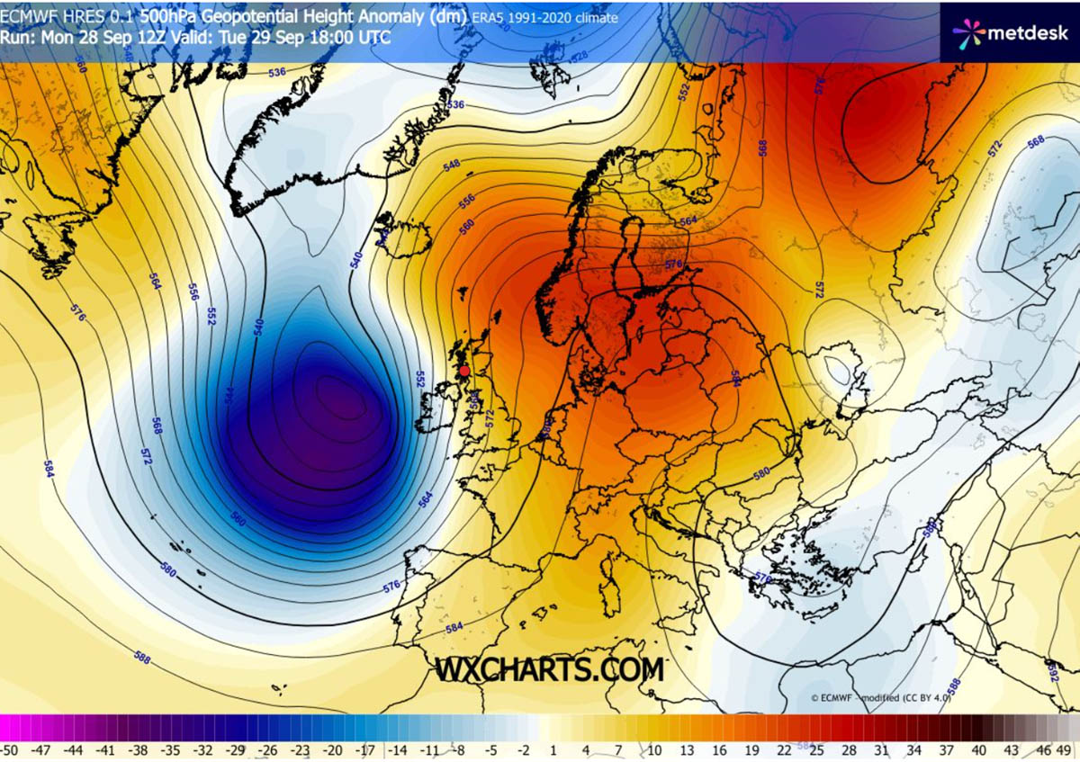
The storm’s development is driven by a high-amplitude upper-level trough originating in the North Atlantic, which is currently colliding with a robust 1035 hPa blocking high-pressure system anchored over Central Europe and Scandinavia. This interaction creates a steep baroclinic gradient—a sharp transition zone between air masses of differing temperatures and densities—which acts as the engine for the storm’s rapid intensification.
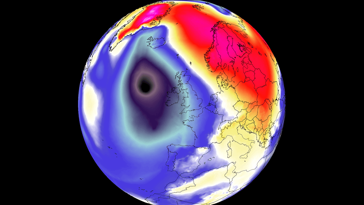
The Mechanics of Explosive Cyclogenesis
In meteorology, a "bomb cyclone" is defined by a specific rate of pressure drop: the central pressure of the system must fall by at least 24 millibars (mbar) within a 24-hour period. This current system is exceeding even these criteria.
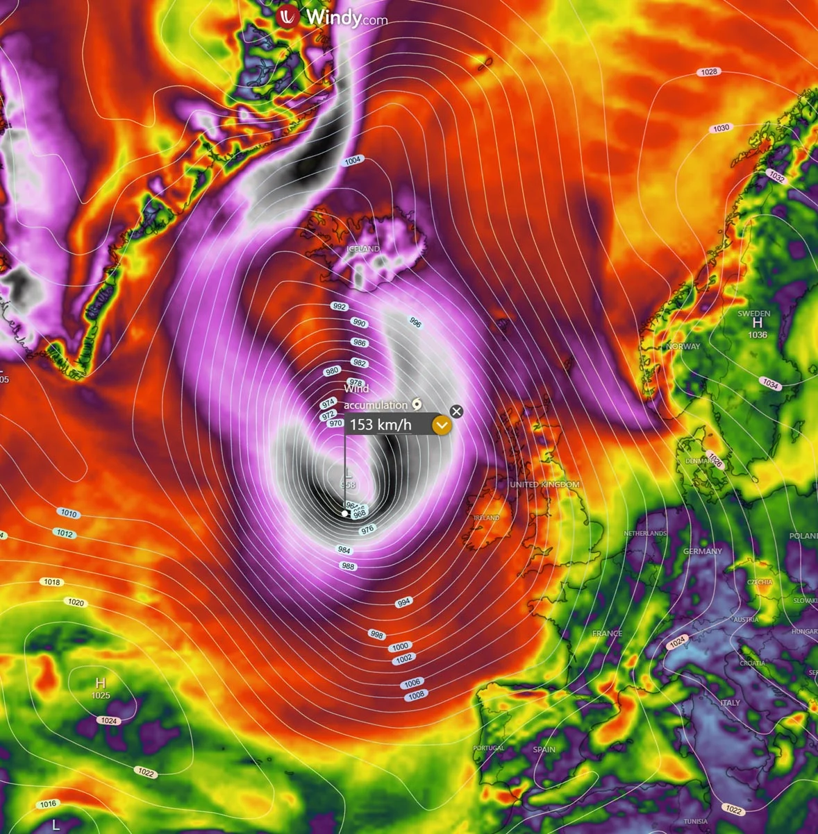
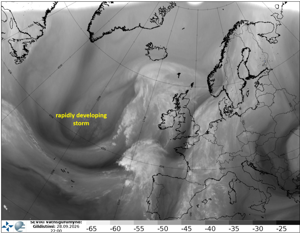
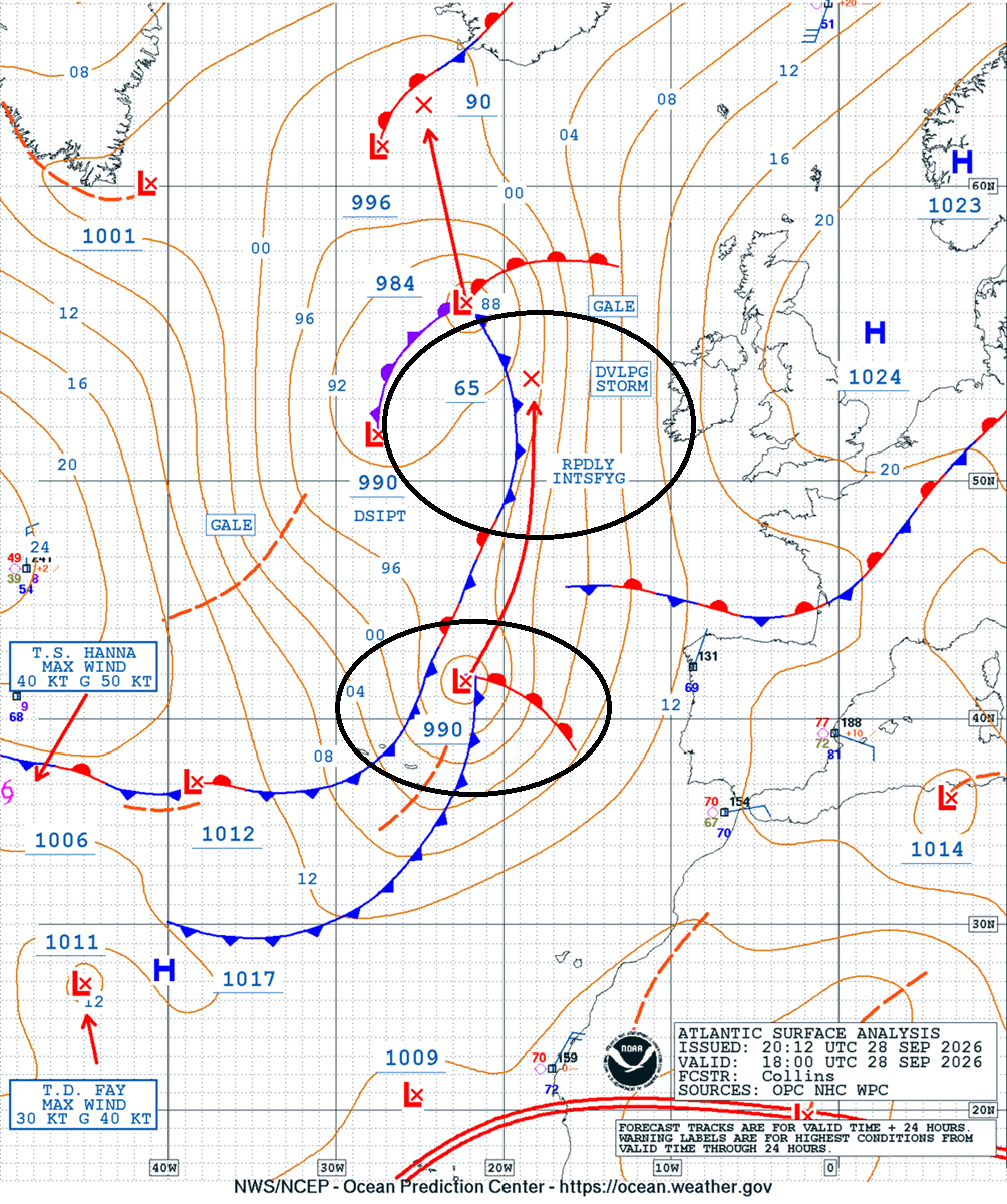
As of Monday night, satellite imagery revealed a textbook setup for this phenomenon: a deep, developing jet stream fueling the rotation and a massive intake of energy from the North Atlantic waters. The pressure, which hovered around 990 mbar on Monday, is projected to plummet toward 950 mbar by Wednesday. This rapid deepening creates a "tightening" of the isobars—lines of equal atmospheric pressure on a weather map. When these lines are packed closely together, the resulting pressure gradient force generates violent winds.
Chronology of the Storm’s Trajectory
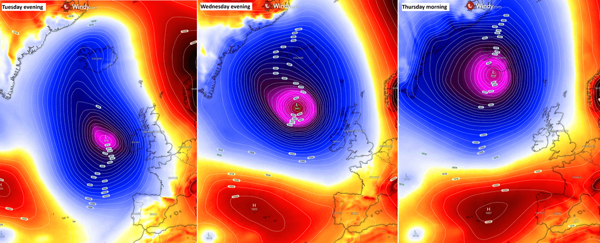
The storm’s lifecycle is defined by its steady northward progression and deepening intensity.
- Monday Night: The system was first identified on satellite imagery as a developing wave west of the Iberian Peninsula. Initial analysis confirmed the transition into a bomb cyclone.
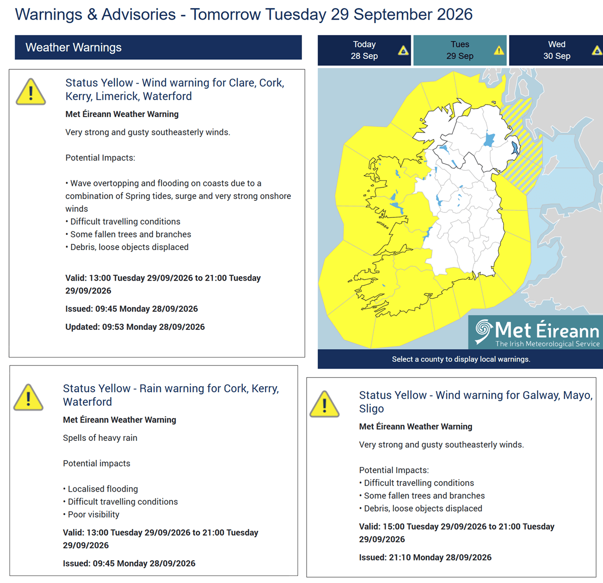
- Tuesday: The storm approaches the western shores of Ireland and the United Kingdom. During this phase, the primary wind core begins to interact with coastal topography, with Met Éireann issuing urgent yellow warnings for coastal regions.
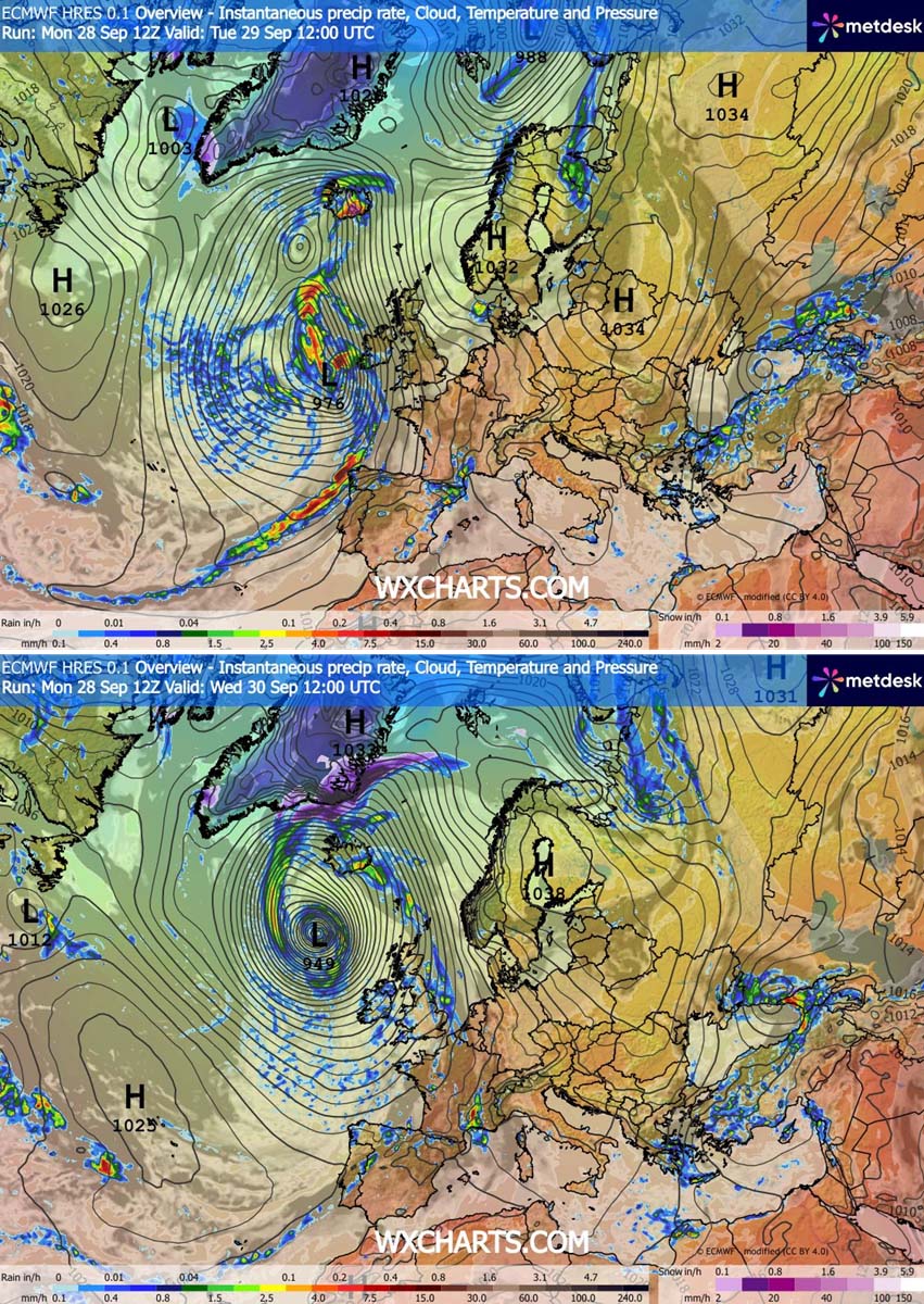
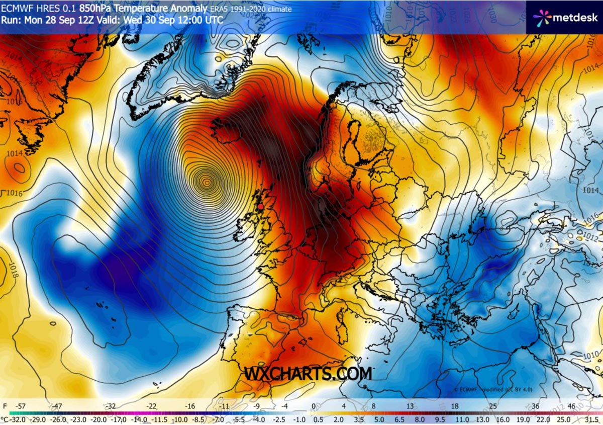
- Wednesday: The low-pressure center reaches its peak intensity, dropping below 950 mbar. As it passes between Scotland and Iceland, the system becomes a behemoth of atmospheric circulation, pulling a warm, moisture-laden plume from the south toward the Arctic Circle.
- Thursday Morning: The system begins its final approach toward Iceland, where it is expected to deliver sustained, high-intensity rainfall and hurricane-force wind gusts.
Supporting Data and Meteorological Analysis
The atmospheric dynamics currently at play are complex, involving an "Omega blocking" pattern over the European continent. This block prevents the storm from moving eastward into mainland Europe, forcing it to track northward toward the North Atlantic and the Faroe Islands.
Surface-front forecasting indicates a classic cold front trailing the system. As this front sweeps across Ireland, Northern Ireland, and Scotland, it will act as a trigger for localized, high-intensity squall lines. While the rainfall associated with these squalls will be fast-moving, the sheer velocity of the wind gusts—expected to range between 100 and 130 km/h—poses the greatest threat to infrastructure.
Perhaps the most concerning data point is the wave height analysis. Oceanographic models suggest that the storm’s circulation will generate swells of 8 to 12 meters along the Atlantic-facing coasts of Ireland, Scotland, and the Outer Hebrides. These massive waves, combined with storm-surge potential, present a severe risk for coastal erosion and flooding in low-lying areas.
Official Responses and Public Safety
National meteorological agencies have begun disseminating warnings to mitigate the impact of the storm. Met Éireann, Ireland’s national weather service, has issued yellow weather warnings for coastal areas, specifically citing the danger of high-velocity wind gusts.
Public safety officials are urging residents in affected regions to prepare for:
- Difficult Driving Conditions: High-profile vehicles are particularly at risk, and motorists are advised to exercise extreme caution on exposed routes.
- Structural Damage: The intensity of the gusts is sufficient to cause damage to trees, roof tiles, and power lines, which may lead to widespread, albeit localized, power outages.
- Coastal Hazards: Due to the 8–12 meter wave forecasts, the public is strongly advised to avoid piers, promenades, and cliff-top paths during the peak of the storm.
Implications: A Shift in Weather Patterns
Beyond the immediate damage, this storm is a stark reminder of the energy stored within the North Atlantic. The interaction between the "warm plume" pulled northward by the storm and the colder, high-latitude air masses is creating a significant temperature anomaly.
In Iceland, the implications of this system are different. Because the storm will be stationary for a longer period relative to its arrival, it will establish an "atmospheric river"—a concentrated band of water vapor. This is expected to dump 250–300 mm of rain on the southern and southeastern regions of Iceland, potentially triggering landslides and flooding in mountainous terrain.
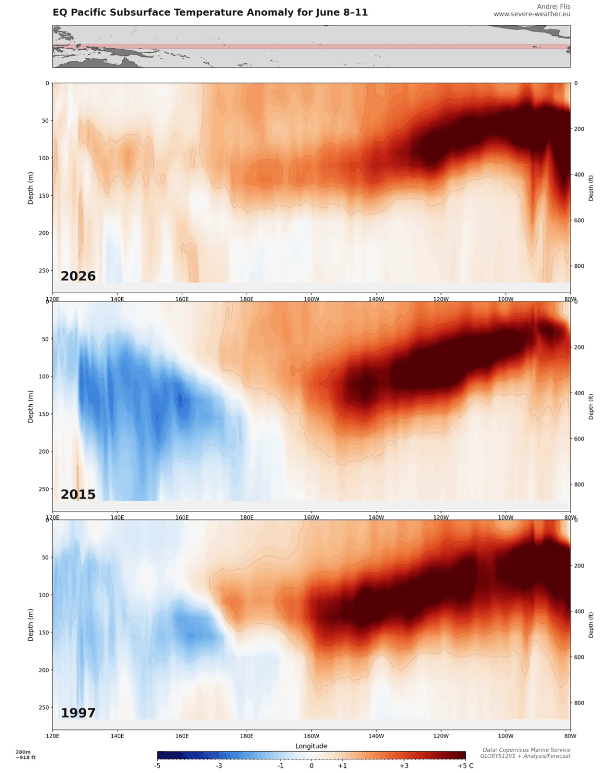
The severity of this event also occurs within the context of larger climatic shifts. Recent data suggests that the 2026/2027 season is seeing the influence of a record-breaking Super El Niño, which continues to alter global jet stream patterns. Meteorologists are monitoring whether this bomb cyclone is an outlier or part of an emerging trend of more volatile North Atlantic weather patterns, potentially linked to the broader, shifting thermal equilibrium of the oceans.
Preparedness and Future Monitoring
As the storm matures, real-time tracking remains the primary tool for defense. Organizations like Windy, Vedur IS, and Wxcharts continue to provide the data necessary for local governments to adjust their response strategies.
For the general public, the advice remains consistent: follow official channels, secure loose outdoor objects, and avoid unnecessary travel during the window of maximum intensity. While the storm is projected to dissipate as it moves further into the high latitudes of the North Atlantic by late Thursday, the aftermath—including the risk of flooded river systems and downed infrastructure—will require careful management in the days that follow.
As we look toward the remainder of the autumn season, this event serves as a critical test of infrastructure resilience in the face of increasingly frequent and intense "bomb" events. The ability of modern forecasting to predict these systems with high accuracy—sometimes days in advance—has saved countless lives, but the sheer power of a sub-950 mbar low remains a humbling reminder of nature’s volatility.
Data sources: This report incorporates analysis provided by Wxcharts, Vedur IS, and wind tracking tools. For the most current updates, residents are encouraged to monitor their local meteorological agency websites.