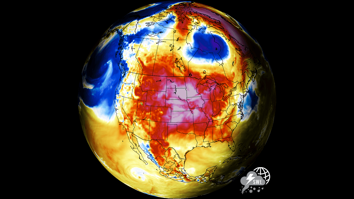
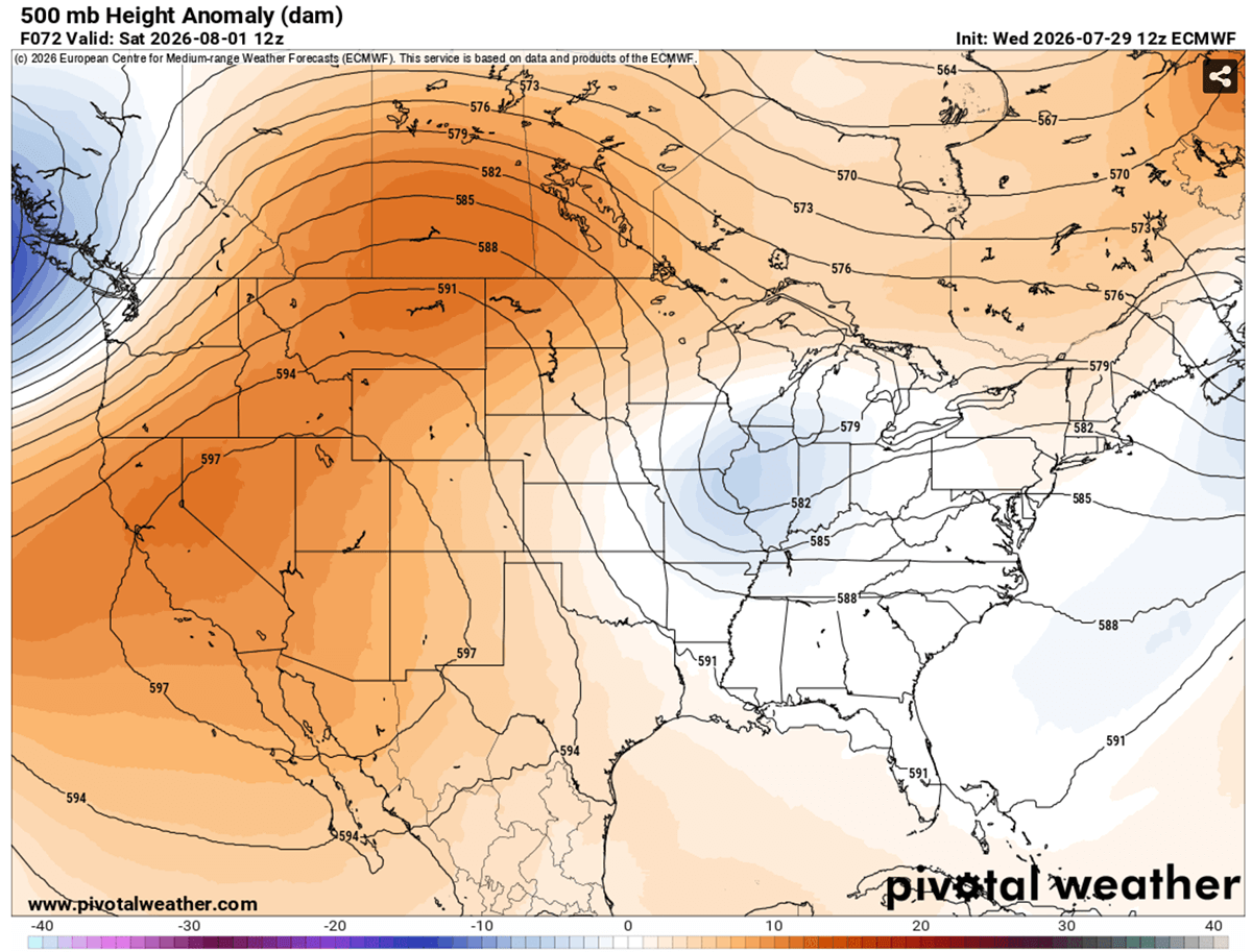
A high-amplitude upper-level ridge has firmly locked a massive, record-shattering "Heat Dome" over the United States and parts of southern Canada. As we move into early August, this atmospheric behemoth is driving afternoon temperatures to dangerous extremes, with readings consistently surging between 105°F and 110°F across the Southwest and the Central Plains. Driven by deep atmospheric compression and persistent high-pressure blocking, this thermal anomaly is currently sitting in the 99th percentile of historical intensity, creating a life-threatening environment for millions.
The phenomenon, which is effectively acting as a thermal lid on the continent, is not merely a passing weather event. It is a multi-week, stationary meteorological crisis that is taxing infrastructure, overwhelming emergency services, and posing significant risks to public health from Southern California through the Mississippi Valley.
The Science of the Heat Dome: A Thermodynamic Trap
To understand the severity of the current situation, one must look at the atmospheric dynamics at play. A heat dome is the result of a strong, stationary high-pressure system—often referred to as an "Upper High" or "Blocking High"—that parks itself over a large geographic area.
Functionally, this system operates like a pressure cooker. As air descends from the upper atmosphere, it compresses. According to the laws of thermodynamics, as air is compressed, its temperature rises. Because the system is locked in place, this superheated air is trapped at lower elevations, where it cannot escape or be diluted by cooler maritime air masses. The dome effectively prevents the formation of clouds, allowing relentless solar radiation to bake the surface, while the high pressure suppresses any potential for vertical cooling or convection.
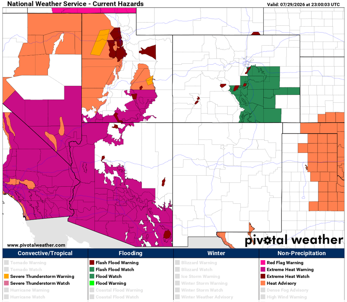
This process creates a feedback loop: the ground becomes hot, the air above it becomes hotter, and the lack of moisture in the soil—caused by the very heat being trapped—exacerbates the problem by removing the cooling effect of evaporation. Consequently, nocturnal cooling, which usually provides a reprieve for both the human body and the power grid, is failing. In many urban corridors, temperatures are struggling to dip below 75°F to 80°F at night, denying residents the physiological recovery time necessary to survive prolonged heat exposure.
Chronology of the Thermal Spike
The current surge began with the consolidation of an upper-level ridge across the Western United States and the Northern Rockies. By mid-week, the high-pressure system solidified, causing a cascade of record-breaking heat across the desert Southwest.
- Mid-Week Intensity: By Wednesday and Thursday, daytime highs in desert basins began pushing toward the 115°F to 120°F mark. These extremes were not confined to the deserts; the heat began to expand eastward, with the Great Plains seeing temperatures in the upper 90s to 103°F.
- The Weekend Peak: As the dome strengthened, the most extreme temperatures shifted toward the High Plains. On Saturday, Montana, Wyoming, and the western Dakotas experienced localized anomalies, with some areas approaching 110°F. Concurrently, Texas, Oklahoma, and Kansas remained under a sustained assault, with temperatures locked in the 100°F–105°F range.
- Early August Outlook: Entering the first full week of August, the heat mass is projected to settle over the central and southern Plains. While some relief is anticipated in the northern regions due to a frontal system pushing out of Canada, the desert Southwest will remain in a "baking" state, with little to no relief in sight for California, Nevada, and Arizona.
Supporting Data: The 850 hPa Anomaly
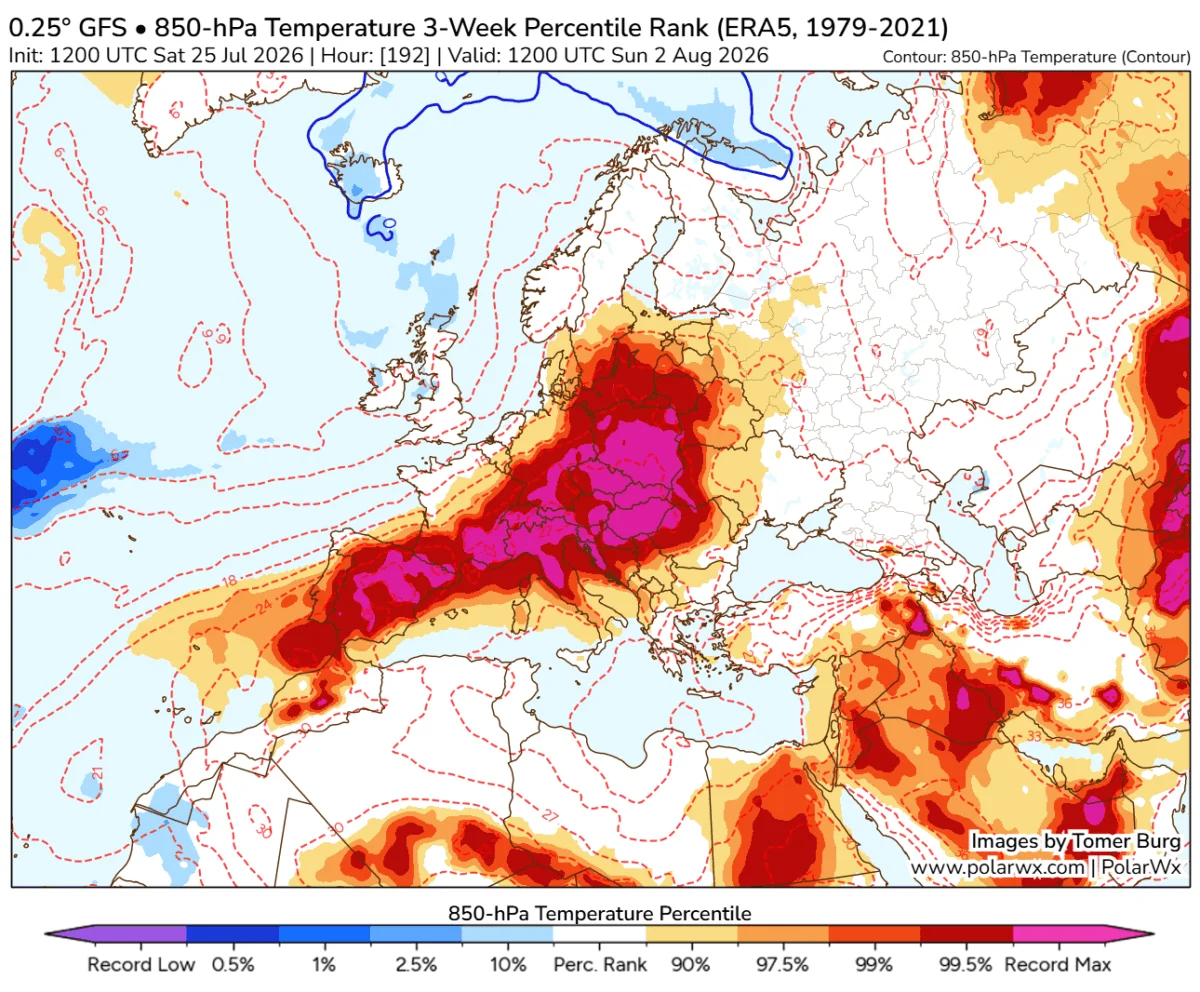
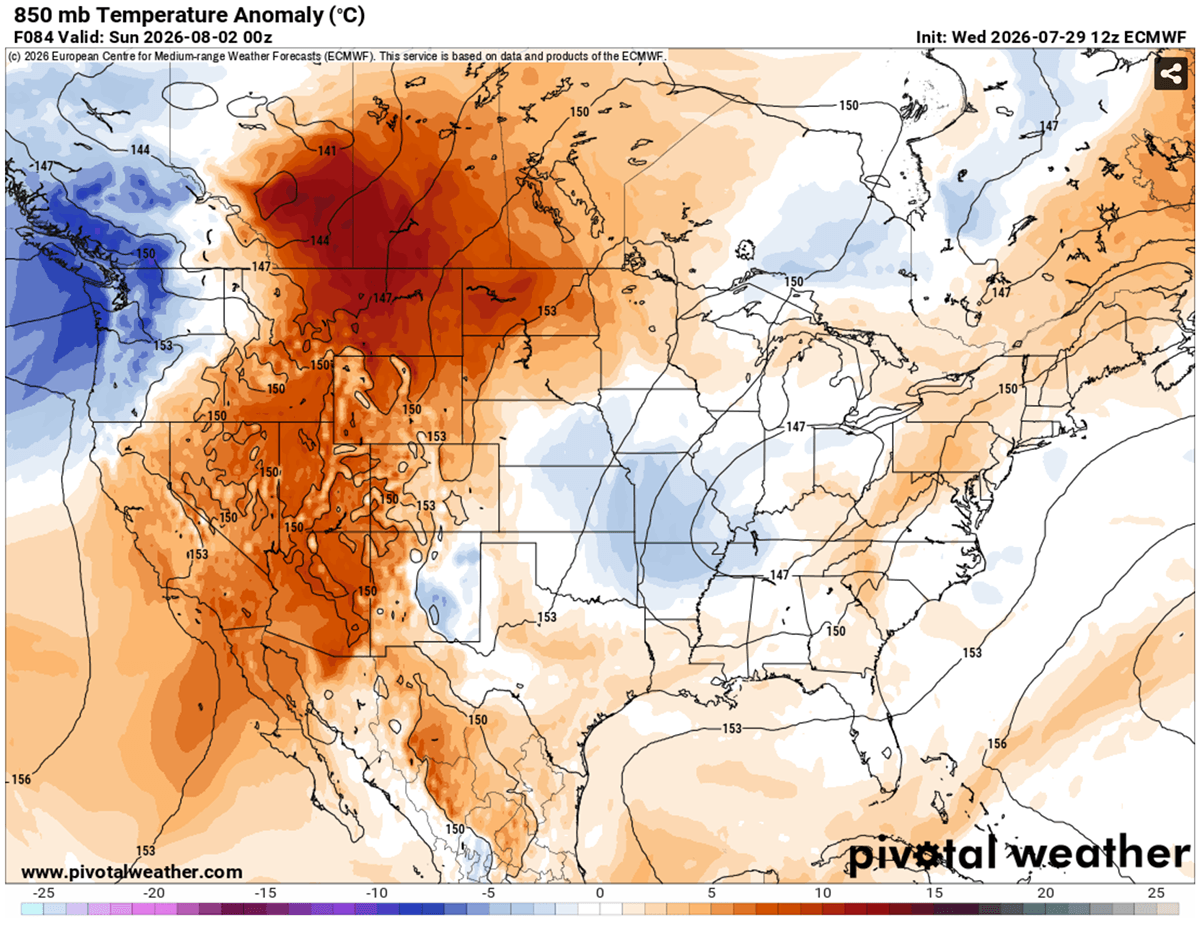
Meteorologists measure the intensity of such events by looking at the 850 hPa level—roughly 5,000 feet above the ground. When this level shows temperature anomalies in the 99th percentile, it indicates that the air mass is historically hot for this time of year. Current maps provided by climate monitoring agencies show a massive "red zone" of high-pressure dominance stretching from the Pacific Coast to the heart of the Mississippi Valley.
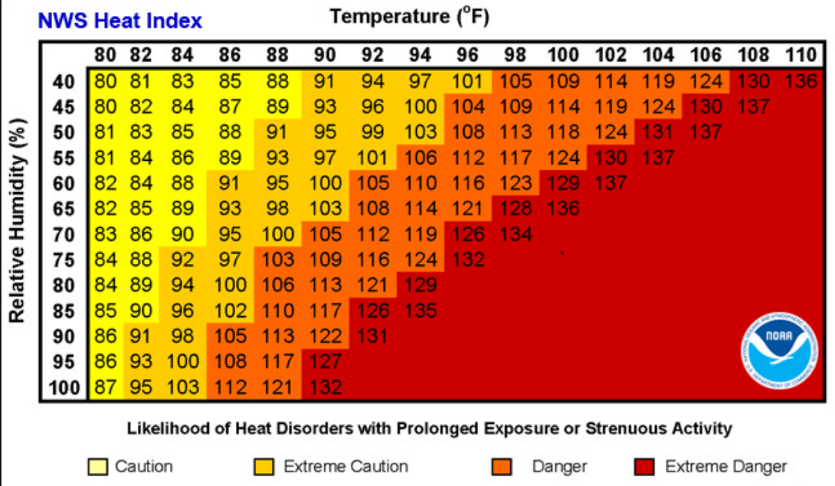
The Heat Index, which calculates the "perceived temperature" by factoring in relative humidity, remains the most critical metric. In areas where humidity is high, even moderate temperatures of 90°F can be rendered lethal. For example, when humidity levels climb above 80%, a 90°F day can feel like 113°F to the human body. This "apparent temperature" is what drives heat exhaustion and, eventually, fatal heat stroke.
Implications for Public Health and Infrastructure
The human toll of a heat dome is often silent but severe. The most vulnerable populations—the elderly, children, and those with pre-existing cardiovascular or respiratory conditions—are at the highest risk. The inability for the body to cool down overnight leads to cumulative physiological strain, which has been directly linked to spikes in emergency room visits for heart attacks and strokes during prolonged heatwaves.
Outdoor workers, including construction crews and agricultural laborers, face an occupational hazard that is rapidly becoming unmanageable. In urban environments, the "Urban Heat Island" effect—where concrete, asphalt, and building materials absorb and radiate heat—turns cities into ovens. Communities living in poverty are disproportionately affected, often residing in older housing with poor insulation or limited access to air conditioning.
Beyond human health, the power grid is under immense stress. As temperatures soar, air conditioning demand surges, threatening the stability of the electrical grid. This creates a dangerous paradox: the very equipment required to survive the heat is the primary driver of potential grid failure, which could leave millions without power during the most dangerous hours of the day. Furthermore, the agricultural sector is suffering as soil moisture depletion accelerates, threatening crop yields across the Great Plains and potentially impacting food security.
Official Responses and Safety Measures
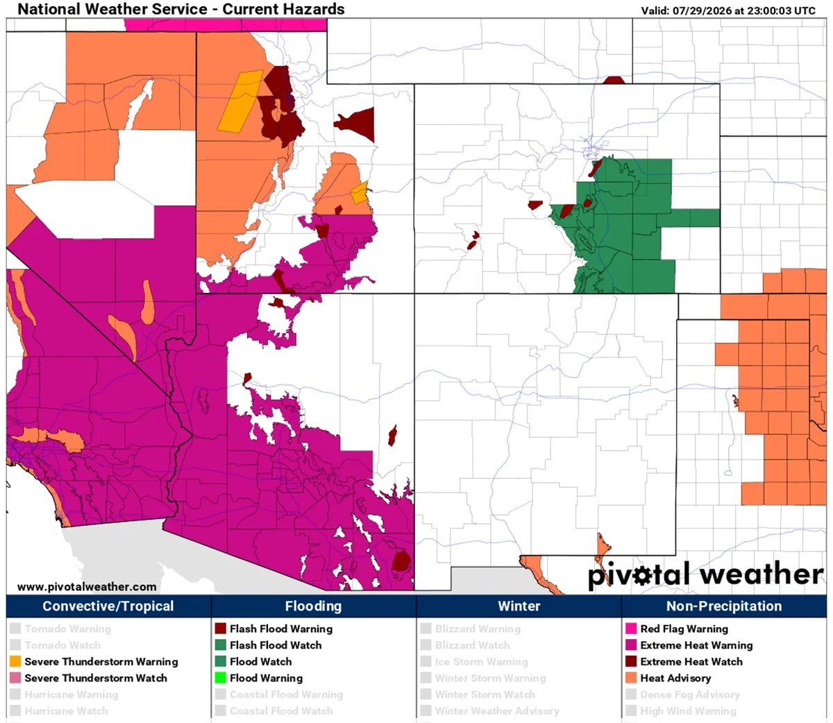
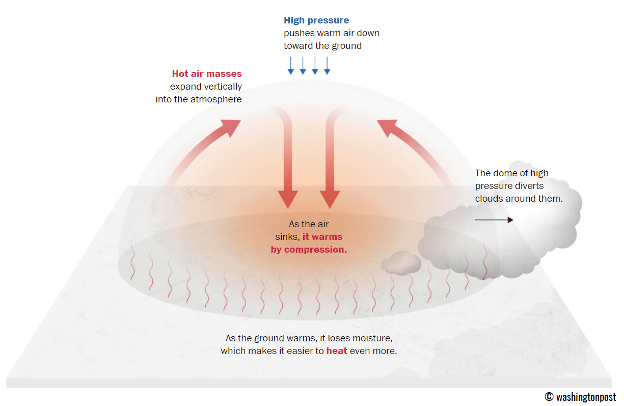
Government agencies and local meteorological services have issued a series of Excessive Heat Warnings and Heat Advisories across nearly a dozen states. Officials are urging residents to:
- Limit Outdoor Activity: Avoid strenuous labor between the hours of 10:00 AM and 6:00 PM.
- Hydration Strategy: Drink water before feeling thirsty and avoid alcohol or excessive caffeine, which contribute to dehydration.
- Check on Neighbors: Prioritize reaching out to the elderly or isolated neighbors who may not have access to cooling centers.
- Monitor Local Alerts: Stay updated through the National Weather Service (NWS) and local emergency management channels.
The persistence of this event is a stark reminder of the volatility of current atmospheric patterns. While global climate models suggest that a frontal system moving out of Canada may provide some relief by the middle of next week, the current "blocking" nature of this heat dome serves as a significant warning of the shifting norms in North American summer weather.
Looking Ahead: Is the Pattern Shifting?
As the current Heat Dome eventually dissipates, meteorologists are already looking toward the broader, long-term trends for the remainder of the summer. The transition into early August is being monitored for signs of a potential pattern shift. The interaction between the weakening of this ridge and the potential for increased moisture transport from the tropics will dictate the weather for the remainder of the season.
However, for the millions currently under the dome, the immediate focus remains on survival. The combination of record-breaking heat and the "lid" effect of the high-pressure system makes this one of the most significant weather events of the year. As the world watches, the scientific community continues to gather data on this event to better understand how these "mega-heatwaves" are evolving in a warming climate.
For those in affected areas, staying informed is not just a matter of convenience—it is a critical component of personal safety. Please monitor local news outlets and the National Weather Service for real-time updates as this situation develops through the coming week.