Europe is on the cusp of a meteorological turning point. After a grueling early September characterized by a persistent and record-breaking Heat Dome, the atmospheric script is about to be rewritten. A high-amplitude, North Atlantic-originated trough is sweeping into Western and Central Europe, signaling the definitive end of the summer season.
This transition is far from subtle. As this polar-origin air mass slams into the entrenched, record-warm air currently dominating the continent, meteorologists are warning of a violent clash. The result will be a multi-day severe weather outbreak stretching from the peaks of the Alps to the coastlines of the Western Balkans, followed by a dramatic "thermal collapse" that will plunge temperatures by as much as 20°C in less than 24 hours.

The Synoptic Setup: The Collapse of the Heat Dome
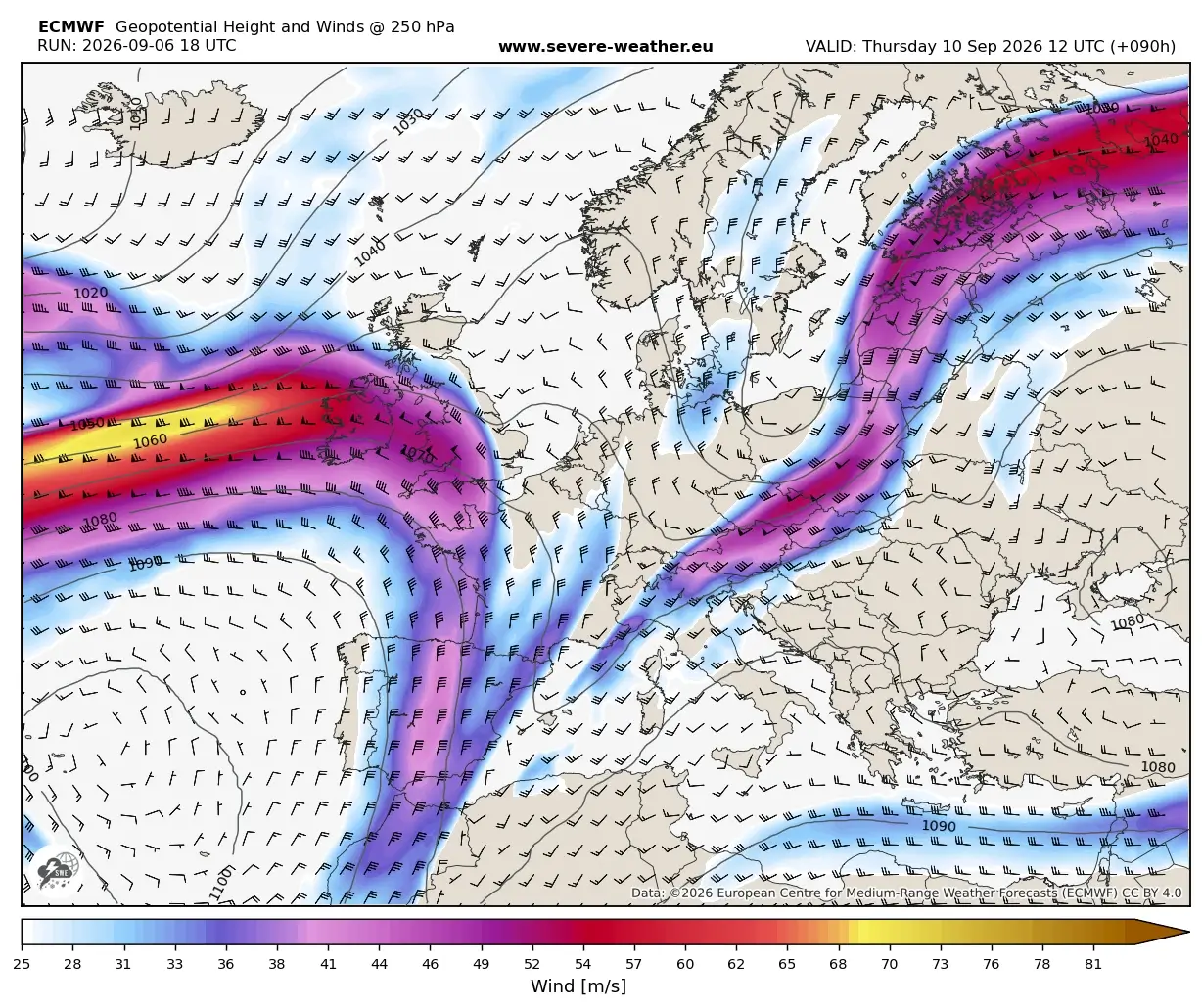
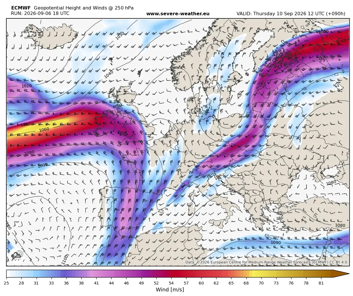
For much of early September, a stagnant upper-level ridge has held Europe in a vice-like grip, suppressing storm activity and driving temperatures to unseasonable highs. However, the synoptic landscape is shifting. A powerful, deep upper-level wave is currently emerging from the North Atlantic, driving a surface cold front that is expected to dismantle the ridge by mid-week.
This system is being classified by weather experts as a "summer-killer" pattern. In meteorological terms, this describes a transition where a prolonged, intense heatwave is abruptly flushed out by a significantly colder, polar-sourced air mass. Unlike a gradual seasonal cooling, this event is characterized by a high-pressure gradient that forces a rapid, aggressive shift in the thermal structure of the atmosphere.
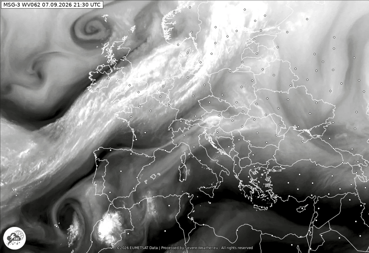
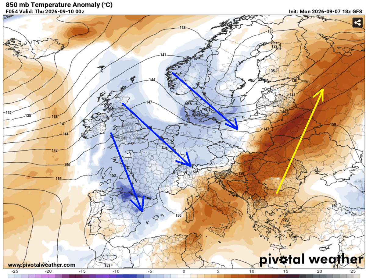
As the front progresses eastward, the warmest air—previously trapped beneath the ridge—will be pushed toward Eastern Europe and western Russia. By Friday, the core of the heat will have been effectively displaced, replaced by a crisp, autumn-like continental airflow.
Chronology of the Event: A 48-Hour Volatility Window
The transition is set to unfold in two distinct phases: the violent convective phase (Wednesday through Thursday) and the post-frontal thermal collapse (Friday into the weekend).
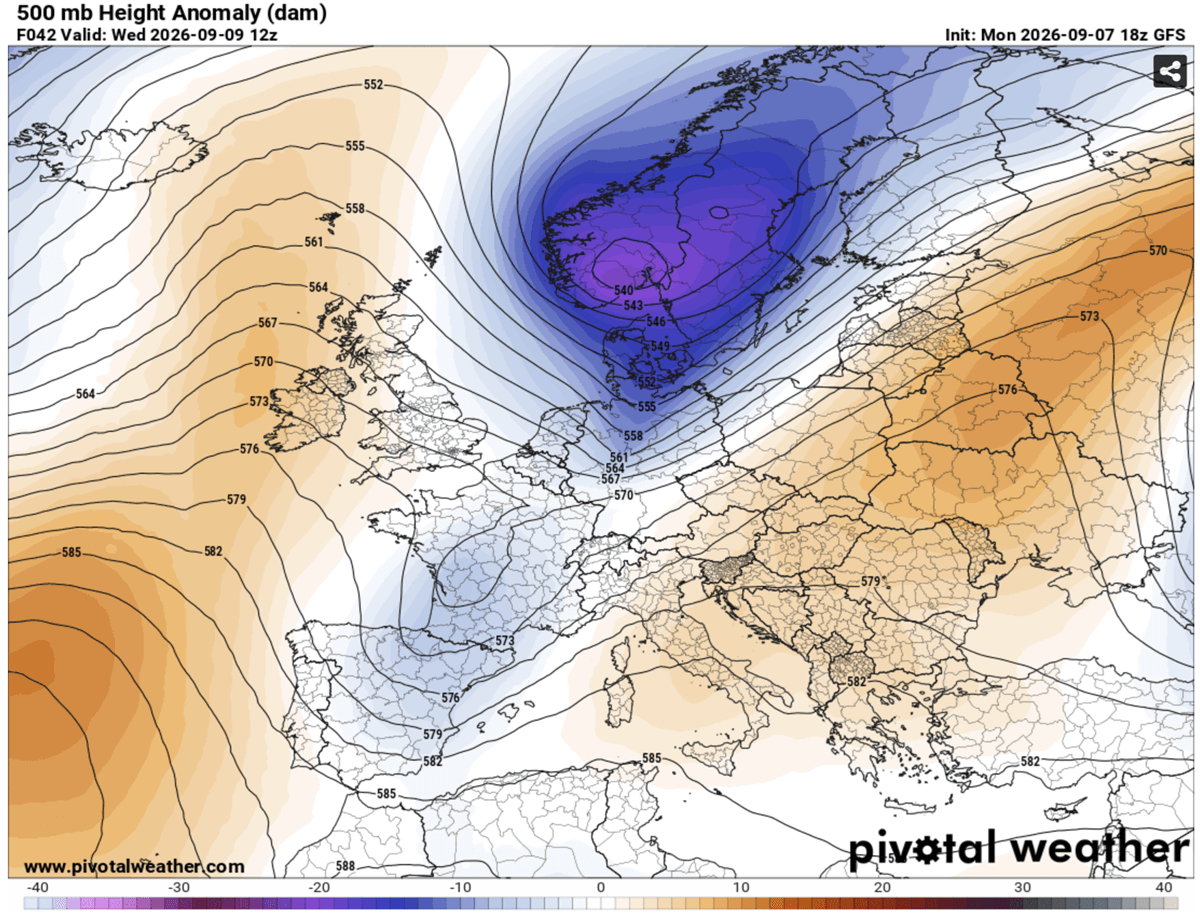
Wednesday: The Onset of Instability
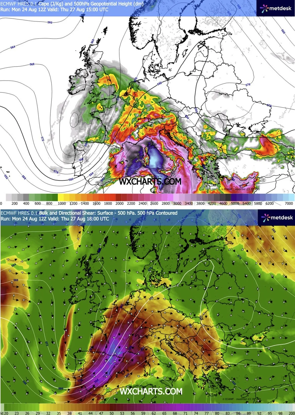
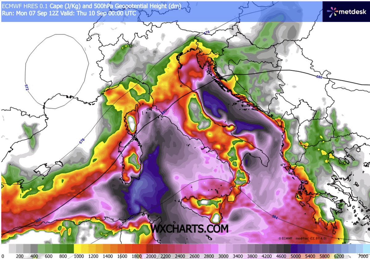
As the upper-level forcing intensifies on Wednesday, the front will interact with extreme moisture reserves accumulated during the historic Mediterranean marine heatwave. The atmospheric profile will become increasingly volatile, with Convective Available Potential Energy (CAPE) values modeled to reach between 3,000 and 4,000 J/kg—levels typically associated with high-end severe weather events.
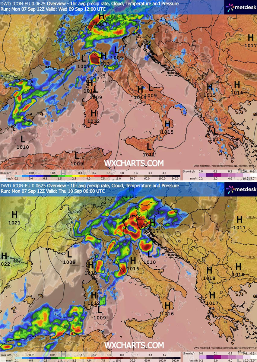
By Wednesday midday, residents in the Balearic Islands and Eastern France should prepare for rapidly deteriorating conditions. The storm activity will push into Northern Italy and the North Adriatic by the evening. Forecasters anticipate the formation of supercells capable of producing large to giant hail, severe straight-line winds, and a localized but significant risk of tornadoes.
Thursday: The Balkan Front
As the system moves east-southeast, the front will stall slightly as a secondary low-pressure system develops over the Northern Mediterranean. This slowing effect will prolong the period of heavy rainfall, particularly over Slovenia, Croatia, and the mountainous terrain of the Western Balkans. During this phase, the threat transitions from wind-and-hail dominance to a major flooding event, as "training" storm cells—where multiple storms pass over the same location—are expected to dump torrential rainfall.
Supporting Data: The Anatomy of a Thermal Collapse
The sheer scale of this weather shift is reflected in current meteorological modeling. Meteogram data for cities like Ljubljana, Slovenia, illustrates a startling drop in 850 mbar temperatures.
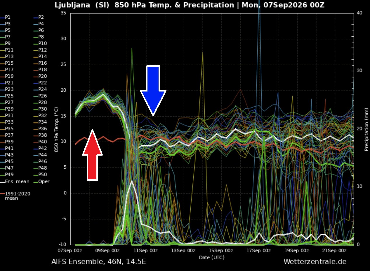
- Pre-Frontal State: Temperatures at the 850 mbar level (approx. 1,500 meters altitude) are currently tracking 10°C above long-term seasonal normals.
- The Drop: Within a 24-hour window, these levels are projected to plummet by 15°C, effectively stripping the atmosphere of its late-summer heat.
At the surface, this translates to daytime highs dropping from the 35–40°C range to mid-teens, a shift so jarring it will feel like an instant migration from Mediterranean summer to mid-autumn. Behind the front, a polar-origin air mass will overspread Central Europe, bringing the season’s first significant snowfall to the high elevations of the Alps. Snow lines are expected to drop rapidly, potentially closing high-mountain passes and creating hazardous conditions for hikers and mountaineers still lingering in the higher altitudes.
Environmental and Infrastructure Implications
The combination of extreme instability and high moisture content from the Mediterranean Sea creates a "worst-case scenario" for flash flooding. Coastal areas, particularly the Liguria Bay, the North Adriatic, and the Tuscany coast, are at high risk.
Current models suggest rainfall totals could reach 150–200 mm in just 48 hours in localized areas. In urban environments, this volume of water—likely arriving in a short burst—poses an extreme risk to drainage systems and low-lying infrastructure.
Key Risks Identified:
- Flash Flooding: High-intensity rainfall concentrated in mountainous and coastal regions will likely cause rapid water level rises in small creeks and rivers.
- Damaging Winds: As the cold front pushes through, the sudden density change in the air mass will generate violent gust fronts, capable of damaging trees, power lines, and temporary structures.
- Hail Hazards: The extreme instability in the warm sector of the storm will likely support the growth of large hailstones, posing risks to agriculture, vehicle fleets, and roofing.
- Marine Hazards: High sea temperatures combined with extreme wind shear will likely generate hazardous sea states in the Adriatic and Mediterranean, necessitating warnings for maritime traffic.
Official Responses and Public Safety Recommendations
National meteorological agencies across the affected countries have begun issuing alerts. In Italy and the Balkan states, civil protection authorities are urging citizens to monitor local updates closely, as the rapid development of convective storms makes precise location-based forecasting difficult until the final hours.
Public safety recommendations include:
- Securing Outdoor Property: Residents should remove or secure loose items such as patio furniture, as the gusty nature of the incoming front can turn debris into projectiles.
- Travel Precautions: High-mountain travel should be avoided until the cold front has fully passed, due to the risk of sudden, heavy snowfall and whiteout conditions at high elevations.
- Flood Vigilance: Those living in flood-prone zones or near small watercourses should remain alert for rapid water accumulation. Avoid driving through standing water, as the force of the flow can be deceptive.
A New Meteorological Chapter
While this "summer-killer" front brings much-needed relief from the oppressive heat, it marks the start of a more dynamic and unpredictable phase of the season. Climate models suggest that the North Atlantic will remain active throughout September, likely driving a series of weather systems into the continent.
The immediate task for Europe is to navigate the next 48 hours of volatility. As the ridge breaks down and the cold front surges through, the continent will transition from a state of sustained, record-breaking heat to a refreshed, albeit turbulent, autumn climate. Stay tuned to local official weather services for the most current warnings and radar imagery as this significant pattern shift reaches its peak.
Data sources for this report include regional weather monitoring stations, satellite imagery from the North Atlantic, and numerical weather prediction models provided by PivotalWeather and WXcharts.