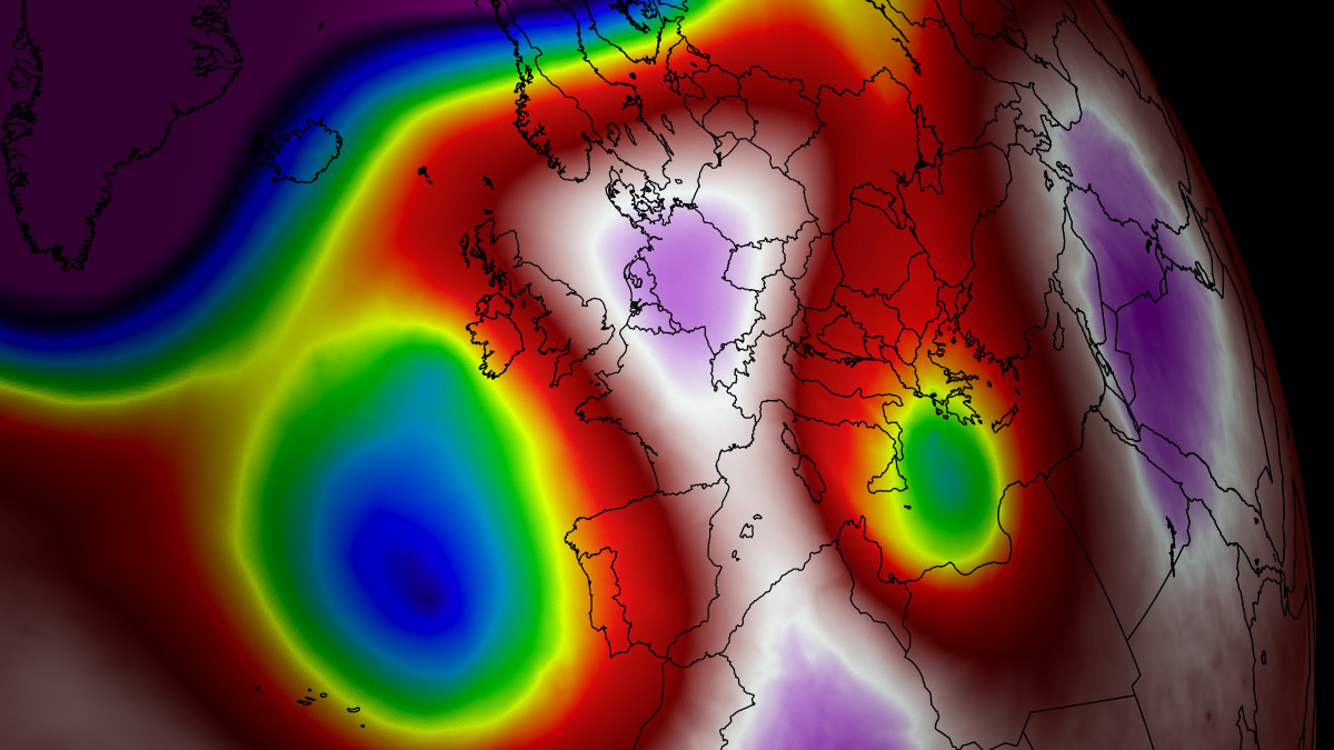
As August begins, a formidable and persistent meteorological phenomenon is tightening its grip on the United States and parts of Canada. A high-amplitude upper-level ridge—commonly referred to by meteorologists as a "Heat Dome"—has locked into place, creating a stagnant atmospheric environment that is driving temperatures to perilous extremes. From the sun-scorched basins of the Southwest to the vital agricultural corridors of the Great Plains and the Mississippi Valley, millions are enduring a prolonged thermal siege that shows little sign of immediate respite.
Main Facts: An Unprecedented Thermal Event
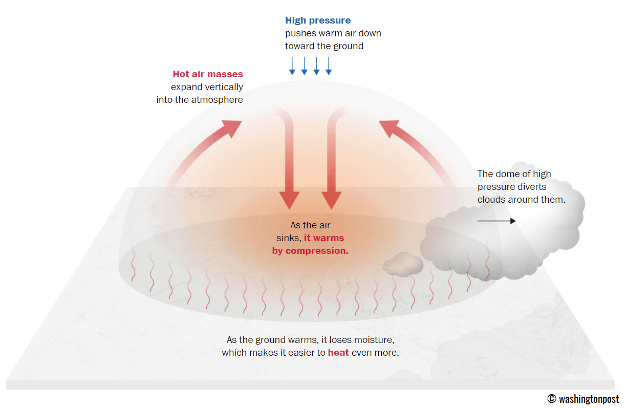
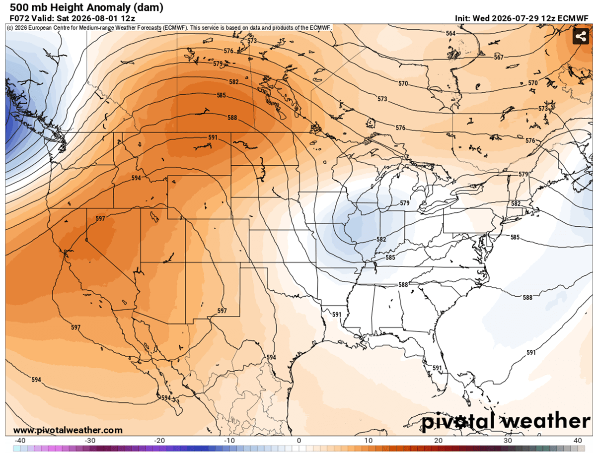
The current weather pattern is characterized by a "blocking high," a dominant high-pressure system that acts as an atmospheric lid. By trapping warm air at all levels and forcing it to sink toward the surface, this system prevents the typical circulation of cooler, more temperate air. The result is a process known as adiabatic compression, where the sinking air heats up significantly as it nears the ground, leading to surface temperatures that are shattering seasonal norms.
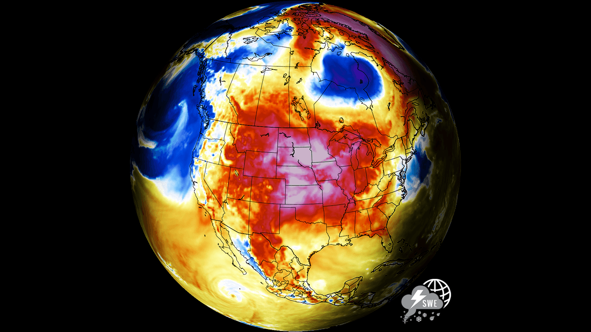
Meteorological data indicates that upper-air thermal anomalies are reaching the 99th percentile—a statistic that highlights just how rare and intense this specific heat event is. Throughout the Southwest, daytime highs are consistently climbing into the 115°F to 120°F range, while the central United States faces peak afternoon temperatures between 105°F and 110°F. Perhaps most alarming is the lack of "nocturnal relief." In many urban centers, overnight lows are struggling to dip below 80°F, preventing buildings and bodies from cooling down, which exponentially increases the risk of heat-related illness.
Chronology of the Siege
The progression of this heatwave follows a clear, multi-week trajectory defined by the expansion of the high-pressure ridge.
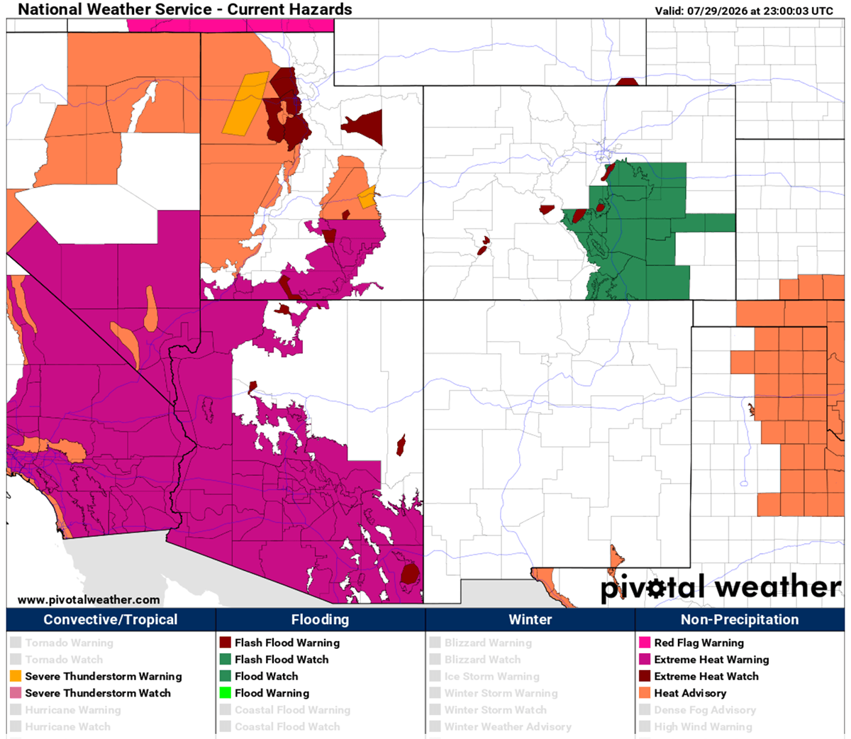
- Mid-to-Late July: The ridge began to solidify over the Western United States and the Northern Rockies. Initial thermal spikes were noted in California and Arizona, with desert basins serving as the epicenter of the early-stage warming.
- Late July to Early August: The system expanded eastward, encompassing the Great Plains and the Mississippi Valley. By Thursday, July 31, regional temperature maps showed widespread readings in the low-to-mid 100s across Texas, Oklahoma, and Kansas.
- The Weekend Peak: Forecasters expect the heat to reach its zenith on Saturday and Sunday. During this period, the dome will be at its most intense, with Montana, Wyoming, and the western Dakotas expected to see temperatures surge from 103°F toward 110°F.
- Early August Outlook: While the Southwest will continue to bake under 120°F temperatures into next week, there is a glimmer of hope on the horizon. Global weather models indicate that a frontal system moving out of Canada may begin to erode the northern edge of the ridge by mid-next week, offering some localized cooling for the northern High Plains.
Supporting Data: Understanding the Physics of the Dome
To understand why this heatwave is so dangerous, one must look at the atmospheric dynamics at play. A heat dome is not merely "hot weather"; it is a systemic failure of the atmosphere to ventilate. When the high-pressure system parks itself over a large continent, it acts like the lid on a boiling pot.
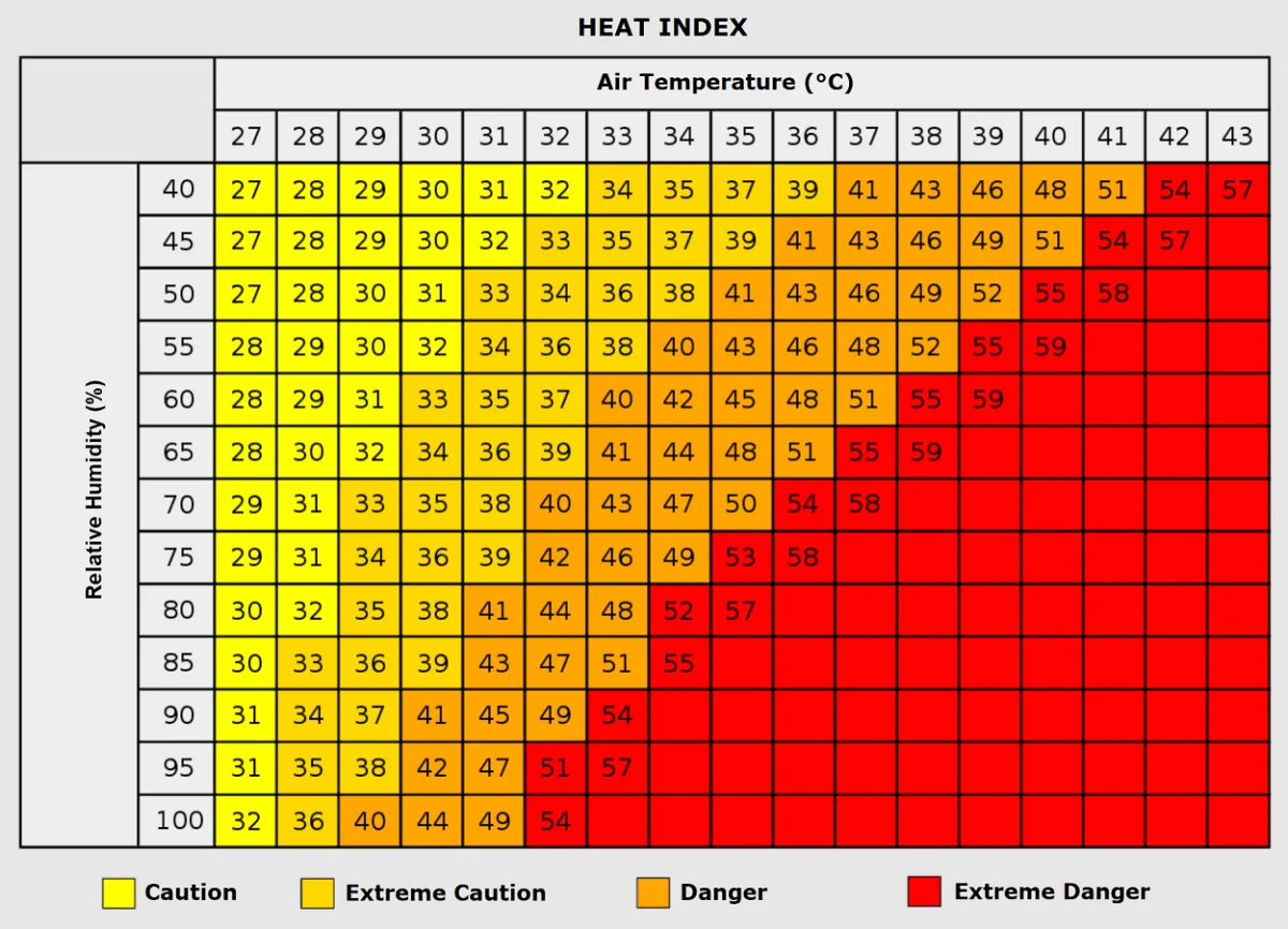
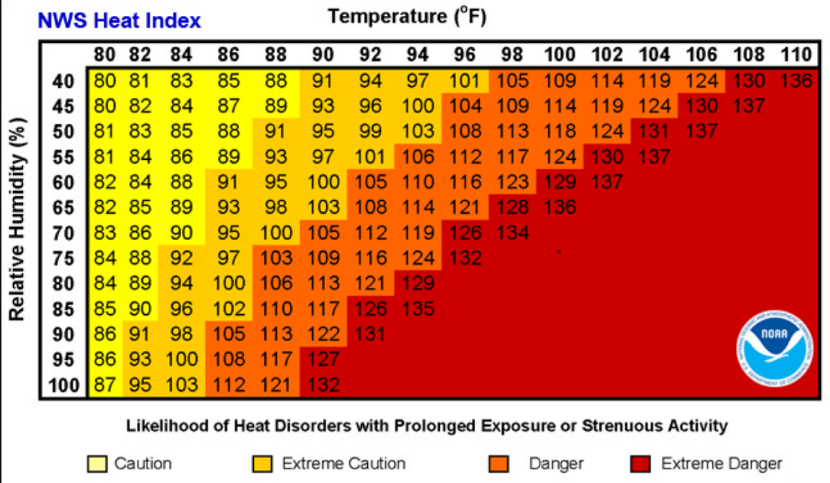
The "Heat Index" is the primary metric currently used to convey the danger to the public. This value combines ambient air temperature with relative humidity. When humidity is high, the human body’s primary cooling mechanism—sweating—becomes inefficient because the air is already saturated with moisture. For example, in an environment with a temperature of 90°F, a 60% humidity level creates a manageable environment. However, if that humidity climbs to 80% or higher, the "feel" temperature can skyrocket to 113°F. This discrepancy is precisely what is currently causing such extreme physiological stress across the Mississippi Valley.
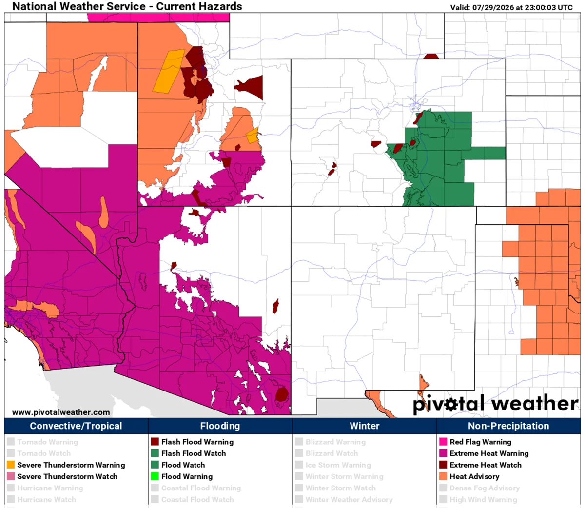
Surface-level sensors and satellite imagery provided by organizations such as PivotalWeather and WXcharts confirm that the 850 hPa (hectopascal) temperature anomalies are consistently above average across nearly 70% of the contiguous United States. This indicates that the heat is not just a surface phenomenon but is deeply ingrained in the lower atmosphere, making it exceptionally difficult for local thunderstorms or breezes to break the cycle.
Implications: A Crisis for Health and Infrastructure
The human and structural toll of such a sustained heat event is profound. Health officials are sounding the alarm for vulnerable populations, including the elderly, children, and those with pre-existing cardiovascular or respiratory conditions.
Physiological Strain
Prolonged exposure to temperatures exceeding 100°F leads to rapid dehydration and heat exhaustion. If untreated, this can escalate to heat stroke, a medical emergency characterized by a body temperature exceeding 104°F, which can cause permanent organ damage or death. The lack of nighttime cooling is a critical factor; the human body requires a drop in ambient temperature to recover from the heat stress of the day. Without this, the cumulative toll on the heart and kidneys increases every 24 hours.
The Power Grid Dilemma
Infrastructure is also under immense pressure. As air conditioning units run at maximum capacity 24 hours a day, electricity demand is hitting record highs. Grid operators are struggling to balance the load, with concerns mounting regarding potential brownouts or rolling blackouts. The failure of power systems during a heat dome is a "worst-case scenario" for public health, as it removes the primary survival tool for millions of people.
Agricultural and Economic Impact
Beyond the urban landscape, the agricultural sector is suffering. The persistent heat, combined with a lack of precipitation, is rapidly accelerating soil moisture depletion. Crops in the central United States are currently facing critical stress, which could lead to significant yield reductions. Furthermore, construction and outdoor industries are seeing a marked decline in productivity, as labor laws and safety standards mandate frequent breaks or total cessation of work during peak heat hours to prevent fatalities among workers.
Official Responses and Safety Measures
Government agencies and local municipalities have initiated heat emergency protocols. These measures typically include:
- Opening Cooling Centers: Designated public spaces with high-capacity air conditioning are being made available for those without home cooling.
- Increased Surveillance: Public health departments are tracking hospital admissions for heat-related illness to deploy resources to the most affected zip codes.
- Public Outreach: Messaging campaigns are emphasizing the "Look Before You Lock" policy (to prevent heat-related deaths in vehicles) and advising residents to limit strenuous activity between the hours of 10:00 AM and 6:00 PM.
Conclusion: The New Normal?
As we move deeper into August, the persistence of this heat dome serves as a stark reminder of the volatility of our current climate patterns. While meteorologists monitor the expected shift in the upper-level ridge by mid-week, the immediate focus remains on safety and resource management.
This event is not an isolated incident but part of a broader trend of more frequent and intense "blocking" weather events. As we analyze the data from this current siege, the necessity for improved urban planning—such as the integration of "cool roofs," increased urban canopy, and more resilient energy grids—becomes undeniably clear. For now, the priority for millions remains the same: stay hydrated, stay indoors, and stay informed as the nation navigates this extraordinary atmospheric challenge.