Every autumn, as the first frosts settle over the Northern Hemisphere, a persistent question resurfaces across weather forums and social media platforms: Is snow spreading rapidly across Siberia? For years, meteorologists and amateur weather enthusiasts alike have treated a fast October snow advance in Eurasia as a "holy grail" indicator—an early warning sign of a brutal, snowy winter for the United States, Canada, and Europe.
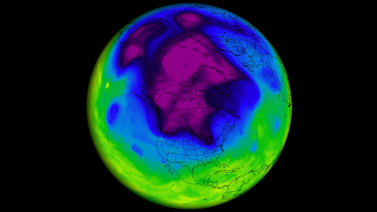
The theory is rooted in a landmark 2011 study that suggested a direct physical link between Eurasian snow cover and the health of the Polar Vortex. However, with modern data now spanning nearly half a century, the reality of this connection has become far more complex. A rigorous re-evaluation of 47 years of climate data suggests that while the "Siberian Snow Theory" was once a beacon of predictability, it may now be little more than a meteorological ghost.
The Genesis of a Weather Legend
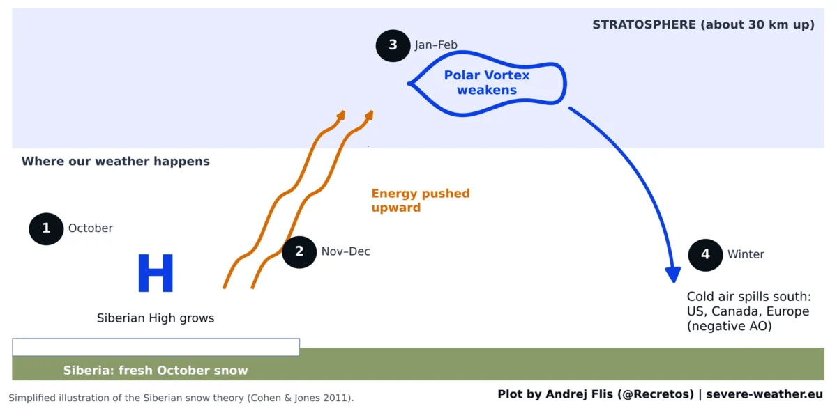
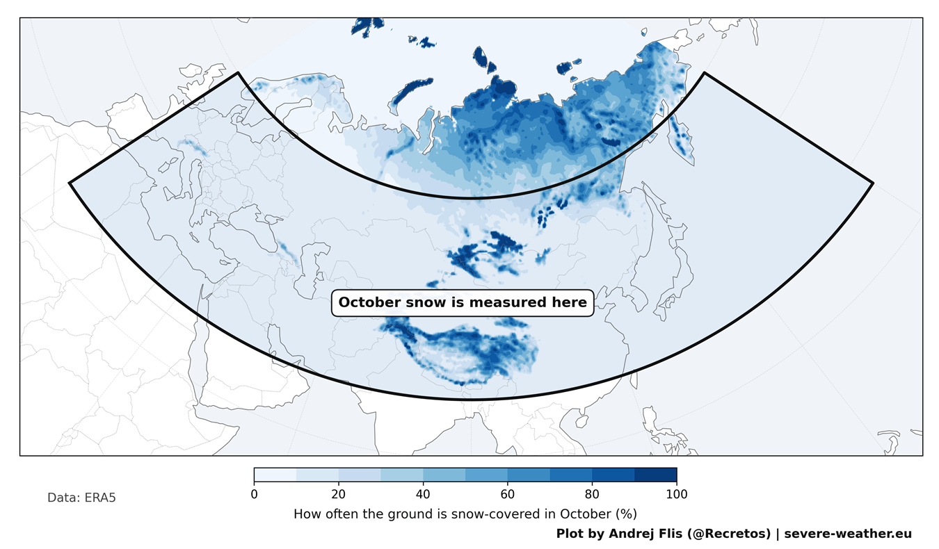
In 2011, atmospheric scientists Judah Cohen and Justin Jones introduced a compelling hypothesis: the speed at which snow cover expands across Eurasia during October serves as a precursor to the winter’s Arctic Oscillation (AO) state.
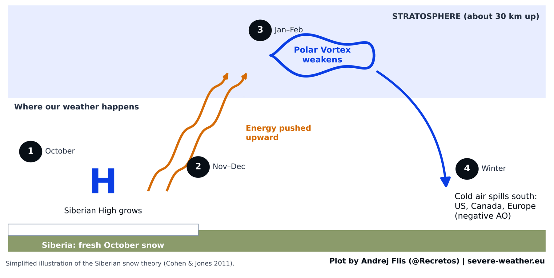
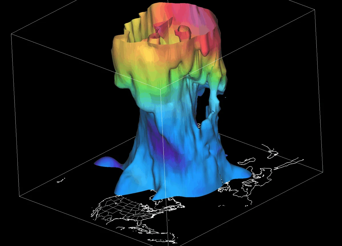
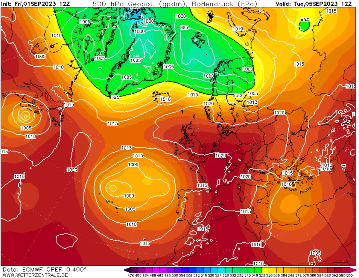
The physical mechanism described was elegant in its simplicity. Fresh snow reflects sunlight and cools the ground, effectively strengthening the "Siberian High"—a massive area of high pressure over northern Asia. This high-pressure system, according to the theory, generates planetary waves that propagate upward into the stratosphere, about 30 kilometers (18.5 miles) above the Earth’s surface. These waves act as a disruptor, shaking the Polar Vortex—a massive, swirling ring of cold air locked over the Arctic—and forcing it to weaken or "wobble."
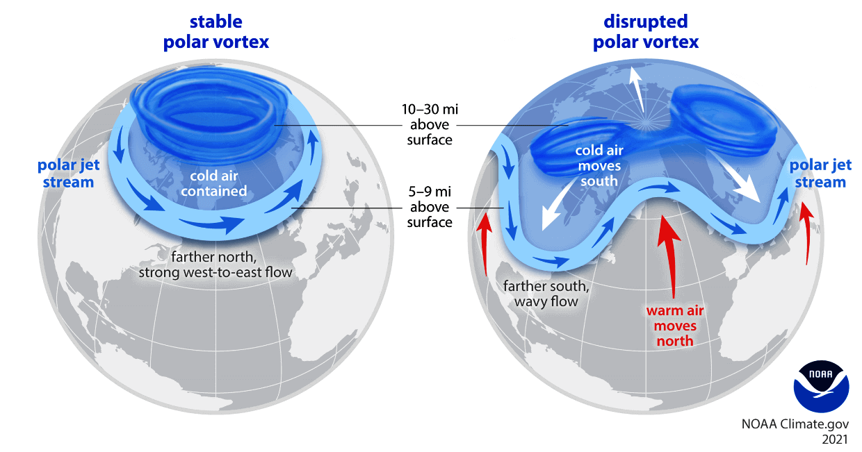
When the Polar Vortex is stable, the bitter cold stays trapped at the North Pole. When it becomes disrupted, lobes of frigid air break away, spilling south into the mid-latitudes, resulting in severe winter outbreaks across the United States, Canada, and Europe.
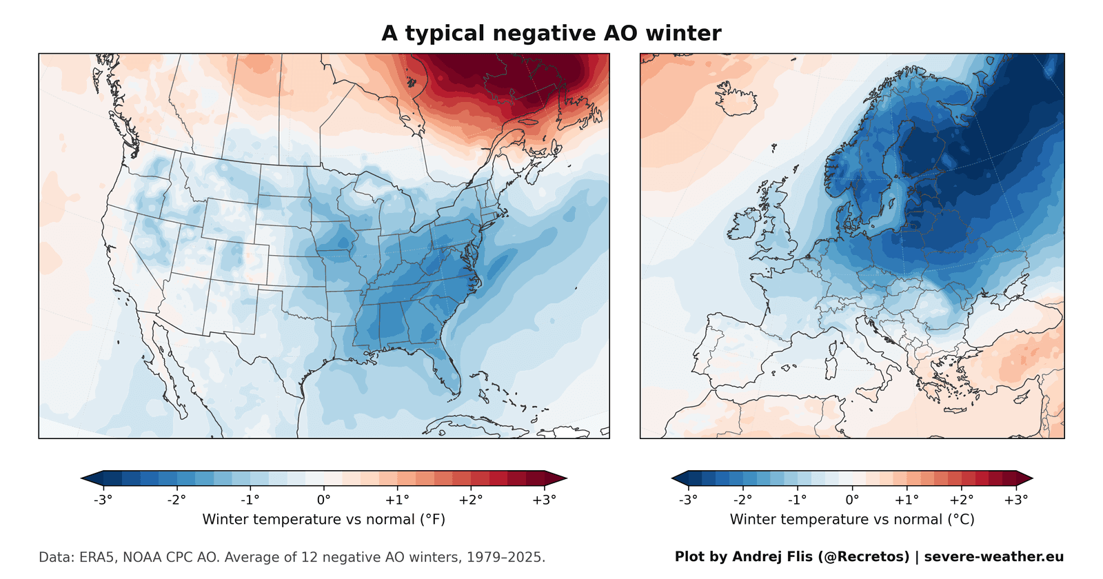
A Chronological Breakdown of the Signal
To test the longevity of this theory, we analyzed 47 years of data, spanning from 1979 to 2025, utilizing four independent snow datasets to ensure accuracy.
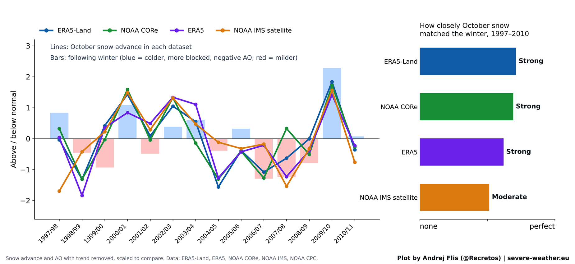
The Golden Age (1997–2010)
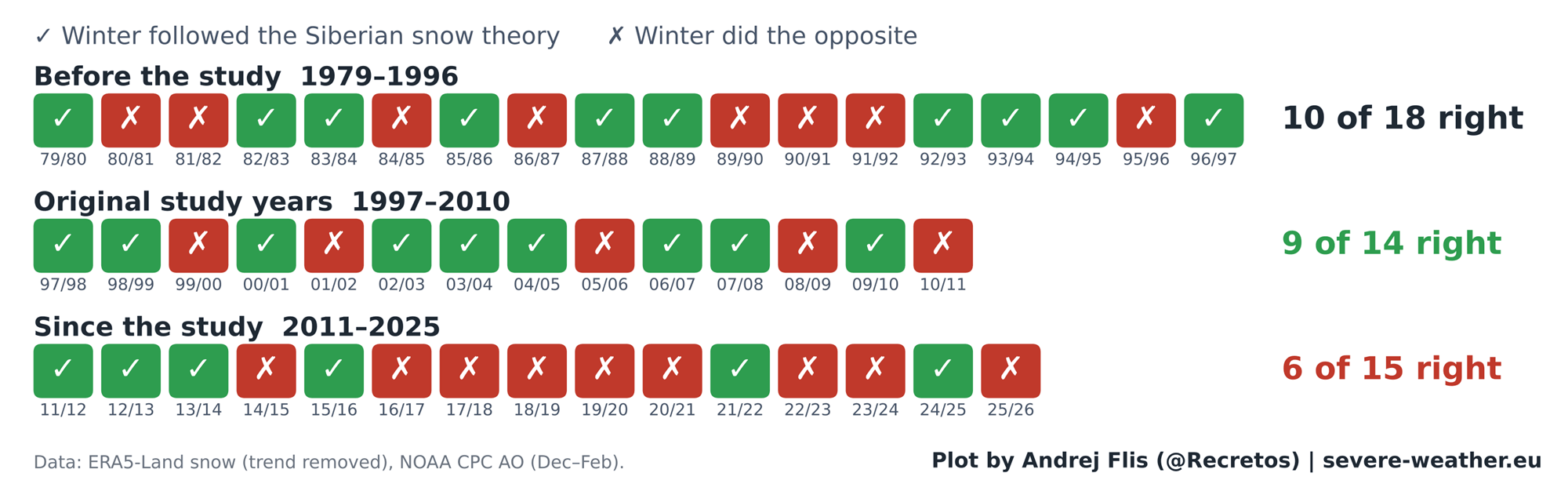
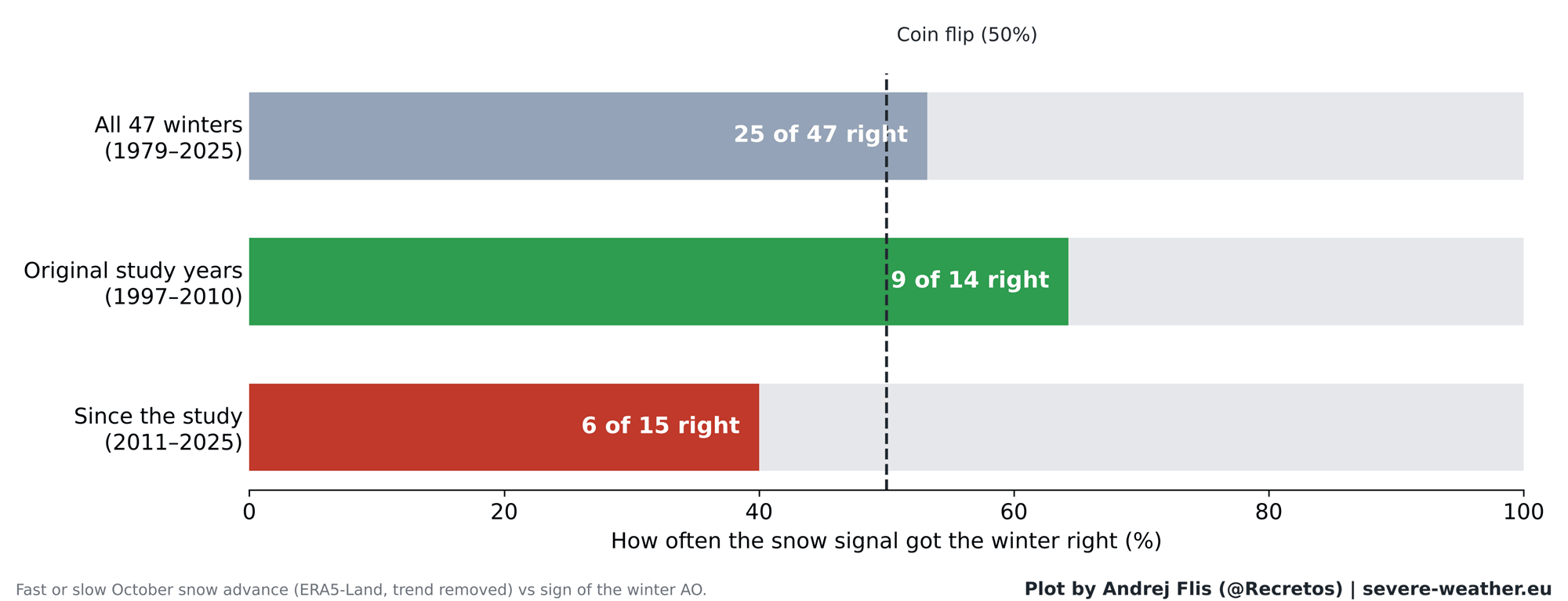
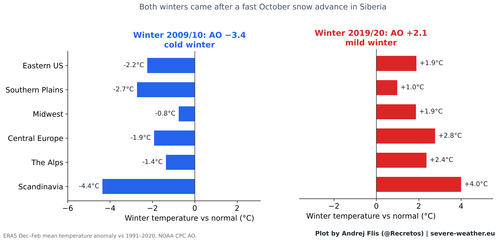
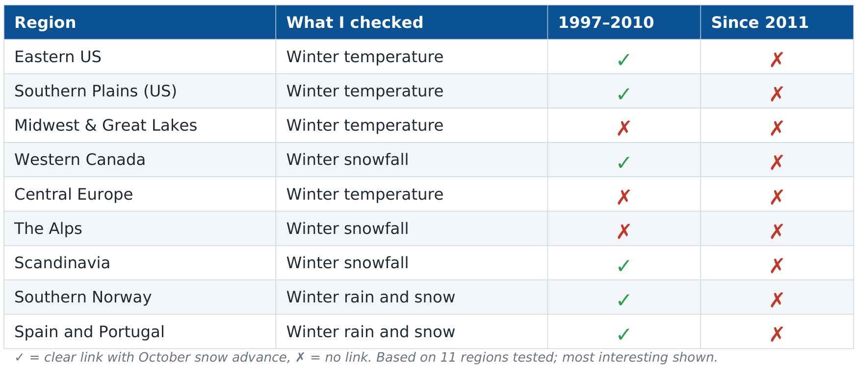
During the years immediately following the original study’s publication, the theory appeared to hold remarkable predictive power. The 2009/2010 winter, in particular, served as a "poster child" for the hypothesis. Following a record-fast October snow advance, the Northern Hemisphere experienced a deeply negative Arctic Oscillation, leading to historic snowstorms in the Eastern United States and a harsh, freezing winter across Europe. During this era, the signal was correct in 9 out of 14 cases.
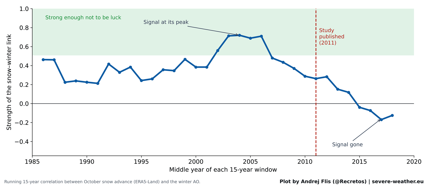
The Era of Fading Correlations (2011–2025)
The narrative shifted significantly in the decade and a half that followed. As we incorporated 15 years of new, high-resolution satellite data, the once-strong correlation began to dissolve. In the 15 winters since 2011, the "snow signal" has accurately predicted the winter outcome only 6 times—a success rate worse than a coin flip.
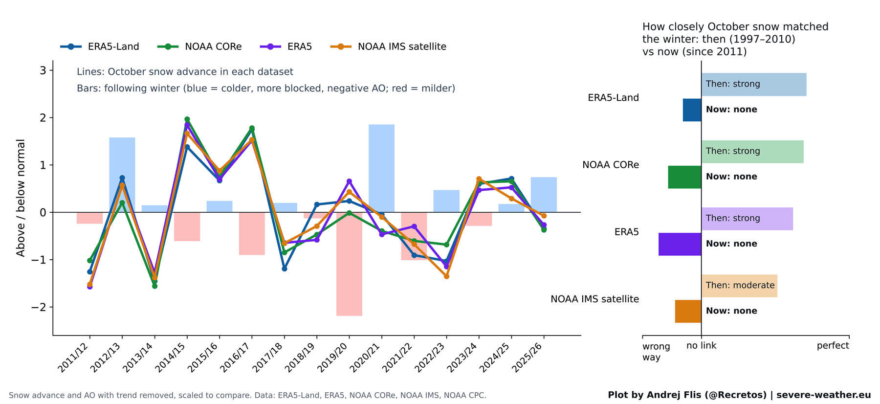
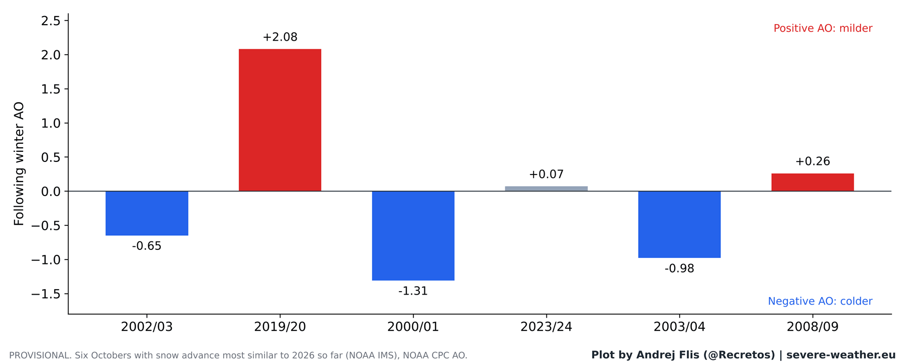
The most notable failure occurred during the 2019/2020 winter. Despite a rapid October snow advance that should have signaled a brutal, cold season, the world experienced one of the warmest, mildest winters on record. The once-dependable link had vanished.
Supporting Data: Where the Physics Breaks Down
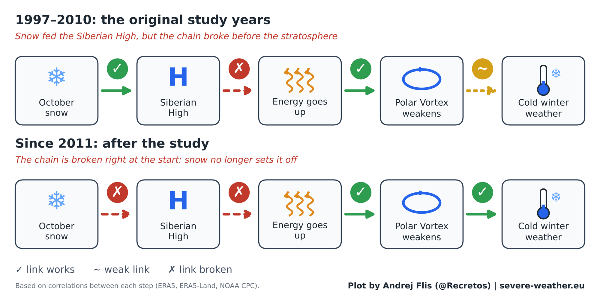
The degradation of the theory does not necessarily mean the underlying physics of the atmosphere are wrong; rather, it suggests the specific link between October snow and the stratosphere has weakened.
Our analysis confirms that the "second half" of the chain reaction remains valid: if energy flows upward into the stratosphere during November and December, the Polar Vortex remains susceptible to disruption, which reliably leads to colder mid-winter weather. However, the "first half"—the link between October Siberian snow and that upward energy flux—has become increasingly erratic.
Several factors likely contribute to this:
- Arctic Sea Ice Loss: The rapid disappearance of Arctic sea ice has fundamentally altered surface-level heating patterns, potentially decoupling the Siberian High from traditional snow-cover responses.
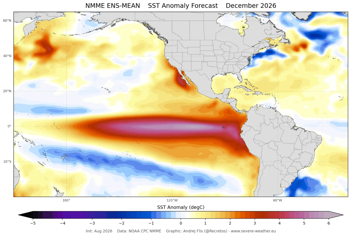
- Pacific Climate Drivers: The influence of the El Niño-Southern Oscillation (ENSO) appears to exert a more powerful influence on winter weather than Siberian snow, often masking or overriding the snow signal.
- The "Lucky Streak" Hypothesis: Some researchers argue that the 2000s were simply a period of favorable atmospheric conditions, and the strength of the 2011 findings was partially inflated by the outlier event of 2009/2010.
Official Perspectives and Scientific Consensus
While the Siberian snow index has lost its luster as a standalone forecaster, the scientific community continues to focus on the stratosphere as the true driver of winter extremes. Major meteorological organizations, including NOAA and the ECMWF, have shifted their focus toward "Sudden Stratospheric Warming" (SSW) events.
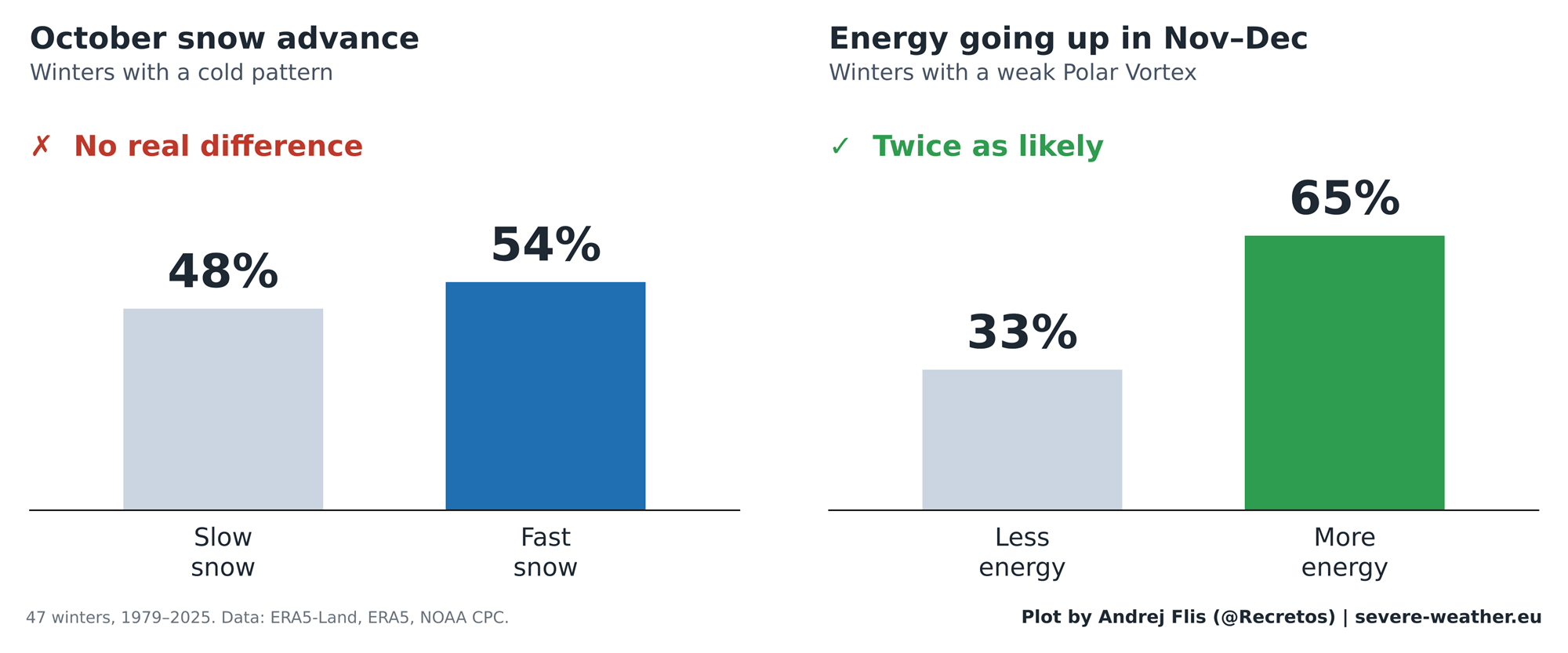
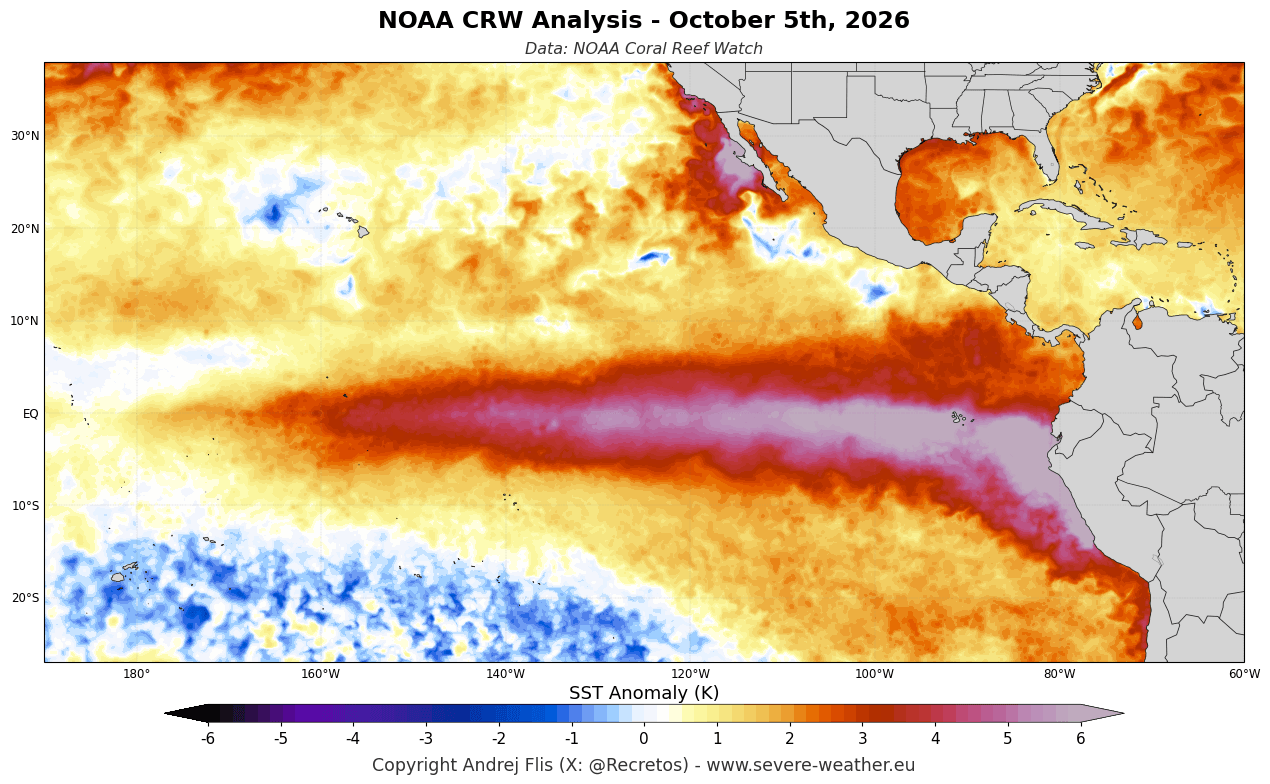
These events, which occur when the Polar Vortex collapses due to wave energy, are now recognized as the primary culprits behind "Polar Express" weather events. Modern climate modeling suggests that while October snow may contribute to the potential for these events, it is no longer a reliable primary indicator. The current consensus among long-range forecasters is to treat October snow as a secondary metric, subservient to the larger, more potent drivers like the Super El Niño and the state of the Pacific jet stream.
Implications for Winter 2026/2027
As we look toward the upcoming winter, the data presents a complex picture. October 2026 began with slower-than-average snow growth, though forecasts suggest a significant surge of accumulation is imminent.
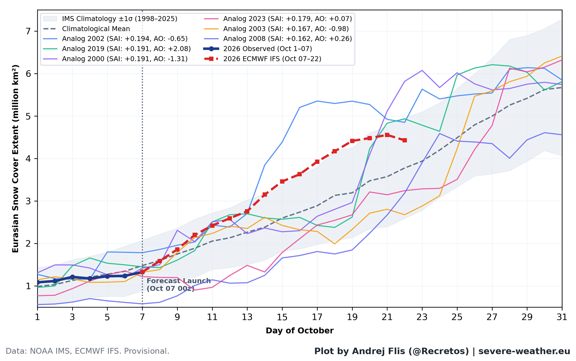
Despite this expected "fast advance," we must be cautious about over-interpreting the results. The 2026/2027 winter is heavily influenced by a Super El Niño, which is already reshaping global circulation patterns. Current ECMWF models indicate a significant stratospheric deceleration of the Polar Vortex heading into January 2027. This suggests a high probability of a "stretched" or disrupted vortex in the second half of winter, independent of the October snow totals in Siberia.
For the United States, this points toward a trend of increased cold-air outbreaks, particularly in the central and eastern regions, fueled by the Pacific storm track and potential stratospheric collapses. Europe, conversely, may see a milder flow, with cold conditions restricted to the northernmost latitudes, unless a specific late-season pattern shift occurs.
Conclusion: Moving Beyond the Snow
The story of the Siberian snow theory serves as a humbling reminder of the fluidity of climate science. What was once considered a robust, almost definitive indicator has proven to be a transient signal, subject to the shifting dynamics of a warming planet.
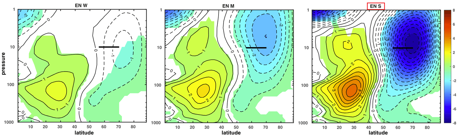
While we should continue to monitor Eurasian snow cover as part of a broader set of variables, it is no longer the "crystal ball" it was once thought to be. The real story for Winter 2026/2027 lies in the stratosphere and the influence of the current Super El Niño. For those hoping to predict the coming months, the lesson is clear: look to the sky, not just the ground, and prepare for a winter that will be defined by the complex, high-altitude dance of the Polar Vortex rather than the frost on the plains of Siberia.