Updated October 15, 2026
As we move deeper into the autumn of 2026, the meteorological community is laser-focused on a single, dominant phenomenon: the development of an extreme “Super El Niño.” This massive oceanic event, currently churning in the tropical Pacific, is not merely a regional temperature anomaly—it is the primary driver of global weather patterns for the upcoming winter. With the release of the latest September forecast data, we are finally seeing a clearer picture of how this atmospheric juggernaut will dictate snow, storm tracks, and temperature anomalies across the United States, Canada, and Europe.
The Core Driver: Anatomy of a Super El Niño
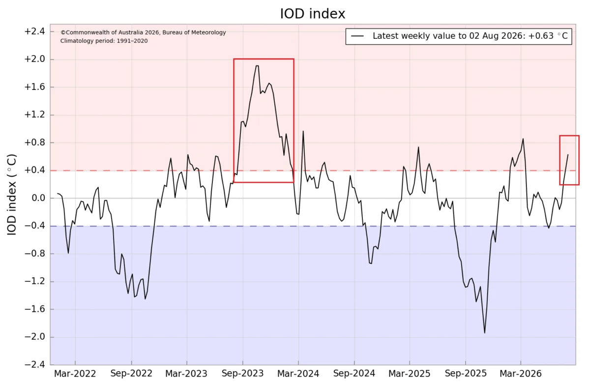
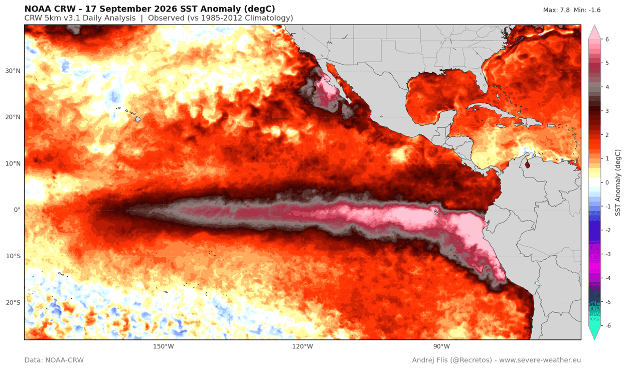
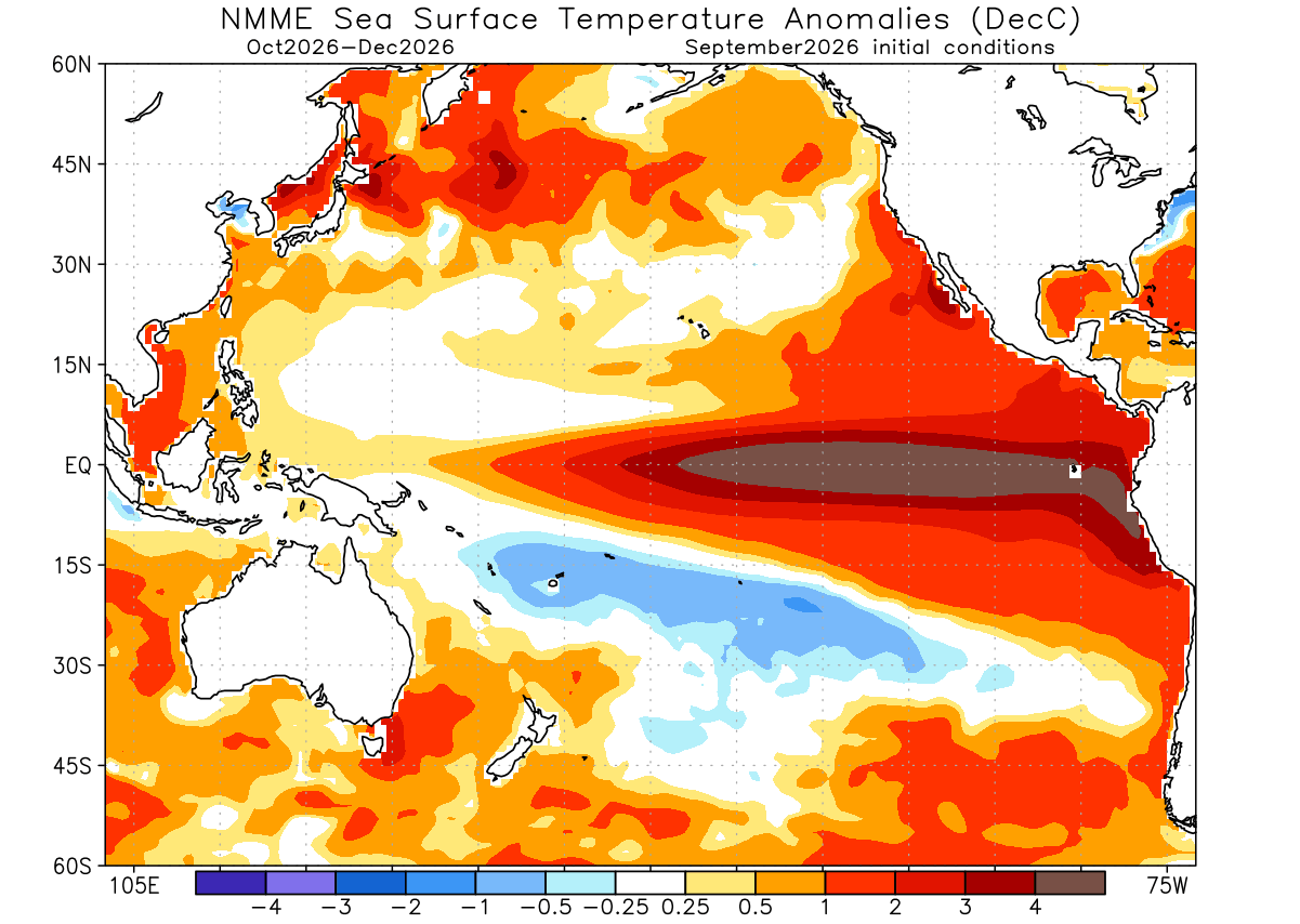
To understand the winter ahead, one must first look beneath the surface of the Pacific Ocean. The current El Niño is characterized by a significant area of above-normal sea surface temperatures in the ENSO (El Niño-Southern Oscillation) region. In recent weeks, NOAA’s Coral Reef Watch (CRW) analysis has confirmed peak anomalies reaching more than 6 degrees Celsius (11°F) above the historical norm.
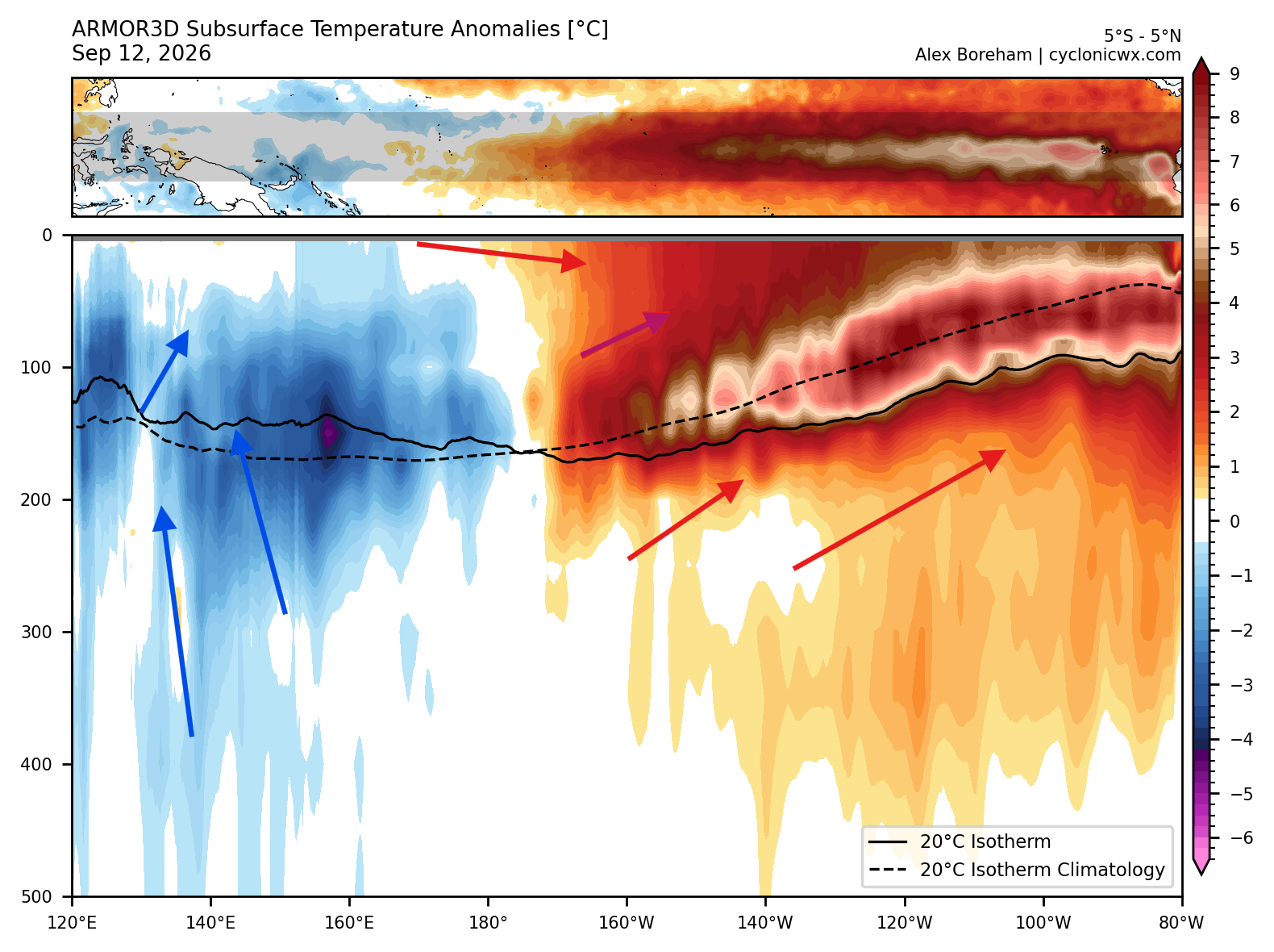
However, the true intensity of this event lies in the subsurface. Current data indicates a powerful downwelling Kelvin Wave—a massive pulse of warm water—traveling eastward across the Pacific. With core anomalies exceeding 9 degrees Celsius (16°F) in the top 200 meters of the ocean, this Kelvin Wave acts as a continuous thermal engine, pumping heat into the surface and ensuring that the El Niño signature remains robust well into the heart of the winter season.
Chronology of Development
- Late Summer 2026: Subsurface temperatures began to show a rapid increase, signaling the formation of a significant Kelvin Wave.
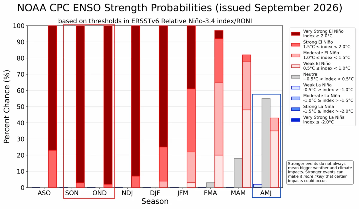
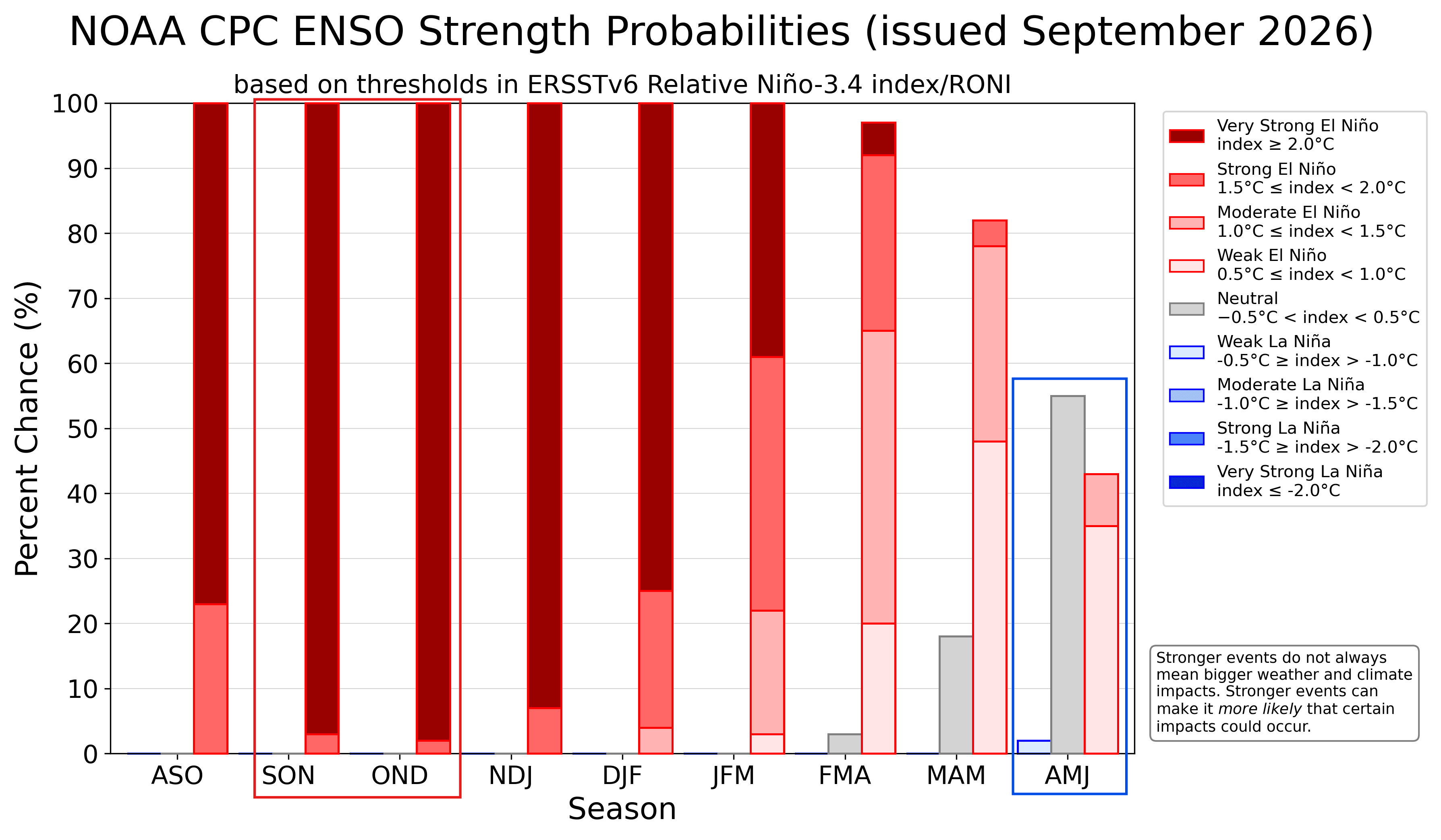
- September 2026: Official NOAA CPC models confirmed a high probability of the event reaching “extreme” status by late autumn.
- October 2026: Integration of ECMWF (European Centre for Medium-Range Weather Forecasts) long-range data provides the first high-resolution look at continental snowfall anomalies.
- Winter 2026/2027 (Forecast): Peak impact expected as the Pacific jet stream reconfigures, shifting storm tracks across the Northern Hemisphere.
The Jet Stream and Global Implications
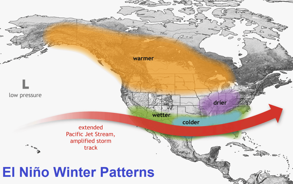
The jet stream, a high-altitude river of air, is the primary delivery mechanism for winter weather. Under normal conditions, the jet stream flows in a relatively predictable path. However, a Super El Niño acts as a physical barrier and a thermal catalyst, forcing the jet stream to extend and strengthen across the southern United States.
This extended Pacific jet stream brings lower pressure, cooler temperatures, and a significant increase in atmospheric moisture. For the central and eastern United States, this setup creates a high-stakes environment: if the jet stream can pull in enough cold air from the north, the potential for heavy, sustained snowfall events increases dramatically. Conversely, regions that usually rely on a northern storm track—such as the Pacific Northwest and the Great Lakes—may find themselves in a precipitation deficit as the ridge of high pressure shifts, potentially suppressing storm activity.
Regional Snowfall Forecasts: What the Data Predicts
The ECMWF seasonal model, which has shown remarkable consistency in recent years, provides the most granular look at the upcoming winter.
North America: A Tale of Two Tracks
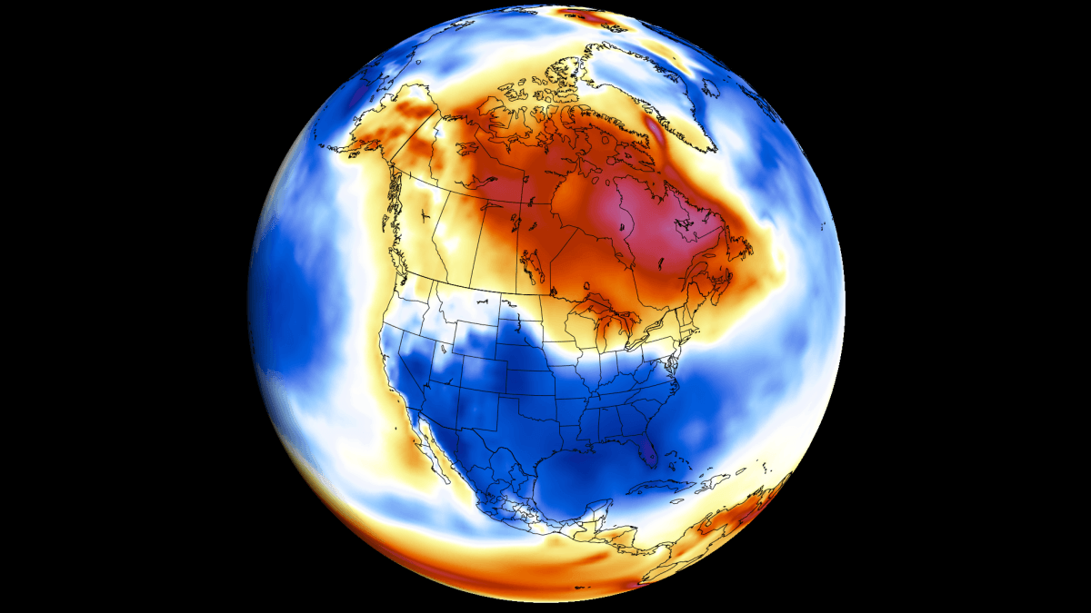
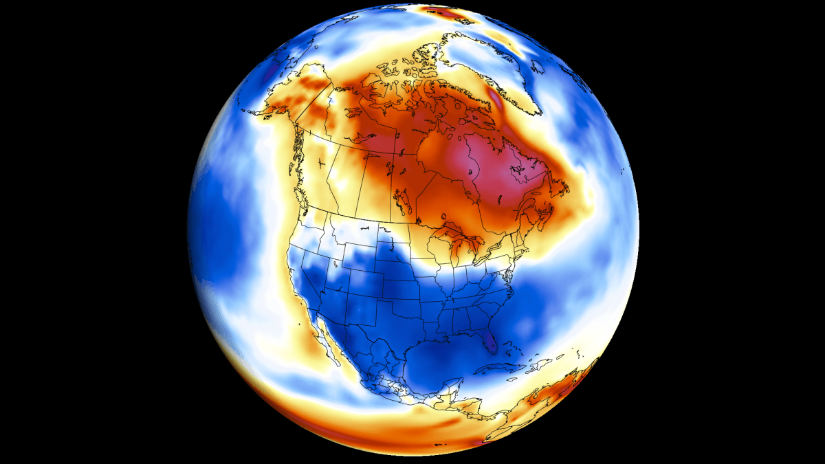
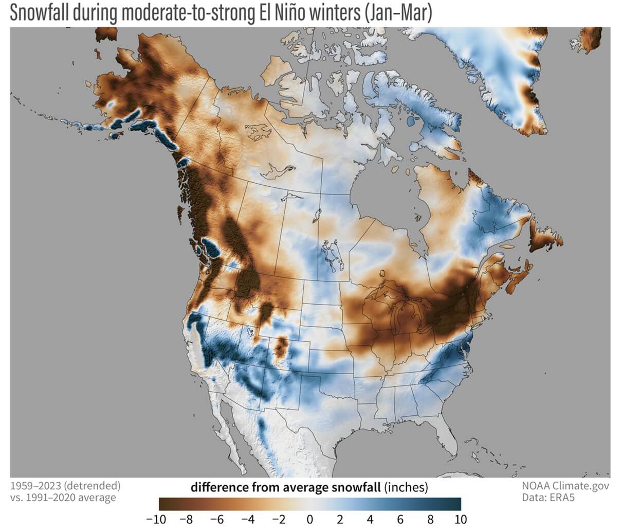
The forecast suggests a divide in North American snowfall. We are likely to see reduced snowfall across the Northeastern and Northwestern United States, as well as portions of western and southeastern Canada. The "warm ridge" effect often associated with extreme El Niño years tends to keep these regions milder than average.
However, the outlook is significantly different for the Central and Eastern United States. A strong, active southern branch of the jet stream points to above-normal snowfall potential for the Southwestern U.S., the Central Plains, and the lower Midwest. For ski enthusiasts, the Sierra Nevada, the Utah mountains, and the Southern Rockies (including Colorado, Arizona, and New Mexico) are currently positioned in a “sweet spot” for increased accumulation.
Europe: The Atlantic Influence
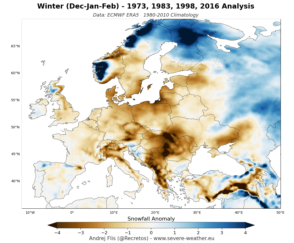
Europe’s winter outlook is governed by a different set of dynamics. Because a Super El Niño often promotes a mild westerly flow from the Atlantic, much of Europe faces a challenging season for snowfall. The forecast models indicate potential deficits in the northwest, south, and north-central regions. While the mountains may see significant accumulation due to elevation, the lower-lying areas are at risk of a “green winter,” with temperatures remaining too high to support widespread snow cover for extended periods.
Interpreting the Snowfall Explorer
To help bridge the gap between abstract climate data and local reality, we have integrated a new Snowfall Explorer tool. This interface allows users to drill down into specific states, provinces, and countries to view seasonal and monthly anomalies.
When analyzing these maps, it is vital to understand the difference between absolute accumulation and anomaly trends. The maps do not necessarily predict the total inches of snow in a specific city; rather, they visualize the trend. By observing the red and blue shading, users can identify whether a specific month is trending toward "above-normal" or "below-normal" precipitation relative to the 30-year average.
For instance, a forecast for the Dakotas might show a below-normal trend for the first half of February, followed by a sharp uptick in the latter half. This level of detail is designed to help professionals and hobbyists alike prepare for the volatility that an extreme El Niño winter often brings.
Official Projections and Scientific Consensus
The National Oceanic and Atmospheric Administration (NOAA) has been clear regarding the strength of the 2026 event. Official outlooks from the Climate Prediction Center (CPC) show overwhelming consensus for an extreme event, with peak intensity expected between October and December.
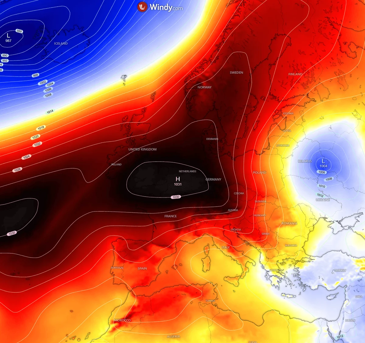
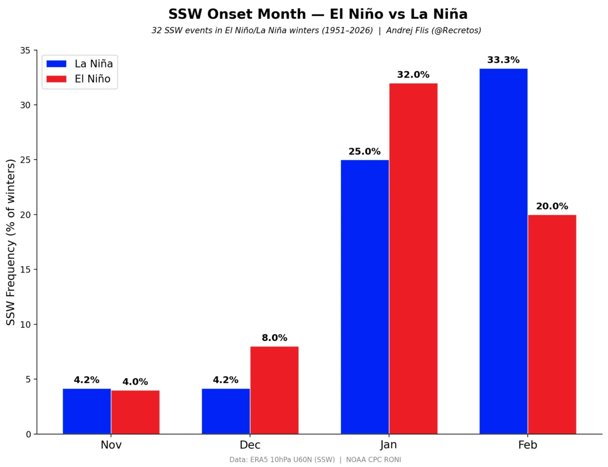
While historical data provides a blueprint, meteorologists warn that no two winters are identical. A Super El Niño is a "forcing" agent, but it interacts with other variables, such as the state of the Polar Vortex and North Atlantic Oscillation (NAO). A major disruption of the Polar Vortex, for example, could override El Niño’s influence, introducing sudden, deep-freeze conditions that would drastically change the snowfall outcomes currently predicted.
Implications for Public Safety and Infrastructure
The potential for a "back-loaded" winter or heavy, rapid-onset snow events in the Southern Plains presents unique challenges for infrastructure. Local municipalities in regions not traditionally accustomed to extreme snowfall may face risks related to emergency response, utility strain, and transportation.
Furthermore, the agricultural sector, particularly in the Central and Southern U.S., will be watching the moisture levels closely. While increased snowfall can be beneficial for soil moisture replenishment in the spring, the timing and rapid melt of such events can lead to flooding risks.
Conclusion: Preparing for the Unpredictable
As we stand on the precipice of the 2026/2027 winter season, the data is unequivocal: we are in for a highly unusual, high-impact season driven by the Pacific Ocean. While the Super El Niño creates a clear, broad-stroke pattern of what to expect, the nuance of the winter will be defined by the day-to-day fluctuations of the atmosphere.
We encourage readers to bookmark our long-range forecast page. As we move into November and December, our monthly updates will refine these predictions, incorporating new satellite data and atmospheric readings. Whether you are a farmer in the Midwest, a skier in the Rockies, or a resident in a vulnerable urban center, staying informed is the best way to navigate the coming months.
For further analysis on how the stratospheric environment—specifically the emerging Polar Vortex—might complicate these predictions, see our latest feature on winter atmospheric disruptions.